

Wandelgids Day Walks on the High Weald AONB - Vertebrate Publ.
20 circular routes in Sussex & Kent from 10.5 to 22.4 km

Korte omschrijving
Wandelgidsen Kent South East England en Sussex, England van Vertebrate Publishing. Ideaal voor tochten in England.
Day Walks on the High Weald AONB - Vertebrate Productomschrijving: 20 circular routes in Sussex & Kent Day Walks on the High Weald features 20 circular routes between 6.5 and 13.9 miles...

Specificaties
- Uitgever: Vertebrate Publishing
- ISBN-13: 9781911342854
- HOOFDCATEGORIEËN: Wandelgids
- Activiteiten: Wandelen, Hiking & Trekking
- Auteur: Deirdre Huston
- Regio: Kent South East England, Sussex, England
- Land: England
- AONB - Area of Outstanding Beauty/National Landscape: High Weald AONB
- Taal: Engels
- Reeks/Serie: Day walks in, vertebrate Publishing
Volledige omschrijving
Day Walks on the High Weald AONB - Vertebrate
Productomschrijving: 20 circular routes in Sussex & Kent
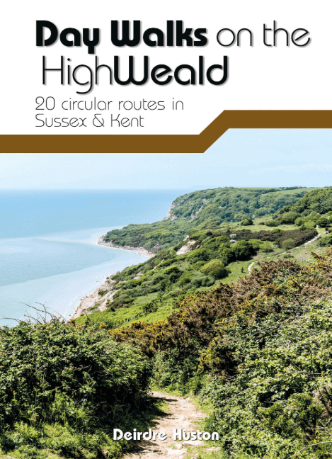
Day Walks on the High Weald features 20 circular routes between 6.5 and 13.9 miles (10.5km and 22.4km) in length, spread across this AONB- Area of Outstanding Natural Beauty in the south-east of England. Local author Deirdre Huston has compiled her favourite walks in the region, which showcase the High Weald’s rich history and varied landscape.
Walk down old coach roads. Clamber through deserted woodland and along riverbanks. March past castles and skirt battlefields. Linger in meadows and leap across Wealden streams. See the countryside that inspired A.A. Milne and Rudyard Kipling. Visit Hastings Country Park, stroll around Bewl Water and through tranquil St Leonard’s Forest. Marvel at the Ouse Valley Viaduct and Bodiam castle, and consider the epic history of Battle and its surrounding landscape.
Together with stunning photography, each route features Ordnance Survey 1:25,000 maps, easy-to-follow directions, details of distance and navigation information, and refreshment stops and local information.
Locatie op kaart
Artikelen uit dezelfde regio

Wandelgids South Downs NP short walks - Cicerone • 9781786312037
South Downs NP short walks - Cicerone Productomschrijving: 15 van de beste en mooiste wandelingen in het gebied van de Nationaal park van de South Downs, in de omgeving van Brighton, Eastbourne & Arundel. De gids komt met topografische kaarten erin van de befaamde cartograaf van Ordnance Survey. Perfect voor mensen die de South Downs nog nooit hebben bewandeld, en die opzoek zijn naar iets…

Wandelkaart 138 Dover Folkstone & Hythe Kent England - OSI • 9780319470107
Wandelkaart Dover- Folkstone & Hythe - Kent England - OSI Productbeschrijving: In het verre zuidoosten van Engeland, Dover, Folkstone en Hythe, grenst aan de Kent Downs, en Area of Outstanding Natural Beauty AONB. U kunt de beroemde White Cliffs of Dover zien, of verder landinwaarts gaan en traditionele dorpen en glooiende heuvels ontdekken. Dit gebied omvat ook een deel van de North Down…

Wandelkaart 150 Canterbury & Isle of Thanet Kent - OSI • 9780319470220
Wandelkaart Canterbury & Isle of Thanet - Kent England Omvat ook: Herne Bay, Deal & Whitstable. Productbeschrijving: Kaart nummer 150 in de OS Explorer kaarten reeks heeft betrekking op de historische stad Canterbury en de Isle of Thanet, Herne Bay, Deal, Margate, Broadstairs, Sandwich, Fordwich en Whitstable. Hoogtepunten van het gebied zijn onder andere: een deel van de Kent Downs AO…

Wandelkaart OL11 Brighton & Hove - Ordnance Survey • 9780319475751
Wandelkaart Brighton & Hove - Ordnance Survey Productomschrijving: Kaart nummer OL11 in de OS Explorer kaartenserie is ideaal voor wie op zoek is naar avontuur in de omgeving van Brighton en Hove. De kust kan te voet worden verkend, waarbij u onderweg de bezienswaardigheden en geluiden van Brighton, Hove, Portslade, Shoreham by Sea, Peacehaven en Newhaven kunt bekijken. Het platteland in …

Wandelkaart 147 Sevenoaks & Tonbridge- Kent - OSI • 9780319243404
Wandelkaart Sevenoaks & Tonbridge - Kent England Omvat ook: Royal Tunbridge Wells & Westerham. Productbeschrijving: Kaart nummer 147 in de OS Explorer reeks heeft betrekking op drie gebieden van uitzonderlijke natuurlijke schoonheid AONB: de Kent Downs, High Weald en de Surrey Uills. De North Downs Way passeert ten noorden van Sevenoaks. Andere hoogtepunten zijn: Royal Tonbridge Wells,…