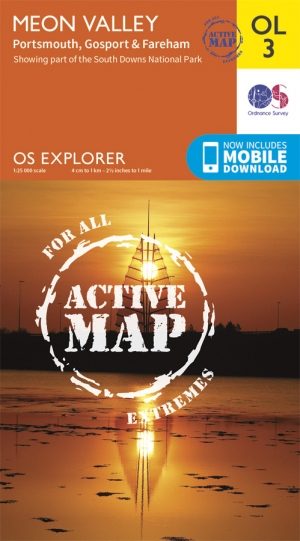
Wandelkaart OL3 Meon Valley- Portsmouth & Gosport - OSI
Omvat Fareham- Waterlooville- Droxford & Owslebury
Korte omschrijving
Wandelkaart Meon Valley- Portsmouth & Gosport - Hampshire Omvat ook: Portsmouth, Gosport & Fareham Productbeschrijving: Met een schat aan geschiedenis achter de rug ligt Portsmouth aan d...

Specificaties
- Uitgever: Ordnance Survey
- ISBN-13: 9780319469217
- HOOFDCATEGORIEËN: Wandelkaart
- Activiteiten: Wandelen, Hiking & Trekking
- Regio: Hampshire, England
- Land: England
- Waterafstotende kaart: Ordnance Survey ACTIVE Explorer Weatherproof Maps
- Nationale parken: South Downs NP, Sussex Egland
- TOPO's & Stafkaarten: Topografisch wandelen
- Schaal: 1:25000
- Taal: Engels
- Reeks/Serie:: Explorer ACTIVE Series OSI
Volledige omschrijving
Wandelkaart Meon Valley- Portsmouth & Gosport - Hampshire
Omvat ook: Portsmouth, Gosport & Fareham
Productbeschrijving: Met een schat aan geschiedenis achter de rug ligt Portsmouth aan de zuidelijke rand van deze kaart die zich uitstrekt van Noord Fareham, Waterlooville, Droxford tot Owslebury. Deze kaart ompvat ook een Zuid-westelijke deel van de South Downs National Park. Er zijn een aantal recreatieve paden, waaronder deel van de South Downs Trail, Solent way, way of the kings, Pilgrim's Trail & travelers way. Explorer OL3 Explorer 119 vervangt, en heeft betrekking op hetzelfde gebied. De OS Explorer kaart voor Meon Valley is beschikbaar in zowel de standaard papieren versie als de weerbestendige 'Actief' versie.
Kaart nummer OL3 is een all purpose kaart vol gepakt met informatie om u het gebied te helpen leren kennen. De kaarten bestrijken het land. Elke kaart heeft een oppervlakte van 40 km door 40 km (25 mijl door 25 mijl) en zoals andere kaarten van Ordnance Survey, National Grid-vierkanten worden verstrekt zodat elke functie een unieke referentienummer kan worden gegeven.
Productdiscription: With a wealth of naval history behind it Portsmouth lies at the southern edge of this map that stretches north taking in Fareham, Waterlooville, Droxford and Owslebury. This map also provides coverage of a south westerly section of the South Downs National Park. There are a number of Recreational Paths, including part of the South Downs Trail, Solent Way, Kings Way, Pilgrim's Trail and Wayfarers Walk.
Explorer OL3 replaces Explorer 119, and covers the same area. The OS Explorer map for Meon Valley is available in both the standard paper version and weatherproof 'Active' version.
Locatie op kaart
Gekoppelde artikelen

Wandelkaart OL3 Meon Valley- Portsmouth & Gosport - OSI • 9780319469217
weatherproof versieWandelkaart Meon Valley- Portsmouth & Gosport - Hampshire Omvat ook: Portsmouth, Gosport & Fareham Productbeschrijving: Met een schat aan geschiedenis achter de rug ligt Portsmouth aan de zuidelijke rand van deze kaart die zich uitstrekt van Noord Fareham, Waterlooville, Droxford tot Owslebury. Deze kaart ompvat ook een Zuid-westelijke deel van de South Downs National Park. Er zijn een…
Artikelen uit dezelfde regio

Wandelkaart OL22 New Forest National Park - OS • 9780319263921
Wandelkaart New Forest National Park - OS Productomschrijving: New Forest National Park, Hampshire England. Omvat: Southampton, Ringwood, Ferndown, Lymington, Christchurch and Bournemouth, parts of the New Forest National Park. Ontdek de OL-serie van Ordnance Survey: De OL-serie (Outdoor Leisure) van Ordnance Survey is dé referentie voor wie gaat wandelen op de Britse eilanden. D…

Wandelkaart South Downs Way - Vertebrate Publ. • 9781839810305
Wandelkaart South Downs Way - Vertebrate Productomschrijving: Easy-to-use folding map and essential information, with custom itinerary planning for walkers, trekkers, fastpackers and trail runners The South Downs Way Guidemap from Vertebrate Publishing is a lightweight, waterproof, durable and easy-to-use folding map with 1:40,000-scale mapping for the linear SDW route. Includes an elevati…

Fietsgids Cycling Days Out - South East England - Vertebrate Publ • 9781906148249
Cycling Days Out - South East England - Vertebrate Productomschrijving: Traffic-free family and leisure cycling in Kent, Sussex, Surrey & Hampshire. Cycling Days Out – South East England is a guide to traffic-free family and leisure cycling in Kent, Sussex, Surrey and Hampshire. Written by local author Deirdre Huston, it explores tourist trails, country parks, forest riding and more. …

Wandelgids Winchester short walks - Cicerone • 9781786311641
Winchester short walks - Cicerone Productomschrijving: Malcolm Leatherdale heeft 15 van de beste korte wandelingen rond Winchester en centraal Hampshire voor je uitgezocht. Onze gids is voorzien van goed leesbare Ordnance Survey-kaarten en duidelijke routebeschrijvingen, perfect als je voor het eerst gaat wandelen of iets zoekt waar je met het hele gezin van kunt genieten. We hebben in…

Wandelkaart 185 Winchester & Basingstoke - England - OSI • 9780319262832
Wandelkaart Winchester & Basingstoke - Hampshire England Productbeschrijving: Kaart nummer 185 in de OS Landranger kaarten reeks, is de ideale kaart om te gebruiken bij het plannen van een dagjr uit rond het gebied van Winchester en Basingstoke. Met tal van culturele attracties in de stad naast de aangename landschappen, doet dit gebied een beroep op alle soorten liefhebber van het buitenl…


