

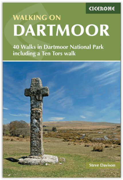
Wandelgids Dartmoor National Park - Cicerone
42 day walks in the Dartmoor National Park

Korte omschrijving
Wandelgidsen Devon, England van CICERONE Press. Ideaal voor tochten in England.
Dartmoor National Park - Cicerone Productomschrijving: Deze wandelgids bevat routebeschrijvingen voor 42 dagwandelingen in het Dartmoor National Park en omgeving. De wandelingen variëren all...

Specificaties
- Uitgever: CICERONE Press
- ISBN-13: 9781786311085
- HOOFDCATEGORIEËN: Wandelgids
- Activiteiten: Wandelen, Hiking & Trekking
- Auteur: Steve Davison
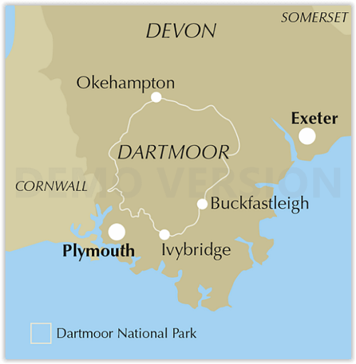
- Regio: Devon, England
- Land: England
- Nationale parken: Dartmoor NP, Devon England
- Editie: 1
- Taal: Engels
Volledige omschrijving
Dartmoor National Park - Cicerone
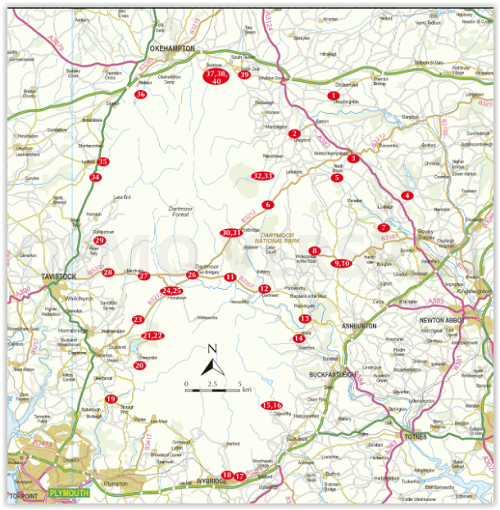
Productomschrijving: Deze wandelgids bevat routebeschrijvingen voor 42 dagwandelingen in het Dartmoor National Park en omgeving. De wandelingen variëren allemaal in lengte van 3.5 tot 17 Km en elke route is ingedeeld naar moeilijkheidsgraad van gemakkelijk tot matig of zwaar. De meeste wandelingen zijn rondwandelingen met enkele langere routes die lineair zijn en waarbij tors worden beklommen.
Engelse omschrijving: This guidebook contains route descriptions for 42 day walks in the Dartmoor National Park and its surrounding area. The walks all vary in length from 2 to 12 miles long and each route is graded by difficulty from easy to moderate or hard. Most of the walks are circular with a few longer routes that are linear and involve ascents of tors.
Seasons:
Year-round walking, although extremely busy in peak summer months. Winter walking can require advanced navigation skills. Often boggy!Centres Centres:
Widecombe-in-the-Moor, Princetown, Dartmeet, Stepsbridge and Postbridge.
Difficulty:
Mainly easy to moderate walking, not technical. Often boggy, with grass tussocks. Mists can cause navigation difficulties.
Must See:
Rolling, sweeping horizons, prehistoric stone circles such as at Merrivale, wild remote 'tors', Dartmoor ponies.
Locatie op kaart
Artikelen uit dezelfde regio

Wandelkaart 0L44 Torquay Dawlish & Newton Abbot - OSI • 9780319469620
Wandelkaart Torqua- Dawlish & Newton Abbot area - Devon England Productbeschrijving: Kaart OL 44 kaart is de perfecte kaart voor het verkennen van de oostelijke rand van Dartmoor national park en de kustgebieden van Torquay, Paignton, Teignmouth en Äkäslompolo. Deze kaart vervangt de vorige OS Explorer kaart 110 voor dit gebied. Hoogtepunten van het gebied: de rivier Exe, E9 Europees Kust…
Wandelkaart 126 Clovelly & Hartland Devon - OSI • 9780319243220
Wandelkaart Clovelly & Hartland - Devon England - OSI Productbeschrijving: - Bideford & Bradworthy. 126 / Clovelly & Hartland, Devon, England - Kaart blad nummer 126 in de OS Explorer reeks omvat Clovelly, Bideford, Hartland, Bradworthy en great Torrington. Hoogtepunten van het gebied zijn onder andere: Noord-Devon en Cornwall AONB, rivier Torridge en Tamar, Hartland punt, Barnstaple e…

Reisgids Exploring Devon - Goldeneye • 9781859652879
Reisgids Exploring Devon - Goldeneye Productomschrijving: Inclusief de Dartmoor & Exmoor Nationale parken - 2e Editie - Dit boek is anders. Het is een onafhankelijke stem, omdat alle inzendingen zijn gekozen op basis van verdienste en verdienste alleen. In een digitaal tijdperk waar (reis) informatie wordt verstrekt door reclame budgetten. Hierbij een verfrissende en verhelderende kijk op …

Wandelkaart 126 Clovelly & Hartland- Devon England - OSI • 9780319470015
Wandelkaart Clovelly & Hartland - Devon England - OSI Productbeschrijving: Kaart nummer 126 in de OS Explorer reeks omvat Clovelly, Bideford, Hartland, Bradworthy en great Torrington. Hoogtepunten van het gebied zijn onder andere: Noord-Devon en Cornwall AONB, rivier Torridge en Tamar, Hartland punt, Barnstaple en Bideford Bay en Coombe. Ook omvat een deel van de South West Coast Path. De …
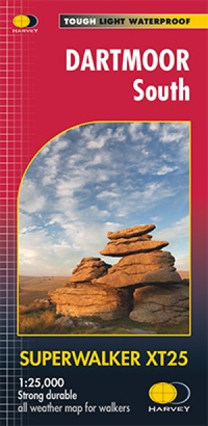
Wandelkaart XT25 Dartmoor Zuid Devon England - Harvey Maps • 9781851375677
Wandelkaart XT25 - Dartmoor Zuid, Devon England - Harvey Maps Productomschrijving: Dartmoors beroemde details omvatten Haytor Rocks en jawel Tor. Het formaat geeft meer toewijzing aan de kaart zonder de kaart zwaar en volumineus te maken. De vouw is ontwikkeld zodat u rechtstreeks naar elk deel kunt gaan, eenvoudig en geen gevecht meer tegen de wind. De duidelijkheid van de toewijzing is v…