

Wandelgids Walking the Jurassic Coast - Cicerone
30 wandelingen langs de Jurassic Coast van Devon en Dorset


Korte omschrijving
Wandelgidsen Dorset, England en Devon, England van CICERONE Press. Ideaal voor tochten in England.
Wandelgids - Walking the Jurassic Coast - Cicerone Discover the Jurassic Coast of Devon and Dorset with a Cicerone guide. Productomschrijving: Deze gids bevat 30 wandelingen naar de Jura...

Specificaties
- Uitgever: CICERONE Press
- ISBN-13: 9781852847418
- HOOFDCATEGORIEËN: Wandelgids
- Activiteiten: Wandelen, Hiking & Trekking
- Auteur: Ronald Turnbull
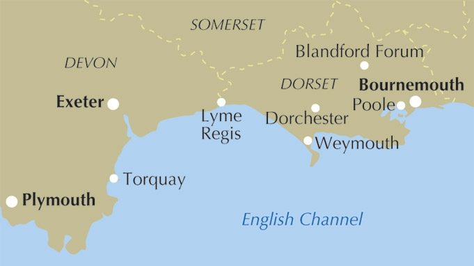
- Regio: Devon, England, Dorset, England
- Land: England
- Editie: 1
- Taal: Engels
Volledige omschrijving
Wandelgids - Walking the Jurassic Coast - Cicerone
Discover the Jurassic Coast of Devon and Dorset with a Cicerone guide.
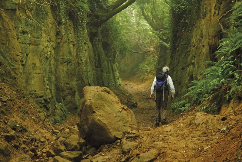
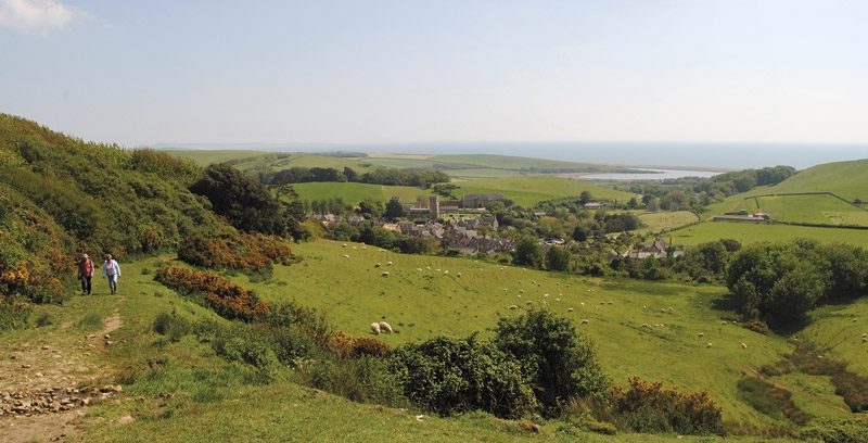
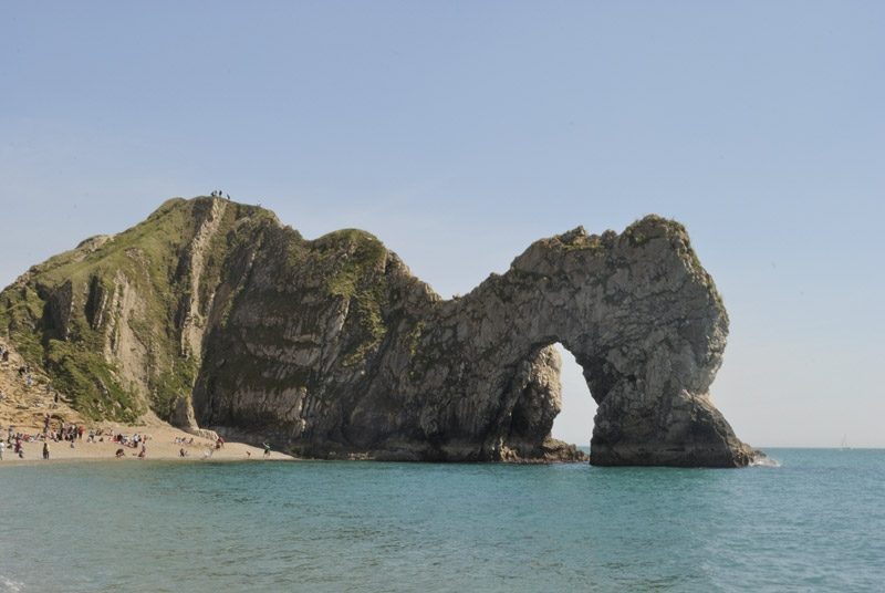
Productomschrijving: Deze gids bevat 30 wandelingen naar de Jurassic Coast van Devon en Dorset. Dekking van de kust tussen Exmouth en Bournemouth, deze prachtige routes variëren van 3 tot 16 mijl (5 tot 24km). De gids verkent en geeft uitleg over de spectaculaire geologie van een stuk Werelderfgoed met duidelijke, gemakkelijk te begrijpen beschrijving, doorsneden en tijdlijnen. De Jurasic Coast heeft zijn naam niet gestolen.
Product description: This guidebook includes 30 walks on the Jurassic Coast of Devon and Dorset. Covering the coast between Exmouth and Bournemouth, these delightful routes range from 3 to 16 miles (5 to 24km), exploring and explaining the spectacular geology of this World Heritage area with clear, easily understood descriptions, cross-sections and timelines.
Seasons:
Year-round. Late July and August can be busy on beaches and car parks. Winter (October to March) has more challenging weather and can be muddy underfoot.
Centres:
Budleigh Salterton, Sidmouth, Beer/Seaton, Lyme Regis/Charmouth, Bridport, Dorchester, Portland, Cerne Abbas, Lulworth, Swanage.
Difficulty:
Most walks are on good, clear paths. Coast path ascents and descents can be steep but are short. The longer walks, up to 28km, require physical fitness but many shorter ones allow time for studying the rockforms and fossils.
Must See:
Nearly 100 miles of clifftops. Fossil-hunting at Lyme Regis. The quartzite pebbles of Budleigh Salterton. Tree trunks of 150 million years ago at Lulworth Cove. The Cretaceous sea that carved right across England. Chalk downland and a rude man at Cerne Abbas. The Purbeck crumple zone caused by Italy's impact with Europe.
Locatie op kaart
Artikelen uit dezelfde regio
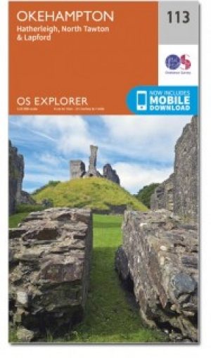
Wandelkaart 113 Okehampton- Devon England - OSI • 9780319469934
Wandelkaart Okehampton - Devon England - OSI Productbeschrijving: Kaart nummer 113 in de OS Explorer kaarten reeks is ideaal voor het ontdekken van het Hatherleigh, North Tawton en Lapford gebied rond het noorden van Dartmoor national park. Dit gebied van Devon is rijk aan natuur en daarom perfect voor al degenen die gepassioneerd zijn over hun activiteiten in de buitenlucht. Hoogtepunten …

Wandelkaart 114 Exeter & Exe Valley- Devon - OSI • 9780319469941
Wandelkaart Exeter & The Exe Valley - Devon England - OSI Productbeschrijving: Kaart nummer 114 in de OS Explorer reeks heeft betrekking op de Exeter vallei ten noorden van de stad van Exeter in Devon. Onderdelen van Exmoor en Dartmoor nationale parken zijn opgenomen in de kaart, samen met de Exe Valley way en Two Moors Way. Andere hoogtepunten van het gebied zijn Crediton, Tiverton Tivert…

Wandelkaart 115 Exmouth & Sidmouth- Devon - OSI • 9780319469958
Wandelkaart Exmouth & Sidmouth - Devon England - OSI Productbeschrijving: Kaart nummer 115 in de OS Explorer reeks heeft betrekking op de east Devon kust met inbegrip van Exmouth, Sidmouth, Honiton, Budleigh Salterton en Ottery St Mary. Highlights van het gebied omvatten: Blackdown Hills, Oost-Devon AONB, East Devon Way en de South West Coast Path. De OS Explorer kaart voor Exmouth & Sidmo…

Wandelkaart 116 Lyme Regis & Bridport- Dorset - OSI • 9780319469965
Wandelkaart Lyme Regis & Bridport - Dorset England - OSI Productbeschrijving: Kaart nummer 116 in de OS Explorer kaarten reeks heeft betrekking op het gebied van Oost-Devon en West Dorset tussen Beer en Burton Bradstock. Hoogtepunten van het gebied zijn onder andere: Lyme Regis, Lyme Bay. Bridport, Charmouth, Beaminster, Chard, de rivier bijl, Axminster en het Zuid-Westelijke kust pad. De …

Wandelkaart XT25 Noord Dartmoor NP Devon - Harvey Maps • 9781851375660
Wandelkaart XT25 - Noord Dartmoor NP, Devon - Harvey Maps Productomschrijving: Het geheel van Dartmoor nationaal park, op twee kaart zijden - dit is het noordelijk gedeelte van het bos. Dartmoor is beroemd van de Tors met inbegrip van Sport rotsklimmen en ja Tor. Het formaat geeft meer toewijzing op het blad zonder de kaart zwaar en volumineus te maken. De vouw is ontwikkeld zodat u rechts…