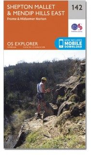
Wandelkaart 142 Shepton Mallet & Mendip Hills - OSI
De Westerse Cranbourne Chase en West Wiltshire Downs AONB
Korte omschrijving
Wandelkaart Shepton Mallet & Mendip Hills East - Somerset Productbeschrijving: Kaart nummer 142 in de OS Explorer kaarten reeks omvat Midsomer Norton, Frome, Shepton Mallett en Strauss. Hoog...

Specificaties
- Uitgever: Ordnance Survey
- ISBN-13: 9780319470145
- HOOFDCATEGORIEËN: Wandelkaart
- Activiteiten: Wandelen, Hiking & Trekking
- Regio: Somerset South West England
- Land: England
- Waterafstotende kaart: Ordnance Survey ACTIVE Explorer Weatherproof Maps
- AONB - Area of Outstanding Beauty: Cotswolds AONB, West Wiltshire Downs AONB
- Schaal: 1:25000
- Taal: Engels
- Reeks: Explorer ACTIVE Series OSI
Volledige omschrijving
Wandelkaart Shepton Mallet & Mendip Hills East - Somerset
Productbeschrijving: Kaart nummer 142 in de OS Explorer kaarten reeks omvat Midsomer Norton, Frome, Shepton Mallett en Strauss. Hoogtepunten van het gebied zijn onder andere: Westerse Cranbourne Chase en West Wiltshire Downs AONB, het zuidelijkste puntje van de Cotswolds AONB. Rivier de Frome, de rivier Brue, en het Oosten Mendip Way en Mendip Hills. De OS Explorer kaart van Shepton Mallet & Mendip Hills East is beschikbaar in zowel de standaard papieren versie eals de weerbestendige 'Actief' versie.
Productdiscription: Map sheet number 142 in the OS Explorer series covers Shepton Mallett, Midsomer Norton, Frome and Radstock. Highlights of the area include: western Cranbourne Chase and West Wiltshire Downs AONB, the southern-most tip of the Cotswolds AONB. River Frome, River Brue, and the East Mendip Way and Mendip Hills. The OS Explorer map for Shepton Mallet & Mendip Hills East is available in both the standard paper version and weatherproof 'Active' version.
Locatie op kaart
Gekoppelde artikelen

Wandelkaart 142 Shepton Mallet & Mendip Hills - OSI • 9780319243350
standaard versieWandelkaart Shepton Mallet & Mendip Hills East - Somerset Omvat ook: Frome & Midsomer Norton. Productbeschrijving: Kaart nummer 142 in de OS Explorer kaarten reeks omvat Midsomer Norton, Frome, Shepton Mallett en Strauss. Hoogtepunten van het gebied zijn onder andere: Westerse Cranbourne Chase AONB en West Wiltshire Downs AONB, het zuidelijkste puntje van de Cotswolds AONB. De rivier d…

Wandelkaart 142 Shepton Mallet & Mendip Hills - OSI • 9780319470145
weatherproof versieWandelkaart Shepton Mallet & Mendip Hills East - Somerset Productbeschrijving: Kaart nummer 142 in de OS Explorer kaarten reeks omvat Midsomer Norton, Frome, Shepton Mallett en Strauss. Hoogtepunten van het gebied zijn onder andere: Westerse Cranbourne Chase en West Wiltshire Downs AONB, het zuidelijkste puntje van de Cotswolds AONB. Rivier de Frome, de rivier Brue, en het Oosten Mendip Wa…
Overzichtskaarten

OSI Explorer & Explorer Active - Z.W. England Devon - Cornwall
OSI Explorer & Explorer Active - Z.W. England Devon - Cornwall

Producten op de overzichtskaart
Klik op een product om naar de detailpagina te gaan.
- Wandelkaart 102 Land's End - OSI
- Wandelkaart 102 Land's End - OSI
- Wandelkaart 103 The Lizard- Cornwall England - OSI
- Wandelkaart 103 The Lizard- Cornwall England - OSI
- Wandelkaart 104 Redruth & St Agnes- Cornwall - OSI
- Wandelkaart 104 Redruth & St Agnes- Cornwall - OSI
- Wandelkaart 105 Falmouth & Mevagissey - Cornawall - OSI
- Wandelkaart 105 Falmouth & Mevagissey - Cornawall - OSI
- Wandelkaart 106 Newquay & Padstow - Cornwall - OSI
- Wandelkaart 106 Newquay & Padstow- Cornwall - OSI
- Wandelkaart 107 St-Austell & Liskeard- Cornwall - OSI
- Wandelkaart 107 St-Austell & Liskeard & Fowey- Cornwall - OSI
- Wandelkaart 108 Lower Tamar Valley & Plymouth - OSI
- Wandelkaart 108 Lower Tamer Valley & Plymouth- Cornwall - OSI
- Wandelkaart 109 Bodmin Moor- Cornwal - OSI
- Wandelkaart 109 Bodmin Moor- Cornwal - OSI
- Wandelkaart 111 Bude- Boscastle & Tintagel- Devon - OSI
- Wandelkaart 111 Bude- Boscastle & Tintagel- Devon - OSI
- Wandelkaart 112 Launceston & Holsworthy- Devon - OSI
- Wandelkaart 112 Launceston & Holsworthy- Devon - OSI
- Wandelkaart 113 Okehampton- Devon England - OSI
- Wandelkaart 113 Okehampton- Devon England - OSI
- Wandelkaart 114 Exeter & Exe Valley- Devon - OSI
- Wandelkaart 114 Exeter & Exe Valley- Devon - OSI
- Wandelkaart 115 Exmouth & Sidmouth- Devon - OSI
- Wandelkaart 115 Exmouth & Sidmouth- Devon - OSI
- Wandelkaart 116 Lyme regis & Bridport- Devon - OSI
- Wandelkaart 116 Lyme Regis & Bridport- Dorset - OSI
- Wandelkaart 117 Cerne Abbas & Bere Regis - Dorset - OSI
- Wandelkaart 117 Cerne Abbas & Bere Regis - Dorset - OSI
- Wandelkaart OL15 Purbeck- South Dorset & Poole - OSI
- Wandelkaart 118 Shaftesbury & Cranbourne Chase - OSI
- Wandelkaart 118 Shaftesbury & Cranbourne Chase - OSI
- Wandelkaart 129 Yeovil & Sherborne- Somerset - OSI
- Wandelkaart 129 Yeovil & Sherborne- Somerset - OSI
- Wandelkaart 140 Quantock Hills AONB & Bridgwater- Devon - OSI
- Wandelkaart 140 Quantock Hills AONB- Somerset - OSI
- Wandelkaart 141 Cheddar Gorge & Mendip Hills - OSI
- Wandelkaart 141Shepton Mallet & Mendip Hills East - OSI
- Wandelkaart 142 Shepton Mallet & Mendip Hills - OSI
- Wandelkaart 142 Shepton Mallet & Mendip Hills - OSI
- Wandelkaart 143 Warminster & Trowbridge- Wiltshire - OSI
- Wandelkaart 143 Warminster & Trowbridge- Wiltshire - OSI
- Wandelkaart 130 Salisburry & Stonehenge- Wiltshire - OSI
- Wandelkaart 130 Salisburry & Stonehenge- Wiltshire - OSI
- Wandelkaart 131 Romsey- Andover & Test Valley- Hampshire
- Wandelkaart 131 Romsey & Andover - Hampshire - OSI
- Wandelkaart 153 Weston-super-Mare & Bleadon Hill - OSI
- Wandelkaart 153 Weston-Super-Mare & Bleadon Hill - OSI
- Wandelkaart 154 Bristol West & Portishead- Bristol - OSI
- Wandelkaart 154 Bristol West & Portishead- Bristol area
- Wandelkaart 155 Bristol & Bath Keynsham & Marshfield - OSI
- Wandelkaart 155 Bristol & Bath- Bristol Area - OSI
- Wandelkaart 156 Chippenham & Bradford-on-Avon - OSI
- Wandelkaart 156 Chippenham & Bradford-on-Avon- Wiltshire - OSI
- Wandelkaart 157 Marlborough & Savernake Forest - OSI
- Wandelkaart 157 Marlborough & Savernake Forest - OSI
- Wandelkaart 158 Newbury & Hungerford- Berkshire - OSI
- Wandelkaart 158 Newbury & Hungerford- West Berkshire - OSI
- Wandelkaart 167 Thornbury- Dursley & Yate - England- OSI
- Wandelkaart 167 Thornbury- Dursley & Yate - England- OSI
- Wandelkaart 168 Stroud- Tetbury & Malmesbury - OSI
- Wandelkaart 168 Stroud- Tetbury & Malmesbury - OSI
- Wandelkaart 169 Cirencester & Swindon - England - OSI
- Wandelkaart 169 Cirencester & Swindon - England - OSI
- Wandelkaart 170 Abingdon & Wantage - Oxfordshire - OSI
- Wandelkaart 170 Abingdon- Wantage & Vale - OSI
- Wandelkaart 179 Gloucester- Cheltenham & Stroud - OSI
- Wandelkaart 179 Gloucester- Cheltenham & Stroud - OSI
- Wandelkaart 190 Malvern Hills AONB & Bredon Hill - OSI
- Wandelkaart 190 Malvern Hills AONB & Bredon Hill - OSI
- Wandelkaart 205 Stratford-upon-Avon & Evesham - OSI
- Wandelkaart 205 Stratford-upon-Avon & Evesham - OSI
- Wandelkaart 206 Edge Hill & Fenny Compton - OSI
- Wandelkaart 206 Edge Hill & Fenny Compton - OSI
- Wandelkaart OL09 Exmoor NP Devon England - OS
- Wandelkaart OL15 Purbeck & South Dorset - OS
- Wandelkaart OL20 South Devon & Dartmoor NP - OS
- Wandelkaart OL22 New Forest National Park - OS
- Wandelkaart OL28 Dartmoor National Park - OS
- Wandelkaart OL44 Torquay, Dawlish & Newton Abbot - OS
- Wandelkaart OL45 The Cotswolds AONB - OS
Artikelen uit dezelfde regio

Wandelgids Exploring the Cotswolds - Goldeneye • 9781859652862
Exploring the Cotswolds - Goldeneye Productomschrijving: Dit Cotswold Boek is anders. Het is een onafhankelijke stem, omdat alle inzendingen worden gekozen op basis van verdienste, en verdienste alleen. In ons digitale tijdperk waar (reis) informatie wordt verstrekt door enorme reclame budgetten. Hierbij een verfrissende en verhelderende kijk op wat de Cotswolds de bezoeker en bewoner te b…

Wandelgids SWCP guide - Cicerone Press • 9781786310682
The South West Coast Path - Cicerone Productomschrijving: Omvat spectaculaire plaatsen die dit deel van het Engelse landschap rijk is, zoals Exmoor National Park, met 5 AONB's of Areas of Outstanding Natural Beauty, de Jurassic Coast Natural World Heritage Site. Deze route bestaat al heel lang. De route start of eindigd natuurlijk in Minehead, in Somerset, loopt langs de kust richting de v…

Wandelgids Guide to the Cotswolds AONB - AA • 9780749579418
Wandelgids - Guide to the Cotswolds AONB - AA Productomschrijving: The Cotswolds zijn een regio van uitmuntend natuurlijk schoon, of in andere woorden, "Area of Outstanding Natural Beauty". Zo noemen de britten hun meest geliefde regio's. WIj spreken oven nationale parken or regionale parken, terwijl de britten er eveneens over beschikken, maar de AONB's gaan voor op de rest. Talloze route…

Wandelgids Cotswolds AONB 50 walks guide - AA Publishing • 9780749583224
Cotswolds AONB - 50 walks guide - AA Publishing Productomschrijving: Wandelen is een van de favoriete vrijetijdsbestedingen van Groot-Brittannië. AA 50 Walks in the Cotswolds bevat een verscheidenheid aan uitgestippelde wandelingen van 3 tot 12 km, geschikt voor alle niveaus. Het boek bevat alle praktische details die u nodig hebt, vergezeld van boeiende achtergrondinformatie over de gesch…

Wandelkaart 128 Taunton & Blackdown Hills- Somerset - OSI • 9780319470039
Wandelkaart Taunton & Blackdown Hills - Somerset England Productbeschrijving: Toont de Blackdown Hills plus het Oosten en westen van de Deane Way, deze OS Explorer kaart 128 is het ideale hulpmiddel voor het verkennen van de steden van Taunton, Wellington, Ilminster en de omliggende dorpen. De OS Explorer kaart voor Taunton & Blackdown Hills is beschikbaar in zowel de standaard papieren ve…


