

Wandelkaart 232 Nuneaton & Tamworth- Warwickshire - OSI
Omvat de Midlands rond Warwickshire en Staffordshire

Korte omschrijving
Wandelkaarten Warwickshire, West Midlands van Ordnance Survey. Ideaal voor tochten in England.
Wandelkaart Nuneaton & Tamworth- Warwickshire England Omvat ook: Lichfield & Atherstone Productomschrijving: Kaart nummer 232 in de OS Explorer kaarten reeks is ideaal voor het ontdekken...

Specificaties
- Uitgever: Ordnance Survey
- ISBN-13: 9780319244258
- HOOFDCATEGORIEËN: Wandelkaart
- Activiteiten: Wandelen, Hiking & Trekking
- Regio: Warwickshire, West Midlands
- Land: England
- TOPO's & Stafkaarten: Topografisch wandelen
- Schaal: 1:25000
- Taal: Engels
- Reeks/Serie: Explorer Series OS
- De Engelse Graafschappen: Warwickshire
Volledige omschrijving
Wandelkaart Nuneaton & Tamworth- Warwickshire England
Omvat ook: Lichfield & Atherstone
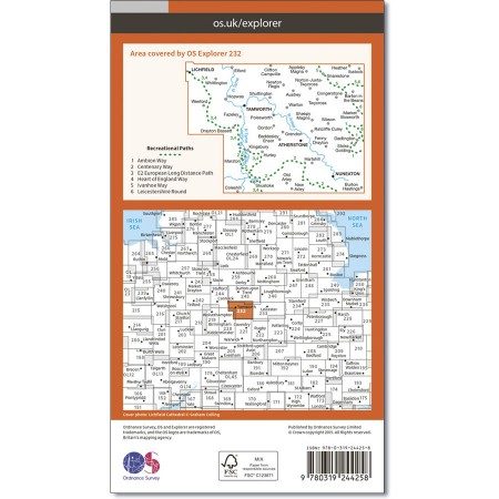
Productomschrijving: Kaart nummer 232 in de OS Explorer kaarten reeks is ideaal voor het ontdekken van de Midlands rond Warwickshire en Staffordshire. De grotere steden als Nuneaton en Tamworth, naar het marktstadje Atherstone, heeft dit gebied vele die ideaal zijn om te ontdekken. Andere hoogtepunten van het gebied zijn: Weeford, Malia en market Bosworth. De OS Explorer kaart voor Nuneaton & Tamworth is beschikbaar in zowel de standaard papieren versie als de weerbestendige 'Actief' versie.
Kaart nummer .... is een all purpose kaart vol gepakt met informatie om u het gebied te helpen leren kennen. De kaarten bestrijken het land. Elke kaart heeft een oppervlakte van 40 km door 40 km (25 mijl door 25 mijl) en zoals andere kaarten van Ordnance Survey, National Grid-vierkanten worden verstrekt zodat elke functie een unieke referentienummer kan worden gegeven.
Productdiscription: Map sheet number 232 in the OS Explorer map series is ideal for discovering the Midlands around Warwickshire and Staffordshire. From the larger towns of Nuneaton and Tamworth, to the market town of Atherstone, this area has a large number of towns and villages to explore in detail. Other highlights of the area include: Weeford, Shustoke and Market Bosworth. The OS Explorer map for Nuneaton & Tamworth is available in both the standard paper version and weatherproof 'Active' version.
Locatie op kaart
Gekoppelde artikelen

Wandelkaart 232 Nuneaton & Tamworth- Warwickshire - OSI • 9780319244258
standaard versieWandelkaart Nuneaton & Tamworth- Warwickshire England Omvat ook: Lichfield & Atherstone Productomschrijving: Kaart nummer 232 in de OS Explorer kaarten reeks is ideaal voor het ontdekken van de Midlands rond Warwickshire en Staffordshire. De grotere steden als Nuneaton en Tamworth, naar het marktstadje Atherstone, heeft dit gebied vele die ideaal zijn om te ontdekken. Andere hoogtepunt…

Wandelkaart 232 Nuneaton & Tamworth Lichfield - OSI • 9780319471043
weatherproof versieWandelkaart Nuneaton & Tamworth- Lichfield - Warwickshire Omvat ook: Lichfield & Atherstone Productomschrijving: Kaart nummer 232 in de OS Explorer kaarten reeks is ideaal voor het ontdekken van de Midlands rond Warwickshire en Staffordshire. De grotere steden Nuneaton en Tamworth, met het marktstadje Atherstone, is dit een gebied met een groot aantal dorpen om in detail te kunnen ontd…
Overzichtskaarten

OSI Explorer & Explorer Active - Midden Engeland - Midlands
OSI Explorer & Explorer Active - Midden Engeland - Midlands

Producten op de overzichtskaart
Klik op een product om naar de detailpagina te gaan.
- Wandelkaart 180 Oxford- England - OSI
- Wandelkaart 181 Chiltern Hills North AONB- Wycombe - OSI
- Wandelkaart 182 St-Albans & Hatfield- Hertfordshire - OSI
- Wandelkaart 189 Hereford & Ross-on-Wye- England - OSI
- Wandelkaart 190 Malvern Hills AONB & Bredon Hill - OSI
- Wandelkaart 191 Banbury- Bicester & Chipping Norton- OSI
- Wandelkaart 192 Buckingham & Milton Keynes - OSI
- Wandelkaart 193 Luton & Stevenage- Bedfordshire - OSI
- Wandelkaart 194 Hertford & Bishop's Stortford - OSI
- Wandelkaart 202 Leominster & Bromyard Hererfordshire - OSI
- Wandelkaart 203 Ludlow & Shropshire Hills AONB - OSI
- Wandelkaart 204 Worcester & Droitwich Spa - OSI
- Wandelkaart 205 Stratford-upon-Avon & Evesham - OSI
- Wandelkaart 206 Edge Hill & Fenny Compton - OSI
- Wandelkaart 207 Newport Pagnell & Northampton - OSI
- Wandelkaart 208 Bedford & St Neots- Bedforeshire - OSI
- Wandelkaart 209 Cambridge - England - OSI
- Wandelkaart 217 Long Mynd & Wenlock Edge - OSI
- Wandelkaart 218 Kidderminster & Wyre Forest - OSI
- Wandelkaart 219 Wolverhampton & Dudley - OSI
- Wandelkaart 220 Birmingham- West Midlands - OSI
- Wandelkaart 221 Coventry & Warwickshire - OSI
- Wandelkaart 222 Rugby & Daventry- Warwickshire - OSI
- Wandelkaart 223 Northampton & Market Harborough - OSI
- Wandelkaart 224 Corby- Kettering & Wellingborough - OSI
- Wandelkaart 225 Huntingdon & St Ives - OSI
- Wandelkaart 227 Peterborough- Cambridgeshire England - OSI
- Wandelkaart 228 March- Ely- Chatteris & Littleport - OSI
- Wandelkaart 232 Nuneaton & Tamworth- Warwickshire - OSI
- Wandelkaart 233 Leicester & Hinckley England - OSI
- Wandelkaart 234 Rutland Water & Stamford- Oakham - OSI
- Wandelkaart 235 Wisbech & Peterborough North - OSI
- Wandelkaart 241 Shrewsbury- shropshire England - OSI
- Wandelkaart 242 Telford- Ironbridge & the Wrekin - OSI
- Wandelkaart 243 Market Drayton- Schropshire - OSI
- Wandelkaart 244 Cannock Chase & Chasewater- Severn - OSI
- Wandelkaart 245 National Forest- Burton-upon-Trent - OSI
- Wandelkaart 245 National Forest - OSI
- Wandelkaart 246 Loughborough- Leicestershire England - OSI
- Wandelkaart 247 Grantham- Lincolnshire - OSI
- Wandelkaart 248 Bourne & Heckington- lincolnshire - OSI
- Wandelkaart 249 Spalding & Holbeach- Lincolnshire - OSI
- Wandelkaart 257 Crewe & Nantwich & Cheshire East - OSI
- Wandelkaart 258 Stoke-on-Trent & Newcastle-under-Lyme- OSI
- Wandelkaart 259 Derby & Utoxeter- Derbyshire - OSI
- Wandelkaart 260 Nottingham & Vale of Belvoir - OSI
- Wandelkaart 261 Boston & Lincolnshire- England - OSI
- Wandelkaart 267 Northwich & Delamere Forest - OSI
- Wandelkaart 268 Wilmslow- Macclesfield & Congleton - OSI
- Wandelkaart 269 Chesterfield & Alfreton- Derbyshire- OSI
- Wandelkaart 270 Sherwood Forest- Nottinghamshire - OSI
- Wandelkaart 271 Newark-on-Trent- Nottinghampshire - OSI
- Wandelkaart 272 Lincoln- England - OSI
- Wandelkaart 273 Lincolnshire Wolds South- England - OSI
- Wandelkaart 274 Skegness- Alford & Spilsby - OSI
- Wandelkaart 275 Liverpool- South West England - OSI
- Wandelkaart 276 Bolton- Wigan & Warrington- Machester - OSI
- Wandelkaart 277 Manchester & Salford - OSI
- Wandelkaart 278 Sheffield & Barnsley- South Yorkshire - OSI
- Wandelkaart 279 Doncaster- South Yorkshire - OSI
- Wandelkaart 280 Isle of Axholme- Lincolnshire - OSI
- Wandelkaart 281 Ancholme Valley- Lincolnshire - OSI
- Wandelkaart 282 Lincolnshire Wolds North- England - OSI
- Wandelkaart 283 Louth & Mablethorpe- Lincolnshire - OSI
- Wandelkaart 284 Grimsby- Cleethorpes & Immingham - OSI
- Wandelkaart OL01 Peak District NP & Dark Peak area - OS
- Wandelkaart OL13 Brecon Beacons National Parc East - OS
- Wandelkaart OL24 Peak District & White Peak area - OS
- Wandelkaart OL40 The Broads National Park - OS
Artikelen uit dezelfde regio
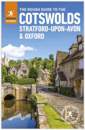
Reisgids Cotswolds England - Rough Guides • 9780241308752
Reisgids Cotswolds England - Rough Guides Productomschrijving: The Rough Guide to the Cotswolds AONB is your definitive handbook to one of the most beautiful and diverse holiday destinations in the UK. From stately homes and wildlife parks to modern art galleries, country walks and adventure sports, there is a section that introduces all of the regions’ highlights. For every town and v…

Wandelgids Cotswolds - Heart of the Cotswolds - Rucksack Readers • 9781913817268
Wandelgids Cotswolds - Heart of the Cotswolds - Rucksack Productomschrijving: The Cotswolds AONB is quintessentially English, with its rich cultural history, medieval ‘wool’ churches and charming domestic architecture of stone, slate and thatch. The book offers three options for walking in the heart of this wonderful area: a 94-mile (151-km) grand tour starting from Cheltenham, and two sh…

Wandelkaart 205 Stratford-upon-Avon & Evesham - OSI • 9780319243985
Wandelkaart Stratford-upon-Avon & Evesham - Warwickshire Omvat ook: Alcester. Productbeschrijving: Kaart nummer 205 in de OS Explorer kaarten reeks beslaat een gebied in de Midlands van Engeland. Dit is een gebied die deel uit maakt van de Cotswolds AONB, alsmede de Monarch en Centenary Way wandelroutes naar het zuiden. Andere steden die zijn opgenomen in het verdragsgebied omvatten Al…

Wandelkaart 151 Stratford-upon-Avon- England - OSI • 9780319262498
Wandelkaart Stratford-upon-Avon - England Productbeschrijving: Als de geboorteplaats van William Shakespeare, is de schilderachtige stad van Stratford-upon-Avon doordrenkt van een rijke geschiedenis en cultuur, en ligt in het hart van het landschap van Warwickshire. OS Landranger kaart 151 toont dit gebied, en omvat een deel van het pad van de E2 Europese lange afstand die door de regio sn…
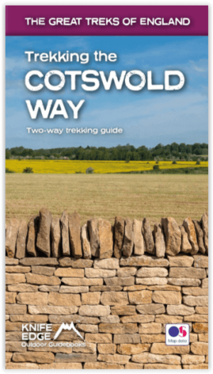
Wandelgids Cotswold - Way Two-way trekking guide - Knife Edge • 9781912933136
Cotswold - Way Two-way trekking guide - Knife Edge Productomschrijving: De Cotswold Way legt 102 mijl af door het sublieme landschap van de Cotswolds, een streek die het toonbeeld is van historisch Engeland. Onderweg gaat u over de top van de Cotswold Escarpment door een prachtig glooiend landschap en historische chocolade-doosdorpjes, gebouwd van prachtige honingkleurige stenen, die eeuwe…