

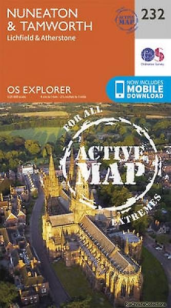
Wandelkaart 232 Nuneaton & Tamworth Lichfield - OSI
Omvat de Midlands rond Warwickshire en Staffordshire
Korte omschrijving
Wandelkaarten Warwickshire, West Midlands van Ordnance Survey. Ideaal voor tochten in England.
Wandelkaart Nuneaton & Tamworth- Lichfield - Warwickshire Omvat ook: Lichfield & Atherstone Productomschrijving: Kaart nummer 232 in de OS Explorer kaarten reeks is ideaal voor het ontde...

Specificaties
- Uitgever: Ordnance Survey
- ISBN-13: 9780319471043
- HOOFDCATEGORIEËN: Wandelkaart
- Activiteiten: Wandelen, Hiking & Trekking
- Regio: Warwickshire, West Midlands
- Land: England
- Waterafstotende kaart: Ordnance Survey ACTIVE Explorer Weatherproof Maps
- TOPO's & Stafkaarten: Topografisch wandelen
- Schaal: 1:25000
- Taal: Engels
- Reeks/Serie: Explorer ACTIVE Series OSI
Volledige omschrijving
Wandelkaart Nuneaton & Tamworth- Lichfield - Warwickshire
Omvat ook: Lichfield & Atherstone
Productomschrijving: Kaart nummer 232 in de OS Explorer kaarten reeks is ideaal voor het ontdekken van de Midlands rond Warwickshire en Staffordshire. De grotere steden Nuneaton en Tamworth, met het marktstadje Atherstone, is dit een gebied met een groot aantal dorpen om in detail te kunnen ontdekken. Andere hoogtepunten van het gebied zijn: Weeford, Malia en market Bosworth. De OS Explorer kaart voor Nuneaton & Tamworth is beschikbaar in zowel de standaard papieren versie als de weerbestendige 'Actief' versie
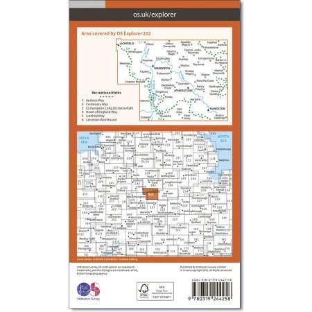
Kaart nummer 232 is een all purpose kaart vol gepakt met informatie om u het gebied te helpen leren kennen. De kaarten bestrijken het land. Elke kaart heeft een oppervlakte van 40 km door 40 km (25 mijl door 25 mijl) en zoals andere kaarten van Ordnance Survey, National Grid-vierkanten worden verstrekt zodat elke functie een unieke referentienummer kan worden gegeven.
Productdiscription: Map sheet number 232 in the OS Explorer map series is ideal for discovering the Midlands around Warwickshire and Staffordshire. From the larger towns of Nuneaton and Tamworth, to the market town of Atherstone, this area has a large number of towns and villages to explore in detail. Other highlights of the area include: Weeford, Shustoke and Market Bosworth. The OS Explorer map for Nuneaton & Tamworth is available in both the standard paper version and weatherproof 'Active' version
Locatie op kaart
Gekoppelde artikelen

Wandelkaart 232 Nuneaton & Tamworth- Warwickshire - OSI • 9780319244258
standaard versieWandelkaart Nuneaton & Tamworth- Warwickshire England Omvat ook: Lichfield & Atherstone Productomschrijving: Kaart nummer 232 in de OS Explorer kaarten reeks is ideaal voor het ontdekken van de Midlands rond Warwickshire en Staffordshire. De grotere steden als Nuneaton en Tamworth, naar het marktstadje Atherstone, heeft dit gebied vele die ideaal zijn om te ontdekken. Andere hoogtepunt…

Wandelkaart 232 Nuneaton & Tamworth Lichfield - OSI • 9780319471043
weatherproof versieWandelkaart Nuneaton & Tamworth- Lichfield - Warwickshire Omvat ook: Lichfield & Atherstone Productomschrijving: Kaart nummer 232 in de OS Explorer kaarten reeks is ideaal voor het ontdekken van de Midlands rond Warwickshire en Staffordshire. De grotere steden Nuneaton en Tamworth, met het marktstadje Atherstone, is dit een gebied met een groot aantal dorpen om in detail te kunnen ontd…
Artikelen uit dezelfde regio
Wandelkaart 151 Stratford-upon-Avon & Warwick - England - OSI • 9780319474747
Wandelkaart Stratford-upon-Avon - Warwick & Banbury Productbeschrijving: Als de geboorteplaats van William Shakespeare, is de schilderachtige stad van Stratford-upon-Avon doordrenkt van een rijke geschiedenis en cultuur, en ligt in het hart van het landschap van Warwickshire. OS Landranger kaart 151 toont dit gebied, en omvat een deel van het E2 Europese lange afstand pad die door de regio…

Wandelgids - Guide to the Cotswolds AONB - AA • 9780749579418
Wandelgids - Guide to the Cotswolds AONB - AA Productomschrijving: The Cotswolds zijn een regio van uitmuntend natuurlijk schoon, of in andere woorden, "Area of Outstanding Natural Beauty". Zo noemen de britten hun meest geliefde regio's. WIj spreken oven nationale parken or regionale parken, terwijl de britten er eveneens over beschikken, maar de AONB's gaan voor op de rest. Talloze route…

Wandelkaart OL45 The Cotswolds AONB - OS • 9780319242841
Wandelkaart The Cotswolds AONB - OS Productomschrijving: Wychwood Community Forest, The Centenary Way, Cotswolds Way, D'Arcy Dalton Way, Diamond Way, E2 European Long Distance Path, Gloucestershire Way, Heart of England Way, Macmillan Way, Monarch's Way, Oxfordshire Way, Thames Path, Shakespeare Way, Warden's Way, Winchcombe Way, Windrush Way & Wychavon Way. Omvat: Burford, Chipping C…
Wandelkaart 221 Coventry & Warwickshire - OSI • 9780319244142
Wandelkaart Coventry & Warwickshire - England Productbeschrijving: Royal Leamington Spa & Kenilworth. 221 / Coventry & Warwickshire, England - OS Explorer kaart 221 dekt Coventry, Warwick, Royal Leamington Spa en de omliggende gebieden. Warwick Castle en vervolgens de rivier de Avon en Fort Lunt Roamn in de buurt van Coventry. De OS Explorer kaart voor Coventry & Warwick is beschikbaa…

Fietskaart 02 Cotswold AONB cycling map - Goldeneye • 9781859653036
Fietskaart Cotswold cycling map - Goldeneye Productomschrijving: De Cotswolds zijn een AONB regio, een regio van uitmuntend natuurschoon. In Engeland geklasseerd als AONB, Area of Outstanding Natural Beauty. Zo heeft de UK er een pak verdeeld over het land. De Cotswold kun je een beetje vergelijken met Cornwall, maar dan zonder de kustlijnen. Hier vindt je prachtige landschappen en trails …