

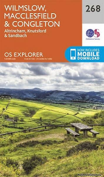
Wandelkaart 268 Wilmslow- Macclesfield & Congleton - OSI
Omvat Wilmslow- Macclesfield & Congleton
Korte omschrijving
Wandelkaarten Cheshire, England van Ordnance Survey. Ideaal voor tochten in England.
Wandelkaart Wilmslow- Macclesfield & Congleton Omvat ook: Altrincham, Knutsford & Sandbach. Productbeschrijving: Kaart nummer 268 in de OS Explorer kaarten reeks omvat Wilmslow, Macclesf...

Specificaties
- Uitgever: Ordnance Survey
- ISBN-13: 9780319244654
- HOOFDCATEGORIEËN: Wandelkaart
- Activiteiten: Wandelen, Hiking & Trekking
- Regio: Cheshire, England
- Land: England
- TOPO's & Stafkaarten: Topografisch wandelen
- Schaal: 1:25000
- Taal: Engels
- Reeks/Serie: Explorer Series OS
Volledige omschrijving
Wandelkaart Wilmslow- Macclesfield & Congleton
Omvat ook: Altrincham, Knutsford & Sandbach.
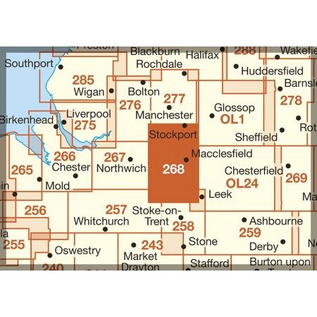
Productbeschrijving: Kaart nummer 268 in de OS Explorer kaarten reeks omvat Wilmslow, Macclesfield & Congleton tussen Stoke-on-Trent en Manchester. Er zijn een heleboel recreatieve paden in dit gebied, met inbegrip van de Gritstone Trail, Dane Valley Way en de Trans Pennine Trail. Het gebied omvat ook een aantal kleinere dorpen, met inbegrip van Sandbach, Congleton, Bollington, Knutsford, Bramhall en Alderley Edge. De OS Explorer kaart voor Wilmslow, Macclesfield & Congleton is beschikbaar in zowel de standaard papieren versie als de weerbestendige 'Active'.
Productdiscription: Map sheet number 268 in the OS Explorer series covers Wilmslow, Macclesfield & Congleton between Stoke-on-Trent and Manchester. There are a lot of recreational paths in this area, including The Gritstone Trail, Dane Valley Way and the Trans Pennine Trail - see the overview below for the complete list. The area also covers a number of smaller villages, including Sandbach, Congleton, Bollington, Knutsford, Bramhall and Alderley Edge. The OS Explorer map for Wilmslow, Macclesfield & Congleton is available in both the standard paper version and weatherproof 'Active'.
Locatie op kaart
Gekoppelde artikelen

Wandelkaart 268 Wilmslow- Macclesfield & Congleton - OSI • 9780319244654
standaard versieWandelkaart Wilmslow- Macclesfield & Congleton Omvat ook: Altrincham, Knutsford & Sandbach. Productbeschrijving: Kaart nummer 268 in de OS Explorer kaarten reeks omvat Wilmslow, Macclesfield & Congleton tussen Stoke-on-Trent en Manchester. Er zijn een heleboel recreatieve paden in dit gebied, met inbegrip van de Gritstone Trail, Dane Valley Way en de Trans Pennine Trail. Het gebied omv…
Wandelkaart 268 Wilmslow Macclesfield & Congleton - OSI • 9780319471401
weatherproof versieWandelkaart Wilmslow- Macclesfield & Congleton - East Cheshire Omvat ook: Altrincham, Knutsford & Sandbach. Productbeschrijving: Kaart nummer 268 in de OS Explorer-reeks omvat Wilmslow, Macclesfield & Congleton tussen Stoke-on-Trent en Manchester. Er zijn een heleboel recreatieve paden op dit gebied te vinden, met inbegrip van de Gritstone Trail, Dane Valley Way en de Trans Pennine Tra…
Overzichtskaarten

OSI Explorer & Explorer Active - Midden Engeland - Midlands
OSI Explorer & Explorer Active - Midden Engeland - Midlands

Producten op de overzichtskaart
Klik op een product om naar de detailpagina te gaan.
- Wandelkaart 180 Oxford- England - OSI
- Wandelkaart 181 Chiltern Hills North AONB- Wycombe - OSI
- Wandelkaart 182 St-Albans & Hatfield- Hertfordshire - OSI
- Wandelkaart 189 Hereford & Ross-on-Wye- England - OSI
- Wandelkaart 190 Malvern Hills AONB & Bredon Hill - OSI
- Wandelkaart 191 Banbury- Bicester & Chipping Norton- OSI
- Wandelkaart 192 Buckingham & Milton Keynes - OSI
- Wandelkaart 193 Luton & Stevenage- Bedfordshire - OSI
- Wandelkaart 194 Hertford & Bishop's Stortford - OSI
- Wandelkaart 202 Leominster & Bromyard Hererfordshire - OSI
- Wandelkaart 203 Ludlow & Shropshire Hills AONB - OSI
- Wandelkaart 204 Worcester & Droitwich Spa - OSI
- Wandelkaart 205 Stratford-upon-Avon & Evesham - OSI
- Wandelkaart 206 Edge Hill & Fenny Compton - OSI
- Wandelkaart 207 Newport Pagnell & Northampton - OSI
- Wandelkaart 208 Bedford & St Neots- Bedforeshire - OSI
- Wandelkaart 209 Cambridge - England - OSI
- Wandelkaart 217 Long Mynd & Wenlock Edge - OSI
- Wandelkaart 218 Kidderminster & Wyre Forest - OSI
- Wandelkaart 219 Wolverhampton & Dudley - OSI
- Wandelkaart 220 Birmingham- West Midlands - OSI
- Wandelkaart 221 Coventry & Warwickshire - OSI
- Wandelkaart 222 Rugby & Daventry- Warwickshire - OSI
- Wandelkaart 223 Northampton & Market Harborough - OSI
- Wandelkaart 224 Corby- Kettering & Wellingborough - OSI
- Wandelkaart 225 Huntingdon & St Ives - OSI
- Wandelkaart 227 Peterborough- Cambridgeshire England - OSI
- Wandelkaart 228 March- Ely- Chatteris & Littleport - OSI
- Wandelkaart 232 Nuneaton & Tamworth- Warwickshire - OSI
- Wandelkaart 233 Leicester & Hinckley England - OSI
- Wandelkaart 234 Rutland Water & Stamford- Oakham - OSI
- Wandelkaart 235 Wisbech & Peterborough North - OSI
- Wandelkaart 241 Shrewsbury- shropshire England - OSI
- Wandelkaart 242 Telford- Ironbridge & the Wrekin - OSI
- Wandelkaart 243 Market Drayton- Schropshire - OSI
- Wandelkaart 244 Cannock Chase & Chasewater- Severn - OSI
- Wandelkaart 245 National Forest- Burton-upon-Trent - OSI
- Wandelkaart 245 National Forest - OSI
- Wandelkaart 246 Loughborough- Leicestershire England - OSI
- Wandelkaart 247 Grantham- Lincolnshire - OSI
- Wandelkaart 248 Bourne & Heckington- lincolnshire - OSI
- Wandelkaart 249 Spalding & Holbeach- Lincolnshire - OSI
- Wandelkaart 257 Crewe & Nantwich & Cheshire East - OSI
- Wandelkaart 258 Stoke-on-Trent & Newcastle-under-Lyme- OSI
- Wandelkaart 259 Derby & Utoxeter- Derbyshire - OSI
- Wandelkaart 260 Nottingham & Vale of Belvoir - OSI
- Wandelkaart 261 Boston & Lincolnshire- England - OSI
- Wandelkaart 267 Northwich & Delamere Forest - OSI
- Wandelkaart 268 Wilmslow- Macclesfield & Congleton - OSI
- Wandelkaart 269 Chesterfield & Alfreton- Derbyshire- OSI
- Wandelkaart 270 Sherwood Forest- Nottinghamshire - OSI
- Wandelkaart 271 Newark-on-Trent- Nottinghampshire - OSI
- Wandelkaart 272 Lincoln- England - OSI
- Wandelkaart 273 Lincolnshire Wolds South- England - OSI
- Wandelkaart 274 Skegness- Alford & Spilsby - OSI
- Wandelkaart 275 Liverpool- South West England - OSI
- Wandelkaart 276 Bolton- Wigan & Warrington- Machester - OSI
- Wandelkaart 277 Manchester & Salford - OSI
- Wandelkaart 278 Sheffield & Barnsley- South Yorkshire - OSI
- Wandelkaart 279 Doncaster- South Yorkshire - OSI
- Wandelkaart 280 Isle of Axholme- Lincolnshire - OSI
- Wandelkaart 281 Ancholme Valley- Lincolnshire - OSI
- Wandelkaart 282 Lincolnshire Wolds North- England - OSI
- Wandelkaart 283 Louth & Mablethorpe- Lincolnshire - OSI
- Wandelkaart 284 Grimsby- Cleethorpes & Immingham - OSI
- Wandelkaart OL01 Peak District NP & Dark Peak area - OS
- Wandelkaart OL13 Brecon Beacons National Parc East - OS
- Wandelkaart OL24 Peak District & White Peak area - OS
- Wandelkaart OL40 The Broads National Park - OS
Artikelen uit dezelfde regio
Reisgids Go Slow Cheshire England - Bradt travel guides • 9781804692684
Reisgids Cheshire England - Bradt Productomschrijving: Part of Bradt’s distinctive, award-winning series of ‘Slow’ travel guides to UK regions, the new, thoroughly updated second edition of Cheshire (Slow Travel) celebrates this charming, popular English county. Written with intimate detail and insider tips by two authors raised in Cheshire, it remains the only standalone guidebook to pro…
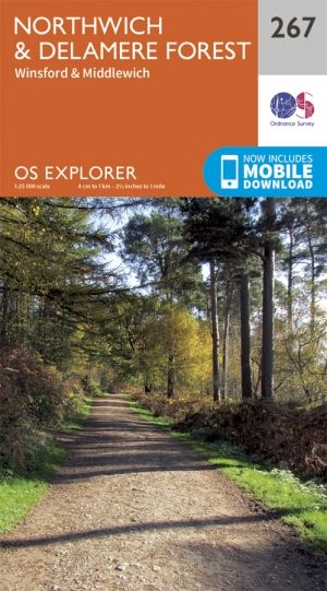
Wandelkaart 267 Northwich & Delamere Forest - OSI • 9780319244647
Wandelkaart Northwich & Delamere Forest - Cheshire England Omvat ook: Winsford & Middlewich Productomschrijving: De Mersey Forest omvat Northwich, Winsford en Delamere Forest. Met routes om te wandelen, fietsen en om te paardrijden, er zijn ook evenementen het hele jaar door. De OS Explorer kaart voor Northwich & Delamere Forest is beschikbaar in zowel de standaard papieren versie als …
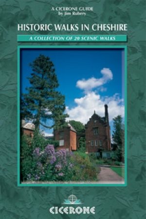
Wandelgids Cheshire England - historic walks - Cicerone • 9781852843915
Wandelgids Cheshire England - historic walks - Cicerone Productomschrijving: Deze handige gids in zakformaat, bevat routebeschrijvingen voor 20 circulaire dagwandelingen in het historische graafschap Cheshire. Deze schilderachtige wandelingen zijn maximaal 9 km lang en variëren van gracht ballade tot wandeltochten door wilder land. De routes zijn vol van historische bezienswaardigheden en …

Fietsgids Peak District cycling - Cicerone • 9781852848781
Fietsgids - Peak District cycling - Cicerone Productomschrijving: Fietsgids over het Peak district, die routes beschrijft in- en rond het National Park, op de weg of op de talrijke fietsroutes. 20 dag routes en één meerdaags fietsroute door het Peak District. Allemaal gemakkelijk toegankelijke routes vanuit Sheffield en Manchester, met routes vanaf het charmante Derbyshire, met steden zoal…

Fietskaart 03 Peak District cycling map - Goldeneye • 9781859653043
Fietskaart Peak District cycling map - Goldeneye Productomschrijving: Het Peak District is een nationaal park van formaat pal in het centrum van Engeland. deze kaart biedt u een overzicht van alle fietsroutes in- en door het park. Het Peak District is dan ook goed gekend voor zijn heuvel, bergen, waterwegen, wandel- en fietsroutes. Egelse omschrijving: The Peak District offers some of …