
Fietskaart 03 Peak District cycling map - Goldeneye
Some of the best country lane cycling in Britain

Korte omschrijving
Fietskaarten Derbyshire & Peak District, England, Cheshire, England, Greater Manchester, England, Staffordshire, England en West Yorkshire, England van Goldeneye. Ideaal voor tochten in England.
Fietskaart Peak District cycling map - Goldeneye Productomschrijving: Het Peak District is een nationaal park van formaat pal in het centrum van Engeland. deze kaart biedt u een overzicht va...

Specificaties
- Uitgever: Goldeneye
- ISBN-13: 9781859653043
- HOOFDCATEGORIEËN: Fietskaart
- Activiteiten: Fietsen / VTT / MTB
- Regio: Cheshire, England, Derbyshire & Peak District, England, Greater Manchester, England, Staffordshire, England, West Yorkshire, England
- Land: England
- Nationale parken: Peak District NP, Derbyshire UK
- Schaal: 1:100000
- Editie: 6
- Taal: Engels
- De Nationale Parken: Peak District Nationaal Park, England
- De Engelse Graafschappen: Derbyshire, South Yorkshire
Volledige omschrijving
Fietskaart Peak District cycling map - Goldeneye
Productomschrijving: Het Peak District is een nationaal park van formaat pal in het centrum van Engeland. deze kaart biedt u een overzicht van alle fietsroutes in- en door het park. Het Peak District is dan ook goed gekend voor zijn heuvel, bergen, waterwegen, wandel- en fietsroutes.
Egelse omschrijving: The Peak District offers some of the best country lane cycling in Britain. The Tissington, Manifold and High Peak Trails are some of the longest converted railway tracks in the country and are a great way for families and inexperienced cyclists to enjoy traffic-free cycling.
• 11 Cycle Hire locations
• 16 circular routes overprinted on map
• National Cycle Network routes 68, 54 and 62 are illustrated, and the Traffic-Free Family Cycling Trails: Carsington Water, Five Pits Trail, High Peak Trail, Kedleston Hall, Manifold Track, Middlewood Way, Monsal Trail, Rudyard Reservoir, Sett Valley Trail and Tissington Trail.
Artikelen uit dezelfde regio

Wandelkaart 104 Leeds & Bradford - West Yorkshire - OSI • 9780319262023
Wandelkaart Leeds- Bradford- Harrogate & Ilkley - West Yorkshire Productbeschrijving: Kaart nummer 104 in de OS Landranger kaarten reeks, dekt Leeds, Bradford en de omliggende gebieden. De Leeds-Bradford metropool is een levendige agglomeratie, en bied van een breed scala aan attracties variërend van musea tot winkelcentra met het landelijke Yorkshire Dales national park in de buurt. Dit …

Wandelkaart 276 Bolton- Wigan & Warrington - OSI • 9780319471487
Wandelkaart Bolton- Wigan & Warrington - Greater Manchester Productbeschrijving: Evenals de steden van Wigan, Bolton en Warrington omvat de OS Explorer kaart 276 delen van de Mersey Forset en The Red Rose Forest. Deze gebieden werden ontwikkeld om de outdoor-activiteiten te verhogen van potentiële bezoekers aan het gebied. De OS Explorer kaart voor Bolton, Wigan & Warrington is beschikbaar…

Wandelkaart 245 National Forest - OSI • 9780319475461
Wandelkaart National Forest - OSI Productomschrijving: The National Forest is een milieuproject in Midden-Engeland dat wordt beheerd door The National Forest Company. U kunt deze wel zeer speciale plaats terug vinden in- en rond de gehuchten van north Leicestershire, south Derbyshire and southeast Staffordshire. Engelse omschrijving: The National Forest is an environmental project in …
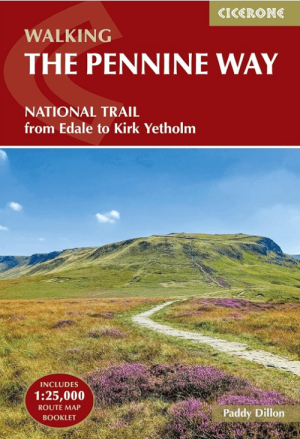
Wandelgids The Pennine Way from Edale to Kirk Yetholm - Cicerone • 9781786311313
The Pennine Way from Edale to Kirk Yetholm - Cicerone Productomschrijving: Guidebook to the Pennine Way National Trail with OS map booklet. The 420 km route from Edale to Kirk Yetholm takes three weeks to walk and is suitable for fit and experienced long distance walkers. The route crosses the Peak District, Yorkshire Dales and North Pennines National Parks. Includes separate OS 1:25,000 …

Wandelkaart 104 Leeds & Bradford & Harrogate - OSI • 9780319474273
Wandelkaart Leeds- Bradford- Harrogate & Ilkley Productbeschrijving: Kaart nummer 104 in de reeks van de OS Landranger kaarten, dekt Leeds, Bradford en de omliggende gebieden. De Leeds-Bradford metropool is een levendige agglomeratie, ie een breed scala aan attracties aanbied, variërend van musea tot winkelcentra met het landelijke Yorkshire Dales national park in de buurt. Deze kaart beva…