

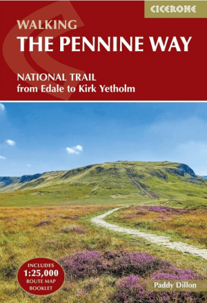
Wandelgids Map Booklet Pennine Way - Cicerone
Pennine Way National Trail - 435 Km


Korte omschrijving
Wandelgidsen Yorkshire-Humberside, Derbyshire & Peak District, England en Northumberland, Engeland van CICERONE Press. Ideaal voor tochten in England.
Map Booklet Pennine Way - Cicerone Productomschrijving: Map of the 270 miles (435km) Pennine Way National Trail, between Edale in the Peak District and Kirk Yetholm in the Scottish Borders....

Specificaties
- Uitgever: CICERONE Press
- ISBN-13: 9781786311412
- HOOFDCATEGORIEËN: Wandelgids
- Activiteiten: Wandelen, Hiking & Trekking
- Regio: Derbyshire & Peak District, England, Northumberland, Engeland, Yorkshire-Humberside
- Land: England
- Nationale parken: North Pennines National Park, Peak District NP, Derbyshire UK, Yorkshire Dales NP, England
- AONB - Area of Outstanding Beauty/National Landscape: Northern Pennines AONB
- Schaal: 1:25000
- Editie: 2
- Taal: Engels
- Reeks/Serie: Map Booklet, Cicerone
- National Trails UK, England & Wales: Pennine Way, England
Volledige omschrijving
Map Booklet Pennine Way - Cicerone
Productomschrijving: Map of the 270 miles (435km) Pennine Way National Trail, between Edale in the Peak District and Kirk Yetholm in the Scottish Borders. This booklet is included with the Cicerone guidebook to the trail, and shows the full route on OS 1:25,000 maps. This popular long-distance route typically takes three weeks to complete.
Seasons:
This National Trail is essentially a summer walk, though it can be completed in spring or autumn, the winter months are solely for dedicated and experienced long-distance walkers.
Centres:
Edale, Crowden, Hebden Bridge, Cowling, Gargrave, Malham, Horton in Ribblesdale, Hawes, Keld, Bowes, Middleton-in-Teesdale, Dufton, Alston, Hadrian's Wall, Bellingham, Byrness, Kirk Yetholm.
Difficulty:
The Pennine Way is a challenging walk, often across high, exposed moorlands. No problems on fine, sunny days, but some parts can be exceptionally difficult in bad weather. In mist, careful navigation is required, but on the whole the route is well-signposted. Suitable for backpackers and youth hostellers, but ample B&B accommodation is also available. Previous long-distance walking experience is an advantage.
Must See:
Peak District National Park - Kinder Scout, Bleaklow and Black Hill; South Pennines - Stoodley Pike and Brontë Country; Yorkshire Dales National Park - Malham Cove, Pen-y-Ghent and Great Shunner Fell; North Pennines AONB - Teesdale, High Cup and Cross Fell; Northumberland National Park - Hadrian's Wall and the Cheviot Hills.

Gekoppelde artikelen
Wandelgids The Pennine Way from Edale to Kirk Yetholm - Cicerone • 9781786311313
standaard versieThe Pennine Way from Edale to Kirk Yetholm - Cicerone Productomschrijving: Guidebook to the Pennine Way National Trail with OS map booklet. The 420 km route from Edale to Kirk Yetholm takes three weeks to walk and is suitable for fit and experienced long distance walkers. The route crosses the Peak District, Yorkshire Dales and North Pennines National Parks. Includes separate OS 1:25,000 …
Artikelen uit dezelfde regio

Wandelgids The Pennine Way - Trailblazer • 9781912716333
The Pennine Way 420 km - Trailblazer Productomschrijving: De Pennine Way, het bekendste nationale pad van Groot-Brittannië, slingert zich 420 km over woeste heidevelden en door stille dalen langs de ruggengraat van Noord-Engeland. Het begint in Edale in het Peak District en eindigt net over de grens in Schotland bij Kirk Yetholm. Dit prachtige wandelpad doorkruist 3 nationale parken - het …

Fietskaart 03 Peak District cycling map - Goldeneye • 9781859653043
Fietskaart Peak District cycling map - Goldeneye Productomschrijving: Het Peak District is een nationaal park van formaat pal in het centrum van Engeland. deze kaart biedt u een overzicht van alle fietsroutes in- en door het park. Het Peak District is dan ook goed gekend voor zijn heuvel, bergen, waterwegen, wandel- en fietsroutes. Egelse omschrijving: The Peak District offers some of …

Mountainbikegids Peak District Mountain Biking - Vertebrate Publ. • 9781906148188
Peak District Mountain Biking - Vertebrate Productomschrijving: Peak District Mountain Biking by Jon Barton features 26 of the best mountain bike rides in the Dark Peak, between 9km and 105km in length, suitable for all levels of mountain bikers. This second edition features Ordnance Survey maps, and is illustrated with action photography. Includes Grenoside Woods and Lady Canning's Planta…
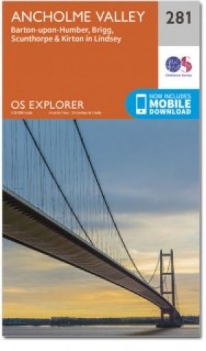
Wandelkaart 281 Ancholme Valley- Lincolnshire - OSI • 9780319471531
Wandelkaart Ancholme Valley - Lincolnshire Yorkshire & The Humber Omvat ook: Barton-upon-Humber, Brigg, Scunthorpe & Kirton in Lindsey. Productbeschrijving: OS Explorer kaart 281 is een dubbel zijdig kaart, en omvat Barton-upon-Humber tot bisschop Norton. Het omvat delen van de Viking way (onderdeel van het E2 Europese Long Distance pad), evenals de New River Ancholme, en een door de m…

Wandelgids 073 Pathfinder guides More Peak District - OS • 9780319091081
Wandelgids More Peak District - OS Productomschrijving: This companion to the Pathfinder Peak District Guidebook contains 28 additional circular walks of 5km (3 miles) to 17km (10.5 miles). Like the main book, each is graded by length difficulty, and ranges from relatively easy strolls to some of the more challenging routes with considerable vertical ascent. Each route includes a deta…