

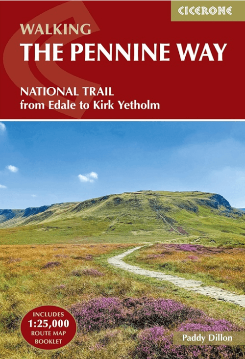
Wandelgids The Pennine Way from Edale to Kirk Yetholm - Cicerone
National Trail- Peak District- Yorkshire Dales and North Pennines
Korte omschrijving
Wandelgidsen Yorkshire-Humberside en Derbyshire & Peak District, England van CICERONE Press. Ideaal voor tochten in England.
The Pennine Way from Edale to Kirk Yetholm - Cicerone Productomschrijving: Guidebook to the Pennine Way National Trail with OS map booklet. The 420 km route from Edale to Kirk Yetholm takes...

Specificaties
- Uitgever: CICERONE Press
- ISBN-13: 9781786311313
- HOOFDCATEGORIEËN: Wandelgids
- Activiteiten: Wandelen, Hiking & Trekking
- Auteur: Paddy Dylan
- Regio: Derbyshire & Peak District, England, Yorkshire-Humberside
- Land: England
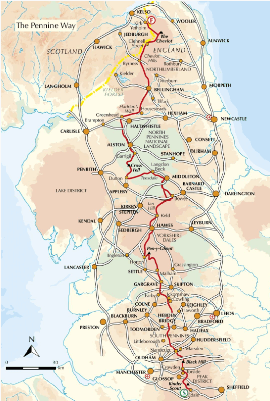
- Lange afstand wandelroutes: Pennine Way (420 km)
- Nationale parken: North Pennines National Park, Peak District NP, Derbyshire UK, Yorkshire Dales NP, England
- AONB - Area of Outstanding Beauty/National Landscape: Northern Pennines AONB
- Editie: 5
- Taal: Engels
- National Trails UK, England & Wales: Pennine Way, England
Volledige omschrijving
The Pennine Way from Edale to Kirk Yetholm - Cicerone
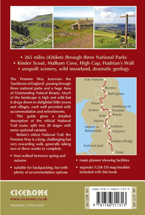
Productomschrijving: Guidebook to the Pennine Way National Trail with OS map booklet. The 420 km route from Edale to Kirk Yetholm takes three weeks to walk and is suitable for fit and experienced long distance walkers. The route crosses the Peak District, Yorkshire Dales and North Pennines National Parks. Includes separate OS 1:25,000 map booklet of the route.
Seasons:
This National Trail is essentially a summer walk, though it can be completed in spring or autumn, the winter months are solely for dedicated and experienced long-distance walkers.
Centres:
Edale, Crowden, Hebden Bridge, Cowling, Gargrave, Malham, Horton in Ribblesdale, Hawes, Keld, Bowes, Middleton-in-Teesdale, Dufton, Alston, Hadrian's Wall, Bellingham, Byrness, Kirk Yetholm.
Difficulty:
The Pennine Way is a challenging walk, often across high, exposed moorlands. No problems on fine, sunny days, but some parts can be exceptionally difficult in bad weather. In mist, careful navigation is required, but on the whole the route is well-signposted. Suitable for backpackers and youth hostellers, but ample B&B accommodation is also available. Previous long-distance walking experience is an advantage.
Must See:
Peak District National Park - Kinder Scout, Bleaklow and Black Hill; South Pennines - Stoodley Pike and Brontë Country; Yorkshire Dales National Park - Malham Cove, Pen-y-Ghent and Great Shunner Fell; North Pennines AONB - Teesdale, High Cup and Cross Fell; Northumberland National Park - Hadrian's Wall and the Cheviot Hills.
Gekoppelde artikelen
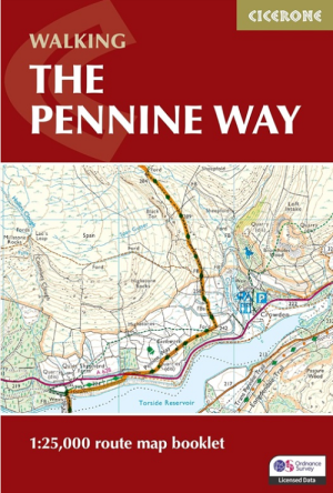
Wandelgids Map Booklet Pennine Way - Cicerone • 9781786311412
standaard versieMap Booklet Pennine Way - Cicerone Productomschrijving: Map of the 270 miles (435km) Pennine Way National Trail, between Edale in the Peak District and Kirk Yetholm in the Scottish Borders. This booklet is included with the Cicerone guidebook to the trail, and shows the full route on OS 1:25,000 maps. This popular long-distance route typically takes three weeks to complete. Seasons: …
Artikelen uit dezelfde regio

Wandelkaart 245 National Forest - OSI • 9780319475461
Wandelkaart National Forest - OSI Productomschrijving: The National Forest is een milieuproject in Midden-Engeland dat wordt beheerd door The National Forest Company. U kunt deze wel zeer speciale plaats terug vinden in- en rond de gehuchten van north Leicestershire, south Derbyshire and southeast Staffordshire. Engelse omschrijving: The National Forest is an environmental project in …
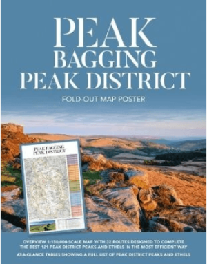
Poster Peak District Peak Bagging fold-out map poster - Vertebrat • 9781839812972
Peak District Peak Bagging fold-out map poster - Vertebrate Productomschrijving: The Peak Bagging Peak District Fold-out Map Poster is designed to give you an at-a-glance guide to 32 routes designed to help you complete 121 of the most rewarding summits in the national park, including the 74 accessible Ethels plus 47 other notable tops, in the most efficient way. Derived from the bests…

Wandelgids Day New Walks in the Peak District - Vertebrate Publ. • 9781839810237
Day New Walks in the Peak District - Vertebrate Productomschrijving: Day Walks in the Peak District – 20 new circular routes features 20 circular walks, between 8.7 and 12.8 miles (14km and 20.6km), suitable for hillwalkers of all abilities. Local authors Norman Taylor and Barry Pope share walks in their favourite areas of the Peak District National Park including Derwent Edge, Dove Dale …

Wandelgids Park Rangers Favourite Walks Peak District - Collins • 9780008439125
Park Rangers Favourite Walks Peak District - Collins Productomschrijving: Wandelgids voor het Peak District National Park, met 20 van de beste routes uitgekozen door de parkwachters. Elke wandeling varieert in lengte van 2 tot 10 km en kan worden voltooid in minder dan 4 uur. Engelse omschrijving: Walking guide to the Peak District National Park, with 20 best routes chosen by the park …

Wandelkaart OL01 Peak District NP & Dark Peak area - OS • 9780319263655
Wandelkaart Peak District NP & Dark Peak area - OS Productomschrijving: Peak District National Park & Dark Peak area, Derbyshire England. Omvat: Parts of Peak districh National & Dark peak Area, Kinder Scout, Bleaklow, Black Hill & Ladybower Reservoir. Ontdek de OL-serie van Ordnance Survey: De OL-serie (Outdoor Leisure) van Ordnance Survey is dé referentie voor wie gaat wandele…