

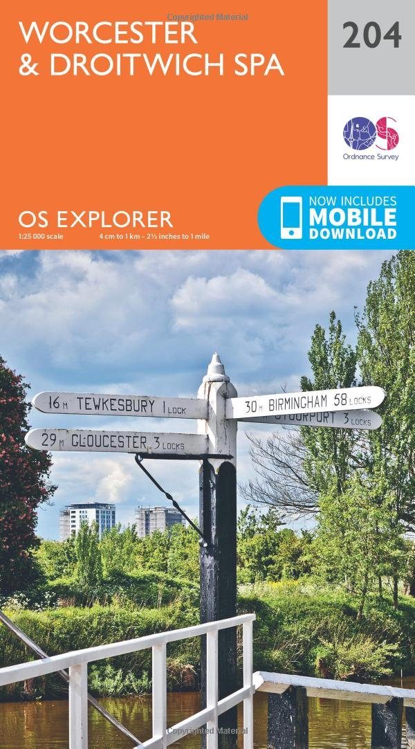
Wandelkaart 204 Worcester & Droitwich Spa - OSI
Met nederzettingen die dateren uit het Neolithicum
Korte omschrijving
Wandelkaarten Worcestershire, West England van Ordnance Survey. Ideaal voor tochten in United Kingdom, Great Britain.
Wandelkaart Worcester & Droitwich Spa - Worcestershire Productbeschrijving: In de buurt van de kruispunten van de rivier Teme en de rivier de Severn, de stad van Worcester en de omliggende s...

Specificaties
- Uitgever: Ordnance Survey
- ISBN-13: 9780319243978
- HOOFDCATEGORIEËN: Wandelkaart
- Activiteiten: Wandelen, Hiking & Trekking
- Regio: Worcestershire, West England
- Land: United Kingdom, Great Britain
- TOPO's & Stafkaarten: Topografisch wandelen
- Schaal: 1:25000
- Taal: Engels
- Reeks/Serie: Explorer Series OS
Volledige omschrijving
Wandelkaart Worcester & Droitwich Spa - Worcestershire
Productbeschrijving: In de buurt van de kruispunten van de rivier Teme en de rivier de Severn, de stad van Worcester en de omliggende steden, vallen onder OS Explorer kaart 204. Dit gebied heeft nederzettingen die dateren uit het Neolithicum, dit gebied huist deel van de Malven Hills, plus een aantal kleinere groene ruimtes om te ontdekken. De OS Explorer kaart voor Worcester & Droitwich Spa is beschikbaar in zowel de standaard papieren versie als de weerbestendige 'Actief' versie.
Productdiscription: Near the junctions of the River Teme and River Severn, the City of Worcester and the surrounding towns and villages are covered by OS Explorer Map 204. With settlements dating back to the Neolithic, this area has par of the Malvern Hills, plus a number of smaller green spaces to discover. The OS Explorer map for Worcester & Droitwich Spa is available in both the standard paper version and weatherproof 'Active' version.
Locatie op kaart
Gekoppelde artikelen

Wandelkaart 204 Worcester & Droitwich Spa - OSI • 9780319243978
standaard versieWandelkaart Worcester & Droitwich Spa - Worcestershire Productbeschrijving: In de buurt van de kruispunten van de rivier Teme en de rivier de Severn, de stad van Worcester en de omliggende steden, vallen onder OS Explorer kaart 204. Dit gebied heeft nederzettingen die dateren uit het Neolithicum, dit gebied huist deel van de Malven Hills, plus een aantal kleinere groene ruimtes om te ontde…

Wandelkaart 204 Worcester & Droitwich Spa - OSI • 9780319470763
weatherproof versieWandelkaart Worcester & Droitwich Spa - England Productbeschrijving: In de buurt van de kruispunten van de rivier Teme en de rivier de Severn, ligt de stad van Worcester, en de omliggende steden en dorpen vallen onder OS Explorer kaart 204. Dit gebied heeft nederzettingen die dateren uit het Neolithicum, en deel van de Malven Hills, plus een aantal kleinere groene ruimtes om te ontdekken. …
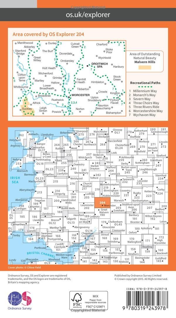
Overzichtskaarten

OSI Explorer & Explorer Active - Midden Engeland - Midlands
OSI Explorer & Explorer Active - Midden Engeland - Midlands

Producten op de overzichtskaart
Klik op een product om naar de detailpagina te gaan.
- Wandelkaart 180 Oxford- England - OSI
- Wandelkaart 181 Chiltern Hills North AONB- Wycombe - OSI
- Wandelkaart 182 St-Albans & Hatfield- Hertfordshire - OSI
- Wandelkaart 189 Hereford & Ross-on-Wye- England - OSI
- Wandelkaart 190 Malvern Hills AONB & Bredon Hill - OSI
- Wandelkaart 191 Banbury- Bicester & Chipping Norton- OSI
- Wandelkaart 192 Buckingham & Milton Keynes - OSI
- Wandelkaart 193 Luton & Stevenage- Bedfordshire - OSI
- Wandelkaart 194 Hertford & Bishop's Stortford - OSI
- Wandelkaart 202 Leominster & Bromyard Hererfordshire - OSI
- Wandelkaart 203 Ludlow & Shropshire Hills AONB - OSI
- Wandelkaart 204 Worcester & Droitwich Spa - OSI
- Wandelkaart 205 Stratford-upon-Avon & Evesham - OSI
- Wandelkaart 206 Edge Hill & Fenny Compton - OSI
- Wandelkaart 207 Newport Pagnell & Northampton - OSI
- Wandelkaart 208 Bedford & St Neots- Bedforeshire - OSI
- Wandelkaart 209 Cambridge - England - OSI
- Wandelkaart 217 Long Mynd & Wenlock Edge - OSI
- Wandelkaart 218 Kidderminster & Wyre Forest - OSI
- Wandelkaart 219 Wolverhampton & Dudley - OSI
- Wandelkaart 220 Birmingham- West Midlands - OSI
- Wandelkaart 221 Coventry & Warwickshire - OSI
- Wandelkaart 222 Rugby & Daventry- Warwickshire - OSI
- Wandelkaart 223 Northampton & Market Harborough - OSI
- Wandelkaart 224 Corby- Kettering & Wellingborough - OSI
- Wandelkaart 225 Huntingdon & St Ives - OSI
- Wandelkaart 227 Peterborough- Cambridgeshire England - OSI
- Wandelkaart 228 March- Ely- Chatteris & Littleport - OSI
- Wandelkaart 232 Nuneaton & Tamworth- Warwickshire - OSI
- Wandelkaart 233 Leicester & Hinckley England - OSI
- Wandelkaart 234 Rutland Water & Stamford- Oakham - OSI
- Wandelkaart 235 Wisbech & Peterborough North - OSI
- Wandelkaart 241 Shrewsbury- shropshire England - OSI
- Wandelkaart 242 Telford- Ironbridge & the Wrekin - OSI
- Wandelkaart 243 Market Drayton- Schropshire - OSI
- Wandelkaart 244 Cannock Chase & Chasewater- Severn - OSI
- Wandelkaart 245 National Forest- Burton-upon-Trent - OSI
- Wandelkaart 245 National Forest - OSI
- Wandelkaart 246 Loughborough- Leicestershire England - OSI
- Wandelkaart 247 Grantham- Lincolnshire - OSI
- Wandelkaart 248 Bourne & Heckington- lincolnshire - OSI
- Wandelkaart 249 Spalding & Holbeach- Lincolnshire - OSI
- Wandelkaart 257 Crewe & Nantwich & Cheshire East - OSI
- Wandelkaart 258 Stoke-on-Trent & Newcastle-under-Lyme- OSI
- Wandelkaart 259 Derby & Utoxeter- Derbyshire - OSI
- Wandelkaart 260 Nottingham & Vale of Belvoir - OSI
- Wandelkaart 261 Boston & Lincolnshire- England - OSI
- Wandelkaart 267 Northwich & Delamere Forest - OSI
- Wandelkaart 268 Wilmslow- Macclesfield & Congleton - OSI
- Wandelkaart 269 Chesterfield & Alfreton- Derbyshire- OSI
- Wandelkaart 270 Sherwood Forest- Nottinghamshire - OSI
- Wandelkaart 271 Newark-on-Trent- Nottinghampshire - OSI
- Wandelkaart 272 Lincoln- England - OSI
- Wandelkaart 273 Lincolnshire Wolds South- England - OSI
- Wandelkaart 274 Skegness- Alford & Spilsby - OSI
- Wandelkaart 275 Liverpool- South West England - OSI
- Wandelkaart 276 Bolton- Wigan & Warrington- Machester - OSI
- Wandelkaart 277 Manchester & Salford - OSI
- Wandelkaart 278 Sheffield & Barnsley- South Yorkshire - OSI
- Wandelkaart 279 Doncaster- South Yorkshire - OSI
- Wandelkaart 280 Isle of Axholme- Lincolnshire - OSI
- Wandelkaart 281 Ancholme Valley- Lincolnshire - OSI
- Wandelkaart 282 Lincolnshire Wolds North- England - OSI
- Wandelkaart 283 Louth & Mablethorpe- Lincolnshire - OSI
- Wandelkaart 284 Grimsby- Cleethorpes & Immingham - OSI
- Wandelkaart OL01 Peak District NP & Dark Peak area - OS
- Wandelkaart OL13 Brecon Beacons National Parc East - OS
- Wandelkaart OL24 Peak District & White Peak area - OS
- Wandelkaart OL40 The Broads National Park - OS
Artikelen uit dezelfde regio

Wandelkaart 190 - Malvern Hills AONB & Bredon Hill - OSI • 9780319470626
Wandelkaart Malvern Hills AONB & Bredon Hill AONB England Omvat ook: Tewkesbury, Ledbury, Pershore & Upton upon Severn. Productbeschrijving: Kaart nummer 190 in de OS Explorer kaarten reeks heeft betrekking op twee gebieden van uitzonderlijke natuurlijke schoonheid; de Cotswolds AONB en het bestuurlijke gebied Malvern Hills AONB en de nederzettingen van de Great Malvern, Upton op Sever…
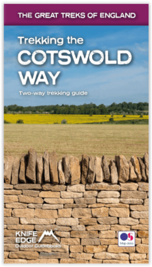
Wandelgids Cotswold - Way Two-way trekking guide - Knife Edge • 9781912933136
Cotswold - Way Two-way trekking guide - Knife Edge Productomschrijving: De Cotswold Way legt 102 mijl af door het sublieme landschap van de Cotswolds, een streek die het toonbeeld is van historisch Engeland. Onderweg gaat u over de top van de Cotswold Escarpment door een prachtig glooiend landschap en historische chocolade-doosdorpjes, gebouwd van prachtige honingkleurige stenen, die eeuwe…
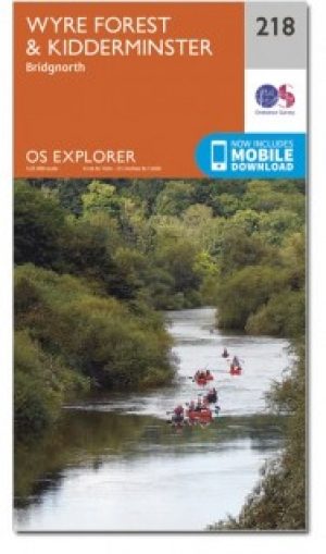
Wandelkaart 218 Kidderminster & Wyre Forest - OSI • 9780319470909
Wandelkaart Kidderminster & Wyre Forest - Worcestershire Omvat ook: Bridgnorth. Productbeschrijving: OS Explorer kaart 218 volgt het zuiden van de rivier de Severn van Stockton naar Stourport-on-Severn. Het toont een aantal Recereational paden, met inbegrip van Jack Mytton Way, Severn way en de Staffordshire way. De OS Explorer kaart voor Kidderminster & Wyre Forest is beschikbaar in z…

Moutainbike Cotswold Gravel & Mountain AONB - Goldeneye • 9781859653135
Moutainbike map Cotswold - Goldeneye Productomschrijving: Cotswold Gravel & Mountain Bike Routes: The Ultimate Off-Road Experience - Gravel & Mountain Bike Routes 18 (Paperback) When mountainbiking in the Cotswolds, in an Area of Outstanding Natural Beauty of AONB area, a lot of sportsfanatics & MTB fanatics are very interested, and cannot go wrong with this new Goldeneye mountainbiki…

Wandelgids - Cotswold Classic Walks - Goldeneye • 9781859652916
Cotswold Classic Walks - Goldeneye Productomschrijving: Met 25 rondwandelingen helpt dit boek u een uitvalsbasis te vinden om de auto te ontvluchten en te genieten van een weekend vol frisse lucht en beweging.... Sommige wandelingen bieden verschillende routemogelijkheden en links naar andere wandelingen. Hoe beslist u welke wandeling u gaat doen? - Waar zijn de mooiste uitzichten? - W…