

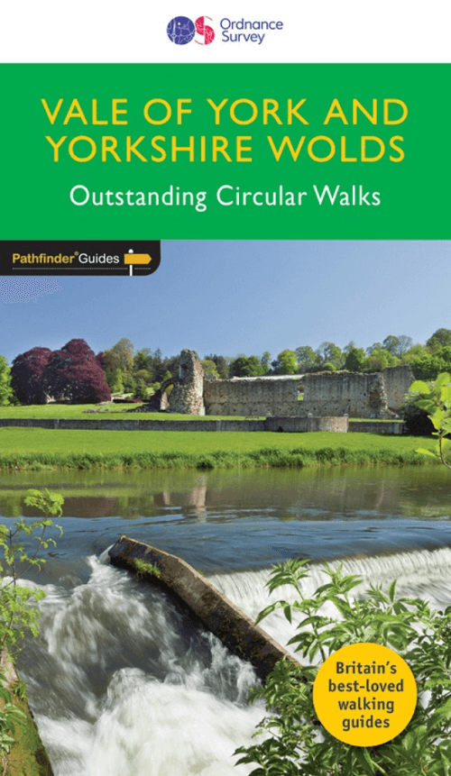
Wandelgids 049 Pathfinder guides Vale of York East England - OS
Flamborough Head - Wharram Percy - Pocklington

Korte omschrijving
Wandelgidsen Yorkshire-Humberside van Ordnance Survey. Ideaal voor tochten in England.
Wandelgids Vale of York East England - OS Productomschrijving: With 28 circular, graded walks all tried and tested by seasoned walkers, this guidebook for the Vale of York and the Yorkshire...

Specificaties
- Uitgever: Ordnance Survey
- ISBN-13: 9780319090732
- HOOFDCATEGORIEËN: Wandelgids
- Activiteiten: Wandelen, Hiking & Trekking
- Auteur: Dennis Kelsal
- Regio: Yorkshire-Humberside
- Land: England
- Taal: Engels
- Reeks/Serie: Outstanding Circular Walks, Pathfinder Series, OS
- De Engelse Graafschappen: Yorkshire
Volledige omschrijving
Wandelgids Vale of York East England - OS
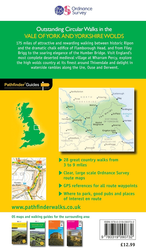
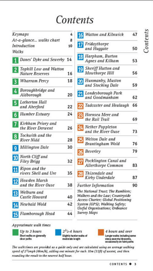
Productomschrijving: With 28 circular, graded walks all tried and tested by seasoned walkers, this guidebook for the Vale of York and the Yorkshire Wolds will help you to make the most of a holiday or day out. Routes range from 4km (2.5 miles) up to 15.3km (9.5 miles), so there is a route to suit all abilities and available time.
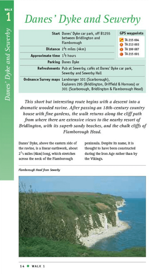
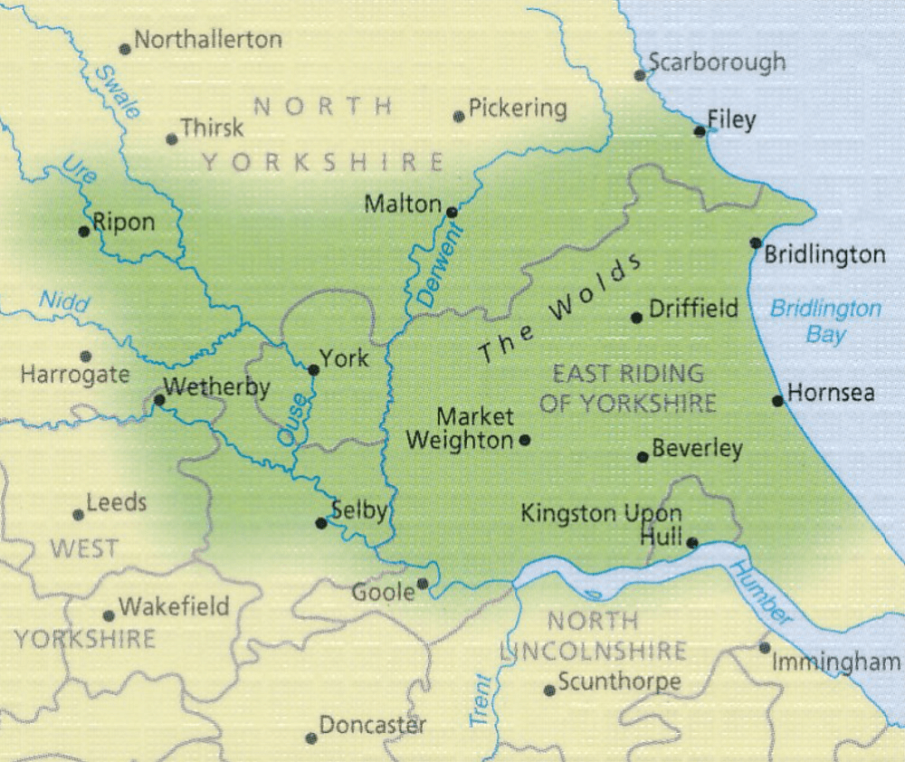
While most visitors to the area go to Yorkshire's two national parks, the flat plains of the Vale of York and the rolling uplands the Wolds are a great alternative, and still provide a huge diversity of scenery and walking opportunities. Highlights of the 28 walks shown include the coast at Flamborough Head, the deserted medieval village of Wharram Percy and the Pocklington Canal.
Each walk includes a full description and an extract of the OS map for the route as well as notes and photos of key features not to miss. This is one of a series of Pathfinder Guides, which are Britain’s best-loved walking guides. Printed with weather-resistant covers featuring durable rounded corners, they are the perfect companion for country walking throughout Britain.
Overzichtskaarten

Overzicht Pathfinder guides - OS
Overzicht Pathfinder guides - OS

Producten op de overzichtskaart
Klik op een product om naar de detailpagina te gaan.
- Wandelgids 001 Pathfinder guides South Devon & Dartmoor NP - OS
- Wandelgids 003 Pathfinder guides Isle of Skye - OS
- Wandelgids 004 Pathfinder guides Cairngorms NP - OS
- Wandelgids 005 Pathfinder guides Cornwall England - OS
- Wandelgids 006 Pathfinder guides Cotswolds AONB - OS
- Wandelgids 007 Pathfinder guides Fort William & Glen Coe - OS
- Wandelgids 008 Pathfinder guides Kent - OS
- Wandelgids 009 Pathfinder guides Exmoor NP & the Quantocks - OS
- Wandelgids 010 Pathfinder guides Snowdonia NP Wales - OS
- Wandelgids 011 Pathfinder guides Dorset England - OS
- Wandelgids 012 Pathfinder New Forest & South Downs NP Hampshire
- Wandelgids 015 Pathfinder guides Yorkshire Dales NP - OS
- Wandelgids 018 Pathfinder guides Brecon Beacons Wales - OS
- Wandelgids 019 Pathfinder guides Dumfries & Galloway - OS
- Wandelgids 020 Pathfinder guides Sherwood Forest - OS
- Wandelgids 022 Pathfinder guides More Lake District - OS
- Wandelgids 023 Pathfinder guides Loch Lomond, Trossachs NP - OS
- Wandelgids 025 Pathfinder guides Thames Valley & Chilterns - OS
- Wandelgids 026 Pathfinder guides Dartmoor National Park - OS
- Wandelgids 027 Pathfinder Perthshire "big county" Angus & Five OS
- Wandelgids 028 Pathfinder guides North York Moors NP - OS
- Wandelgids 029 Pathfinder guides Wye Valley AONB & Forrest of Dean
- Wandelgids 030 Pathfinder guides Loch Ness & Iverness - OS
- Wandelgids 031 Pathfinder guides Oban, Mull & Kintyre - OS
- Wandelgids 034 Pathfinder guides Pembrokeshire Wales - OS
- Wandelgids 035 Pathfinder guides Northumberland- Scottish Borders
- Wandelgids 039 Pathfinder Durham, North Pennines & Tyne & Wear OS
- Wandelgids 041 Pathfinder guides Central Wales - OS
- Wandelgids 042 Pathfinder guides Cheshire England - OS
- Wandelgids 044 Pathfinder guides Essex England - OS
- Wandelgids 045 Pathfinder guides Norfolk - OS
- Wandelgids 046 Pathfinder guides Aberdeen & Royal Deeside - OS
- Wandelgids 047 Pathfinder Edinburgh, Pentlands & Lothians - OS
- Wandelgids 048 Pathfinder guides Suffolk East England - OS
- Wandelgids 049 Pathfinder guides Vale of York East England - OS
- Wandelgids 050 Pathfinder guides Lincolnshire & the Wolds - OS
- Wandelgids 051 Pathfinder guides Cambridgeshire & The Fens - OS
- Wandelgids 053 Pathfinder guides Lancashire NW En England - OS
- Wandelgids 054 Pathfinder guides Hertfordshire & Bedfordshire- OS
- Wandelgids 055 Pathfinder guides Gower, Swansea & Cardiff - OS
- Wandelgids 060 Pathfinder guides Lake District NP - OS
- Wandelgids 063 Pathfinder guides Peak District England - OS
- Wandelgids 064 Pathfinder guides South Pennines - OS
- Wandelgids 065 Pathfinder guides Surrey England - OS
- Wandelgids 066 Pathfinder guides West Sussex & South Downs - OS
- Wandelgids 067 Pathfinder guides South Downs NP & East Sussex- OS
- Wandelgids 068 Pathfinder guides Devon North & Mid - OS
- Wandelgids 069 Pathfinder guides South West England Coastal walks
- Wandelgids 071 Pathfinder guides High Fells of Lakeland - OS
- Wandelgids 073 Pathfinder guides More Peak District - OS
Artikelen uit dezelfde regio
Wandelkaart 290 York- Yorkshire and the Humber - OSI • 9780319471623
Wandelkaart York- Yorkshire and the Humber England Omvat ook: Selby & Tadcaster. Productbeschrijving: Deze twee-zijdige kaart (OS Explorer 290) toont York tot Selby, met inbegrip van de Trans Pennine Way en de Ebor Way. U kunt er de historische stad verkennen, of verder weg gaan en de rivier de Ouse volgen. De OS Explorer kaart voor York is beschikbaar in zowel de standaard papieren ve…
Wandelgids Map Booklet Pennine Way - Cicerone • 9781786311412
Map Booklet Pennine Way - Cicerone Productomschrijving: Map of the 270 miles (435km) Pennine Way National Trail, between Edale in the Peak District and Kirk Yetholm in the Scottish Borders. This booklet is included with the Cicerone guidebook to the trail, and shows the full route on OS 1:25,000 maps. This popular long-distance route typically takes three weeks to complete. Seasons: …

Wandelkaart 107 Kingston upon Hull- Beverley - OSI • 9780319474303
Kingston upon Hull- Beverley - Yorkshire & Humber Productbeschrijving: OS Landranger kaart 107 omvat Kingston upon Hull, Beverley, Driffield, Barton-Upon-Humber, Withernsea, Hornsea en Hedon. Spurn head is eigendom van het Yorkshire Wildlife Trust, en is een natuurreservaat voor vogels (Threskiornithidae). De kaart OS Landranger voor Kingston upon Hull is beschikbaar in zowel de standaard …
Wandelkaart 281 Ancholme Valley- Lincolnshire - OSI • 9780319471531
Wandelkaart Ancholme Valley - Lincolnshire Yorkshire & The Humber Omvat ook: Barton-upon-Humber, Brigg, Scunthorpe & Kirton in Lindsey. Productbeschrijving: OS Explorer kaart 281 is een dubbel zijdig kaart, en omvat Barton-upon-Humber tot bisschop Norton. Het omvat delen van de Viking way (onderdeel van het E2 Europese Long Distance pad), evenals de New River Ancholme, en een door de m…

Wandelkaart 293 Kingston upon Hull & Beverley - OSI • 9780319244906
Wandelkaart Kingston upon Hull & Beverley - Yorkshire Productomschrijving: Kaart nummer 293 in de OS Explorer kaarten reeks beslaat een gebied ten noorden van de rivier de Humber rond Kingston Upon Hull en Beverley. Hoogtepunten van het gebied zijn onder andere: Yorkshire Wolds Way, Wilberforce way, Trans Pennine Way en de Beverley 20. De OS Explorer kaart voor Kingston upon Hull & Beverle…