

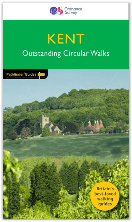
Wandelgids 008 Pathfinder guides Kent - OS
Isle of Sheppey - Lullington Castle - St Margaret's Bay

Korte omschrijving
Wandelgidsen Kent South East England van Ordnance Survey. Ideaal voor tochten in England.
Wandelgids Kent South-East England - OS Productomschrijving: This walking guidebook for Kent has 28 great walks exploring coastal and inland Kent, including the Isle of Sheppey. Kent contai...

Specificaties
- Uitgever: Ordnance Survey
- ISBN-13: 9780319090183
- HOOFDCATEGORIEËN: Wandelgids
- Activiteiten: Wandelen, Hiking & Trekking
- Regio: Kent South East England
- Land: England
- Taal: Engels
- Reeks/Serie: Outstanding Circular Walks, Pathfinder Series, OS
- De Engelse Graafschappen: Kent
Volledige omschrijving
Wandelgids Kent South-East England - OS
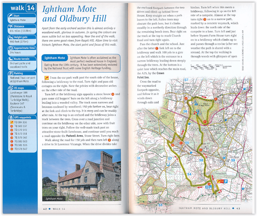
Productomschrijving: This walking guidebook for Kent has 28 great walks exploring coastal and inland Kent, including the Isle of Sheppey. Kent contains a wealth of history from Roman times to modern day, with many of the key sites visited on these pre-planned walks. Each walk includes easy-to-follow route directions and are accompanied by large-scale Ordnance Survey route maps, GPS waypoints and captivating photographs.
Walks include the Stodmarsh Nature Reserve, Lullington Castle, St Margaret's Bay and the Stour valley, as well as parts of the North Downs Way, Weald way, Pilgrims' Way and Greensand Way. The routes range from 3.5 miles to 10 miles, and each is rated for difficulty by an experienced walker. Pathfinder Guides are Britain’s best-loved walking guides. Printed with weather-resistant covers featuring durable rounded corners, they are the perfect companion for country walking throughout Britain.
Overzichtskaarten

Overzicht Pathfinder guides - OS
Overzicht Pathfinder guides - OS

Producten op de overzichtskaart
Klik op een product om naar de detailpagina te gaan.
- Wandelgids 001 Pathfinder guides South Devon & Dartmoor NP - OS
- Wandelgids 003 Pathfinder guides Isle of Skye - OS
- Wandelgids 004 Pathfinder guides Cairngorms NP - OS
- Wandelgids 005 Pathfinder guides Cornwall England - OS
- Wandelgids 006 Pathfinder guides Cotswolds AONB - OS
- Wandelgids 007 Pathfinder guides Fort William & Glen Coe - OS
- Wandelgids 008 Pathfinder guides Kent - OS
- Wandelgids 009 Pathfinder guides Exmoor NP & the Quantocks - OS
- Wandelgids 010 Pathfinder guides Snowdonia NP Wales - OS
- Wandelgids 011 Pathfinder guides Dorset England - OS
- Wandelgids 012 Pathfinder New Forest & South Downs NP Hampshire
- Wandelgids 015 Pathfinder guides Yorkshire Dales NP - OS
- Wandelgids 018 Pathfinder guides Brecon Beacons Wales - OS
- Wandelgids 019 Pathfinder guides Dumfries & Galloway - OS
- Wandelgids 020 Pathfinder guides Sherwood Forest - OS
- Wandelgids 022 Pathfinder guides More Lake District - OS
- Wandelgids 023 Pathfinder guides Loch Lomond, Trossachs NP - OS
- Wandelgids 025 Pathfinder guides Thames Valley & Chilterns - OS
- Wandelgids 026 Pathfinder guides Dartmoor National Park - OS
- Wandelgids 027 Pathfinder Perthshire "big county" Angus & Five OS
- Wandelgids 028 Pathfinder guides North York Moors NP - OS
- Wandelgids 029 Pathfinder guides Wye Valley AONB & Forrest of Dean
- Wandelgids 030 Pathfinder guides Loch Ness & Iverness - OS
- Wandelgids 031 Pathfinder guides Oban, Mull & Kintyre - OS
- Wandelgids 034 Pathfinder guides Pembrokeshire Wales - OS
- Wandelgids 035 Pathfinder guides Northumberland- Scottish Borders
- Wandelgids 039 Pathfinder Durham, North Pennines & Tyne & Wear OS
- Wandelgids 041 Pathfinder guides Central Wales - OS
- Wandelgids 042 Pathfinder guides Cheshire England - OS
- Wandelgids 044 Pathfinder guides Essex England - OS
- Wandelgids 045 Pathfinder guides Norfolk - OS
- Wandelgids 046 Pathfinder guides Aberdeen & Royal Deeside - OS
- Wandelgids 047 Pathfinder Edinburgh, Pentlands & Lothians - OS
- Wandelgids 048 Pathfinder guides Suffolk East England - OS
- Wandelgids 049 Pathfinder guides Vale of York East England - OS
- Wandelgids 050 Pathfinder guides Lincolnshire & the Wolds - OS
- Wandelgids 051 Pathfinder guides Cambridgeshire & The Fens - OS
- Wandelgids 053 Pathfinder guides Lancashire NW En England - OS
- Wandelgids 054 Pathfinder guides Hertfordshire & Bedfordshire- OS
- Wandelgids 055 Pathfinder guides Gower, Swansea & Cardiff - OS
- Wandelgids 060 Pathfinder guides Lake District NP - OS
- Wandelgids 063 Pathfinder guides Peak District England - OS
- Wandelgids 064 Pathfinder guides South Pennines - OS
- Wandelgids 065 Pathfinder guides Surrey England - OS
- Wandelgids 066 Pathfinder guides West Sussex & South Downs - OS
- Wandelgids 067 Pathfinder guides South Downs NP & East Sussex- OS
- Wandelgids 068 Pathfinder guides Devon North & Mid - OS
- Wandelgids 069 Pathfinder guides South West England Coastal walks
- Wandelgids 071 Pathfinder guides High Fells of Lakeland - OS
- Wandelgids 073 Pathfinder guides More Peak District - OS
Artikelen uit dezelfde regio

Wandelgids North Downs Way - Trailblazer Publications • 9781912716500
Wandelgids North Downs Way - Trailblazer Productomschrijving: The North Downs Way, from Farnham to Dover is a 131-mile (211km) National Trail. (British Walking Guide) 84 trail maps 16 town plans 50 colour photos 120mm x 180mm, 5" x 7" The North Downs Way, a 131-mile (211km) National Trail runs from Farnham in Surrey to Dover in Kent via Canterbury, winding its way through…
Reisgids Kent, Sussex & Surrey - Rough Guides • 9781835290088
Reisgids Kent, Sussex & Surrey Productomschrijving: The brand-new, full-colour Rough Guide to Kent, Sussex & Surrey is the ultimate guide to this beautiful corner of England, with clear maps and lively accounts of both the big cultural attractions and the smaller, quirkier sights, and full coverage of vibrant Brighton and historic Canterbury. The region is fast gaining a reputation as …
Reisgids Zuid-Engeland - Uitgeverij Lannoo • 9789059960978
Reisgids Zuid-Engeland - Lannoo Productomschrijving: Engelandkenner Dirk Musschoot laat je op een onovertroffen wijze kennismaken met de regio's Kent, East en West Sussex, Surrey, Hampshire en het eiland Wight, en de bestemmingen die je daar absoluut niet mag missen. Enkele voorbeelden: de optrekjes van Charles Darwin, Winston Churchill en Rudyard Kipling, de imposante kliffen van Beac…
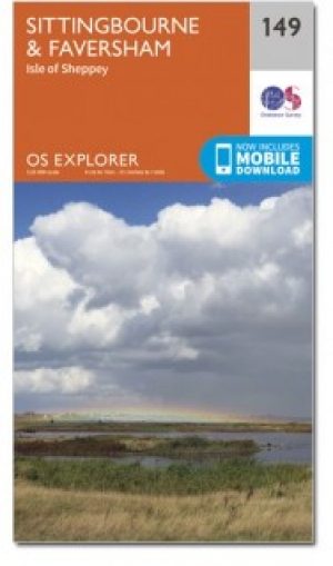
Wandelkaart 149 Sittingbourne & Faversham- Kent - OSI • 9780319243428
Wandelkaart Sittingbourne & Faversham - Kent England Omvat ook: Isle of Sheppey Productbeschrijving: OS Explorer Kaart 149 omvat de Kent Downs AONB en het eiland Sheppey. Dit laaggelegen gebied heeft een aantal natuurreservaten, plus de Swale Heritage Trail. De OS Explorer kaart voor Sittingbourne & Faversham is beschikbaar in zowel de standaard papieren versie als de weerbestendige 'A…

Wandelkaart 125 Romney Marsh Rye & Winchelsea - OSI • 9780319243213
Wandelkaart Romney Marsh- Rye & Winchelsea - OSI Omvat ook: Rye & Winchelsea Tenterden & New Romney. Productbeschrijving: Kaart nummer 125 in de OS Explorer kaarten reeks omvat High Weald tussen East Sussex en Kent aan de zuidkust van Engeland. De kaart beslaat een gebied van Tenterden, New Romney en Rye en omvat wandelingen zoals de Saxon Shore Way, die ook de 1066 country en Sussex g…