

Wandelgids North Downs Way - Trailblazer Publications
From Farnham in Surrey to Dover in Kent via Canterbury


Korte omschrijving
Wandelgidsen Kent South East England en Surrey South England van Trailblazer Publications. Ideaal voor tochten in England.
Wandelgids North Downs Way - Trailblazer Productomschrijving: The North Downs Way, from Farnham to Dover is a 131-mile (211km) National Trail. (British Walking Guide) 84 trail maps ...

Specificaties
- Uitgever: Trailblazer Publications
- ISBN-13: 9781912716500
- HOOFDCATEGORIEËN: Wandelgids
- Activiteiten: Wandelen, Hiking & Trekking
- Auteur: Henry Stedman, John Curtin
- Regio: Kent South East England, Surrey South England
- Land: England
- Lange afstand wandelroutes: North Downs Way, England (211 km)
- Editie: 3
- Taal: Engels
- De Engelse Graafschappen: Kent, Surrey
- National Trails UK, England & Wales: North Downs Way, England
Volledige omschrijving
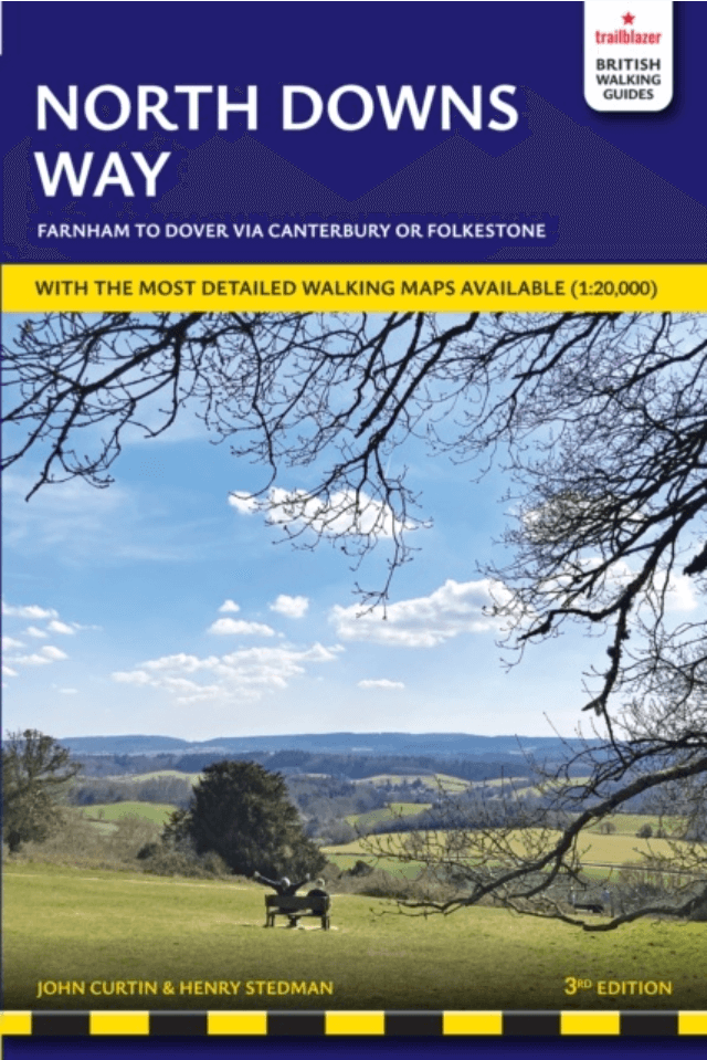
Wandelgids North Downs Way - Trailblazer
Productomschrijving: The North Downs Way, from Farnham to Dover is a 131-mile (211km) National Trail.
(British Walking Guide)
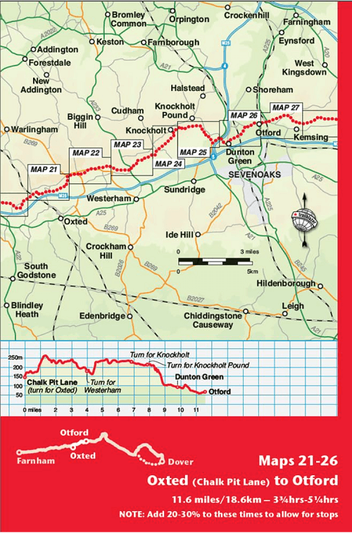
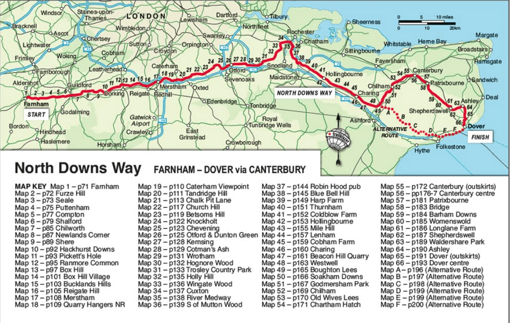
84 trail maps
16 town plans
50 colour photos
120mm x 180mm, 5" x 7"
The North Downs Way, a 131-mile (211km) National Trail runs from Farnham in Surrey to Dover in Kent via Canterbury, winding its way through the protected landscape of two Areas of Outstanding National Beauty, the Surrey Hills and the Kent Downs. The path passes medieval churches, castles, Neolithic burial sites, vineyards and numerous WWII defences. There are literary associations with Swift, Cobbett, Dickens and Jane Austen.
- 16 towns plans and 84 large-scale walking maps
- Itineraries for all walkers
- Practical information for all budgets
- Comprehensive public transport information
- 12 overview maps and trail profiles
- Downloadable gps waypoints
Artikelen uit dezelfde regio

Wandelkaart OL33 Haslemere- Petersfield & Midhurst - OSI • 9780319469514
Wandelkaart Haslemere- Petersfield & Midhurst - Surrey England Omvat ook: Midhurst & Selborne Productbeschrijving: Kaart nummer OL 33 omvat Haslemere, Petersfield, Midhurst en Selborne. Hoogtepunten zijn het Nationaal Park South Downs, de Surrey Hills en de Sussex border path. Andere hoogtepunten van het gebied zijn Greensand way, Hangers way, de rivier Rother en nieuwe Lipchis way Dez…

Wandelgids 065 Pathfinder guides Surrey England - OS • 9780319090206
Wandelgids Surrey England - OS Productomschrijving: Get lost in these 28 beautiful walks across Surrey with the OS Pathfinder Guidebooks, graded by length and ranging from 3 to 9.5 miles. The routes range from extended strolls to longer hikes, something for all levels! The Surrey Pathfinder is tried and tested by seasoned walkers - it's ideal for both visitors and locals. Each walk in…

Wandelkaart 150 Canterbury & Isle of Thanet Kent - OSI • 9780319470220
Wandelkaart Canterbury & Isle of Thanet - Kent England Omvat ook: Herne Bay, Deal & Whitstable. Productbeschrijving: Kaart nummer 150 in de OS Explorer kaarten reeks heeft betrekking op de historische stad Canterbury en de Isle of Thanet, Herne Bay, Deal, Margate, Broadstairs, Sandwich, Fordwich en Whitstable. Hoogtepunten van het gebied zijn onder andere: een deel van de Kent Downs AO…

Wandelkaart OL33 Haslemere & Petersfield - OS • 9780319242728
Wandelkaart Haslemere & Petersfield - OS Productomschrijving: Haslemere, Petersfield, Midhurt & Selborne. Omvat: Haslemere, Petersfield, Midhurst and Selborne, South Downs National Park, Surrey Hills and the Sussex Border Path, Greensand Way, Hangers Way, the River Rother and New Lipchis Way Ontdek de OL-serie van Ordnance Survey: De OL-serie (Outdoor Leisure) van Ordnance Surve…
Wandelkaart 145 Guildford & Farnham- Surrey - OSI • 9780319243381
Wandelkaart Guildford & Farnham- Surrey England Productbeschrijving: Guildford & Farnham- Surrey zijn plaatsen in het bestuurlijke gebied Guildford, in het Engelse graafschap Surrey. 145 / Guildford & Farnham, Surrey, England - Kaart nummer 145 is een all purpose kaart vol gepakt met informatie om u het gebied te helpen leren kennen. De 204 Landranger-kaarten bestrijken het land. Elke …