

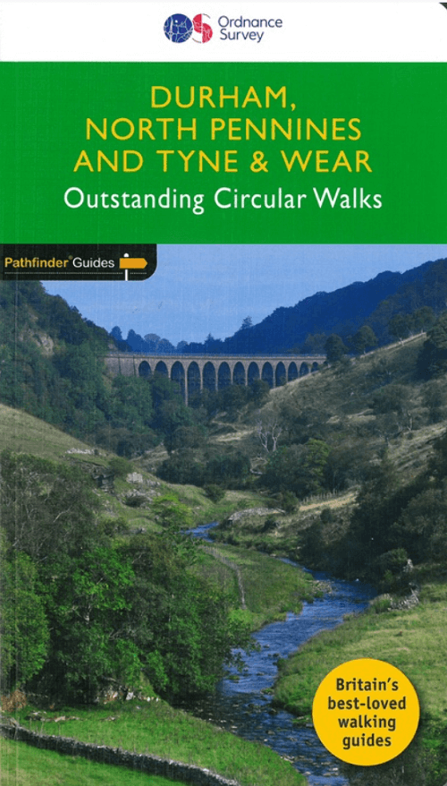
Wandelgids 039 Pathfinder Durham, North Pennines & Tyne & Wear OS
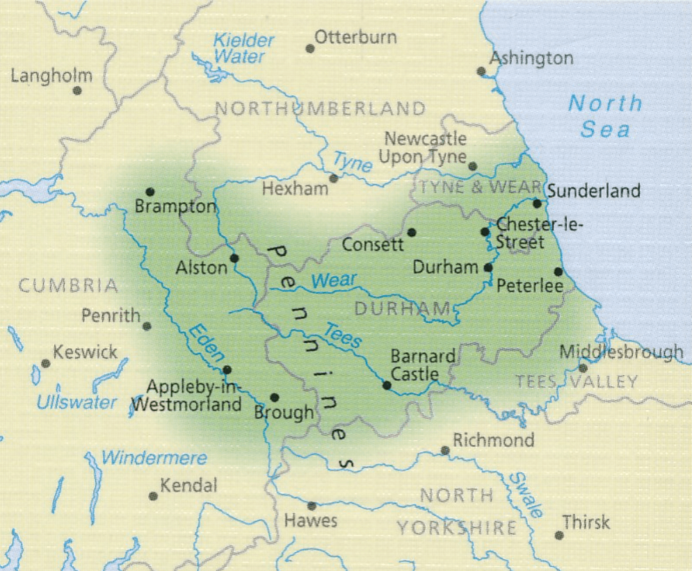
Cumbrian and Durham sides - North Pennines AONB - North Sea Coast
Korte omschrijving
Wandelgidsen North Yorkshire, Engeland, Northumberland, Engeland en Durham, England van Ordnance Survey. Ideaal voor tochten in England.
Wandelgids Durham, North Pennines & Tyne & Wear - OS Productomschrijving: This walking guide covers both the Cumbrian and Durham sides of the North Pennines, a designated Area of Outstanding...

Specificaties
- Uitgever: Ordnance Survey
- ISBN-13: 9780319090411
- HOOFDCATEGORIEËN: Wandelgids
- Activiteiten: Wandelen, Hiking & Trekking
- Auteur: Brian Conduit
- Regio: Durham, England, North Yorkshire, Engeland, Northumberland, Engeland
- Land: England
- AONB - Area of Outstanding Beauty/National Landscape: Northern Pennines AONB
- Taal: Engels
- Reeks/Serie: Outstanding Circular Walks, Pathfinder Series, OS
- De Engelse Graafschappen: Durham, North Yorkshire, Northumberland
Volledige omschrijving
Wandelgids Durham, North Pennines & Tyne & Wear - OS
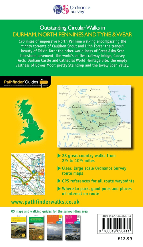
Productomschrijving: This walking guide covers both the Cumbrian and Durham sides of the North Pennines, a designated Area of Outstanding Beauty, and also extends eastwards to Durham to the North Sea Coast. The area contains some of the finest moorland in the country, walks across Bowes Moor and Holwick as well as low-level walks beside rivers, through woodlands and forests, by the coast, and former railway tracks.
Durham Castle and Cathedral, Brough Castle, High Force the mightiest of England's waterfalls, and Causey Arch, the world's earliest railway bridge, are featured.
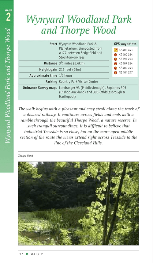
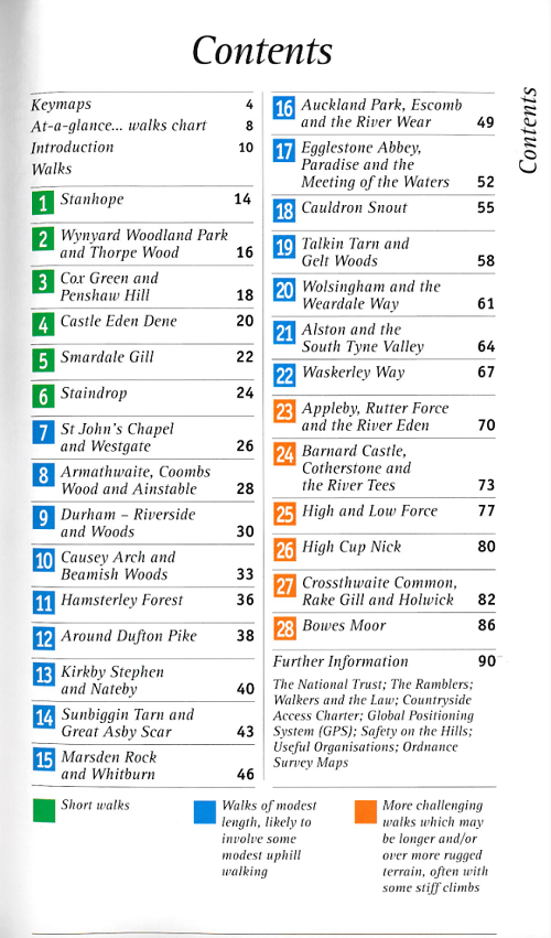
This book contains 28 circular, graded walks all tried and tested by seasoned walkers. The routes range from extended strolls to exhilarating hikes, so there is something for everyone.
Overzichtskaarten

Overzicht Pathfinder guides - OS
Overzicht Pathfinder guides - OS

Producten op de overzichtskaart
Klik op een product om naar de detailpagina te gaan.
- Wandelgids 001 Pathfinder guides South Devon & Dartmoor NP - OS
- Wandelgids 003 Pathfinder guides Isle of Skye - OS
- Wandelgids 004 Pathfinder guides Cairngorms NP - OS
- Wandelgids 005 Pathfinder guides Cornwall England - OS
- Wandelgids 006 Pathfinder guides Cotswolds AONB - OS
- Wandelgids 007 Pathfinder guides Fort William & Glen Coe - OS
- Wandelgids 008 Pathfinder guides Kent - OS
- Wandelgids 009 Pathfinder guides Exmoor NP & the Quantocks - OS
- Wandelgids 010 Pathfinder guides Snowdonia NP Wales - OS
- Wandelgids 011 Pathfinder guides Dorset England - OS
- Wandelgids 012 Pathfinder New Forest & South Downs NP Hampshire
- Wandelgids 015 Pathfinder guides Yorkshire Dales NP - OS
- Wandelgids 018 Pathfinder guides Brecon Beacons Wales - OS
- Wandelgids 019 Pathfinder guides Dumfries & Galloway - OS
- Wandelgids 020 Pathfinder guides Sherwood Forest - OS
- Wandelgids 022 Pathfinder guides More Lake District - OS
- Wandelgids 023 Pathfinder guides Loch Lomond, Trossachs NP - OS
- Wandelgids 025 Pathfinder guides Thames Valley & Chilterns - OS
- Wandelgids 026 Pathfinder guides Dartmoor National Park - OS
- Wandelgids 027 Pathfinder Perthshire "big county" Angus & Five OS
- Wandelgids 028 Pathfinder guides North York Moors NP - OS
- Wandelgids 029 Pathfinder guides Wye Valley AONB & Forrest of Dean
- Wandelgids 030 Pathfinder guides Loch Ness & Iverness - OS
- Wandelgids 031 Pathfinder guides Oban, Mull & Kintyre - OS
- Wandelgids 034 Pathfinder guides Pembrokeshire Wales - OS
- Wandelgids 035 Pathfinder guides Northumberland- Scottish Borders
- Wandelgids 039 Pathfinder Durham, North Pennines & Tyne & Wear OS
- Wandelgids 041 Pathfinder guides Central Wales - OS
- Wandelgids 042 Pathfinder guides Cheshire England - OS
- Wandelgids 044 Pathfinder guides Essex England - OS
- Wandelgids 045 Pathfinder guides Norfolk - OS
- Wandelgids 046 Pathfinder guides Aberdeen & Royal Deeside - OS
- Wandelgids 047 Pathfinder Edinburgh, Pentlands & Lothians - OS
- Wandelgids 048 Pathfinder guides Suffolk East England - OS
- Wandelgids 049 Pathfinder guides Vale of York East England - OS
- Wandelgids 050 Pathfinder guides Lincolnshire & the Wolds - OS
- Wandelgids 051 Pathfinder guides Cambridgeshire & The Fens - OS
- Wandelgids 053 Pathfinder guides Lancashire NW En England - OS
- Wandelgids 054 Pathfinder guides Hertfordshire & Bedfordshire- OS
- Wandelgids 055 Pathfinder guides Gower, Swansea & Cardiff - OS
- Wandelgids 060 Pathfinder guides Lake District NP - OS
- Wandelgids 063 Pathfinder guides Peak District England - OS
- Wandelgids 064 Pathfinder guides South Pennines - OS
- Wandelgids 065 Pathfinder guides Surrey England - OS
- Wandelgids 066 Pathfinder guides West Sussex & South Downs - OS
- Wandelgids 067 Pathfinder guides South Downs NP & East Sussex- OS
- Wandelgids 068 Pathfinder guides Devon North & Mid - OS
- Wandelgids 069 Pathfinder guides South West England Coastal walks
- Wandelgids 071 Pathfinder guides High Fells of Lakeland - OS
- Wandelgids 073 Pathfinder guides More Peak District - OS
Artikelen uit dezelfde regio

Wandelkaart 301 Scarborough- Bridlington - OSI • 9780319471739
Wandelkaart Scarborough- Bridlington & Flamborough Head Productbeschrijving: Kaart nummer 301 in de OS Explorer kaarten reeks heeft betrekking op de oostkust van Yorkshire rond Scarnorough, Bridlington en Flamborough Head. Hoogtepunten van het gebied zijn onder andere: Cleveland Way, de Yorkshire Wolds Way, Het nationall park zelf, en de North Sea Trail. De OS Explorer kaart voor Scarborou…
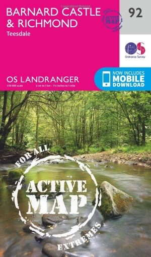
Wandelkaart 92 Barnard Castle Teesdale - England - OSI • 9780319475416
Wandelkaart Barnard Castle Teesdale - Durham england Productomschrijving: Barnard Castle is een marktplaats in het Engelse Durham in de Pennine Mountains. De plaats hoorde bij een groot kasteel waarvan de ruïne aan de Tees nog opvallend aanwezig is. Deze kaart, als onderdeel van de Landranger active waterproff series, is een topografische kaart voor wandelaars, de kwaliteit is onevenaarbaa…
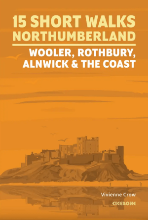
Wandelgids Northumberland short walks - Cicerone • 9781786312013
Northumberland short walks - Cicerone Productomschrijving: Wil je het beste van Wooler, Rothbury, Alnwick en de kust van Northumberland ontdekken? Deze gids bevat 15 van de beste korte wandelingen in Northumberland (3 uur of minder, tussen 3 en 14 km), waaronder Holy Island (Lindisfarne), de Simonside Hills, Alnwick Castle, Craster, Dunstanburgh Castle, Bamburgh en Berwick-upon-Tweed. …

Wandelgids 093 Pathfinde North Yorkshire Accessible walks - OS • 9780319092859
Wandelgids North Yorkshire Accessible walks - OS Productomschrijving: This guide comprises 33 beautiful walks, ranging in distance from 0.5 to 8 miles, across North Yorkshire, with ten routes in the Yorkshire Dales National Park, eleven in the North York Moors National Park, North Sea coast routes at Whitby, Robin Hood’s Bay and Bempton, and routes handily placed near the Richmond, Ripon, …

Fietskaart Yorkshire Dales National Park - Goldeneye • 9781859651421
Fietskaart Yorkshire Dales National Park - Goldeneye Productomschrijving: De Yorkshire Dales is een heuvellandschap in Noord-Engeland dat voornamelijk ten oosten van de waterscheiding van het Penninisch gebergte is gelegen in Noord-Yorkshire. Het maakt voornamelijk deel uit van het graafschap North Yorkshire, een klein gedeelte is gelegen in Cumbria. Het beeld dat men in deze omgeving aant…