

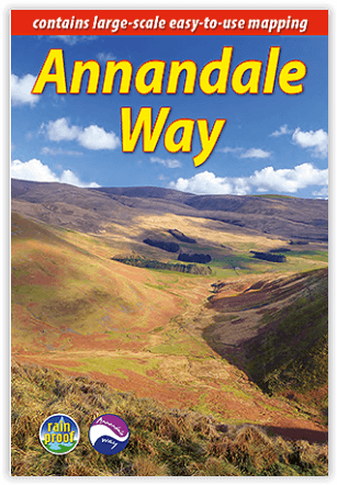
Wandelgids The Annandale Way - Schotland - Rucksack Readers
Moffat- Lochmaben- Almagill Hill- Lockerbie- Eskrigg Reserve
Korte omschrijving
Wandelgidsen Dumfries & Galloway, Schotland van RUCKSACK READERS. Ideaal voor tochten in Schotland.
The Annandale Way - Schotland - Rucksack Readers Productomschrijving: De Annandale Way is één van de Great Trails van Schotland, een charmante lange wandeling in een weinig bekend, maar zeer...

Specificaties
- Uitgever: RUCKSACK READERS
- ISBN-13: 9781913817169
- HOOFDCATEGORIEËN: Wandelgids
- Activiteiten: Wandelen, Hiking & Trekking
- Auteur: Jacquetta Megarry, Roger Turnbull
- Regio: Dumfries & Galloway, Schotland
- Land: Schotland
- Lange afstand wandelroutes: Annandale Way, Dumfries & Galloway Schotland (90 km)
- Schaal: 1:44000
- Editie: 2
- Taal: Engels
Volledige omschrijving
The Annandale Way - Schotland - Rucksack Readers
Productomschrijving: De Annandale Way is één van de Great Trails van Schotland, een charmante lange wandeling in een weinig bekend, maar zeer toegankelijk deel van Zuid-Schotland. De route strekt zich uit van de bron van de rivier Annan tot aan de zee, begint in het schapenstadje Moffat en loopt 56 mijl (90 km) zuidwaarts via Lochmaben.
Onderweg heb je prachtige uitzichten vanaf de top van Almagill Hill en een grote kans om wilde dieren te zien. Een iets kortere tak loopt via Lockerbie en Eskrigg Nature Reserve. De twee takken komen ten noorden van Annan weer bij elkaar op weg naar de Solway Firth.
Englese omschrijving: The Annandale Way is one of Scotland’s Great Trails, a charming long walk in a little-known, but very accessible, part of southern Scotland. Stretching from the River Annan’s source to the sea, it starts in the sheep town of Moffat, and runs for 56 miles (90 km) southward via Lochmaben.
En route there are superb views from the top of Almagill Hill and great chances to spot wildlife. A slightly shorter branch goes via Lockerbie and Eskrigg Nature Reserve. The two branches rejoin north of Annan en route for the Solway Firth.
This guidebook contains all you need to plan and eanjoy your trip:
• lavishly illustrated, with over 110 colour photos
• seven pages of detailed mapping of the route at 1:44,000
• section on habitats and wildlife, with superb images
• planning information for transport and accommodation
• detailed route description southbound, plus concise directions for northbound walkers
• section summaries with distance, terrain and food/drink stops
• rucksack-friendly format, printed on rainproof paper.

Artikelen uit dezelfde regio

Wandelkaart Galloway Hills XT40 ultra - Harvey Maps • 9781851377282
Wandelkaart Galloway Hills - Harvey Maps Productomschrijving: De Galloway Hills zijn een reeks heuvels in de Schotse regio Dumfries and Galloway. Ze liggen in het zuidwesten van Galloway. De Galloway Hills bestaan uit de bergen Merrick, Criffel & Cairnsmore of Fleet.
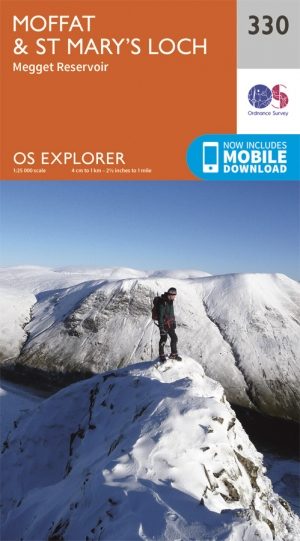
Wandelkaart 330 Moffat & St Mary's Loch - Dumfries - OSI • 9780319245828
Wandelkaart Moffat & St Mary's Loch - Schotland Omvat ook: Megget Reservoir Productomschrijving: Omvat Moffat in Dumfries and Galloway, Schotland. OS Explorer kaart 330 omvat ook St. Mary's Loch, Megget Reservoir en deel van de Southern Upland Way, een lange afstand wandelroute. De OS Explorer kaart voor Moffat & St Mary's Loch is beschikbaar in zowel de standaard papieren versie als …

Reisgids Go Slow Dumfries & Galloway - Bradt travel guides • 9781804692721
Reisgids Dumfries & Galloway - Bradt Productomschrijving: Written by Southern Scotland experts, this new, thoroughly updated third edition of Bradt's Dumfries & Galloway (Slow Travel) remains the only full-blown guide to this beguiling southwest corner of Scotland. The region is covered in depth, from Eskdale in the east to Scotland's southern tip at the Mull of Galloway, via Annandal…

Wandelgids Dumfries and Galloway short walks - Cicerone • 9781786311726
Dumfries and Galloway short walks - Cicerone Productomschrijving: Ronald Turnbull heeft 15 van de beste korte wandelingen rond Dumfries and Galloway voor je uitgezocht. Onze gids is voorzien van goed leesbare Ordnance Survey-kaarten en duidelijke routebeschrijvingen, perfect als je voor het eerst gaat wandelen of iets zoekt waar je met het hele gezin van kunt genieten. We hebben inform…
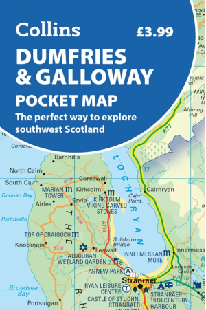
Landkaart Wegenkaart Pocket map Dumfries & Galloway - Harper • 9780008780449
Wegenkaart Pocket map Dumfries & Galloway - Harper Collins Productomschrijving: Dumfries & Galloway Pocket Map: The perfect way to explore southwest Scotland Map Handy little full colour map of Dumfries & Galloway.