

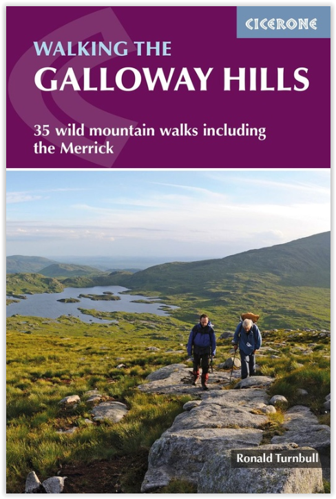
Wandelgids Walking the Galloway Hills - Cicerone
35 wild mountain walks including the Merrick
Korte omschrijving
Wandelgidsen Dumfries & Galloway, Schotland van CICERONE Press. Ideaal voor tochten in Schotland.
Wandelgids - Walking the Galloway Hills - Cicerone Productomschrijving: Deze gids omvat 34 dagwandelingen en een langeafstandsroute in de wilde en afgelegen heuvels van de Galloway in Schotl...

Specificaties
- Uitgever: CICERONE Press
- ISBN-13: 9781786310101
- HOOFDCATEGORIEËN: Wandelgids
- Activiteiten: Wandelen, Hiking & Trekking
- Auteur: Ronald Turnbull
- Regio: Dumfries & Galloway, Schotland
- Land: Schotland
- Editie: 1
- Taal: Engels
Volledige omschrijving
Wandelgids - Walking the Galloway Hills - Cicerone
Productomschrijving: Deze gids omvat 34 dagwandelingen en een langeafstandsroute in de wilde en afgelegen heuvels van de Galloway in Schotland. Hoewel er enkele kortere en gemakkelijkere routes zijn, zijn dit enkele van de meest populaire, lange afstandswandelingen in het land, dus ze zijn meer geschikt voor ervaren wandelaars.
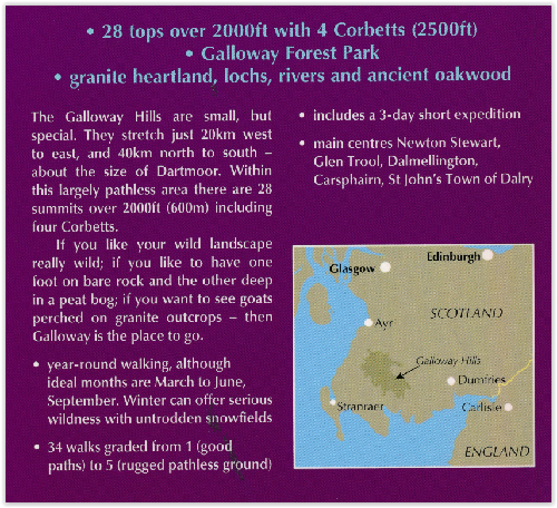
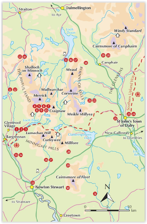
De wandelingen omvatten onder meer de suggestieve gebieden van The Merrick, The Awful Hand, The Rhinns of Kells, de Minnigaff Hills en Cairnsmore of Fleet. De gids gebruikt OS 1: 50.000 kaarten met gedetailleerde wegbeschrijvingen en inspirerende foto's. Belangrijke informatie zoals afstand, tijd en opstijging worden gegeven. Een 'hardheid' cijfer geeft een indicatie aan van hoe ruw de grond naar verwachting zal zijn, en suggesties van varianten, en manieren om de route uit te breiden. Er wordt veel achtergrondinformatie gegeven over de fascinerende en belangrijke geschiedenis van de regio.
Als je echt van het wilde landschap houdt ... Als je graag een voet op de rots hebt en de andere diep in een veengebied, Als je van graniet met geiten houdt, dan is Galloway de plek om naartoe te gaan.
Product description: This guide covers 34 day walks and one long-distance route in the wild and remote hills of Galloway. Although there are some shorter and easier routes, many of these hill walks are long and on rugged terrain, so are more suitable for experienced walkers. The walks cover the evocative areas of The Merrick, The Awful Hand, The Rhinns of Kells, the Minnigaff hills and Cairnsmore of Fleet, among others.
The guide uses OS 1:50,000 maps with detailed route descriptions and inspirational photos accompanying each route. Key information such as distance, time, and ascent are given. A 'harshness' grade gives an indication of how rough the ground is expected to be, and suggestions of variants, shortcuts and ways to extend each walk are also given. Plenty of background information is given on the region's fascinating and important history.
If you like your wild landscape really wild… If you like your lakes to have whooper swans in the middle and no ice-cream vans around the edge… If you like to have one foot on bare rock and the other one deep in a peat bog… If you like your granite with goats on… Then Galloway is the place to go.
Locatie op kaart
Artikelen uit dezelfde regio

Wandelkaart 321 Nithsdale & Dumfries & Thornhill - OSI • 9780319245736
Wandelkaart Nithsdale & Dumfries - Thornhill Dumfries Omvat ook: Thornhill Productomschrijving: OS Explorer kaart 321 omvat Dumfries te Thornhill. Het gebied staat bekend als Nithsdale, want het is de vallei van de rivier de Nith. De indrukwekkende Drumlanrig Castle is het hele jaar geopend, of er zijn wandelpaden over het Nithsdale gebied. De OS Explorer kaart voor Nithsdale & Dumfrie…
Wandelkaart 330 Moffat & St Mary's Loch - Dumfries - OSI • 9780319245828
Wandelkaart Moffat & St Mary's Loch - Schotland Omvat ook: Megget Reservoir Productomschrijving: Omvat Moffat in Dumfries and Galloway, Schotland. OS Explorer kaart 330 omvat ook St. Mary's Loch, Megget Reservoir en deel van de Southern Upland Way, een lange afstand wandelroute. De OS Explorer kaart voor Moffat & St Mary's Loch is beschikbaar in zowel de standaard papieren versie als …

Reisgids Go Slow Dumfries & Galloway - Bradt travel guides • 9781804692721
Reisgids Dumfries & Galloway - Bradt Productomschrijving: Written by Southern Scotland experts, this new, thoroughly updated third edition of Bradt's Dumfries & Galloway (Slow Travel) remains the only full-blown guide to this beguiling southwest corner of Scotland. The region is covered in depth, from Eskdale in the east to Scotland's southern tip at the Mull of Galloway, via Annandal…
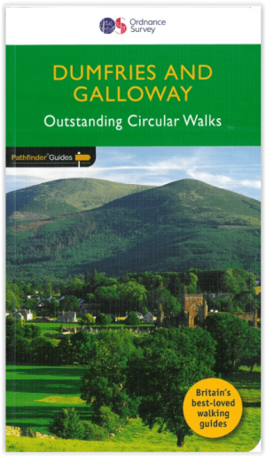
Wandelgids 019 Pathfinder guides Dumfries & Galloway - OS • 9780319091180
Wandelgids Dumfries & Galloway Schotland - OS Productomschrijving: Dumfries and Galloway form the South-west of Scotland, a broad wedge of land jutting out into the Irish Sea between the Solway Firth and the Firth of Clyde. The area is also part of Scotland's border country a peaceful, unspoilt region that possesses a mild climate, a great variety of scenery and a rich historic legacy. …

Wandelkaart Galloway Hills XT40 ultra - Harvey Maps • 9781851377282
Wandelkaart Galloway Hills - Harvey Maps Productomschrijving: De Galloway Hills zijn een reeks heuvels in de Schotse regio Dumfries and Galloway. Ze liggen in het zuidwesten van Galloway. De Galloway Hills bestaan uit de bergen Merrick, Criffel & Cairnsmore of Fleet.