


Regio
Taal
Editie
Schaal
Auteur:
Reeks/Serie:
Lange afstand wandelroutes
Historische wandelroutes
Bedevaart routes
Nationale parken
Regionale parken
AONB - Area of Outstanding Beauty/National Landscape
UNESCO werelderfgoed
TOPO's & Stafkaarten
Toepasselijke bergketen
HOOFDCATEGORIEËN
Uitgever


 Wandelen in Engeland
Wandelen in Engeland ligt naast Wales, Schotland en Noord-Ierland één van de 4 gebieden die samen het Verenigd Koninkrijk vormen. Het volledige landmassa van dit grote eiland wordt meestal aangeduid met de naam "Groot-Brittannië". In de volksmond wordt echter heel vaak over een uitstapje naar "Engeland" gesproken als men in het algemeen ergens in Groot-Brittannië is geweest. Interessant is de collectie van de 40 meest Iconische wandelroutes van Europa, de pagina is gloednieuw.
Bij Bibliotrek bedoelen we met Engeland wel degelijk het specifieke gebied. De Wandelgidsen Engeland vallen onder de grootste categorieën die Bibliotrek heeft. We hebben meer dan 1.200 wandelgidsen van verschillende uitgevers zoals Harper Collins, Sunflower books, het zeer gekende Cicerone, Elmar, en de nationale uitgever AA. Dit zijn stuk voor stuk professionele uitgevers met schitterende wandelgidsen voor Engeland. Het land bestaat uit vele graafschappen, die ten tijde van de Angelsaksen "Shires" werden genoemd. Dit blijkt nog uit de namen van een groot aantal graafschappen zoals Bedfordshire, Hampshire enz.
In Engeland hebben ze er aan nationale sport van gemaakt, en dat met de uitzinnige "National Trails". Dit zijn wandelroutes van formaat, die je natuurlijk niet enkel met een Wandelgids kan doen, maar ook met onze Wandelkaarten Engeland. De National Trails zijn heel bekend en vormen zelfs de bakermatr van de Engelse Wandelsport. Om er maar enkele te noemen:
The South Downs Way, door Sussex van Winchester naar Eastbormne, door The South Downs AONB.
The South West Coast Path, rond South West England, van Minehead bij Exmoor NP tot Pool in Dorset
The Yorkshire Wolds Way, van Hessle, East Riding of Yorkshire, tot Filey, North Yorkshire, 127 Km.
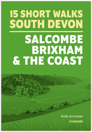
Wandelgids South Devon 15 short walks - Cicerone Press • 9781786312532
Wandelgids South Devon 15 short walks - Cicerone Productomschrijving: Would you like to explore the best of Salcombe, Brixham and the coast? This guidebook covers 15 of the best short walks in South Devon (all under three hours), including Start Point, Bigbury-on-Sea, Hope Cove and Bolberry Down, Brixham and Berry Head and Dartmouth Castle. Why choose this guidebook? - Easy to mode…

Wandelgids King Charles III England Coast Path Map Booklet • 9781786310415
King Charles III England Coast Path Map Booklet - Cicerone Productomschrijving: This map booklet to the Lancashire and Merseyside section of the England Coast Path contains detailed mapping for walking the route in either direction. With easy access at many points along the way, the Lancashire/Merseyside section can be enjoyed as a trek of around 12 days or in shorter sections. - Full…

Wandelgids King Charles III England Coast Path - Cicerone • 9781786310279
King Charles III England Coast Path - Cicerone Productomschrijving: A guidebook to walking the northwest section of the King Charles III England Coast Path between Gretna and Chester. Covering 590km (367 miles), this straightforward trail along the Cumbria, Lancashire and Merseyside coast takes around 1 month to hike. The route is described from north to south in 28 stages between 13 a…

Wandelgids 001 Pathfinder guides South Devon & Dartmoor NP - OS • 9780319090084
Wandelgids South Devon & Dartmoor NP - OS Productomschrijving: Each of the Pathfinder titles features 28 circular routes, all tried and tested by seasoned walkers. The routes range from extended strolls to exhilarating hikes, so there is something for everyone. 28 circular walks • Graded by length ranging from 3 to 12 miles • Clear, large scale Ordnance Survey maps • GPS referen…

Wandelgids 012 Pathfinder New Forest & South Downs NP Hampshire • 9780319090107
Wandelgids New Forest & South Downs NP Hampshire - OS Productomschrijving: This Pathfinder walking guidebook covers the New Forest National Park, Hampshire and the South Downs National Park, including the Itchen and Test valleys. There are 28 outstanding circular walks in the Hampshire countryside ranging from two to ten miles in length, and graded by difficulty by expert outdoor writer D…

Wandelgids 054 Pathfinder guides Hertfordshire & Bedfordshire- OS • 9780319090077
Wandelgids Hertfordshire & Bedfordshire - OS Productomschrijving: This walkers guide contains 28 outstanding circular walks in Hertfordshire and Bedfordshire ranging from 5.5km to 15km. Each route has easy-to-follow route descriptions, clear Ordnance Survey route maps, GPS waypoints, where to park, good pubs and places of interest en route. All of the routes have been researched and writt…

Wandelgids 064 Pathfinder guides South Pennines - OS • 9780319090046
Wandelgids South Pennines - OS Productomschrijving: This book gives details of 28 amazing walks across the Pennines (Lancashire and Yorkshire), including South Pennines’ most famous viewpoint at Stoodley Pike and the parts of the Pennine Way. Each of the routes has information on local amenities, a detailed route description, and extract of the large-scale OS Map for the area and notes an…

Wandelgids 045 Pathfinder guides Norfolk - OS • 9780319090152
Wandelgids Norfolk East England - OS Productomschrijving: These 28 circular, graded walks around Norfolk are all tried and tested by seasoned walkers. The routes range from extended strolls of four miles to exhilarating hikes of eleven, so there is something for everyone. Each route includes information on parking and local amenities, detailed route description, a large-scale OS map a…

Wandelgids 060 Pathfinder guides Lake District NP - OS • 9780319090169
Wandelgids Lake District NP - OS Productomschrijving: The Pathfinder Guide for the Lake District NP is the ideal companion to gaining an appreciation of England's most mountainous region with its balanced range of walks across the whole of the National Park. There are a total of 28 outstanding circular walks in the Lake District National Park from 3 to 10 miles with easy-to-follow route de…

Wandelgids 009 Pathfinder guides Exmoor NP & the Quantocks - OS • 9780319090114
Wandelgids Exmoor National Park & the Quantocks - OS Productomschrijving: Exmoor National Park comprises 265 square miles, of which about two-thirds lie in west Somerset and the remaining third in north Devon. This walking guidebook contains 28 circular, graded walks in Exmoor, all tried and tested by seasoned walkers. The routes range from extended strolls to longer hikes, so there is som…

Wandelgids 008 Pathfinder guides Kent - OS • 9780319090183
Wandelgids Kent South-East England - OS Productomschrijving: This walking guidebook for Kent has 28 great walks exploring coastal and inland Kent, including the Isle of Sheppey. Kent contains a wealth of history from Roman times to modern day, with many of the key sites visited on these pre-planned walks. Each walk includes easy-to-follow route directions and are accompanied by large-scal…

Wandelgids 028 Pathfinder guides North York Moors NP - OS • 9780319090251
Wandelgids North York Moors National Park - OS Productomschrijving: The Pathfinder guidebook for The North York Moors is designed to help you make the most of your time in the area. It contains 28 walks, each graded by difficulty and ranging from 3.5 miles up to 11 miles in length. All the routes are created by seasoned walkers, and designed to help you make the most of the area. High…
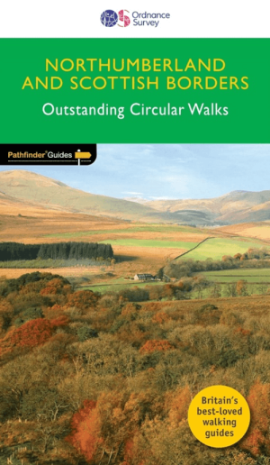
Wandelgids 035 Pathfinder guides Northumberland- Scottish Borders • 9780319090268
Wandelgids Northumberland & Scottish Borders - OS Productomschrijving: This revised version of the Pathfinder walking guidebook for Northumberland and the Scottish Borders contains 28 carefully selected walking routes to help you make the most of the area. All the routes have been created and tested by seasoned walkers, and range from two to thirteen miles in length. Each route include…
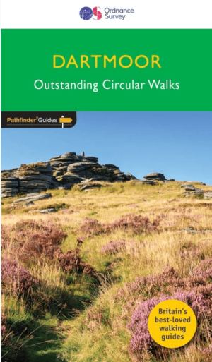
Wandelgids 026 Pathfinder guides Dartmoor National Park - OS • 9780319090305
Wandelgids Dartmoor National Park Devon - OS Productomschrijving: Discover the rugged, iconic landscape of Dartmoor National park, with this selection of 28 walks designed to help you find the best it has to offer. While largely uninhabited wilderness with few villages, farms and roads, there are still plenty of opportunities for walks of all levels. Some of the most significant featu…

Wandelgids 042 Pathfinder guides Cheshire England - OS • 9780319090312
Wandelgids Cheshire - OS Productomschrijving: This walking guidebook for Cheshire contains 28 outstanding walks all tried and tested by experienced walkers. The routes range from extended strolls to exhilarating hikes - four to eleven miles in length. Each walk includes a detailed description of both the route and the areas you will pass through, as well as an extract of the OS map for th…
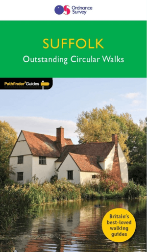
Wandelgids 048 Pathfinder guides Suffolk East England - OS • 9780319090381
Wandelgids Suffolk - OS Proiductomschrijving: This walkers guide has 28 circular, graded walks in Suffolk, all tested by seasoned walkers. The routes range from extended strolls to exhilarating hikes, from under three to over ten miles, so there is something for everyone. Each walk includes a detailed, turn by turn description, an extract of the large-scale OS map, photos and notes identi…

Wandelgids 015 Pathfinder guides Yorkshire Dales NP - OS • 9780319090404
Wandelgids Yorkshire Dales NP - OS Productomschrijving: Pathfinder Yorkshire Dales covering parts of the National Park, Ribblesdale and Swaledale. This selection offers interest, regional variety and balance of routes in the Yorkshire Dales providing the best walks in the area. From an easy stroll through Ingleton Waterfalls to the much more challenging walks in Gunnerside, this volume co…

Wandelgids 029 Pathfinder guides Wye Valley AONB & Forrest of Dean • 9780319090442
Wandelgids Wye Valley AONB & Forrest of Dean -OS Productomschrijving: The Wye Valley and Forest of Dean Pathfinder guidebook contains 28 circular walks for all abilities. Walks are from 4km to 17km long, and each route includes a difficulty rating, route directions, an extract of the Ordnance Survey map and notes and photos of key features to look for. All of them have been created and te…
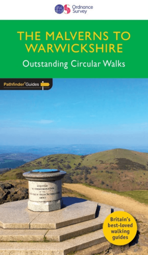
Wandelgids 074 Pathfinder guides Malverns to Warwickshire - OS • 9780319090725
Wandelgids The Malverns AONB to Warwickshire - OS Productomschrijving: With 28 circular, graded walks all tried and tested by seasoned walkers, this walking guidebook for The Malverns AONB and Warwickshire is ideal for both holidays and locals. The routes discovered in this guidebook are from 4.8 to 15km (3 to 9 miles), so there's a choice for all abilities. Each route includes a detailed…

Wandelgids 049 Pathfinder guides Vale of York East England - OS • 9780319090732
Wandelgids Vale of York East England - OS Productomschrijving: With 28 circular, graded walks all tried and tested by seasoned walkers, this guidebook for the Vale of York and the Yorkshire Wolds will help you to make the most of a holiday or day out. Routes range from 4km (2.5 miles) up to 15.3km (9.5 miles), so there is a route to suit all abilities and available time. While most vi…

Wandelgids 006 Pathfinder guides Cotswolds AONB - OS • 9780319090282
Wandelgids Cotswolds AONB - OS Productomschrijving: 28 carefully selected and tested country walks around The Cotswolds, graded by length and ranging from just over four to 10 miles. All of the walks in this book include written directions, an extract of the OS map for the area and some background on the history and natural environment you may see. Most of the walks avoid busy roads, a…

Wandelgids 039 Pathfinder Durham, North Pennines & Tyne & Wear OS • 9780319090411
Wandelgids Durham, North Pennines & Tyne & Wear - OS Productomschrijving: This walking guide covers both the Cumbrian and Durham sides of the North Pennines, a designated Area of Outstanding Beauty, and also extends eastwards to Durham to the North Sea Coast. The area contains some of the finest moorland in the country, walks across Bowes Moor and Holwick as well as low-level walks beside …
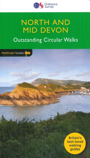
Wandelgids 068 Pathfinder guides Devon North & Mid - OS • 9780319090756
Wandelgids North & Mid Devon - OS Productomschrijving: A must-have for a day trip to North Devon, this Jarrold Pathfinder Guide maps out 28 walks that are ideal for exploring new regions and beautiful scenery. Ideal for planning a weekend walk with the family, this handy walking guide from Jarrold lets you explore with extended strolls and exhilarating hikes for young and old. - Featu…

Wandelgids 051 Pathfinder guides Cambridgeshire & The Fens - OS • 9780319090794
Wandelgids Cambridgeshire & The Fens - OS Productomschrijving: Often dismissed as flat and featureless, the waterlands of East Anglia offer great, and largely undiscovered, opportunities for any walker. With the tranquil riverside scenery, charming towns, villages and country houses, and the mesmerising beauty of the Fens, the area is rich in heritage, wildlife and history. Each walk i…

Wandelgids 067 Pathfinder guides South Downs NP & East Sussex- OS • 9780319090909
Wandelgids South Downs NP & East Sussex - OS Productomschrijving: The Pathfinder walking guidebook for East Sussex and the South Downs National Park has 28 carefully selected walking routes for all abilities. Routes range from 5km (3 miles) to 19km (12 miles) and each is also graded by difficulty. With each route these is a detailed route description, an extract of the OS map of the area a…
Wandelvakantie in Engeland
Wandelvakantie in Engeland. Engeland bestaat uit 9 grote wandelregio’s, elk met hun eigen karakteristieken en natuurpracht. In bijna elke regio is wel ergens een natuurgebied te vinden dat tot de zogenaamde AONB regio’s behoort, voluit geschreven, een “Area of Outstanding Natural Beauty”. Vertaald betekent dit “gebied van uitmuntend natuurschoon”. Hoe meer u naar het noorden trekt, hoe meer het landschap zich open trekt. Maar dit betekent in geen geval dat de omgeving er minder interessant op wordt. Hoe verder u Engeland in trekt, hoe mooier het wordt voor de wandelaar. Dit dankzij de vele Nationale parken en Regionale parken die Engeland rijk is.
Met behulp van onze wandelgidsen zit u uiteraard goed! Maar met de Wandelkaarten Engeland heeft u een beter overzicht. Zo krijgt u met een kaart minder informatie. Europese reisgidsen bieden u dan weer de toeristische informatie die ook best nuttig is.
Deze parken zijn tot ver buiten de Engelse grenzen gekend. Gebieden als de Chilterns, Cornwall, de Cotswolds, Forest of Bowland, de Kent Downs, de Isle of Wight, Nidderdale, Zuid Engeland, Kent, Yorkshire, Lake district, Stonehenge ... kleuren het Engelse landschap. Ze maken het grote eiland tot een schitterend natuurfenomeen. Uiteraard zijn er de Wandelgidsen Engeland door een pak verschillende uitgevers gerealiseerd. Zij hebben meestal de AONB regio’s uitgebreid en tot in detail in hun gamma opgenomen. De AONB’s zijn niet alleen in Engeland te vinden, maar ook in de andere gebieden van Groot-Brittannië. Het aanbod aan Wandelgidsen voor het gebied Engeland alleen al, is zodanig groot dat u best eerst bepaalt waar in Engeland u precies op wandel wil. Daarna kunt u dan de wandelgidsen selecteren die uw gekozen regio specifiek behandelen. Iconische wanelroutes, een 40-tal toppers uit Europa en omstreken.
Van Southhampton tot in Cumbria
Van Southhampton tot in Cumbria, Engeland leent zich werkelijk uitstekend als wandelgebied. De uitgebreide waaier aan wandelgidsen laat u toe het gebied Engeland in verschillende regio's op te splitsen. Op die manier kunt u de specifieke cultuur- en natuuraspecten per gebied ontdekken. De verschillende regio’s bieden soms compleet verschillende wandelmogelijkheden.
Soms kunt u wandelen van steden naar dorpen, naar natuurgebieden, naar universiteitssteden, nationale en regionale parken en zelfs bergen. Regio’s als Cheshire, Cumbria, Yorkshire, Manchester, Lancashire, Merseyside, ... bezorgen Engeland unieke wandeltroeven die om het even welk type wandelaar nieuwsgierig zullen maken. Met een beetje creativiteit weet u als Wandelaar precies wat er interessant is de buurlanden, zo kunt u als wandelaar steeds naar die buurlanden gaan kijken op de pagina: Hebben we het over Wales, dan is deze pagina belangrijk Wandelgidsen Wales of is het Schotland dan zijn het de Wandelgidsen Schotland.
FAQ: Wandelgidsen ENGELAND
Ordnance Survey voor kaartbasis (de reeks Explorer OL op schaal 1:25.000, of de serie Landranger op schaal 1:50.000); Harvey Maps voor trailgerichte detailkaarten. Selecteer titel per Regio of Trail. Filter op Uitgever & Serie, links op uw scherm.
Dagtochten: Lake District en Peak District. Lange trajecten: South West Coast Path, Cotswolds, Yorkshire Dales. Kies gids met duidelijke Etappes en Hoogtemeters. Filter op Regio en Moeilijkheid, links op uw scherm.
De beste periode is tijdens de Lente of het Najaar. Weer wisselt snel; kies Waterbestendige gidsen. Toegang via Public Rights Of Way en gemarkeerde paden. Controleer Parkeren/Startpunt per route in de gids.