


HOOFDCATEGORIEËN
Activiteiten
Kamperen
Fietsen
VTT / MTB
Klimmen
Auteur:
Land
Regio
Reeks/Serie:
Taal
Schaal
Wandkaarten & Planokaarten
Lange afstand wandelroutes
Nationale parken
Regionale parken
TOPO's & Stafkaarten
Waterafstotende kaart
Historische wandelroutes
Uitgever

 Wandelen in Snowdonia NP
Wandelen in Snowdonia National Park, een deel van de UK, is een weliswaar een klein gedeelte van Engeland, maar daarvoor niet minder interessant. Wales biedt een paar wereldbekende Nationale Parken als Snowdonia & De Brecon- Beacons, alsook bekende kastelen als Caernarfon, Conwy & Harlech. De Wandelkaarten & Wandelgidsen over Wales zijn een stuk minder talrijk dan pakweg de rest van Groot-Brittannië. Voor wat de Nationale parken betreft is het toch beter om Topografische Wandelkaarten te nemen, aangezien de grote van de parken.
Dezelfde Uitgevers als AA & Ordnance Survey bieden de beste informatie om dit mooie land te doorkruisen. Wales kent een eigen vlag en een eigen taal, een zeer oude taal wel degelijk te verstaan, die weinig inwoners vandaag de dag nog hanteren. Wales is redelijk bergachtig in zijn geheel, en de reeks van kaarten & gidsen over Wales speelt hier uiteraard perfect op in. Wales is toeristisch gezien nog steeds aan het groeien. Tot voor kort, was het toeristisch gezien nog geen zo’n hotspot. Beetje bij beetje door de vormingen van wandelwegen en Mountainbiking is Wales uit het dal aan het klimmen. Om er de juiste kaarten- en gidsen van te vinden moet u op onze pagina zijn van Wandelgidsen Wales & Wandelkaarten Wales.
Wales heeft dan ook een heel bekende National Trail, deze ligt helemaal aan de andere kant van het land aan de kust. Het omvat de Pembrokeshire Coast National park route rond het park. Genaamd Pembrokeshire Coast Path, is deze route geknipt voor wie van wind, zon en zee houd. De route loopt van Amroth naar St. Dogmaels Pembroke, en is een dikke 300 Km lang.

Wandelgids Glyndwr's Way walking - Cicerone • 9781786311290
Glyndwr's Way walking - Cicerone Productomschrijving: Gids over de hystorische wandelroute van de Glyndwr's Way, een langeafstandspad door midden-Wales. De 217 Km lange route van Knighton via Machynlleth naar Welshpool duurt 9 dagen om te lopen, en 2 dagen (29 mijl) om de lus langs het Offa's Dyke Path af te maken zodat er een rondwandeling ontstaat. Een prachtige route door rustige heuvel…
Wandelkaart XT25 Brecon Beacons Oost - Harvey Maps • 9781851376711
Wandelkaart Brecon Beacons Oost - Harvey Maps Productomschrijving: Gedetailleerde kaart voor bergwandelaars van het oostelijke deel van het Brecon Beacons National Park. Inclusief de Pen y Fan en de Black Mountains. - De kaart is sterk, licht, duurzaam en 100% waterbestendig - Inclusief opengestelde wegen - Opent direct aan beide zijden van het blad - Eenvoudig opnieuw te vou…
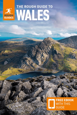
Reisgids Wales - Rough Guides • 9781839059971
Reisgids Wales - Rough Guides Productomschrijving: Discover this beautiful country with the most incisive and entertaining guidebook on the market. Whether you plan to hike through the wilds of Snowdonia, follow in Wordsworth’s footsteps at Tintern Abbey or explore Welsh music and theatre in Swansea, The Rough Guide to Wales will show you the ideal places to sleep, eat, drink and shop alon…

Reisgids Great Britain - Rough Guides • 9781835290415
Great Britain reisgids - Rough Guides Productomschrijving: Full-colour throughout, The Rough Guide to Britain is the ultimate guide to Rough Guides’ home patch. With 30 years experience and our trademark ‘tell it like it is’ writing style, Rough Guides cover all the basics with practical, on-the-ground details, as well as unmissable alternatives to the usual must-see sights. At the top of …
Wandelgids 50 walks in the Brecon Beacons & South Wales - AA • 9780749583705
Wandelgids Brecon Beacons & South Wales - AA Productomschrijving: De Brecon Beacons in Wales vormen een waar paradijs voor wandelaars. Met zijn uitgestrekte landschappen, ruige bergen en diepe valleien biedt dit nationale park meer dan genoeg om de avontuurlijke wandelaar bezig te houden. Stel je voor dat er 50 wandelroutes zijn, elk met hun eigen charme en uitdaging, variërend van eenvoud…

Wandelgids The Wye Valley walk - Welsh Borders - Cicerone • 9781786311986
The Wye Valley walk along the Welsh Borders - Cicerone Productomschrijving: De Wye Valley Walk volgt de rivier de Wye over een afstand van 218 Km door het het Cambriumgebergte in Wales lang de grenzen van Wales. De route begint in Chepstow en volgt de Wye vallei tot aan de hellingen van Plynlimon, Powys, en duurt meestal 10 dagen. De Wye Valley Walk is een perfecte mix van rivier- en bergw…
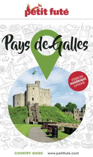
Reisgids Pays de Galles / Wales - Petit futé • 9782305113098
Guide de voiage Pays de Galles - Petit futé Productomschrijving: Si l'on devait faire le portrait du Pays de Galles, on le comparerait volontiers à un petit bout, très occidental, de la France de l'Ouest. Une contrée qui serait un mélange de pays de Retz, avec ses côtes rocheuses, ses petits ports de pêche, ses plages et ses criques, de Normandie, pour ses nombreux vallons verdoyants et hu…
Wandelgids Bannau Brycheiniog - Brecon Beacons Wales - Cicerone • 9781786312358
Bannau Brycheiniog - Brecon Beacons Wales - Cicerone Productomschrijving: Would you like to explore the best of the Brecon Beacons? This guidebook covers 15 of the best short walks in the area (between 4 and 9km), including Henrhyd Falls, Pen y Fan, Table Mountain, Sugar Loaf, Craig y Cilau and Ysgyryd Fawr. Why choose this guidebook? - Walks under three hours, plus one challenge r…

Wegenatlas Groot Brittanië & Noord Ierland - Freytag & Berndt • 9783707924084
Wegenatlas Groot Brittanië & Noord Ierland - F&B Productomschrijving: Autoatlas Großbritannien - Nordirland 1:200.000 - 1:266.000 ist der ideale Begleiter für alle, die mit dem Auto unterwegs sind und dabei nicht nur die Hauptstraßen und Autobahnen nutzen möchten. Er ist ideal für die Planung und erweist sich auch während der Reise als unverzichtbare Orientierungshilfe. Mit dem detail…

Wandelkaart Snowdonia Central XT40 Ultra - Harvey Maps • 9781851376780
Wandelkaart Snowdonia Central - Harvey Maps Productomschrijving: Omvat een groot gebied maar is praktisch en compact, zakformaat. Gedetailleerde kaart voor lopers en wandelaars van het centrale deel Snowdonia National Park. Omvat : Rhinog Fawr, Rhinog Fach en Moelwyn Mawr. Welsh-Engelse tekst. Heeft de voordelen van zijn grotere broers: - Inclusief opengestelde wegen - Gebru…
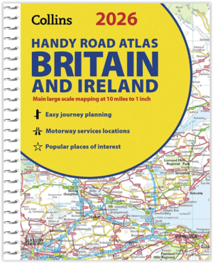
Wegenatlas Britain & Ireland road atlas A5-formaat - Collins • 9780008719227
Wegenatlas Britain & Ireland road atlas - Collins Productomschrijving: This easy-to-use, handy A5 sized road atlas with popular lie-flat spiral binding features extremely clear route planning maps of Britain and Ireland and fits neatly into your glove box or bag. The atlas has been fully updated. The maps of Britain are at 9.9 miles to 1 inch (1:625,000) and the whole of Ireland is co…
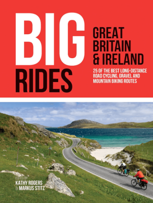
Fietsgids Big Rides- Great Britain & Ireland - Vertebrate Publ. • 9781839810725
Big Rides- Great Britain & Ireland - Vertebrate Productomschrijving: 25 of the best long-distance road cycling, gravel and mountain biking routes Big Rides: Great Britain & Ireland features twenty-five long-distance cycling trails in England, Scotland, Wales, Northern Ireland and Ireland, and includes a general overview of the trails, specific technical information, overview mapping, …
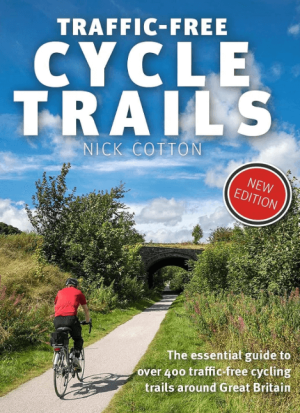
Traffic-Free Cycle Trails around Great Britain - Vertebrate Publ. • 9781912560769
Traffic-Free Cycle Trails around Great Britain - Vertebrate Productomschrijving: The essential guide to over 400 traffic-free cycling trails around Great Britain Traffic-Free Cycle Trails by Nick Cotton contains over 400 cycle routes in Great Britain. This book includes a great variety of routes on former railway paths, canal towpaths and forest trails in England, Scotland and Wales, w…

Fietsgids Great British Bike Rides - Vertebrate Publ. • 9781906148553
Great British Bike Rides - Vertebrate Productomschrijving: 40 classic routes for road cyclists Great British Bike Rides by Dave Barter brings together 40 of the best road rides in England, Scotland and Wales, searching out the country's most celebrated routes, toughest climbs and scenic roads. Features detailed route information, bespoke mapping and a statistical breakdown of every det…

Fietsgids Great British Gravel Rides - Vertebrate Publ. • 9781839811265
Great British Gravel Rides - Vertebrate Productomschrijving: Cycling the wild trails of England, Scotland & Wales Great British Gravel Rides by Markus Stitz is a collection of 25 routes – each is a favourite of a passionate gravel cyclist – exploring the very best gravel cycling across England, Wales and Scotland. Illustrated with stunning action photography and overview mapping; downl…

Fietsgids Wales Mountain Biking - Vertebrate Publ. • 9781906148133
Wales Mountain Biking - Vertebrate Productomschrijving: Wales Mountain Biking – Beicio Mynydd Cymru by Tom Hutton showcases 20 of the best mountain bike rides in Wales, between 12km and 50km in length, suitable for all levels of mountain bikers. It features three sections: South Wales, Mid Wales and North Wales. Each route is described with easy-to-follow directions and includes OS 1:50,00…
Wandelgids Day Walks in the Brecon Beacons - Vertebrate Publ. • 9781906148621
Day Walks in the Brecon Beacons - Vertebrate Productomschrijving: Day Walks in the Brecon Beacons features 20 circular routes between 6.8 and 16.5 miles (11km and 16.6km) in length. Author Harri Roberts shares his favourite walks in the region, including Llangors Lake, the Taf Fechan Skyline and the Llanbedr Horseshoe. Each route features Ordnance Survey maps, easy-to-follow directions an…

Wandelgids Classic Day Walks in England & Wales - Vertebrate Publ • 9781839810695
Classic Day Walks in England & Wales - Vertebrate Productomschrijving: 20 of the UK’s best walks Classic Day Walks in England & Wales features a selection of 20 of the best day-length hillwalking routes from Vertebrate Publishing’s popular series of walking guidebooks. Edited by Jon Barton, this guidebook takes you to the best hiking country in England and Wales: take in Lake District…

Wandelgids Day Walks in Snowdonia NP - Vertebrate Publ. • 9781906148416
Day Walks in Snowdonia NP - Vertebrate Productomschrijving: 20 circular routes in North Wales. Day Walks in Snowdoniaby Tom Hutton showcases 20 circular routes, between 5.5 and 12 miles (9km and 19km) in length, suitable for hillwalkers of all abilities. Also included are two of the UK's classic scrambles: The Bochlwyd Horseshoe and The Snowdon Horseshoe. Each route is described with …
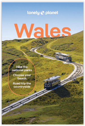
Reisgids Wales UK - Lonely Planet • 9781837583614
Reisgids Wales UK - Lonely Planet Productomschrijving: The phrase ‘good things come in small packages’ may be a cliché, but in the case of Wales it’s undeniably true. Lonely Planet will get you to the heart of Wales, with amazing travel experiences and the best planning advice. Lonely Planet Wales is your passport to the most relevant, up-to-date advice on what to see and skip, and wha…

Landkaart Wegenkaart Planning maps Wales - Lonely Planet • 9781788688987
Wegenkaart Planning maps Wales - Lonely Planet Productomschrijving: From Lonely Planet, the world's leading travel guide publisher Durable and waterproof, with a handy slipcase and an easy-fold format, Lonely Planet's Wales Planning Map helps you get around with ease. Get more from your map and your trip with images and information about top attractions, itinerary suggestions, a transport …

Reisgids Great Britain - Groot Brittannië - Lonely Planet • 9781837583515
Travelguide Great Britain - Lonely Planet Productomschrijving: Buckingham Palace, Stonehenge, Manchester United, The Beatles – Britain does icons like nowhere else, and travel here is a fascinating mix of famous names and hidden gems. Covers: Planning chapters, London, Canterbury, Southeast England, Oxford, Cotswolds, Southwest England, Cambridge, East Anglia, Birmingham, the Midlands…

Wandelgids Gower walking South Wales - Cicerone • 9781786312846
Wandelgids Gower walking - Cicerone Productomschrijving: The 30 circular routes in this guide to walking on the Gower peninsula, an Area of Outstanding Natural Beauty in South Wales, cover the rugged coastline, beaches and inland valleys and ridges. The walks visit a variety of landscapes and range from 2½ to 14 miles long. Packed with historical and geological information. Seasons: …
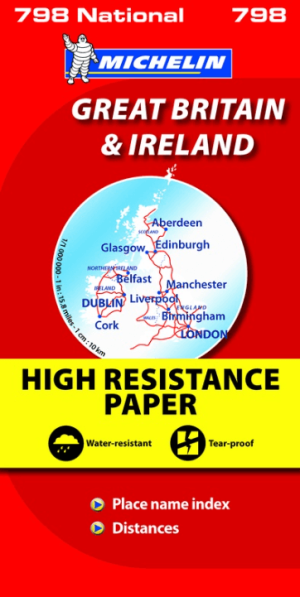
Landkaart Wegenkaart 798 Groot-Brittannië & Ierland - Michelin • 9782067137998
Wegenkaart Groot-Brittannië & Ierland - Michelin Productomschrijving: Deze Nationale kaart van Groot-Brittannië & Ierland, biedt een gedetailleerd overzicht van alle plaatsen. het wegennet wordt verfijnd aangeduid met allerhande symbolen, en voorziet in alle behoeftes, of u op zoek bent naar specifieke wegen, of zich snel uit de voeten wil maken, de plaatsnamenindex, en toeristische inform…
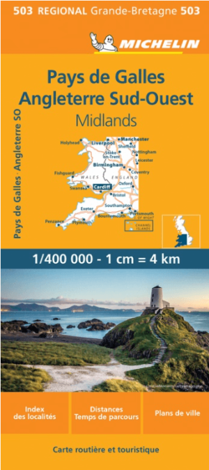
Landkaart Wegenkaart 503 Wales, Midlands & Engeland ZW - Michelin • 9782067183285
Regionale Wegenkaart Wales, Midlands & Engeland ZW - Michelin Productomschrijving: De volledig bijgewerkte MICHELIN kaart van Engeland Zuidwest Wales biedt u alle weg- en toeristische informatie die u nodig heeft om het meeste uit uw reis te halen: een INDEX VAN LOCATIES en een TABEL VAN AFSTANDEN en REISTIJDEN. De schaal van 1:400.000, d.w.z. 1 cm = 4 km, maakt het gemakkelijk om zowel d…
Wales Pembrokeshire wandelen
Wales Pembrokeshire wandelen beschikt over veel groene zones, en eveneens over veel bekende plaatsen waar veel aan outdoor wordt gedaan. Neem nu de Pembrokeshire Coast National Park, vlak aan de westkust van Wales gelegen, is een nationaal park die direct aan het strand uitkomt. Hiervan zijn redelijk wat kaarten en gidsen beschikbaar, gezien de toepassing van outdooractiviteiten er de laatste 20 jaar verviervoudigd is. De grens van Wales en Engeland bieden 1 samenkomend gebied genaamd de Schropshire Hills AONB. Dit gebied van uitmuntend natuurlijk schoon, host elk jaar opnieuw de Engels Wales games, die van over gans West-Engeland mee gevolgd worden. Wenst u van deze route kaarten te vinden dan zijn er de uitgevers Harvey Maps voor de kaarten, of Rucksack Readers voor Wandelgidsen. Ook Cicerone, en waarschijnlijk nog anderen kunnen u deze route voorstellen.
Voor de rest is Wales relatief toegankelijk, waarmee de reeks kaarten & gidsen over Wales uiteraard goede hulp biedt voor navigatie door het ganse land. Het noorden biedt dan weer plaats voor schiereilanden als Anglesey. Dit gebied als uitloper van het Snowdonia National Park is een plaats met een geval van ver van alles, met aan de ene zijde de Ierse zee, en de andere zijde het Nationale park.
Mountainbiking, Down Hillers, hikers & outdoor specialisten van over gans de wereld hebben hier al hun tenten opgeslagen. Het gebied staat bekend voor zijn spectaculaire berglandschappen en is een populaire toeristische trekpleister. De Brecon Beacons zijn bekend als International Dark Skye Reserve, en zijn voor het meeste bedekt met grasgroene moorland. Er loopt ook een lange afstandsfietsroute door, de Taff trail die loopt van de ene zijde van het NP, doormidden tot Cardiff. Ook is er de Breacons Way 161km, die loopt van Ysgyryd Fawr ten oosten van Abergavenny en loopt tot de stad van Bethlehem in Carmarthenshire.
In sommige van de hoger gelegen plaatsen in de Brecon Beacons, die weliswaar serieus afgelegen zijn, wordt er jaarlijks de “Fan Dance” georganiseerd door de “Special Forces Elite” van de SAS en de SBS, bedoeld als selectieprocedure voor de harde kern van soldaten, die hier een soort ultieme toegangstest vormen. Een bekende plaats voor trekking, Gorge walking, paardrijden en MTB/VTT is Dinosaur Park.
Op reis naar Wales
Een reis naar Wales is een avontuur dat natuurliefhebbers, cultuursnuivers en geschiedenisfanaten zal bekoren. Dit prachtige land, gelegen aan de westkust van Groot-Brittannië, staat bekend om zijn adembenemende landschappen, indrukwekkende kastelen en rijke Keltische cultuur. Wales biedt een breed scala aan bezienswaardigheden en activiteiten. In het noorden ligt het adembenemende Snowdonia National Park, waar je de hoogste berg van Wales, de Mount Snowdon, kunt beklimmen. Dit park is een paradijs voor wandelaars en biedt spectaculaire uitzichten, bergmeren en uitgestrekte valleien. De kustlijn van Wales, met name in het Pembrokeshire Coast National Park, staat bekend om zijn ruige kliffen, idyllische stranden en pittoreske vissersdorpjes, en biedt de befaamde wandelroute aan van de Pembrokshire Coastal path, 300 km en loopt van Amroth naar St. Dogmaels Pembroke.
Naast de natuurlijke schoonheid is Wales rijk aan geschiedenis. De vele kastelen, zoals het imposante Caernarfon Castle en het pittoreske Conwy Castle, zijn getuigen van het turbulente verleden van dit land. Cardiff, de hoofdstad, combineert historische charme met moderne architectuur en biedt tal van musea, winkels en restaurants. De Welshe cultuur is levendig en uniek, met een eigen taal die nog steeds wordt gesproken door een groot deel van de bevolking. Proef de lokale specialiteiten zoals Welsh cakes en laverbread, en geniet van de gastvrijheid in de vele traditionele pubs. Op reis naar Wales is een ervaring vol avontuur, ontdekking en verwondering, waarbij elke bocht in de weg een nieuw en onvergetelijk landschap onthult.
Voor Wandelkaarten van dit land gaat u best naar Wandelkaarten Wales & Wandelgidsen Wales voor de meer informatieve gidsen.