

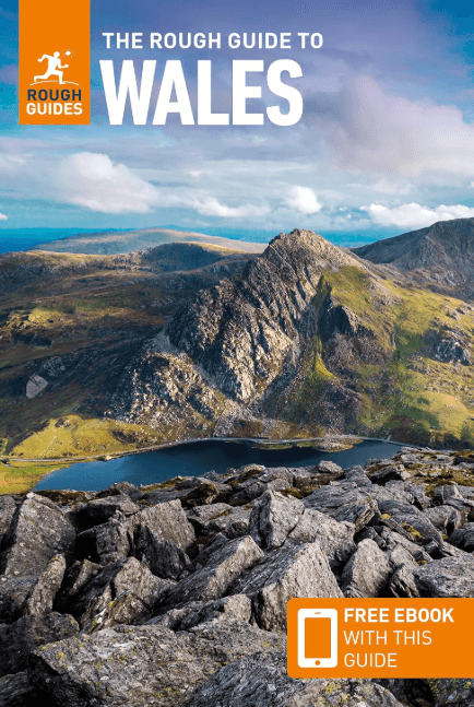
Reisgids Wales - Rough Guides
Cardiff - Swansea - Brecon Beacons NP - Snowdonia NP
Korte omschrijving
Reisgidsen Wales van Rough Guides. Ideaal voor tochten in Wales.
Reisgids Wales - Rough Guides Productomschrijving: Discover this beautiful country with the most incisive and entertaining guidebook on the market. Whether you plan to hike through the wilds...

Specificaties
- Uitgever: Rough Guides
- ISBN-13: 9781839059971
- HOOFDCATEGORIEËN: Reisgids
- Activiteiten: Toerisme
- Regio: Wales
- Land: Wales
- Editie: 11
- Taal: Engels
- Reeks/Serie: Rough Guides Main, Rough Guides Mini
Volledige omschrijving
Reisgids Wales - Rough Guides
Productomschrijving: Discover this beautiful country with the most incisive and entertaining guidebook on the market. Whether you plan to hike through the wilds of Snowdonia, follow in Wordsworth’s footsteps at Tintern Abbey or explore Welsh music and theatre in Swansea, The Rough Guide to Wales will show you the ideal places to sleep, eat, drink and shop along the way.
Inside The Rough Guide to Wales:– Independent, trusted reviews written with Rough Guides’ trademark blend of humour, honesty and insight, to help you get the most out of your visit.
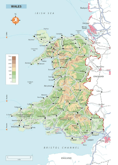
– Full-colour maps throughout – navigate the arcades of central Cardiff or the peaks of Brecon Beacons National Park without needing to get online.
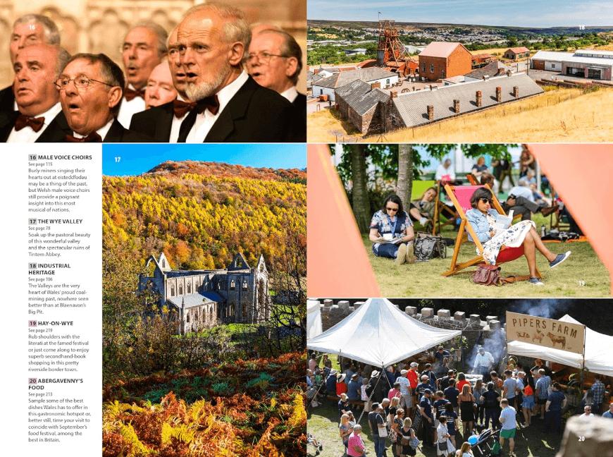
– Stunning, inspirational images
– Itineraries – carefully planned routes to help you organize your trip.
– Detailed regional coverage – Whether off the beaten track or in more mainstream tourist destinations, this travel guide has in-depth practical advice for every step of the way.
Covers: Cardiff, Swansea and the southeast, the southwest, the Brecon Beacons and Powys, the Cambrian coast, the Dee Valley, Snowdonia and the Llyn, the north coast and Anglesey.
Attractions include: Cardiff Bay, St David’s Cathedral, Pembrokeshire National Park, Conwy Castle, Cadair Idris, Ffestiniog Railway, Hay Festival, the beaches of the Llyn and Gower peninsulas.
- Essential pre-departure practical information including getting there, local transport, accommodation, food and drink, the media, health.
– Background information – a Contexts chapter devoted to Welsh history, politics, natural history, music, film and books, plus a handy language section.
Artikelen uit dezelfde regio

Wandelkaart Snowdonia Central XT40 Ultra - Harvey Maps • 9781851376780
Wandelkaart Snowdonia Central - Harvey Maps Productomschrijving: Omvat een groot gebied maar is praktisch en compact, zakformaat. Gedetailleerde kaart voor lopers en wandelaars van het centrale deel Snowdonia National Park. Omvat : Rhinog Fawr, Rhinog Fach en Moelwyn Mawr. Welsh-Engelse tekst. Heeft de voordelen van zijn grotere broers: - Inclusief opengestelde wegen - Gebru…

Wegenatlas Britain & Ireland road atlas - Harper Collins • 9780008779047
Wegenatlas Britain & Ireland - Harper Collins Productomschrijving: This easy-to-use, handy A5 sized road atlas with popular lie-flat spiral binding features extremely clear route planning maps of Britain and Ireland and fits neatly into your glove box or bag. The atlas has been fully updated. The maps of Britain are at 9.9 miles to 1 inch (1:625,000) and the whole of Ireland is covered at …

Plano Postcode Wandkaart Groot-Brittannië 84 x 119 - Lovell Johns • 9781910378977
Wandkaart Groot-Brittannië 84 x 119 - Lovell Johns Productomschrijving: De Postcodegebieden van de Britse eilanden worden duidelijk weergegeven en het gebied Groot-Londen wordt uitgebreid om deze postcodegebieden duidelijk te tonen. Bevat informatie, inclusief stads-, provincie- en districtsnamen. Steden zijn gemarkeerd om de geschatte populatie te tonen. Gebruik van de kaart: de postc…
Landkaart Wegenkaart Groot-Brittannië - Reise Know-How Verlag • 9783831772605
Wegenkaart Groot-Brittannië - Reise Know-How Verlag Productomschrijving: De Reise Know-How wegenkaart van Groot-Brittannië is een betrouwbare, gedetailleerde en duurzame landkaart voor wie Groot-Brittannië zelfstandig wil verkennen. Deze hoogwaardige reiskaart is ideaal voor gebruik tijdens een rondreis met de auto, camper, motor of fiets en biedt alle informatie die je nodig hebt voor een…

Wegenatlas Groot Brittanië & Noord Ierland - Freytag & Berndt • 9783707924985
Groot Brittanië & Noord Ierland - Freytag & Berndt Productomschrijving: De ideale autoatlas voor Groot-Brittannië en Noord-Ierland Het dichte wegennet is nauwkeurig weergegeven en veel uitstapjes zijn op de kaart aangegeven. Auto- en motorrijders waarderen de nauwkeurige cartografie vooral voor het plannen en oriënteren ter plaatse. Om de reis ook met een camper, caravan of kampeerwag…