
Wandelgids - Corsica GR20 - The high level route - Cicerone
De GR 20 "la route du solitude" enkel voor ervaren wandelaars


Korte omschrijving
Wandelgidsen Corsica, Frankrijk van CICERONE Press. Ideaal voor tochten in Frankrijk.
Wandelgids - Corsica GR20 - the high level route - Cicerone Productomschrijving: Deze gids beschrijft de klassieke GR20 trek, door de Noord naar Zuid-traverse van de ruige bergen van Corsica...

Stockactie
Specificaties
- Uitgever: CICERONE Press
- ISBN-13: 9781852848521
- HOOFDCATEGORIEËN: Wandelgids
- Activiteiten: Wandelen, Hiking & Trekking
- Regio: Corsica, Frankrijk
- Land: Frankrijk
- GR® routes: GR20
- Departement: Haute-Corse (2B)
- Editie: 4
- Taal: Engels

Volledige omschrijving
Wandelgids - Corsica GR20 - the high level route - Cicerone
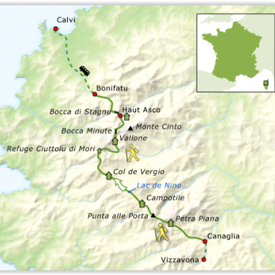
Productomschrijving: Deze gids beschrijft de klassieke GR20 trek, door de Noord naar Zuid-traverse van de ruige bergen van Corsica. Vanaf de route van Corscia in het noordwesten, in de pittoreske Calenzana, door naar het Zuid-Oosten, door het hart van Corsica, aan de oostkant van het eiland, net ten noorden van Porto Vecchio door de township van Conca.
In 16 stappen met hoge niveau & laag niveau alternatieven voor de relevante fasen. De route is ongeveer 200 kilometer lang en duurt ongeveer twee weken om te voltooien. De GR20 klimt hoog in de bergen. Het eist kracht en is alleen geschikt voor ervaren wandelaars. Stapsgewijze beschrijvingen van elke fase worden vergezeld door toewijzing op schaal 1:50,000, samen met informatie over beklimming & afdalingen, het terrein, en eetplaatsen, water en onderdak onderweg.
Ook inbegrepen is waardevolle informatie zoals pad voorwaarden, wat mee te nemen. Deze uitgebreide gids bevat ook informatie over de geschiedenis en de geologie van Corsica, samen met opmerkingen over de lokale fauna & flora en dieren in het wild.
Product description: This guidebook describes the classic GR20 trek, the north to south traverse of the rugged mountains of Corsica. Starting in Corscia's north-west, in picturesque Calenzana, the route winds south-east, through the heart of Corsica, finishing on the eastern side of the island, just north of Porto Vecchio in the township of Conca. Described in 16 stages with high level/low level alternatives for relevant stages, the route is roughly 200km in length and takes approximately two weeks to complete. The GR20 climbs high into the mountains. It is demanding trek and only suitable for experienced walkers. Step-by-step descriptions of each stage are accompanied by 1:50,000 mapping, together with information on ascent/descent, terrain, and food, water and shelter en route.
Also included is invaluable information such as path conditions, what to take, and getting to/from and around Corsica. This comprehensive guide also includes information on the history and geology of Corsica, together with notes on the local plants and wildlife. An island of surreal beauty, Corsica showcases dramatic mountains, enchanting coastline and ethereal vistas.
Bare rock and sheer cliff contrasts with black sand beaches, alpine pastures and pockets of forest. Mediterranean flair abounds, history lingers and culture is celebrated, making it the perfect destination for a trek bursting with adventure.
Seasons:
Possible mid-May to mid-October; June or September is ideal, with July and August being the hottest and busiest months.
Centres:
Calvi, Vizzavona, Porto Vecchio; limited accommodation and facilities on or near the route.
Difficulty:
The GR20 is a challenging walk (with scrambling) through isolated mountain terrain for experienced, fit walkers; backpacking throughout.
Must See:
The ascent of Monte Cinto and the ascent of Paglia Orba.

Locatie op kaart
Overzichtskaarten
GR20 Wandelroutes Corsica - Tour du solitude
GR20 Wandelroutes Corsica - Tour du solitude

Producten op de overzichtskaart
Klik op een product om naar de detailpagina te gaan.
- Wandelkaart 2251 - Corsica Zuid - Kompass
- Wandelkaart - Le GR20 Corse - Didier Richard
- Wandelgids Corsica - 70 wandelingen - ELMAR
- Wandelgids - Corsica GR20 - The high level route - Cicerone
- Wandelgids - GR 20 Corse - 16 jours de marche - Belle Balades
- Wandelkaart 09 Corsica zuid - Corse du Sud - Didier Richard
- Wandelgids - Corsica GR20 - The high level route - Cicerone
- Wandelgids - GR20 - A travers la montagne Corse - FFR
- Wandelgids - GR20 - Fra li monti - la légende corse - Ed.Glénat
- Wandelgids 067 - A travers la montagne Corse - GR20 - FFR
- Wandelgids - Short Treks in Corsica - Cicerone
- Wandelkaart - GR 20 Traversee de la Corse - IGN
Artikelen uit dezelfde regio

Wandelgids Walk & Eat Corsica (Frankrijk) - Sunflower Books • 9781856915670
Wandelgids Walk & Eat Corsica - Sunflower Productomschrijving: This pocket-sized full-colour guide to walking in Corsica is designed for visitors who would like to do some fairly easy walking as opposed to tackling the more difficult routes described in Landscapes of Corsica. It’s ideal for high season, when strenuous routes may be too hot, or for those travelling with children. Even…
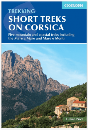
Wandelgids - Short Treks in Corsica - Cicerone • 9781786310590
Short Treks in Corsica - Cicerone Press Productomschrijving: Met spectaculaire berglandschappen, prachtige ruige kusten, bossen, en opvallende rivierkloven, is Corsica een paradijs voor wandelaars. Deze gids beschrijft 5 van de populairste kortere tochten van het eiland: de 2-daagse Sentier du Douanier langs de kust (Customs Officer's Path) rond Cap Corse, 2 routes van kust tot kust door d…
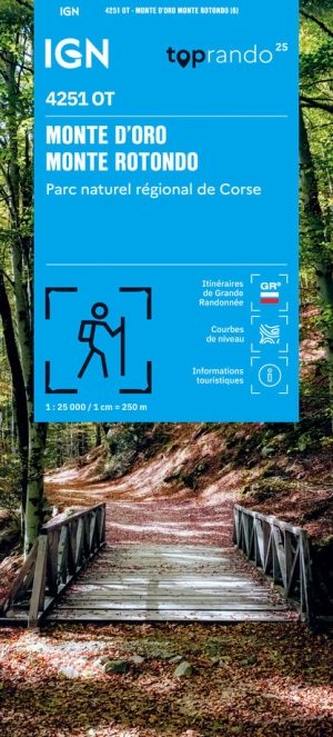
Wandelkaart 4251 OT Monte d'Oro, Monte Rotondo - IGN • 9782758559627
Wandelkaart Monte d'Oro, Monte Rotondo - IGN Productomschrijving: De TOP 25 kaarten (kaart nummers die eindigen op "T") hebben betrekking op gebieden van bijzonder toeristisch belang zoals de Alpen, de Pyreneeën,De Cevennes, de Vogezen, de Provence, en de Atlantische en Middellandse zeekusten. De kaarten hebben een opdruk en benadrukken zo de lokale wandelpaden, lange afstand GR routes en,…

Wandelkaart TOP75 029 Calvi- Cargese Corsica - IGN • 9782758547839
Wandelkaart Calvi- Cargese Corsica - IGN Productomschrijving: DIt deel van Corsica, die valt onder het departement van de Haute-Corse, is een zeer bosrijk gebied, en is gekend onder de Fransen als prachtige wandelregio. Corsica is onder meer gekend voor zijn GR20 wandelroute. Gecentreerd op uitzonderlijke locaties zoals natuurparken, gerenommeerde massieven. Ze zijn op maat gemaakt voo…

Wandelgids GR20, Fra li monti & la légende corse - Ed.Glénat • 9782344044384
Wandelgids GR20 - Fra li monti - la légende corse Productomschrijving: Lang geleden waren de vele paden die de hoge Alpenpassen kruisten om van een vallei, van het ene departement of van de ene staat naar de andere te gaan vooral bedoeld om de essentiële culturele, commerciële en zelfs smokkeluitwisselingen te vergemakkelijken, in plaats van uit te nodigen voor de eenvoudig plezier van wan…