

Regio
Taal
Editie
Schaal
Auteur:
Reeks/Serie:
Lange afstand wandelroutes
Historische wandelroutes
Bedevaart routes
Nationale parken
Regionale parken
AONB - Area of Outstanding Beauty/National Landscape
UNESCO werelderfgoed
TOPO's & Stafkaarten
Toepasselijke bergketen
HOOFDCATEGORIEËN
Uitgever


 Wandelen in Engeland
Wandelen in Engeland ligt naast Wales, Schotland en Noord-Ierland één van de 4 gebieden die samen het Verenigd Koninkrijk vormen. Het volledige landmassa van dit grote eiland wordt meestal aangeduid met de naam "Groot-Brittannië". In de volksmond wordt echter heel vaak over een uitstapje naar "Engeland" gesproken als men in het algemeen ergens in Groot-Brittannië is geweest. Interessant is de collectie van de 40 meest Iconische wandelroutes van Europa, de pagina is gloednieuw.
Bij Bibliotrek bedoelen we met Engeland wel degelijk het specifieke gebied. De Wandelgidsen Engeland vallen onder de grootste categorieën die Bibliotrek heeft. We hebben meer dan 1.200 wandelgidsen van verschillende uitgevers zoals Harper Collins, Sunflower books, het zeer gekende Cicerone, Elmar, en de nationale uitgever AA. Dit zijn stuk voor stuk professionele uitgevers met schitterende wandelgidsen voor Engeland. Het land bestaat uit vele graafschappen, die ten tijde van de Angelsaksen "Shires" werden genoemd. Dit blijkt nog uit de namen van een groot aantal graafschappen zoals Bedfordshire, Hampshire enz.
In Engeland hebben ze er aan nationale sport van gemaakt, en dat met de uitzinnige "National Trails". Dit zijn wandelroutes van formaat, die je natuurlijk niet enkel met een Wandelgids kan doen, maar ook met onze Wandelkaarten Engeland. De National Trails zijn heel bekend en vormen zelfs de bakermatr van de Engelse Wandelsport. Om er maar enkele te noemen:
The South Downs Way, door Sussex van Winchester naar Eastbormne, door The South Downs AONB.
The South West Coast Path, rond South West England, van Minehead bij Exmoor NP tot Pool in Dorset
The Yorkshire Wolds Way, van Hessle, East Riding of Yorkshire, tot Filey, North Yorkshire, 127 Km.

Wandelgids 063 Pathfinder guides Peak District England - OS • 9780319090275
Wandelgids Peak District England - OS Productomschrijving: The Pathfinder Guide for the Lake District is the ideal companion to gaining an appreciation of England's most mountainous region with its balanced range of walks across the whole of the National Park. There are a total of 28 outstanding circular walks in the Lake District National Park from 3 to 10 miles with easy-to-follow route…

Wandelgids 005 Pathfinder guides Cornwall England - OS • 9780319090299
Wandelgids Cornwall England - OS Productomschrijving: Pathfinder(R) Cornwall covering Land's End, Prussia Cove and Bodmin Moor. This selection offers interest, regional variety and balance of routes in Cornwall providing the best walks in the area. From an easy stroll along Falmouth Bay to the much more challenging walks along Looe Bar this volume contains something for everyone. Cover…
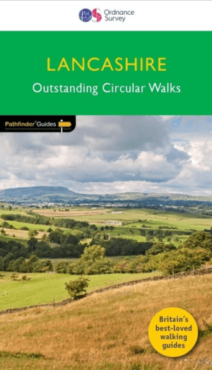
Wandelgids 053 Pathfinder guides Lancashire NW En England - OS • 9780319091203
Wandelgids Lancashire NW En England - OS Productomschrijving: With its fen-like lowlands, its coastal scenery, the high fells of Bowland and the lush river valleys of the Ribble and Lune, Lancashire is a county of surprising diversity from its great Industrial heritage towns to its attractive, rural villages and its numerous historic monuments. There can be no better way of exploring Lanc…
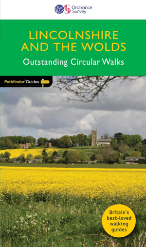
Wandelgids 050 Pathfinder guides Lincolnshire & the Wolds - OS • 9780319091005
Wandelgids Lincolnshire & the Wolds - OS Productomschrijving: The second largest county in England, Lincolnshire offers a surprising diversity of landscape - rolling wolds, coastal reaches, marshlands with endless skies and wide and impressive vistas, interspersed with historic market towns, magnificent churches and, of course, the ancient cathedral city of Lincoln. The county is larg…

Wandelgids 020 Pathfinder guides Sherwood Forest - OS • 9780319091098
Wandelgids Sherwood Forest - OS Productomschrijving: With 28 circular, graded walks all tried and tested by seasoned walkers, this guidebook for the Sherwood Forest & the East Midlands walks guidebook is ideal for holidaymakers and locals alike. Sherwood Forest lies in Nottinghamshire England.

Wandelgids 069 Pathfinder guides South West England Coastal walks • 9780319091135
Wandelgids South West England Coastal walks - OS Productomschrijving: Immerse yourself in 28 beautiful walks along the South West Coast of England with the OS Pathfinder Guidebooks, graded by length and ranging from 3 to 9 miles. The routes range from extended strolls to longer hikes, something for all levels! Each walk includes a detailed description, an OS map, GPS waypoints and notes of…

Wandelgids 044 Pathfinder guides Essex England - OS • 9780319091166
Wandelgids Essex England - OS Productomschrijving: This book has 28 circular, graded walks all around Essex. The routes range from extended 4.8km (3 miles) up to 15.6km (10 miles), so there is something for everyone of all abilities. Each walk includes a detailed description, an extract of the OS Explorer 1:25k map, GPS waypoints and key features to look out for. You can also find informa…

Wandelgids 073 Pathfinder guides More Peak District - OS • 9780319091081
Wandelgids More Peak District - OS Productomschrijving: This companion to the Pathfinder Peak District Guidebook contains 28 additional circular walks of 5km (3 miles) to 17km (10.5 miles). Like the main book, each is graded by length difficulty, and ranges from relatively easy strolls to some of the more challenging routes with considerable vertical ascent. Each route includes a deta…
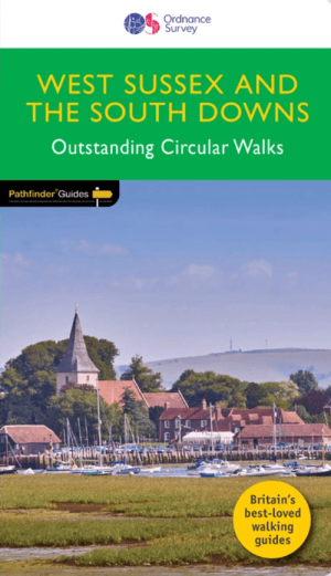
Wandelgids 066 Pathfinder guides West Sussex & South Downs - OS • 9780319091746
Wandelgids West Sussex & South Downs AONB - OS Productomschrijving: Containing 28 circular, graded walks that have all been created and tested by experienced walkers, this walking guidebook is ideal for both visitors and locals. The routes range from extended strolls to exhilarating hikes, so there is something for everyone. Each route includes a detailed description, the Ordnance Survey …

Wandelgids 084 Pathfinder Berkshire- Buckinghamshire- Oxfordshire • 9780319092279
Wandelgids Berkshire- Buckinghamshire- Oxfordshire Productomschrijving: This all-new Pathfinder® Guide covering the ceremonial counties of Berkshire, Buckinghamshire and Oxfordshire features 28 outstanding circular walks across all three counties, offering more wonderful Pathfinder® routes in the south-central Midlands between the Cotswolds (PF 6 Cotswolds) and the Chilterns (PF 25 Thames…

Wandelgids 080 Pathfinder guides Shropshire England - OS • 9780319092040
Wandelgids Shropshire England - OS Productomschrijving: 180 miles of stunning walking among A. E. Housman's 'Blue remembered hills' of the Shropshire Hills Ara of Outstanding Natural Beauty, including the Long Mynd, Stiperstones, and Caer Caradoc. There's also a climb to the top of The Wrekin. By way of contrast, walks visit the marshy meres of Brown and Whixall Moss, the World Heritage S…

Wandelgids 076 Pathfinder guides Somerset & the Mendips Hills- OS • 9780319091999
Wandelgids Somerset & the Mendips Hills - OS Productomschrijving: Gelegen tussen Weston-super-Mare en het oostelijker gelegen Frome. Pathfinder Guide to Somerset and the Mendips (Mendip Hills), featuring 28 outstanding walks designed for a range of abilities covering 170 miles of walking. Features: 28 guided walks for a range of abilities Large scale Ordnance Survey map extracts K…

Wandelgids 022 Pathfinder guides More Lake District - OS • 9780319092071
Wandelgids More Lake District - OS Productomschrijving: The Second Lake District title has 28 circular walks - all tried and tested by seasoned walkers. The routes range from extended strolls to exhilarating hikes, meaning there is something for everyone. This guidebook includes several walks that are either on the periphery of or outside the boundaries of the national park. There are…

Wandelgids 065 Pathfinder guides Surrey England - OS • 9780319090206
Wandelgids Surrey England - OS Productomschrijving: Get lost in these 28 beautiful walks across Surrey with the OS Pathfinder Guidebooks, graded by length and ranging from 3 to 9.5 miles. The routes range from extended strolls to longer hikes, something for all levels! The Surrey Pathfinder is tried and tested by seasoned walkers - it's ideal for both visitors and locals. Each walk in…
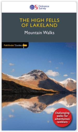
Wandelgids 071 Pathfinder guides High Fells of Lakeland - OS • 9780319091111
Wandelgids High Fells of Lakeland - OS Productomschrijving: Discover 20 majestic and challenging fell walks amid the glorious scenery of the Lake District mountains. The routes range from extended strolls to longer hikes, something for all levels! This book was created for those looking to push their walking adventures that bit further. Compiled by photographer and prolific guidebook …
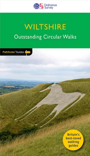
Wandelgids 077 Pathfinder guides Wiltshire - OS • 9780319092002
Wandelgids Wiltshire - OS Productomschrijving: Walking among the expansive landscapes and fascinating prehistoric sites of Wiltshire has never been easier or more rewarding. Discover rolling chalk downs, stone circles, white horses and millennia of English history with these 28 walks through gorgeous Wiltshire, graded by length and difficulty. Featured Wiltshire walks include: - S…

Wandelgids 081 Pathfinder guides Staffordshire - OS • 9780319092057
Wandelgids Staffordshire - OS Productomschrijving: 185 miles of superb country walking from the moorland of The Roaches and Three Shire Heads in the Peak District to the rolling woodlands and open countryside explored from Kinver. There's waterside walking along the Shropshire Union Canal and best the Trent, Heathland rambles across Cannock Chase and beautiful walks within easy reach of L…

Wandelgids 087 Pathfinder guides Northumberland - OS • 9780319092576
Wandelgids Northumberland - OS Productomschrijving: Opening with a gentle short walk at Kielder Water and concluding with an energetic and challenging ramble to the summit of The Cheviot, walks are arranged in the book by completion time, with shorter and easier routes at the start and longer outings at the end. Walks are professionally authored and depicted with GPS waypoints, Ordnance S…

Wandelgids 093 Pathfinde North Yorkshire Accessible walks - OS • 9780319092859
Wandelgids North Yorkshire Accessible walks - OS Productomschrijving: This guide comprises 33 beautiful walks, ranging in distance from 0.5 to 8 miles, across North Yorkshire, with ten routes in the Yorkshire Dales National Park, eleven in the North York Moors National Park, North Sea coast routes at Whitby, Robin Hood’s Bay and Bempton, and routes handily placed near the Richmond, Ripon, …

Wandelgids 094 Pathfinder guides The Isle of Wight - OS • 9780319092989
Wandelgids The Isle of Wight - OS Productomschrijving: The ISle of White is an island of the Coast of England, Het eiland wordt van Engeland gescheiden door de zeestraat de Solent. Aan de overkant ligt Southampton.

Wandelgids Mountain Walks Scafell Pike - Vertebrate Publ. • 9781839812569
Wandelgids Mountain Walks Scafell Pike - Vertebrate Productomschrijving: 15 routes to enjoy on and around the Sca Fell range Mountain Walks Scafell Pike by Graham Uney is a guide to walking routes to the summit of Scafell Pike – England’s highest mountain – in the Lake District. Alongside the summit routes, there are also lower-level alternatives for mixed weather or shorter days and…

Wandelgids Lea Valley walk - Cicerone Press • 9781786312877
Wandelgids Lea Valley walk - Cicerone Productomschrijving: Guidebook to the Lea Valley Walk, a 53 mile path from Luton to the Thames. The walk traces the River Lea from Leagrave, near Luton to East India Dock opposite Greenwich where it joins the Thames Path. Features an alternative finish at Limehouse and an optional tour of the Olympic Park. Split into 9 stages, the walk is suitable for …
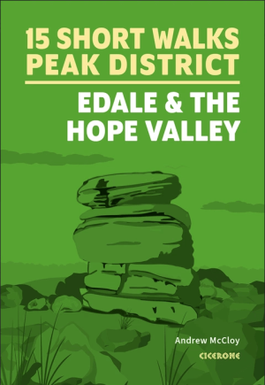
Wandelgids Peak District, Edale and the Hope Valley - Cicerone • 9781786312587
Peak District National Park - Edale and the Hope Valley - Cicerone Productomschrijving: Would you like to explore the best of Edale and the Hope Valley in the Peak District? This guidebook covers 15 of the best short walks in the area, including Hollins Cross and Mam Tor, Castleton, Ladybower Reservoir, Stanage Edge and North Lees, Kinder Scout and Castleton. Why choose this guidebook?…
Wandelgids Nord England Lake District & Yorkshire Dales - Rother • 9783763314522
Nord England Lake District & Yorkshire Dales - Rother Productomschrijving: Der Norden von England ist hierzulande als Ziel für einen Wanderurlaub nicht allzu bekannt, dies aber völlig zu Unrecht. Nicht umsonst gehören Lake District und Yorkshire Dales zu den bekanntesten Wanderregionen Großbritanniens und können selbst anspruchsvolle Wanderer begeistern. Doch auch hinter weniger bekannten…
Wandelgids Forest of Dean, 15 Short Walks - Cicerone • 9781786312884
Wandelgids 15 Short Walks in the Forest of Dean - Cicerone Productomschrijving: Would you like to explore the best of the Forest of Dean? This guidebook covers 15 of the best short walks in the area (between 4 and 9km, all under three hours), including the Dean Sculpture Trail, Tidenham Chase and the Devil’s Pulpit, Nagshead Nature Reserve and May Hill. Why choose this guidebook? -…
Wandelvakantie in Engeland
Wandelvakantie in Engeland. Engeland bestaat uit 9 grote wandelregio’s, elk met hun eigen karakteristieken en natuurpracht. In bijna elke regio is wel ergens een natuurgebied te vinden dat tot de zogenaamde AONB regio’s behoort, voluit geschreven, een “Area of Outstanding Natural Beauty”. Vertaald betekent dit “gebied van uitmuntend natuurschoon”. Hoe meer u naar het noorden trekt, hoe meer het landschap zich open trekt. Maar dit betekent in geen geval dat de omgeving er minder interessant op wordt. Hoe verder u Engeland in trekt, hoe mooier het wordt voor de wandelaar. Dit dankzij de vele Nationale parken en Regionale parken die Engeland rijk is.
Met behulp van onze wandelgidsen zit u uiteraard goed! Maar met de Wandelkaarten Engeland heeft u een beter overzicht. Zo krijgt u met een kaart minder informatie. Europese reisgidsen bieden u dan weer de toeristische informatie die ook best nuttig is.
Deze parken zijn tot ver buiten de Engelse grenzen gekend. Gebieden als de Chilterns, Cornwall, de Cotswolds, Forest of Bowland, de Kent Downs, de Isle of Wight, Nidderdale, Zuid Engeland, Kent, Yorkshire, Lake district, Stonehenge ... kleuren het Engelse landschap. Ze maken het grote eiland tot een schitterend natuurfenomeen. Uiteraard zijn er de Wandelgidsen Engeland door een pak verschillende uitgevers gerealiseerd. Zij hebben meestal de AONB regio’s uitgebreid en tot in detail in hun gamma opgenomen. De AONB’s zijn niet alleen in Engeland te vinden, maar ook in de andere gebieden van Groot-Brittannië. Het aanbod aan Wandelgidsen voor het gebied Engeland alleen al, is zodanig groot dat u best eerst bepaalt waar in Engeland u precies op wandel wil. Daarna kunt u dan de wandelgidsen selecteren die uw gekozen regio specifiek behandelen. Iconische wanelroutes, een 40-tal toppers uit Europa en omstreken.
Van Southhampton tot in Cumbria
Van Southhampton tot in Cumbria, Engeland leent zich werkelijk uitstekend als wandelgebied. De uitgebreide waaier aan wandelgidsen laat u toe het gebied Engeland in verschillende regio's op te splitsen. Op die manier kunt u de specifieke cultuur- en natuuraspecten per gebied ontdekken. De verschillende regio’s bieden soms compleet verschillende wandelmogelijkheden.
Soms kunt u wandelen van steden naar dorpen, naar natuurgebieden, naar universiteitssteden, nationale en regionale parken en zelfs bergen. Regio’s als Cheshire, Cumbria, Yorkshire, Manchester, Lancashire, Merseyside, ... bezorgen Engeland unieke wandeltroeven die om het even welk type wandelaar nieuwsgierig zullen maken. Met een beetje creativiteit weet u als Wandelaar precies wat er interessant is de buurlanden, zo kunt u als wandelaar steeds naar die buurlanden gaan kijken op de pagina: Hebben we het over Wales, dan is deze pagina belangrijk Wandelgidsen Wales of is het Schotland dan zijn het de Wandelgidsen Schotland.
FAQ: Wandelgidsen ENGELAND
Ordnance Survey voor kaartbasis (de reeks Explorer OL op schaal 1:25.000, of de serie Landranger op schaal 1:50.000); Harvey Maps voor trailgerichte detailkaarten. Selecteer titel per Regio of Trail. Filter op Uitgever & Serie, links op uw scherm.
Dagtochten: Lake District en Peak District. Lange trajecten: South West Coast Path, Cotswolds, Yorkshire Dales. Kies gids met duidelijke Etappes en Hoogtemeters. Filter op Regio en Moeilijkheid, links op uw scherm.
De beste periode is tijdens de Lente of het Najaar. Weer wisselt snel; kies Waterbestendige gidsen. Toegang via Public Rights Of Way en gemarkeerde paden. Controleer Parkeren/Startpunt per route in de gids.