

Wandelkaart 324 Liddesdale & Kershope Forest - OSI
Omvat Liddesdale- Kershope forest & het Liddel Water

Korte omschrijving
Wandelkaarten Schotse grenzen van Ordnance Survey. Ideaal voor tochten in Schotland.
Wandelkaart Liddesdale & Kershope Forest - Schotish borders Productbeschrijving: Aan de Schotse - Engelse grens, omvat OS Explorer kaart 324 Liddesdale, Kershope forest en het Liddel Water. ...

Specificaties
- Uitgever: Ordnance Survey
- ISBN-13: 9780319263297
- HOOFDCATEGORIEËN: Wandelkaart
- Activiteiten: Wandelen, Hiking & Trekking
- Regio: Schotse grenzen
- Land: Schotland
- Regionale parken: Kershope Forest
- TOPO's & Stafkaarten: Topografisch wandelen
- Schaal: 1:25000
- Taal: Engels
- Reeks/Serie: Explorer Series OS
Volledige omschrijving
Wandelkaart Liddesdale & Kershope Forest - Schotish borders
Productbeschrijving: Aan de Schotse - Engelse grens, omvat OS Explorer kaart 324 Liddesdale, Kershope forest en het Liddel Water. De Hermitage Castle in de buurt van Liddel Water, die er ene is van de best bewaarde in Schotland. De OS Explorer kaart voor doorverwijspagina & Kershope Forest is beschikbaar in zowel de standaard papieren versie als de weerbestendige 'Actief' versie.
Productdiscription: On the Scotland - England border, OS Explorer map 324 covers Liddesdale, Kershope Forest and the Liddel Water. The Hermitage Castle near Liddel Water is one of the better preserved in Scotland. The OS Explorer map for Liddesdale & Kershope Forest is available in both the standard paper version and weatherproof 'Active' version.
Locatie op kaart
Gekoppelde artikelen

Wandelkaart 324 Liddesdale & Kershope Forest - OSI • 9780319263297
standaard versieWandelkaart Liddesdale & Kershope Forest - Schotish borders Productbeschrijving: Aan de Schotse - Engelse grens, omvat OS Explorer kaart 324 Liddesdale, Kershope forest en het Liddel Water. De Hermitage Castle in de buurt van Liddel Water, die er ene is van de best bewaarde in Schotland. De OS Explorer kaart voor doorverwijspagina & Kershope Forest is beschikbaar in zowel de standaard papi…

Wandelkaart 324 Liddesdale & Kershope Forest - Schotland • 9780319475324
weatherproof versieWandelkaart Liddesdale & Kershope Forest - Schotsich borders Omvat ook: Newcastleton & Canonbie. Productbeschrijving: Aan de Schots / engelsee grens, omvat OS Explorer kaart 324 de omgevingen van Kershope bos en het Liddel Water. De Hermitage Castle in de buurt van Liddel Water is één van de best bewaarde in Schotland. De OS Explorer kaart voor Liddesdale & Kershope Forest is beschikba…
Overzichtskaarten
OSI Explorer & Explorer Active - Zuid Scotisch Borders
OSI Explorer & Explorer Active - Zuid Scotisch Borders

Producten op de overzichtskaart
Klik op een product om naar de detailpagina te gaan.
- Wandelkaart 307 Consett & Derwent reservoir - OSI
- Wandelkaart 308 Durham & Sunderland - England - OSI
- Wandelkaart 309 Stranraer & The Rhins - Dumfries - OSI
- Wandelkaart 310 Glenluce & Kirkcowan - Schotland - OSI
- Wandelkaart 311 Wigtown- Whithorn & The Machars - OSI
- Wandelkaart 312 Kirkcudbright & Castle Douglas - OSI
- Wandelkaart 313 Dumfries & Dalbeattie- Schotland - OSI
- Wandelkaart 314 Solway Firth- Wigton & Silloth - OSI
- Wandelkaart 315 Carlisle- Brampton & Longtown - OSI
- Wandelkaart 316 Newcastle upon Tyne - Northumberland - OSI
- Wandelkaart 318 Galloway Forest Park North- Ayrshire
- Wandelkaart 319 Galloway Forest Park South - OSI
- Wandelkaart 320 Castle Douglas & Loch Ken - OSI
- Wandelkaart 321 Nithsdale & Dumfries & Thornhill - OSI
- Wandelkaart 322 Annandale- Dumfries & Galoway - OSI
- Wandelkaart 323 Eskdale & Castle O'er Forest- Schotland - OSI
- Wandelkaart 324 Liddesdale & Kershope Forest - OSI
- Wandelkaart 325 Morpeth & Blyth - Northumberland - OSI
- Wandelkaart 326 Ayr & Troon - South Ayrshire - OSI
- Wandelkaart 327 Cumnock & Dalmellington - OSI
- Wandelkaart 328 Sanquhar & New Cumnock - OSI
- Wandelkaart 329 Lowther Hills- Sanquhar & Leadhills - OSI
- Wandelkaart 330 Moffat & St Mary's Loch - Dumfries - OSI
- Wandelkaart 331 Teviotdale South - Schotisch Borders - OSI
- Wandelkaart 332 Alnwick Amble - Northumberland - OSI
- Wandelkaart 333 Kilmarnock & Irvine - East Ayrshire - OSI
- Wandelkaart 334 East Kilbride- Galston & Darvel - Glasgow - OSI
- Wandelkaart 335 Lanark & Tinto Hills - South Lankashire - OSI
- Wandelkaart 336 Biggar & Broughton - South Lanarkshire - OSI
- Wandelkaart 337 Peebles & Interleithen - Schotish Borders - OSI
- Wandelkaart 338 Galashiels- Selkirk & Melrose - OSI
- Wandelkaart 339 Kelso- Coldstream & Lower Tweed Valley - OSI
- Wandelkaart 340 Holy Island & Bamburgh - OSO
- Wandelkaart 341 Greenock- Largs & Millport - OSI
- Wandelkaart 342 Glasgow Schotland - OSI
- Wandelkaart 343 Motherwell & Coatbridge- Glasgow - OSI
- Wandelkaart 344 Pentland Hills RP- Edinburgh - OSI
- Wandelkaart 345 Lammermuir Hills - Edinburgh - OSI
- Wandelkaart 346 Berwick-upon-Tweed - Northumberland - OSI
- Wandelkaart 349 Falkirk- Cumbernauld & Livingston - OSI
- Wandelkaart 350 Edinburgh - East Schotland - OSI
- Wandelkaart 351 Dunbar & North Berwick - Edinburgh - OSI
- Wandelkaart 361 Isle of Arran - OSI
- Wandelkaart 362 Cowal West & Isle of Bute - OSI
- Wandelkaart OL04 English Lakes - North Western area - OS
- Wandelkaart OL05 English Lakes - North Eastern area - OS
- Wandelkaart OL16 Cheviot Hills, Jedburgh & Wooler - OS
- Wandelkaart OL37 Cowal East- Dunoon & Iverary - OS
- Wandelkaart OL38 Loch Lomond South & Dumbarton - OSI
- Wandelkaart OL42 Kielder Water & Forest - OS
- Wandelkaart OL43 Hadrian's Wall- Haltwhistle & Hexham - OS
Artikelen uit dezelfde regio

Wandelkaart 67 Duns- Dunbar & Eyemouth- Schotland - OSI • 9780319473900
Wandelkaart Duns- Dunbar & Eyemouth - Schotland Productbeschrijving: OS Landranger kaart 67 toont de oostkust van de buurt van Edinburgh, en omvat de steden Duns, Dunbar, East Linton, Eyemouth en Cosckburnspath. Het markeert het oostelijke uiteinde van de Southern Upland Way, en u kunt ook het verkennen van de Lammermuir Hills. De OS Landranger kaarten reeks heeft betrekking op Groot-Britt…

Wandelkaart 338 Galashiels Selkirk & Melrose - OSI • 9780319472101
Wandelkaart Galashiels- Selkirk & Melrose - Scotisch Borders Omvat ook: St-Boswell’s & Lauder. Productbeschrijving: Kaart nummer 338 dekt Galashiels, Selkirk en Melrose. Hoogtepunten zijn onder andere Eilon en Leaderfoot, Southern Upland Way en Borders Abbeys Way. Omvat ook Lauder, St. Boswells, Bloomfield en Fountainhall. De OS Explorer kaart voor Galashiels, Selkirk & Melrose is besc…
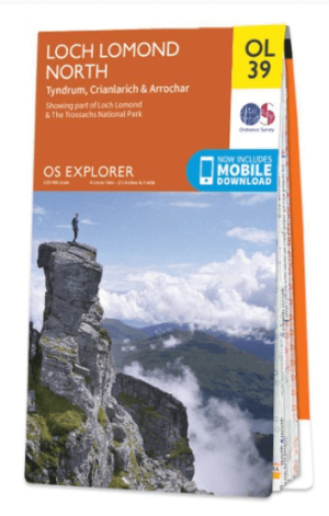
Wandelkaart OL39 Loch Lomond North & Tyndrum - OS • 9780319242780
Wandelkaart Loch Lomond North & Tyndrum - OS Productomschrijving: Loch Lomond North & Tyndrum, Crianlarich & Arrochar, part of Loch Lomond & The Trossachs National Park. Omvat: Loch Lomond North & Tyndrum, Crianlarich & Arrochar, part of Loch Lomond & The Trossachs National Park. Ontdek de OL-serie van Ordnance Survey: De OL-serie (Outdoor Leisure) van Ordnance Survey is dé refe…

Wandelgids 088 Pathfinder guides Scottish Borders - OS • 9780319092583
Wandelgids Scottish Borders - OS Productomschrijving: Opening with a gentle short walk at Hawick, visiting Wilton Lodge Park is the company of the River Teviot, and concluding with a more challenging ramble to the north of Melrose, walks are arranged in the book by completion time, with shorter and easier routes at the start and longer outings at the end. Walks are professionally authored …
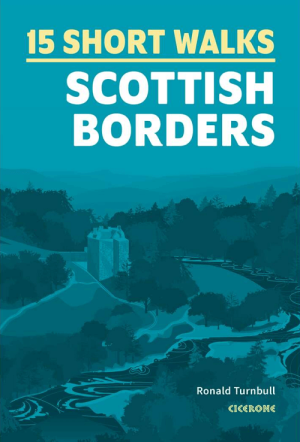
Wandelgids Scottish Borders, 15 Short Walks - Cicerone • 9781786312518
Wandelgids Scottish Borders - Cicerone Productomschrijving: Would you like to explore the best of the Scottish Borders? This guidebook covers 15 of the best short walks in the area (between 6 and 11.5km, all under three hours), including St Abbs Head, Eyemouth Shores, Wideopen Hill, Eildon Hills, Hawick, Peebles and Neidpath Castle. Why choose this guidebook? - Easy to moderate wa…