

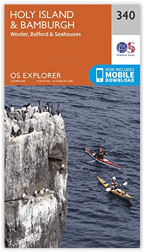
Wandelkaart 340 Holy Island & Bamburgh - OSO
Wooler - Belford - Seahouses - Holy Island - Bamburgh
Korte omschrijving
Wandelkaarten Northumberland, Engeland van Ordnance Survey. Ideaal voor tochten in England.
Wandelkaart Holy Island & Bamburgh - OSI Productomschrijving: Holy Island en Bamburgh zijn 2 aan de kust liggende eilanden/archipel die de interesse trekt van velen in het teken van natuur b...

Specificaties
- Uitgever: Ordnance Survey
- ISBN-13: 9780319263907
- HOOFDCATEGORIEËN: Wandelkaart
- Activiteiten: Wandelen, Hiking & Trekking
- Regio: Northumberland, Engeland
- Land: England
- TOPO's & Stafkaarten: Topografisch wandelen
- AONB - Area of Outstanding Beauty/National Landscape: Northumberland coast AONB
- Schaal: 1:25000
- Taal: Engels
- Reeks/Serie: Explorer Series OS
Volledige omschrijving
Wandelkaart Holy Island & Bamburgh - OSI
Productomschrijving: Holy Island en Bamburgh zijn 2 aan de kust liggende eilanden/archipel die de interesse trekt van velen in het teken van natuur bezoek, wandelen of fietsen. De locatie is zeer mooi wat de natuur betreft.
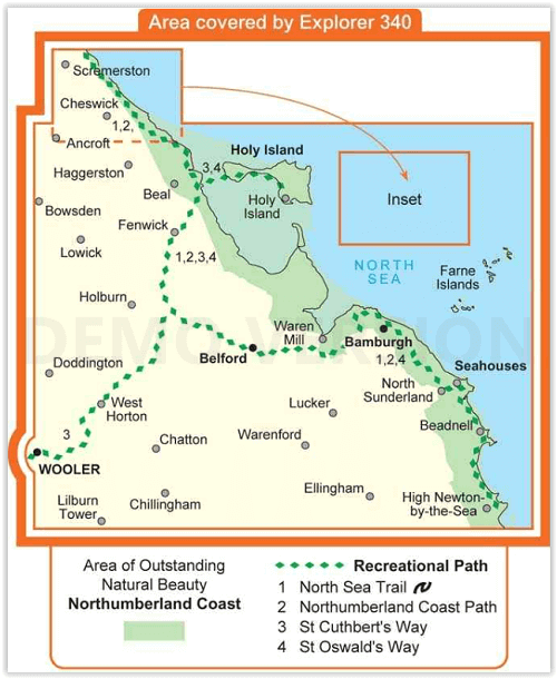
Omvat: Cheswick, Ancroft, Haggerston, Bowsden, Beal, Fenwick; Holy Island, Holburn, Doddington, Belford, Waren Mill, Bamburgh, Seahouses, West Horton, CHatton, Warenford, Lucker, North Sunderland, Beadnell, Woolern Lilburn Tower, Chillingham, Ellingham, Nigh Newton-by-the-Sea.
Engelse omschrijving: These highly detailed maps show all the administrative boundaries, settlements as small as isolated farms, the road network down to unfenced roads and country tracks, and field boundaries (hedges and drystone walls) which make navigation across the countryside much easier. Steep gradients on roads are indicated. Various landmarks, e.g. powerlines, archaeological sites, windmills, churches and lighthouses are shown and additional graphics indicate natural terrain features such as cliffs, scree, mud and vegetation variations. The contour interval is 5 metres in the lower parts of the country and 10 metres in the uplands, and spot heights are marked. Each map covers an area of 30 x 20km (i.e. approx. 19 x 12 miles), with some double-sided maps covering more, as indicated in the individual descriptions. The maps are fully GPS compatible, with the National Grid shown at 1km intervals and latitude and longitude indicated by margin ticks at 1'.
The Explorer series has replaced the earlier, green-cover Pathfinder maps. The Explorer series is now complete and covers all of England, Wales & Scotland. Some sheets for popular areas like the National Parks are still branded as Outdoor Leisure (OL) maps, but are now included in this series as the cartography is the same as that in the Explorer Maps. The Explorer maps offer a substantial improvement on the Pathfinder series, with greater use of colour, larger area per map, and stronger emphasis on information for ramblers and tourists.
Locatie op kaart
Overzichtskaarten
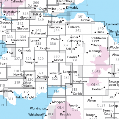
OSI Explorer & Explorer Active - Zuid Scotisch Borders
OSI Explorer & Explorer Active - Zuid Scotisch Borders

Producten op de overzichtskaart
Klik op een product om naar de detailpagina te gaan.
- Wandelkaart 307 Consett & Derwent reservoir - OSI
- Wandelkaart 308 Durham & Sunderland - England - OSI
- Wandelkaart 309 Stranraer & The Rhins - Dumfries - OSI
- Wandelkaart 310 Glenluce & Kirkcowan - Schotland - OSI
- Wandelkaart 311 Wigtown- Whithorn & The Machars - OSI
- Wandelkaart 312 Kirkcudbright & Castle Douglas - OSI
- Wandelkaart 313 Dumfries & Dalbeattie- Schotland - OSI
- Wandelkaart 314 Solway Firth- Wigton & Silloth - OSI
- Wandelkaart 315 Carlisle- Brampton & Longtown - OSI
- Wandelkaart 316 Newcastle upon Tyne - Northumberland - OSI
- Wandelkaart 318 Galloway Forest Park North- Ayrshire
- Wandelkaart 319 Galloway Forest Park South - OSI
- Wandelkaart 320 Castle Douglas & Loch Ken - OSI
- Wandelkaart 321 Nithsdale & Dumfries & Thornhill - OSI
- Wandelkaart 322 Annandale- Dumfries & Galoway - OSI
- Wandelkaart 323 Eskdale & Castle O'er Forest- Schotland - OSI
- Wandelkaart 324 Liddesdale & Kershope Forest - OSI
- Wandelkaart 325 Morpeth & Blyth - Northumberland - OSI
- Wandelkaart 326 Ayr & Troon - South Ayrshire - OSI
- Wandelkaart 327 Cumnock & Dalmellington - OSI
- Wandelkaart 328 Sanquhar & New Cumnock - OSI
- Wandelkaart 329 Lowther Hills- Sanquhar & Leadhills - OSI
- Wandelkaart 330 Moffat & St Mary's Loch - Dumfries - OSI
- Wandelkaart 331 Teviotdale South - Schotisch Borders - OSI
- Wandelkaart 332 Alnwick Amble - Northumberland - OSI
- Wandelkaart 333 Kilmarnock & Irvine - East Ayrshire - OSI
- Wandelkaart 334 East Kilbride- Galston & Darvel - Glasgow - OSI
- Wandelkaart 335 Lanark & Tinto Hills - South Lankashire - OSI
- Wandelkaart 336 Biggar & Broughton - South Lanarkshire - OSI
- Wandelkaart 337 Peebles & Interleithen - Schotish Borders - OSI
- Wandelkaart 338 Galashiels- Selkirk & Melrose - OSI
- Wandelkaart 339 Kelso- Coldstream & Lower Tweed Valley - OSI
- Wandelkaart 340 Holy Island & Bamburgh - OSO
- Wandelkaart 341 Greenock- Largs & Millport - OSI
- Wandelkaart 342 Glasgow Schotland - OSI
- Wandelkaart 343 Motherwell & Coatbridge- Glasgow - OSI
- Wandelkaart 344 Pentland Hills RP- Edinburgh - OSI
- Wandelkaart 345 Lammermuir Hills - Edinburgh - OSI
- Wandelkaart 346 Berwick-upon-Tweed - Northumberland - OSI
- Wandelkaart 349 Falkirk- Cumbernauld & Livingston - OSI
- Wandelkaart 350 Edinburgh - East Schotland - OSI
- Wandelkaart 351 Dunbar & North Berwick - Edinburgh - OSI
- Wandelkaart 361 Isle of Arran - OSI
- Wandelkaart 362 Cowal West & Isle of Bute - OSI
- Wandelkaart OL04 English Lakes - North Western area - OS
- Wandelkaart OL05 English Lakes - North Eastern area - OS
- Wandelkaart OL16 Cheviot Hills, Jedburgh & Wooler - OS
- Wandelkaart OL37 Cowal East- Dunoon & Iverary - OS
- Wandelkaart OL38 Loch Lomond South & Dumbarton - OSI
- Wandelkaart OL42 Kielder Water & Forest - OS
- Wandelkaart OL43 Hadrian's Wall- Haltwhistle & Hexham - OS
Artikelen uit dezelfde regio

Wandelkaart Hadrian's Wall Path - Vertebrate Publ. • 9781839810312
Hadrian's Wall Path - Vertebrate Productomschrijving: Easy-to-use folding map and essential information, with custom itinerary planning for walkers, trekkers, fastpackers and trail runners Hadrian's Wall Path Guidemap from Vertebrate Publishing is a lightweight, waterproof, durable and easy-to-use folding map with 1:40,000-scale mapping for the east to west HWP route. Includes route va…
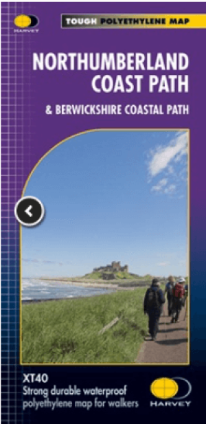
Wandelkaart Northumberland - Harvey Maps • 9781851376681
Wandelkaart Northumberland - Harvey Maps Productomschrijving: De Gehele route op één kaart! - Het Northumberland Coast Path strekt zich uit over 103 km van Cresswell in het zuiden naar Berwick-upon-Tweed in het noorden, waarna het Berwickshire Coastal Path 48 km (28 m) verdergaat naar Cockburnspath. Beide routes staan op deze kaart en ze maken deel uit van het Noordzeepad. Het Northumb…

Wandelkaart 340 Holy Island & Bamburgh - OSI • 9780319475768
Wandelkaart Holy Island & Bamburgh - Explorer Active Productomschrijving: Holy Island en Bamburgh zijn 2 aan de kust liggende eilanden/archipel die de interesse trekt van velen in het teken van natuur bezoek, wandelen of fietsen. De locatie is zeer mooi wat de natuur betreft. Omvat: Cheswick, Ancroft, Haggerston, Bowsden, Beal, Fenwick, Holy Island, Holburn, Doddington, Belford, Waren …
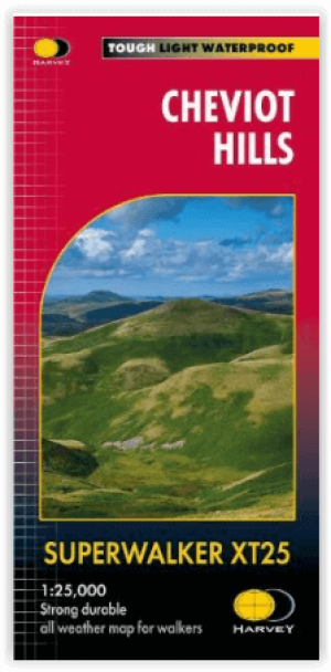
Wandelkaart XT25 Cheviot Hills - Harvey Maps • 9781851376094
Wandelkaart Cheviot Hills - Harvey Maps Productomschrijving: Ideaal voor The Cheviot, Windy Gyle en het noordelijke deel van Northumberland National Park. Omvat: Wooler, Kirk Yetholm, Breamish Valley en Harthope Valley - Lichtgewicht, gedetailleerd, duidelijk en makkelijk te lezen - Geprint op sterk, 100% watervast en scheurbestendig papier - Toont de horeca voor na je dagtrip …

Wandelgids Hadrian's wall Path - Knife Edge • 9781912933075
Wandelgids - Hadrian's wall Path - Knife Edge Productomschrijving: De definitieve tweerichtingsgids voor het Hadrian's Wall Path: zowel oostwaartse als westelijke routes worden volledig beschreven. 14 verschillende routes: schema's van 3, 4, 5, 6, 7, 8 en 9 dagen voor wandelaars en hardlopers. Omvat reisroutes naar het noorden en het zuiden. De moeilijkere berekeningen van tijd, afstand en…