

Wandelkaart OL42 Kielder Water & Forest - OS
Kielder Water & Forest- Bellingham- Simonside Hills


Korte omschrijving
Wandelkaarten Northumberland, Engeland van Ordnance Survey. Ideaal voor tochten in England.
Wandelkaart Kielder Water & Forest - OS Productomschrijving: Kielder Water & Forest, Bellingham & Simonside Hills, part of Northumberland National Park, Pennine Way, St Oswald's Way, Lakesi...

Specificaties
- Uitgever: Ordnance Survey
- ISBN-13: 9780319242810
- HOOFDCATEGORIEËN: Wandelkaart
- Activiteiten: Wandelen, Hiking & Trekking
- Auteur: Ordnance Survey
- Regio: Northumberland, Engeland
- Land: England
- Lange afstand wandelroutes: Pennine Way (420 km), St Oswald's Way (156 km)
- Nationale parken: Northumberland NP, England
- TOPO's & Stafkaarten: Topografisch wandelen
- Schaal: 1:25000
- Taal: Engels
- Reeks/Serie: Explorer Series OS
Volledige omschrijving
Wandelkaart Kielder Water & Forest - OS
Productomschrijving: Kielder Water & Forest, Bellingham & Simonside Hills, part of Northumberland National Park, Pennine Way, St Oswald's Way, Lakeside Way & E2 European long distance Path.
Omvat: Kielder Water & Forest, Bellingham & Simonside Hills
Ontdek de OL-serie van Ordnance Survey:
De OL-serie (Outdoor Leisure) van Ordnance Survey is dé referentie voor wie gaat wandelen op de Britse eilanden. Deze topografische kaarten maken deel uit van de Explorer-reeks en bieden ongeëvenaarde nauwkeurigheid en detail op een schaal van 1:25.000. Perfect voor wandelaars, hikers en outdoorliefhebbers.
Waarom kiezen voor de OL Explorer-kaarten?
Gedetailleerde topografie: Elk hekje, pad, beekje en hoogteverschil staat erop.
Ingetekende National Trails: Bekende wandelroutes zoals de South West Coast Path, Hadrian’s Wall Path en Pennine Way zijn duidelijk gemarkeerd.
Betrouwbaarheid: Ordnance Survey is al decennialang de standaard voor kaarten in het VK.
Weerbestendige versies beschikbaar – ideaal voor gebruik in weer en wind.
De beste keuze voor wandelaars
Vergeet generieke wandelkaarten. Met de OL-serie krijg je precieze, actuele informatie, zodat je zonder zorgen op pad kunt.
KOOP NU UW TOPOGRAFISCHE WANDELKAART
Bekijk ons aanbod en kies de OL-kaart die past bij jouw volgende wandelroute. Wandel slim, wandel met Ordnance Survey. wandelroute. Wandel slim, wandel met Ordnance Survey.

Overzichtskaarten
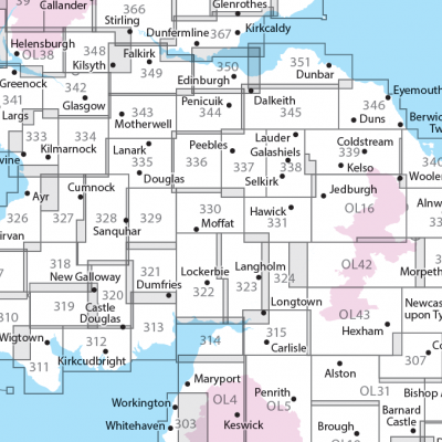
OSI Explorer & Explorer Active - Zuid Scotisch Borders
OSI Explorer & Explorer Active - Zuid Scotisch Borders

Producten op de overzichtskaart
Klik op een product om naar de detailpagina te gaan.
- Wandelkaart 307 Consett & Derwent reservoir - OSI
- Wandelkaart 308 Durham & Sunderland - England - OSI
- Wandelkaart 309 Stranraer & The Rhins - Dumfries - OSI
- Wandelkaart 310 Glenluce & Kirkcowan - Schotland - OSI
- Wandelkaart 311 Wigtown- Whithorn & The Machars - OSI
- Wandelkaart 312 Kirkcudbright & Castle Douglas - OSI
- Wandelkaart 313 Dumfries & Dalbeattie- Schotland - OSI
- Wandelkaart 314 Solway Firth- Wigton & Silloth - OSI
- Wandelkaart 315 Carlisle- Brampton & Longtown - OSI
- Wandelkaart 316 Newcastle upon Tyne - Northumberland - OSI
- Wandelkaart 318 Galloway Forest Park North- Ayrshire
- Wandelkaart 319 Galloway Forest Park South - OSI
- Wandelkaart 320 Castle Douglas & Loch Ken - OSI
- Wandelkaart 321 Nithsdale & Dumfries & Thornhill - OSI
- Wandelkaart 322 Annandale- Dumfries & Galoway - OSI
- Wandelkaart 323 Eskdale & Castle O'er Forest- Schotland - OSI
- Wandelkaart 324 Liddesdale & Kershope Forest - OSI
- Wandelkaart 325 Morpeth & Blyth - Northumberland - OSI
- Wandelkaart 326 Ayr & Troon - South Ayrshire - OSI
- Wandelkaart 327 Cumnock & Dalmellington - OSI
- Wandelkaart 328 Sanquhar & New Cumnock - OSI
- Wandelkaart 329 Lowther Hills- Sanquhar & Leadhills - OSI
- Wandelkaart 330 Moffat & St Mary's Loch - Dumfries - OSI
- Wandelkaart 331 Teviotdale South - Schotisch Borders - OSI
- Wandelkaart 332 Alnwick Amble - Northumberland - OSI
- Wandelkaart 333 Kilmarnock & Irvine - East Ayrshire - OSI
- Wandelkaart 334 East Kilbride- Galston & Darvel - Glasgow - OSI
- Wandelkaart 335 Lanark & Tinto Hills - South Lankashire - OSI
- Wandelkaart 336 Biggar & Broughton - South Lanarkshire - OSI
- Wandelkaart 337 Peebles & Interleithen - Schotish Borders - OSI
- Wandelkaart 338 Galashiels- Selkirk & Melrose - OSI
- Wandelkaart 339 Kelso- Coldstream & Lower Tweed Valley - OSI
- Wandelkaart 340 Holy Island & Bamburgh - OSO
- Wandelkaart 341 Greenock- Largs & Millport - OSI
- Wandelkaart 342 Glasgow Schotland - OSI
- Wandelkaart 343 Motherwell & Coatbridge- Glasgow - OSI
- Wandelkaart 344 Pentland Hills RP- Edinburgh - OSI
- Wandelkaart 345 Lammermuir Hills - Edinburgh - OSI
- Wandelkaart 346 Berwick-upon-Tweed - Northumberland - OSI
- Wandelkaart 349 Falkirk- Cumbernauld & Livingston - OSI
- Wandelkaart 350 Edinburgh - East Schotland - OSI
- Wandelkaart 351 Dunbar & North Berwick - Edinburgh - OSI
- Wandelkaart 361 Isle of Arran - OSI
- Wandelkaart 362 Cowal West & Isle of Bute - OSI
- Wandelkaart OL04 English Lakes - North Western area - OS
- Wandelkaart OL05 English Lakes - North Eastern area - OS
- Wandelkaart OL16 Cheviot Hills, Jedburgh & Wooler - OS
- Wandelkaart OL37 Cowal East- Dunoon & Iverary - OS
- Wandelkaart OL38 Loch Lomond South & Dumbarton - OSI
- Wandelkaart OL42 Kielder Water & Forest - OS
- Wandelkaart OL43 Hadrian's Wall- Haltwhistle & Hexham - OS
Artikelen uit dezelfde regio

Wandelgids The Pennine Way - Trailblazer • 9781912716333
The Pennine Way 420 km - Trailblazer Productomschrijving: De Pennine Way, het bekendste nationale pad van Groot-Brittannië, slingert zich 420 km over woeste heidevelden en door stille dalen langs de ruggengraat van Noord-Engeland. Het begint in Edale in het Peak District en eindigt net over de grens in Schotland bij Kirk Yetholm. Dit prachtige wandelpad doorkruist 3 nationale parken - het …
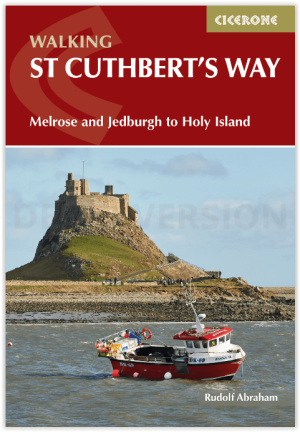
Wandelgids St Cuthbert's Way - Cicerone • 9781786311566
Wandelgids St Cuthbert's Way - Cicerone Productomschrijving: Deze wandelgids beschrijft de lange afstand St Cuthbert's Way door het ongerepte landschap van Northumberland en de Borders. De 100 km lange route begint in Melrose en doorkruist de ruige rotsen en heidevelden van de Cheviot Hills, gaat door het Northumberland National Park naar het sfeervolle Lindisfarne (Holy Island). De tocht …

Wandelkaart St Cuthbert's Way XT40 - Harvey Maps • 9781851377237
Wandelkaart St Cuthbert's Way - Harvey Maps Productomschrijving: De gehele route op één kaart, Eén van de bekendste routes van Schotland. De St Cuthbert's Way verbindt plaatsen die verband houden met het leven van de Heilige uit de 7e eeuw, Cuthbert. Van Melrose Abbey naar Holy Island (Lindisfarne). 100 km (62 mijl). - De kaart is sterk, licht, duurzaam en 100% waterbestendig - …
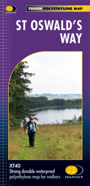
Wandelkaart St-Oswald's Way - Harvey maps • 9781851375233
Wandelkaart St-Oswald's Way - Harvey maps Productomschrijving: Van Holy Island naar Heavenfield, verbindt de 97 mijl lange St. Oswald's way enkele van de plaatsen die zijn gekoppeld aan St Oswald, die de koning van Northumbria in de vroege 7e eeuw was. De route loopt via het natuurpark van Northumbria langs de prachtige kust van Northumberland en loopt in het binnenland door via het platte…
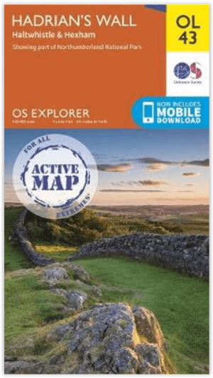

Wandelkaart OL43 Hadrian's Wall - OSI • 9780319475621
Wandelkaart Hadrian's Wall - England Productomschrijving: Wandel in de shaduw van de romeinen en ontdek dit eeuwen oud monument van om en bij de 2000 jaar oud. Hoogtepunten omvatten: Gilsland, Corbridge, Haltwhistle, Humshaugh, Hexham, Haydon Bridge, Bardon Mill, Greenlea lough, Housesteads, Chesters Roman Fort & Vindolanda. Een van de klassieke wandelingen van Engeland, en één die genotte…