

Wandelkaart 320 Castle Douglas & Loch Ken - OSI
Het gebied rond nieuwe Galloway- incl. Luch Ken & Loch Urr
Korte omschrijving
Wandelkaarten Dumfries & Galloway, Schotland van Ordnance Survey. Ideaal voor tochten in Schotland.
Wandelkaart Castle Douglas - Loch Ken - Schotland Productbeschrijving: St John’s Town of Dalry & Moniaive. 320 / Castle Douglas, Loch Ken, New Galloway, Dumfries, Schotland - Toont het ...

Specificaties
- Uitgever: Ordnance Survey
- ISBN-13: 9780319245729
- HOOFDCATEGORIEËN: Wandelkaart
- Activiteiten: Wandelen, Hiking & Trekking
- Regio: Dumfries & Galloway, Schotland
- Land: Schotland
- TOPO's & Stafkaarten: Topografisch wandelen
- Schaal: 1:25000
- Taal: Engels
- Reeks/Serie: Explorer Series OS
Volledige omschrijving
Wandelkaart Castle Douglas - Loch Ken - Schotland
Productbeschrijving: St John’s Town of Dalry & Moniaive.
320 / Castle Douglas, Loch Ken, New Galloway, Dumfries, Schotland - Toont het gebied rond nieuwe Galloway, incl. Luch Ken, Loch Urr, Lochinvar en het bos Laurieston, toont de OS Explorer kaart 320 zo ver zuiden als Castle Douglas. Ook weergegeven: delen van de Southern Upland Way en de E2 Europese Long Distance pad. De OS Explorer kaart voor Castle Douglas, Loch Ken & New Galloway is beschikbaar in zowel de standaard papieren versie als de weerbestendige 'Actief' versie.
320 / Castle Douglas, Loch Ken, New Galloway, Dumfries, Schotland - Showing the area around New Galloway, including Luch Ken, Loch Urr, Lochinvar and the Laurieston Forest, OS Explorer map 320 shows as far south as Castle Douglas. Also showing parts of the Southern Upland Way and the E2 European Long Distance Path. The OS Explorer map for Castle Douglas, Loch Ken & New Galloway is available in both the standard paper version and weatherproof 'Active' version.
Locatie op kaart
Gekoppelde artikelen

Wandelkaart 320 Castle Douglas & Loch Ken - OSI • 9780319245729
standaard versieWandelkaart Castle Douglas - Loch Ken - Schotland Productbeschrijving: St John’s Town of Dalry & Moniaive. 320 / Castle Douglas, Loch Ken, New Galloway, Dumfries, Schotland - Toont het gebied rond nieuwe Galloway, incl. Luch Ken, Loch Urr, Lochinvar en het bos Laurieston, toont de OS Explorer kaart 320 zo ver zuiden als Castle Douglas. Ook weergegeven: delen van de Southern Upland Way…

Wandelkaart 320 Castle Douglas & Loch Ken - OSI • 9780319471920
weatherproof versieWandelkaart Castle Douglas- Loch Ken - New Galloway Schotland Omvat ook: St John’s Town of Dalry & Moniaive. Productbeschrijving: Deze kaart omvat het gebied rond new Galloway, inclusief Luch Ken, Loch Urr, Lochinvar en het bos Laurieston, de OS Explorer kaart 320 gaat zo ver naar het zuiden als Castle Douglas. Ook weergegeven zijn delen van de Southern Upland Way en de E2 Europese Lon…
Overzichtskaarten
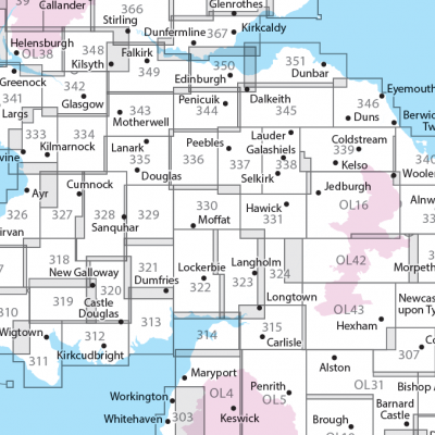
OSI Explorer & Explorer Active - Zuid Scotisch Borders
OSI Explorer & Explorer Active - Zuid Scotisch Borders

Producten op de overzichtskaart
Klik op een product om naar de detailpagina te gaan.
- Wandelkaart 307 Consett & Derwent reservoir - OSI
- Wandelkaart 308 Durham & Sunderland - England - OSI
- Wandelkaart 309 Stranraer & The Rhins - Dumfries - OSI
- Wandelkaart 310 Glenluce & Kirkcowan - Schotland - OSI
- Wandelkaart 311 Wigtown- Whithorn & The Machars - OSI
- Wandelkaart 312 Kirkcudbright & Castle Douglas - OSI
- Wandelkaart 313 Dumfries & Dalbeattie- Schotland - OSI
- Wandelkaart 314 Solway Firth- Wigton & Silloth - OSI
- Wandelkaart 315 Carlisle- Brampton & Longtown - OSI
- Wandelkaart 316 Newcastle upon Tyne - Northumberland - OSI
- Wandelkaart 318 Galloway Forest Park North- Ayrshire
- Wandelkaart 319 Galloway Forest Park South - OSI
- Wandelkaart 320 Castle Douglas & Loch Ken - OSI
- Wandelkaart 321 Nithsdale & Dumfries & Thornhill - OSI
- Wandelkaart 322 Annandale- Dumfries & Galoway - OSI
- Wandelkaart 323 Eskdale & Castle O'er Forest- Schotland - OSI
- Wandelkaart 324 Liddesdale & Kershope Forest - OSI
- Wandelkaart 325 Morpeth & Blyth - Northumberland - OSI
- Wandelkaart 326 Ayr & Troon - South Ayrshire - OSI
- Wandelkaart 327 Cumnock & Dalmellington - OSI
- Wandelkaart 328 Sanquhar & New Cumnock - OSI
- Wandelkaart 329 Lowther Hills- Sanquhar & Leadhills - OSI
- Wandelkaart 330 Moffat & St Mary's Loch - Dumfries - OSI
- Wandelkaart 331 Teviotdale South - Schotisch Borders - OSI
- Wandelkaart 332 Alnwick Amble - Northumberland - OSI
- Wandelkaart 333 Kilmarnock & Irvine - East Ayrshire - OSI
- Wandelkaart 334 East Kilbride- Galston & Darvel - Glasgow - OSI
- Wandelkaart 335 Lanark & Tinto Hills - South Lankashire - OSI
- Wandelkaart 336 Biggar & Broughton - South Lanarkshire - OSI
- Wandelkaart 337 Peebles & Interleithen - Schotish Borders - OSI
- Wandelkaart 338 Galashiels- Selkirk & Melrose - OSI
- Wandelkaart 339 Kelso- Coldstream & Lower Tweed Valley - OSI
- Wandelkaart 340 Holy Island & Bamburgh - OSO
- Wandelkaart 341 Greenock- Largs & Millport - OSI
- Wandelkaart 342 Glasgow Schotland - OSI
- Wandelkaart 343 Motherwell & Coatbridge- Glasgow - OSI
- Wandelkaart 344 Pentland Hills RP- Edinburgh - OSI
- Wandelkaart 345 Lammermuir Hills - Edinburgh - OSI
- Wandelkaart 346 Berwick-upon-Tweed - Northumberland - OSI
- Wandelkaart 349 Falkirk- Cumbernauld & Livingston - OSI
- Wandelkaart 350 Edinburgh - East Schotland - OSI
- Wandelkaart 351 Dunbar & North Berwick - Edinburgh - OSI
- Wandelkaart 361 Isle of Arran - OSI
- Wandelkaart 362 Cowal West & Isle of Bute - OSI
- Wandelkaart OL04 English Lakes - North Western area - OS
- Wandelkaart OL05 English Lakes - North Eastern area - OS
- Wandelkaart OL16 Cheviot Hills, Jedburgh & Wooler - OS
- Wandelkaart OL37 Cowal East- Dunoon & Iverary - OS
- Wandelkaart OL38 Loch Lomond South & Dumbarton - OSI
- Wandelkaart OL42 Kielder Water & Forest - OS
- Wandelkaart OL43 Hadrian's Wall- Haltwhistle & Hexham - OS
Artikelen uit dezelfde regio
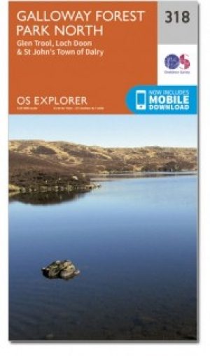
Wandelkaart 318 Galloway Forest Park North - OSI • 9780319471906
Wandelkaart Galloway Forest Park North - Schotland Omvat ook: Glen Trool & Loch Doon St John’s Town of Dalry. Productbeschrijving: OS Explorer kaart nummer 318 toont het noordelijk deel van het Gallowway Forest Park, Doon Loch, Loch Trool, de Southern Upland Way en de E2 Europese Long Distance pad. De OS Explorer kaart voor Galloway Forest Park North is beschikbaar in zowel de standaar…
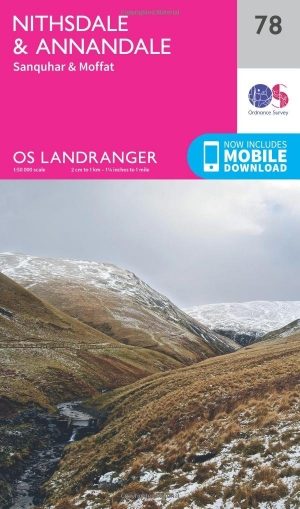
Wandelkaart 78 Nithsdale & Annandale- Schotland - OSI • 9780319261767
Wandelkaart Nithsdale & Annandale - Schotland Productbeschrijving: OS Landranger kaart 78 toont Nithsdale en Annandale, de steden Sanquhar, Moffat, Lockerbie, Lochmaben, de Lowther Hills en het bos van Ae (gesproken als 'hooi' zonder de 'h'). Het gebied staat bekend voor zijn goeie berg- en fietspaden, terwijl u een bezoek brengt aan de Sanquhar Tolbooth Museum of Crawick Multiverse gebeel…

Wandelkaart 322 Annandale- Dumfries & Galoway - OSI • 9780319245743
Wandelkaart Annandale - Dumfries & Galoway Schotland Productbeschrijving: Annan, Lockerbie & Beattock 322 - Annandale, Dumfries & Galoway, West Schotland - Ordnance Survey OS Explorer kaart 322 dekt Annan aan noord Solway Firth tot Beattock, die betrekking hebben op de way van Annandale en deel van de Southern Upland Way. Vermijd de A74(m) en gebruik de wegen en wandelpaden om de geb…

Wandelkaart 313 Dumfries & Dalbeattie Schotland - OSI • 9780319471852
Wandelkaart Dumfries & Dalbeattie - Schotland Omvat ook: New Abbey & Mabie Forest. Productbeschrijving: Kaart nummer 313 omvat Dumfries en Tokaj. Hoogtepunten zijn Nith Estuary & East Stewarty Coast. Omvat ook Mabie Forest, Milton Loch, Urr Loch en Maidenpap. De OS Explorer kaart voor Dumfries & Tokaj is beschikbaar in zowel de standaard papieren versie als de weerbestendige 'Actief' v…
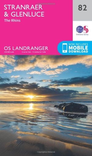
Wandelkaart 82 Stranraer & Glenluce - Schotland - OSI • 9780319261804
Wandelkaart Stranraer & Glenluce - Schotland Productbeschrijving: OS Landranger kaart 82 van Stranraer & Glenluce bevat ook nieuwe Luce, Kirkcowan, Dunragit, Stoneykirk, Ardwell, Port Lagan, Drummore, Port Patrick, onderdeel van de E2 Europese Long Distance pad en deel van de Southern Upland Way. Stranraer is de haven van de veerboot naar Belfast in Noord-Ierland, maar u kunt er ook het ka…