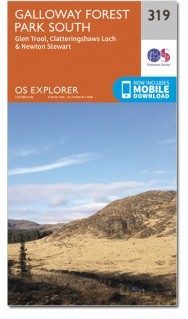
Wandelkaart 319 Galloway Forest Park South - OSI
Omvat het zuidelijke deel van het Galloway Forest park
Korte omschrijving
Wandelkaart Galloway Forest Park South - Schotland Omvat ook: Glen Trool & Clatteringshaws Loch Newton Stewart. Productbeschrijving: OS Explorer kaart 319 toont het zuidelijke deel van h...

Specificaties
- Uitgever: Ordnance Survey
- ISBN-13: 9780319471913
- HOOFDCATEGORIEËN: Wandelkaart
- Activiteiten: Wandelen, Hiking & Trekking
- Regio: Dumfries & Galloway, Schotland
- Land: Schotland
- Waterafstotende kaart: Ordnance Survey ACTIVE Explorer Weatherproof Maps
- Regionale parken: Galloway Forest park, Schotland
- Schaal: 1:25000
- Taal: Engels
- Reeks: Explorer ACTIVE Series OSI
Volledige omschrijving
Wandelkaart Galloway Forest Park South - Schotland
Omvat ook: Glen Trool & Clatteringshaws Loch Newton Stewart.
Productbeschrijving: OS Explorer kaart 319 toont het zuidelijke deel van het Galloway Forest park, Clatteringshaws Loch, Southern Upland Way, E2 Europese Long Distance pad, Loch Grannoch en Loch Ken. De OS Explorer kaart voor Galloway Forest Park South is beschikbaar in zowel de standaard papieren versie als de weerbestendige 'Actief' versie.
Productdiscription: OS Explorer Map 319 shows the Southern part of the Galloway Forest, Clatteringshaws Loch, Southern Upland Way, E2 European Long Distance Path, Loch Grannoch and Loch Ken. The OS Explorer map for Galloway Forest Park South is available in both the standard paper version and weatherproof 'Active' version.
Locatie op kaart
Gekoppelde artikelen

Wandelkaart 319 Galloway Forest Park South - OSI • 9780319245712
standaard versieWandelkaart Galloway Forest Park South - Ayrshire Schotland Productbeschrijving: Glen Trool & Clatteringshaws Loch Newton Stewart. 319 / Galloway Forest Park South, Ayrshire, Schotland - OS Explorer kaart 319 toont het Zuidelijke deel van het Galloway Forest, Clatteringshaws Loch, Southern Upland Way, E2 Europese Long Distance pad, Loch Grannoch en Loch Ken. De OS Explorer kaart voor …

Wandelkaart 319 Galloway Forest Park South - OSI • 9780319471913
weatherproof versieWandelkaart Galloway Forest Park South - Schotland Omvat ook: Glen Trool & Clatteringshaws Loch Newton Stewart. Productbeschrijving: OS Explorer kaart 319 toont het zuidelijke deel van het Galloway Forest park, Clatteringshaws Loch, Southern Upland Way, E2 Europese Long Distance pad, Loch Grannoch en Loch Ken. De OS Explorer kaart voor Galloway Forest Park South is beschikbaar in zowel…
Artikelen uit dezelfde regio

Wandelkaart 329 Lowther Hills- Sanquhar & Leadhills - OSI • 9780319245811
Wandelkaart Lowther Hills- Sanquhar & Leadhills - Schotland Omvat ook: Wanlockhead & Crawford Productomschrijving: OS Explorer kaart 329 omvat de Lowther Hills, Daer Water en Daer Resevoir, Sanquhar en Leadhills. Verder wordt de Southern Upland Way getoont, evenals een onderdeel van de E2 Europese Long Distance pad. Dit gebied beschikt ook over het hoogstgelegen dorp in Schotland - Wan…

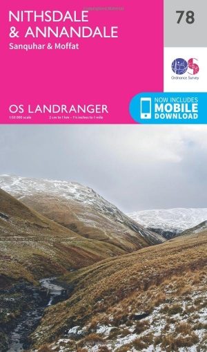
Wandelkaart 78 Nithsdale & Annandale- Schotland - OSI • 9780319261767
Wandelkaart Nithsdale & Annandale - Schotland Productbeschrijving: OS Landranger kaart 78 toont Nithsdale en Annandale, de steden Sanquhar, Moffat, Lockerbie, Lochmaben, de Lowther Hills en het bos van Ae (gesproken als 'hooi' zonder de 'h'). Het gebied staat bekend voor zijn goeie berg- en fietspaden, terwijl u een bezoek brengt aan de Sanquhar Tolbooth Museum of Crawick Multiverse gebeel…

Wandelkaart 322 Annandale Schotland - OSI • 9780319471944
Wandelkaart Annandale - Dumfries & Galoway Schotland Omvat ook: Annan, Lockerbie & Beattock. Productbeschrijving: OS Explorer kaart 322 dekt Annan aan de Solway Firtht noorden tot Beattock, en dekt het meeste van de Annandale way en deel van de Southern Upland Way. Vermijd de A74(m) en gebruik de terug wegen en wandelpaden en de te ontdekken gebieden zoals Castle Loch en Hoddom kasteel…

Wandelkaart 313 Dumfries & Dalbeattie Schotland - OSI • 9780319471852
Wandelkaart Dumfries & Dalbeattie - Schotland Omvat ook: New Abbey & Mabie Forest. Productbeschrijving: Kaart nummer 313 omvat Dumfries en Tokaj. Hoogtepunten zijn Nith Estuary & East Stewarty Coast. Omvat ook Mabie Forest, Milton Loch, Urr Loch en Maidenpap. De OS Explorer kaart voor Dumfries & Tokaj is beschikbaar in zowel de standaard papieren versie als de weerbestendige 'Actief' v…

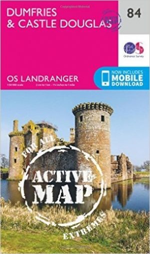
Wandelkaart 84 Dumfries & Castle Douglas- Schotland - OSI • 9780319474075
Wandelkaart Dumfries & Castle Douglas - Schotland Productbeschrijving: OS Landranger kaart 84 toont Dumfries & Castle Douglas, en omvat ook Parton, Crossmicheal, Shawhead, Tokaj, Kirkcudbright, Ringford en deel van de Galloway Forest Park. De kust rond de Solway Firth is aangewezen als AONB, Area of Outstanding Natural Beauty. De OS Landranger kaarten reeks heeft betrekking op Groot-Britta…


