

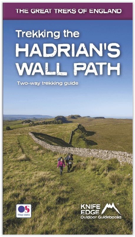
Wandelgids Hadrian's wall Path - Knife Edge
De definitieve tweerichtingsgids voor het Hadrian's Wall Path
Korte omschrijving
Wandelgidsen Cumbria, England en Northumberland, Engeland van Knife Edge Outdoor Limited. Ideaal voor tochten in England.
Wandelgids - Hadrian's wall Path - Knife Edge Productomschrijving: De definitieve tweerichtingsgids voor het Hadrian's Wall Path: zowel oostwaartse als westelijke routes worden volledig besc...

Specificaties
- Uitgever: Knife Edge Outdoor Limited
- ISBN-13: 9781912933075
- HOOFDCATEGORIEËN: Wandelgids
- Activiteiten: Wandelen, Hiking & Trekking
- Regio: Cumbria, England, Northumberland, Engeland
- Land: England
- Historische wandelroutes: Hadrian's Wall path (135 km)
- Editie: 1
- Taal: Engels
- Iconische Wandelroutes: Hadrians Wall Path, UK
- National Trails UK, England & Wales: Hadrians Wall, England
Volledige omschrijving
Wandelgids - Hadrian's wall Path - Knife Edge
Productomschrijving: De definitieve tweerichtingsgids voor het Hadrian's Wall Path: zowel oostwaartse als westelijke routes worden volledig beschreven. 14 verschillende routes: schema's van 3, 4, 5, 6, 7, 8 en 9 dagen voor wandelaars en hardlopers. Omvat reisroutes naar het noorden en het zuiden. De moeilijkere berekeningen van tijd, afstand en hoogtewinst, worden voor u gedaan in de dit boek.
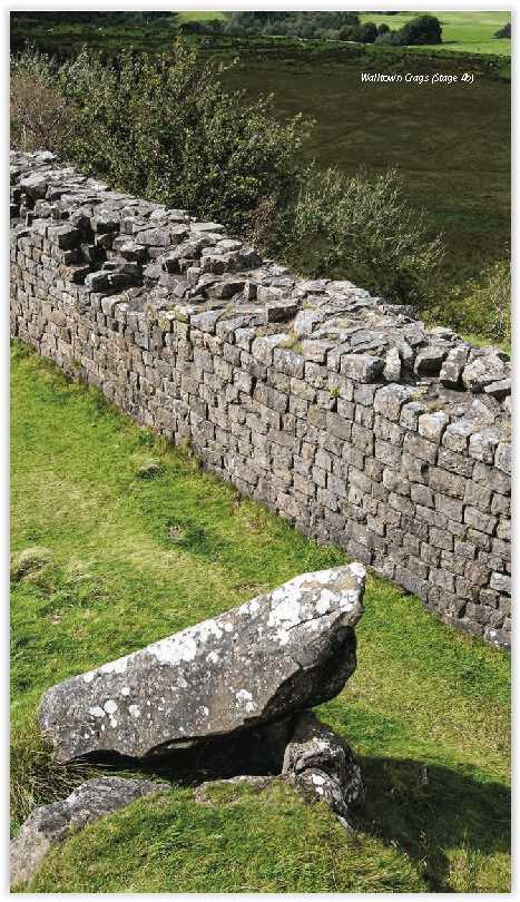
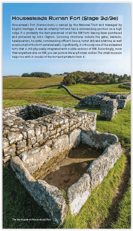
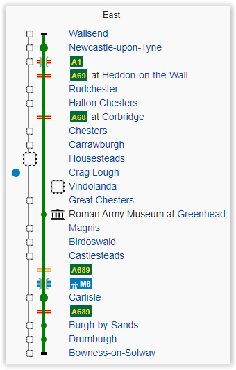
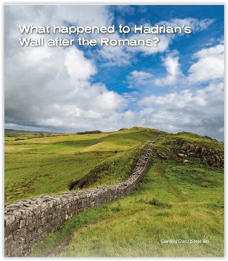
De muur van Hadrianus was een van de meest ambitieuze bouwwerken van de Romeinen. Na voltooiing liep het 73 mijl tussen de west- en oostkust van Noord-Engeland. Het doorkruiste de rotsen en heuvels van enkele van de wildste en mooiste terreinen van Groot-Brittannië. Het Hadrian's Wall-pad is een van de officiële ‘National Trails’ van Engeland. Het leidt je op een onvergetelijke ontdekkingsreis langs de route van de Muur. Ontdek de ongelooflijke overgebleven delen van de muur en zijn forten, milecastles en torentjes.
Engelse omschrijving: The definitive two-way guide to the Hadrian’s Wall Path: both eastbound and westbound routes are described in full. 14 different itineraries: schedules of 3, 4, 5, 6, 7, 8 and 9 days for walkers and runners. Includes both northbound and southbound itineraries. Difficult calculations of time, distance and altitude gain are done for you.
Hadrian’s Wall was one of the Romans’ most ambitious structures. When completed, it ran for 73 miles between the west and east coasts of Northern England. It crossed the crags and hills of some of Britain’s wildest and most beautiful terrain. The Hadrian’s Wall path is one of England’s official ‘National Trails’. It leads you on an unforgettable journey of discovery along the route of the Wall. Discover the incredible surviving sections of the Wall and its forts, milecastles and turrets.
Also includes:
Extraordinary detail on the history and construction of Hadrian’s Wall
Section on the unmissable forts of Hadrian’s Wall
Detailed information on equipment and travelling light
Everything the trekker needs to know: route, costs, difficulty, weather, travel, and more
Full accommodation listings: the best inns, B&Bs and hotels
Information for both self-guided and guided trekkers
Numbered waypoints linking the Real Maps to our clear descriptions
Locatie op kaart
Overzichtskaarten
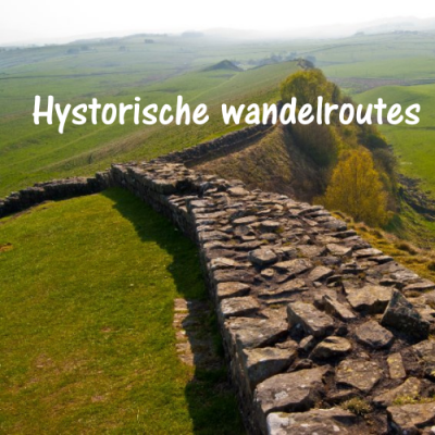
Hystorische wandel- en fietsroutes
Hystorische wandel- en fietsroutes

Producten op de overzichtskaart
Klik op een product om naar de detailpagina te gaan.
- Wandelkaart South Downs Way - Harvey maps
- Wandelgids North Yorkshire historic walks - Cicerone
- Wandelkaart OL13 - Brecon Beacons NP - Eastern area - OSI
- Wandelgids The Great Glen Way - Trailblazer
- Wandelgids Hadrian's wall Path - Knife Edge
- Wandelkaart XT40 Offa's Dyke Path - Harvey Maps
- Wandelkaart OL43 Hadrian's Wall - OSI
- Wandelkaart 351 Dunbar & North Berwick- Schotland - OSI
- Wandelgids Walking in the Forest of Dean - Cicerone
- Wandelkaart 130 Salisburry & Stonehenge- Wiltshire - OSI
- Wandelkaart 256 Wrexham- Wrecsam & Llangollen - OSI
- Wandelkaart 130 Salisbury & Stonehenge- Wiltshire - OSI
- Wandelgids John Muir Trail - Cicerone
- Wandelkaart Rob Roy Way National trail - Harvey maps
- Wandelkaart Hadrian's Wall Path - Harvey maps
- Wandelkaart Offa's Dyke Path- Route Map Booklet - Cicerone
Artikelen uit dezelfde regio
Wandelgids Great Mountain Days in the Pennines - Cicerone • 9781852846503
Wandelgids - Great Mountain Days in the Pennines - Cicerone Productomschrijving: Een inspirerende gids naar 50 klassieke wandelingen op het glooiende landschap van de Walliser. De gesorteerde routes, tussen 6 en 13 mijl in lengte, dekken de klassieke Walliser fells en veenland zoals Whernside, Ilkley Moor en Pendle Hill; verkennen van Noord- en Zuid-Pennines, Yorkshire Dales, Howgills en D…

Wandelgids Lake District North - Cicerone Press • 9781786310460
Walks & scrambles Lake District North - Cicerone Productomschrijving: omvat 100 klauterroutes in het noorden van het Engelse Lake District, die Wasdale, Ennerdale, Buttermere, Borrowdale, Blencathra en Thirlmere omvatten. De gids presenteert een uitgebreide verzameling scrambles op rotsen en kieuwen, die aan elkaar zijn gekoppeld om 25 eersteklas bergdagen te vormen. De zorgvuldig gesortee…
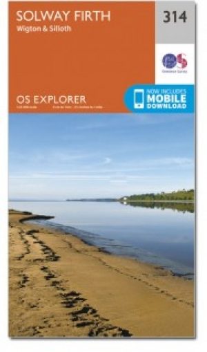
Wandelkaart 314 Solway Firth- Wigton & Silloth - OSI • 9780319245668
Wandelkaart Solway Firth- Wigton & Silloth - Cumbria England Productbeschrijving: OS Explorer 314 toont de Solway Firth, Annan, Wigton en Silloth. Het omvat ook een deel van het nationale Scenic gebied van Nith estuarium, en de Solway Coast gebied van buitengewone natuurlijke schoonheid AONB. Er zijn eveneens de Cumbria Costal Way, Allerdale Ramble en deel van de Haridlan Wall Path. De OS …

Wandelkaart OL06 English Lakes - South Western area - OS • 9780319264010
Wandelkaart English Lakes - South Western area - OS Productomschrijving: Een topografische wandelkaart van het Zuid-westelijke deel van het Lake district National Park Omvat: Coniston, Ulverston & Barrow-in-Furness, Part of the Lake District National Park & The Cumbria Way. Ontdek de OL-serie van Ordnance Survey: De OL-serie (Outdoor Leisure) van Ordnance Survey is dé referentie …
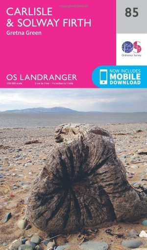
Wandelkaart 85 Carlisle & Solway Firth- Cumbria England - OSI • 9780319261835
Wandelkaart Carlisle & Solway Firth - Cumbria England Productbeschrijving: Deze kaart van Carlisle & Solway Firth omvat ook Gretna Green, Annan, Canonbie, Brydekirk, Dalton, Kirkbride, Silloth, Wigton, Thursby evenals deel van het Lake District National Park en deel van Hadrianus Wall path. De OS Landranger kaarten reeks heeft betrekking op Groot-Brittannië met 204 gedetailleerde kaart…