

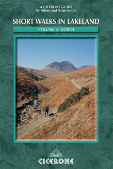
Wandelgids Lakeland short walks - Cicerone
Beautifull landscapes to lose yourself into
Korte omschrijving
Wandelgidsen Cumbria, England van CICERONE Press. Ideaal voor tochten in England.
Wandelgids - Lakeland short walks - Cicerone Omvat: Routes bedekken Rydal, Grasmere, Langdale, Weinig Langdale, Coniston, Torver en het zuiden, Grizedale, Satterthwaite, het Rusland Vallei e...

Specificaties
- Uitgever: CICERONE Press
- ISBN-13: 9781852842321
- HOOFDCATEGORIEËN: Wandelgids
- Activiteiten: Wandelen, Hiking & Trekking
- Auteur: Aileen Evans
- Regio: Cumbria, England
- Land: England
- Nationale parken: Lake District NP, Cumbria England
- Editie: 1
- Taal: Engels
Volledige omschrijving
Wandelgids - Lakeland short walks - Cicerone
Omvat: Routes bedekken Rydal, Grasmere, Langdale, Weinig Langdale, Coniston, Torver en het zuiden, Grizedale, Satterthwaite, het Rusland Vallei e.a.
Productomschrijving: Een gids van korte wandelingen in het zuiden van het engelse Lake District, het VK, de tweede van deze drie-delige lake landserie. Routes bedekken Rydal, Grasmere, Langdale, Weinig Langdale, Coniston, Torver en het zuiden, Grizedale, Satterthwaite, het Rusland Vallei, Winster Vallei, Troutbeck, Kentmere, Longsleddale en doorkruist Tebay. Deze gids over wandelen in het Lake District is de tweede van de drie in de Korte Wandelingen in Lakeland-trilogie, die ook betrekking heeft op wandelroutes in Noord-Lakeland (boek 1) en West Lakeland / boek 3.
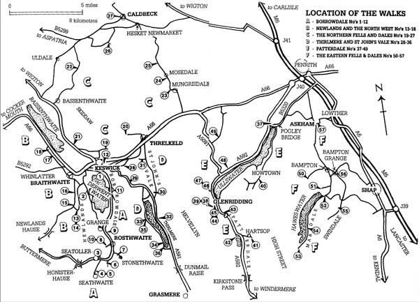
Detail: Deze gids verdeelt de north Lakelands region in 6 verschillende regio's:
- Borrowdale
- The Northern Fells
- Thirlmere
- Newlands & the north west
- Patterdale & Ullswater
- The Eastern Fells and Dales.
Product description: This guidebook contains 57 short half to full-day walks in the northern Lake District. Walking areas include Borrowdale, Newlands, Bassenthwaite, Thirlmere, Ullswater, Haweswater and the area north of Keswick up to Caldbeck. Part of a three-volume series, and predominantly focusing on low-level walks between 2 to 9 miles, and graded for difficulty.
Seasons:
Year round walking but be prepared for winter conditions.
Centres:
Keswick is the main town, also Penrith further east. Numerous villages and facilities such as Rosthwaite, Braithwaite, Glenridding, Pooley Bridge, Shap, Caldbeck and Hesket Newmarket.
Difficulty:
Fairly straightforward half- and full-day routes, mainly exploring valleys and lesser-known hills, but with a few peaks thrown in.
Must See:
Lakeside routes, valley and beck routes, viewpoints, smaller peaks, tarns, some of the very best of the north Lakes.
Locatie op kaart
Artikelen uit dezelfde regio
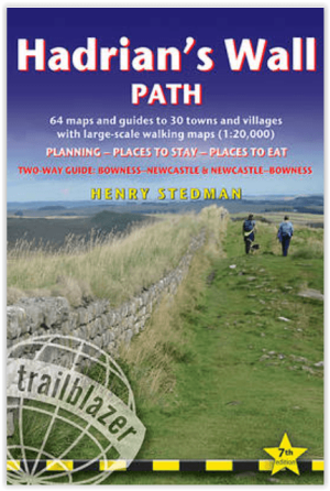
Wandelgids Hadrian's Wall Path - Trailblazer Publications • 9781912716630
Wandelgids Hadrian's Wall - Trailblazer Productomschrijving: Hadrian's Wall Path - Two-way guide Bowness - Newcastle and Newcastle - Bowness - 64 trail maps + town plans, 12 stage maps with profiles and 2 overview maps - 60 colour photos + colour flower guide Hadrian's Wall Path, 84 miles (135 km) from end to end, follows the course of northern Europe's largest surviving Roman mo…

Wandelkaart OL31 Northern Pennines AONB, Teesdale & Weardale - OS • 9780319242704
Wandelkaart Northern Pennines, Teesdale & Weardale - OS Productomschrijving: Northern Pennines AONB, Teesdale & Weardale, part of the Pennine Way, Omvat: A pennine Journey, E2 European Long Distance Path, Isaac's Tea Trail, Pennine Way, South Tyne Trail, Tees Railway Path, Teesdale Way & Weardale Way. Ontdek de OL-serie van Ordnance Survey: De OL-serie (Outdoor Leisure) van Ordn…
Fietsgids Hadrian's Cycleway - Cicerone • 9781786310422
Fietsgids - Hadrian's Cycleway - Cicerone Productomschrijving: Hadrian's Cycleway, een dikke 250 km lange kust tot kust fietsroute over noordelijk Engeland, die de route volgt voor zover mogelijk natuurlijk, langs de bekende Hadrian's Wall World Heritage Site. Deze route loopt van Ravenglass in Cumbria doorheen Northumberland to South Shields aan de oostkust van Engeland, met een eventuele…

Wandelgids Cumbria Way- Carlisle naar Ulverston - Rucksack • 9781898481577
Wandelgids Cumbria Way - Carlisle naar Ulverston 118 km Productomschrijving: De Cumbria Way begint bij Ulverston en gaat noordwaarts voor 73 mijl (123 km) via de ongerepte dales met stenen boerderijen van het Lake District, langs charmante meren, en passeert onderweg ruige fells. De route combineert drukke toeristische steden en dorpen met contrasterende bossen, wilde fells en hoge passen…

Scramblegids Lake District South and East - Cicerone • 9781786310453
Scramblegids - Lake District South and East - Cicerone Productomschrijving: Gids met 126 klauterroutes in het Engelse Lake District. De gegradeerde scrambles beklimmen de rotsen en ghylls van Langdale, Easedale, Coniston, Duddon Valley, Howgills, Eskdale, Longsleddale en Kentmere. Routes variëren van graad 1 tot en met graad 2 tot 4, waarbij het gebruik van een touw wordt aanbevolen. Bevat…