

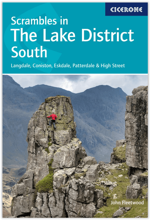
Scramblegids Lake District South and East - Cicerone
Langdale- Easedale- Coniston- Duddon Valley- Howgills & Eskdale

Korte omschrijving
Wandelgidsen Cumbria, England van CICERONE Press. Ideaal voor tochten in England.
Scramblegids - Lake District South and East - Cicerone Productomschrijving: Gids met 126 klauterroutes in het Engelse Lake District. De gegradeerde scrambles beklimmen de rotsen en ghylls va...

Specificaties
- Uitgever: CICERONE Press
- ISBN-13: 9781786310453
- HOOFDCATEGORIEËN: Wandelgids
- Activiteiten: Wandelen, Hiking & Trekking
- Auteur: John Fleetwood
- Regio: Cumbria, England
- Land: England
- Nationale parken: Lake District NP, Cumbria England
- Editie: 1, 3
- Taal: Engels
- Klimmen: Rotsklimmen
- De Nationale Parken: Lake district National Park, England
- Iconische Wandelroutes: Lake district, Cumbria England
- Wandelen in de Bossen & natuurgebieden van Europa: Lake district, England
Volledige omschrijving
Scramblegids - Lake District South and East - Cicerone
Productomschrijving: Gids met 126 klauterroutes in het Engelse Lake District. De gegradeerde scrambles beklimmen de rotsen en ghylls van Langdale, Easedale, Coniston, Duddon Valley, Howgills, Eskdale, Longsleddale en Kentmere. Routes variëren van graad 1 tot en met graad 2 tot 4, waarbij het gebruik van een touw wordt aanbevolen. Bevat advies over uitrusting, veiligheid en technieken.
Engelse omschrijving: Guidebook to 126 scrambling routes in the English Lake District. The graded scrambles climb the rocks and ghylls of Langdale, Easedale, Coniston, Duddon Valley, Howgills, Eskdale, Longsleddale and Kentmere. Routes range from grade 1 through grades 2 to 4, where the use of a rope is recommended. Includes advice on equipment, safety and techniques.
Seasons:
Not suitable in winter or bad weather conditions.
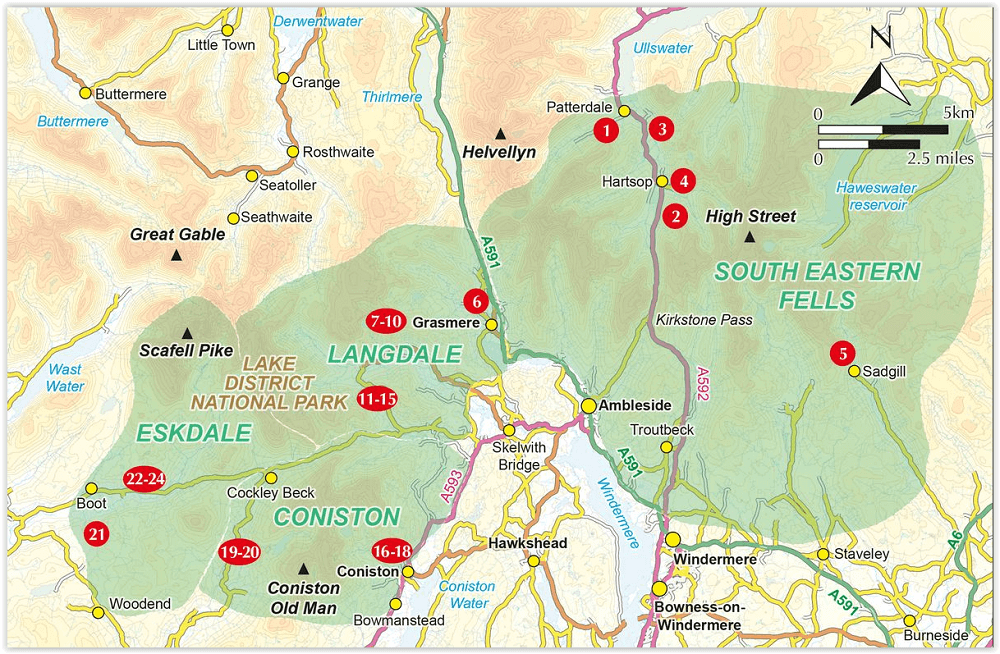
Centres:
Ambleside, Coniston, Langdale valley, Seathwaite, Boot, Staveley, Tebay.
Difficulty:
All scrambles graded: the easiest are suitable for adventurous walkers while higher grades require rope and mountaineering skills.
Must See:
Esk Gorge, Crescent Climb (Pavey Ark), Long Crag Buttress, Pike of Stickle, Raven Crag (Yewdale), Easy Terrace (Dow Crag).
Artikelen uit dezelfde regio

Wandelgids Hadrian's wall Path - Knife Edge • 9781912933075
Wandelgids - Hadrian's wall Path - Knife Edge Productomschrijving: De definitieve tweerichtingsgids voor het Hadrian's Wall Path: zowel oostwaartse als westelijke routes worden volledig beschreven. 14 verschillende routes: schema's van 3, 4, 5, 6, 7, 8 en 9 dagen voor wandelaars en hardlopers. Omvat reisroutes naar het noorden en het zuiden. De moeilijkere berekeningen van tijd, afstand en…

Wandelkaart Coast to Coast (west) St Bees to Keld - Harvey maps • 978185137618
Wandelkaart Coast to Coast (west) St Bees to Keld - Harvey maps Productomschrijving: Toont de gehele westelijke helft van de route op één deel van de kaart. Heeft betrekking op het gedeelte van St Bees naar Keld. Omvat alle alternatieve routes. Gedetailleerde kaart met aanvullende informatie en handige telefoonnummers, schaal van 1: 40.000. Nieuwe generatie HARVEY Superwalker, XT25 wat…

Wandelkaart XT25 Lake District Zuid Oost - Harvey maps • 9781851375486
Wandelkaart - Lake District Zuid Oost - XT25 - Harvey maps Productomschrijving: Het Lake District (Merengebied) is een nationaal park in het graafschap Cumbria in het noordwesten van Engeland. Het is een van de dertien nationale parken in het Verenigd Koninkrijk. Het zuidoosten is een bergachtige streek. Alle toppen in Engeland hoger dan 900 meter boven zeeniveau liggen in dit gebied. Het …
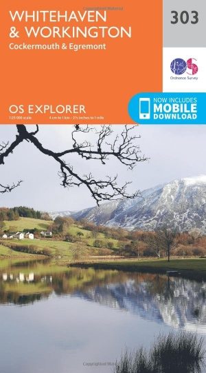
Wandelkaart 303 Whitehaven & Workington - OSI • 9780319245552
Wandelkaart Whitehaven & Workington - Cumbria England Omvat ook: Cockermouth & Egremont. Productbeschrijving: OS Explorer kaart 303 toont Workington en Cockermouth tot aan Calderbridge, de westelijke rand van het Lake District National Park. Hoogtepunten zijn Ennerdale Water, Whitehaven Harbour en Lank Rigg, op 541 m. De OS Explorer kaart voor Whitehaven & Workington is beschikbaar in …

Wandelgids Arnside and Silverdale AONB - short walks - Cicerone • 9781786311580
Wandelgids Arnside and Silverdale - Cicerone Productomschrijving: David Jordan heeft 15 van de beste korte wandelingen rond Arnside en Silverdale voor u uitgezocht. Onze gids is voorzien van goed leesbare Ordnance Survey-kaarten en duidelijke routebeschrijvingen, perfect als u voor het eerst gaat wandelen of iets zoekt waar u met het hele gezin van kunt genieten. We hebben informatie …