

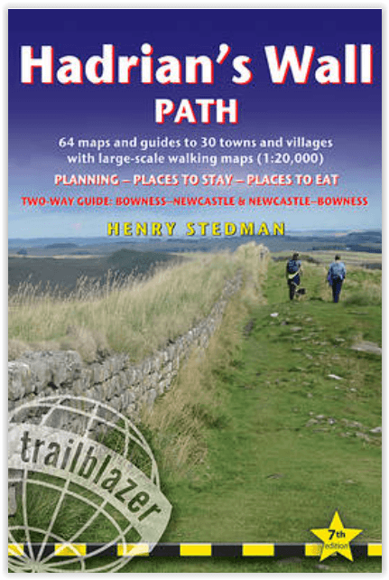
Wandelgids Hadrian's Wall Path - Trailblazer Publications
Bowness - Newcastle and Newcastle - Bowness
Korte omschrijving
Wandelgidsen North East England en Cumbria, England van Trailblazer Publications. Ideaal voor tochten in England.
Wandelgids Hadrian's Wall - Trailblazer Productomschrijving: Hadrian's Wall Path - Two-way guide Bowness - Newcastle and Newcastle - Bowness - 64 trail maps + town plans, 12 stage maps w...

Specificaties
- Uitgever: Trailblazer Publications
- ISBN-13: 9781912716630
- HOOFDCATEGORIEËN: Wandelgids
- Activiteiten: Wandelen, Hiking & Trekking
- Auteur: Henry Stedman
- Regio: Cumbria, England, North East England
- Land: England
- Historische wandelroutes: Hadrian's Wall path (135 km)
- Lange afstand wandelroutes: Hadrian's Wall path (135 km)
- Editie: 8
- Taal: Engels
- National Trails UK, England & Wales: Hadrians Wall, England
Volledige omschrijving
Wandelgids Hadrian's Wall - Trailblazer
Productomschrijving: Hadrian's Wall Path - Two-way guide Bowness - Newcastle and Newcastle - Bowness
- 64 trail maps + town plans, 12 stage maps with profiles and 2 overview maps
- 60 colour photos + colour flower guide
Hadrian's Wall Path, 84 miles (135 km) from end to end, follows the course of northern Europe's largest surviving Roman monument, the 2nd century fortification built on the orders of the Emperor Hadrian in AD122 and now listed as a UNESCO World Heritage Site. Opened in 2003, the path crosses the beautiful border country between England and Scotland. This week-long walk is regarded as one of the least physically challenging National Trails.
- Post pandemic, stay-cations remain the holidays of choice
- Two-way edition – routes rewalked from east to west and from west to east, making the book easier to use in either direction.
- Text and maps in clear two-colour style
- All-in-one guide
– Trailblazer guides include practical information not usually found in walking guides to the UK: reviews of places to stay, places to eat, attractions along the way and detailed public transport information showing all access points on the path and car parks near the trail, for weekend and day walkers.
- The largest scale walking maps available – At just under 1:20,000 (8cm or 31/8 inches to 1 mile) our maps (fully-edited and drawn by walkers for walkers) are bigger than even the most detailed walking maps currently available in the shops.
Artikelen uit dezelfde regio

Wandelkaart XT25 Lake District Zuid Oost - Harvey maps • 9781851375486
Wandelkaart - Lake District Zuid Oost - XT25 - Harvey maps Productomschrijving: Het Lake District (Merengebied) is een nationaal park in het graafschap Cumbria in het noordwesten van Engeland. Het is een van de dertien nationale parken in het Verenigd Koninkrijk. Het zuidoosten is een bergachtige streek. Alle toppen in Engeland hoger dan 900 meter boven zeeniveau liggen in dit gebied. Het …
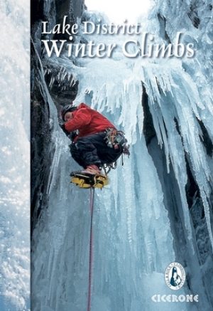
Klimgids Lake District winter climbs - Cicerone • 9781852847166
Klimgids - Lake District winter climbs - Cicerone Productomschrijving: Een onmisbare gids voor de beste winter klimroutes in het Lake District. Alle bekende routes in elk deel van de Meren zijn beschreven. Van klassieke hoge-berg afvoerputten en steunberen op de rotsen zoals Scafell, Pilar en Great Gable tot bevroren waterlopen en ijs(water)vallen met inbegrip van Great Gully op de Wasdale…
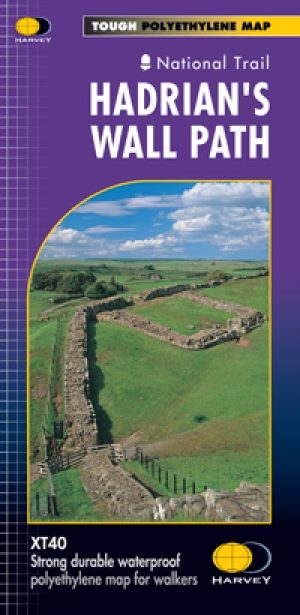
Wandelkaart Hadrian's Wall Path - Harvey maps • 9781851374380
Wandelkaart Hadrian's Wall Path - Harvey maps Productomschrijving: Kaart van de gehele Hadrians Way op één kaart. 130km (81 mijl) van de Solway Coast naar Newcastle. Met de gelegenheid voor een bezoek aan een groot aantal historische plekken langs de weg. Informatie over het vinden van accommodatie, camping, voedsel. Met routebeschrijving naar de start van de route. Nieuwe generatie H…

Wandelgids Durham County walking guide - Cicerone • 9781786311375
Wandelgids Durham County walking guide - Cicerone Productomschrijving: Gids met gedetailleerde beschrijvingen van 40 dagwandelingen door het graafschap Durham. De wandelingen variëren van 5 tot 24 km en laten de geschiedenis en natuurlijke wonderen van de regio zien. Het terrein beslaat veldwegen en open heidevelden, van de Noordzee tot de hoge Pennines. Engelse omschrijving: Guidebook…
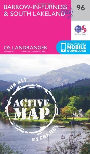
Wandelkaart 96 Barrow-in-Furness & South Lakeland - OSI • 9780319474198
Wandelkaart Barrow-in-Furness & South Lakeland - Cumbria Productbeschrijving: OS Landranger kaart 96 is de ideale kaart voor het plannen van wandelingen in deze prachtige kuststreek van het Lake District. Buitenshuis kunnen liefhebbers kiezen tussen dramatische lakeside Panorama's of kust paden. Hoogtepunten van het gebied zijn Piel castle, Walney Island, Ulverston en Coniston Water De…