

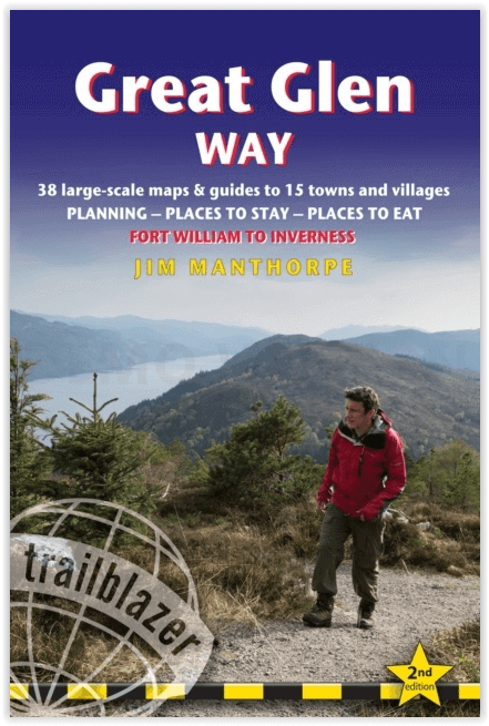
Wandelgids The Great Glen Way - Trailblazer
The Great Glen Way begint waar de West Highland Way eindigt

Korte omschrijving
Wandelgidsen Highlands, Schotland van Trailblazer Publications. Ideaal voor tochten in Schotland.
The Great Glen Way - Trailblazer Publications Productomschrijving: The Great Glen Wayfrom Fort William to Inverness. Het langeafstandswandelpad Great Glen Way begint waar de West Highland Wa...

Specificaties
- Uitgever: Trailblazer Publications
- ISBN-13: 9781912716104
- HOOFDCATEGORIEËN: Wandelgids
- Activiteiten: Wandelen, Hiking & Trekking
- Regio: Highlands, Schotland
- Land: Schotland
- Historische wandelroutes: The Great Glen Way (119 km)
- Editie: 2
- Taal: Engels
- Iconische Wandelroutes: The Graet Glenn Way, Irerland
- Scotlands Great Trails: Great Glen Way
Volledige omschrijving
The Great Glen Way - Trailblazer Publications
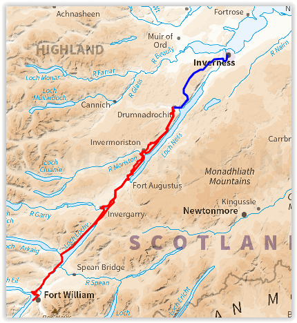
Productomschrijving: The Great Glen Wayfrom Fort William to Inverness. Het langeafstandswandelpad Great Glen Way begint waar de West Highland Way eindigt - in Fort William - en volgt de breuklijn van de Great Glen om na 79 mijl (127 km) te eindigen in Inverness. Het pad loopt langs Loch Lochy, Loch Oich en Loch Ness en volgt ook het jaagpad van het Caledonisch Kanaal. Het is een relatief gemakkelijke wandeling van een week in een prachtig Highland landschap, maar er is een hooggelegen optie tussen Fort Augustus en Drumnadrochit die een nog beter uitzicht op de bergen biedt.
192 pages,
38 trail maps + 10 town plans
40 colour photos + 4pp colour flower guide
8 stage maps + 2 overview maps
Engelse omschrijving: The Great Glen Way long-distance footpath begins where the West Highland Way ends – at Fort William – and follows the Great Glen faultline to finish at Inverness after 79 miles (127km). The trail passes Loch Lochy, Loch Oich and Loch Ness and also follows the towpath of the Caledonian Canal. It’s a relatively easy week-long walk amongst beautiful Highland scenery but there’s a high level option between Fort Augustus and Drumnadrochit that gives even better mountain views.
Features:
1. Unique mapping features – In many walking guides the reader has to read a route description then try to relate it to the map. Our guides are easier to use because walking directions, tricky junctions, places to stay and eat, points of interest and walking times are all written onto the maps themselves in the places to which they apply. With their uncluttered clarity, these are not general-purpose maps but fullyedited maps drawn by walkers for walkers. Downloadable GPS waypoints also included.
2. The largest scale walking maps available – At just under 1:20,000 (8cm or 31/8 inches to 1 mile) our maps are bigger than even the most detailed walking maps currently available in the shops.
3. An all-in-one guide – Trailblazer guides include practical information not usually found in walking guides to the UK: reviews of places to stay, places to eat, attractions along the way and detailed public transport information showing all access points on the path, for weekend and day walkers.
Locatie op kaart
Overzichtskaarten
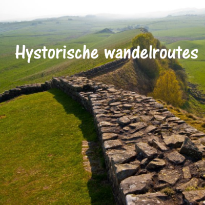
Hystorische wandel- en fietsroutes
Hystorische wandel- en fietsroutes

Producten op de overzichtskaart
Klik op een product om naar de detailpagina te gaan.
- Wandelkaart South Downs Way - Harvey maps
- Wandelgids North Yorkshire historic walks - Cicerone
- Wandelkaart OL13 - Brecon Beacons NP - Eastern area - OSI
- Wandelgids The Great Glen Way - Trailblazer
- Wandelgids Hadrian's wall Path - Knife Edge
- Wandelkaart XT40 Offa's Dyke Path - Harvey Maps
- Wandelkaart OL43 Hadrian's Wall - OSI
- Wandelkaart 351 Dunbar & North Berwick- Schotland - OSI
- Wandelgids Walking in the Forest of Dean - Cicerone
- Wandelkaart 130 Salisburry & Stonehenge- Wiltshire - OSI
- Wandelkaart 256 Wrexham- Wrecsam & Llangollen - OSI
- Wandelkaart 130 Salisbury & Stonehenge- Wiltshire - OSI
- Wandelgids John Muir Trail - Cicerone
- Wandelkaart Rob Roy Way National trail - Harvey maps
- Wandelkaart Hadrian's Wall Path - Harvey maps
- Wandelkaart Offa's Dyke Path- Route Map Booklet - Cicerone
Artikelen uit dezelfde regio

Wandelkaart 444 Helmsdale & Strath of Kildonan - OSI • 9780319472965
Wandelkaart Helmsdale & Strath of Kildonan - Highland Schotland Productbeschrijving: OS Explorer kaart 444 toont Strath van Kildonan en Helmsdale. Er was hier iets van een kleine goudkoorts in 1869 - maar als u daar naar op zoek bent zult u nu waarschijnlijk teleurgesteld worden. Ondanks, de ruige landschappen en externe paden nog steeds te vinden zijn. De OS Explorer kaart voor Helmsdale …

Wandelkaart 441 Lairg- Bonar Bridge & Golspie- Schotland • 9780319246849
Wandelkaart Lairg- Bonar Bridge & Golspie - Highland Schotland Productbeschrijving: Dornoch & Brora. Aan de Moray Firth toont OS Explorer kaart 441, Omvat de route van Brora naar Dornoch en het binnenland van Lairg te Bonar Bridge. Ga op verkenning rond Loch Fleet en Loch Brora of volg de rivier van Loch Shin naar Kyle of Sutherland. De OS Explorer kaart voor Lairg, Bonar Bridge & Gols…
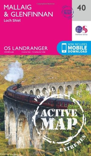
Wandelkaart 40 Mallaig & Glenfinnan- Highland's - OSI • 9780319473634
Wandelkaart Mallaig & Glenfinnan - Highland's Schotland Productbeschrijving: De haven van Mallaig ligt langs de beroemde weg naar de eilanden, en is een uitstekende uitvalsbasis om de hooglanden en Loch Morar vanuit te verkennen. Recht op de oevers van Loch Shiel is Glenfinnan, een klein maar mooie dorp met een prachtig landschap. De OS Landranger kaarten reeks heeft betrekking op Groo…
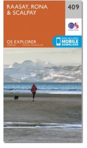
Wandelkaart 409 Raasay Rona & Scalpay Schotland - OSI • 9780319472644
Wandelkaart Raasay- Rona & Scalpay - Highland's Schotland Productbeschrijving: Kaart nummer 409 in de OS Explorer kaart reeks is ideaal voor het verkennen van de Isle of Skye, Raasay, Rona en Scalpay. Hoogtepunten van het gebied zijn onder andere: Dun Caan, Brochel castle, clear Hebridean waters, & The Storr. De OS Explorer kaart voor Raasay, Rona & Scalpay is beschikbaar in zowel de stand…

Wandelgids 004 Pathfinder guides Cairngorms NP - OS • 9780319090398
Wandelgids Cairngorms National Park - OS Productomschrijving: The Cairngorms NP covers 300 sq miles, making it the most mountainous area in Britain, with an equally wide range of wildlife. This walking guidebook contains 28 carefully selected walking routes of 1.5 to 18 miles, each tested and graded by experienced walkers. All routes include information on getting to the start point, …