

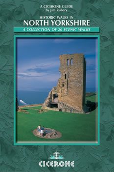
Wandelgids North Yorkshire historic walks - Cicerone
Omvat Skipton Castle- Ripon en Fountains Abbey & Ripley Castle
Korte omschrijving
Wandelgidsen North & North East England en Yorkshire, England van CICERONE Press. Ideaal voor tochten in England.
Wandelgids - North Yorkshire historic walks - Cicerone Productomschrijving: Een gids over historische wandelingen in North Yorkshire, in 20 meestal circulaire routes. Zij brengen u van open ...

Specificaties
- Uitgever: CICERONE Press
- ISBN-13: 9781852843892
- HOOFDCATEGORIEËN: Wandelgids
- Activiteiten: Wandelen, Hiking & Trekking
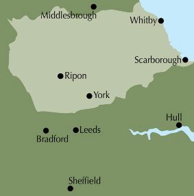
- Regio: North & North East England, Yorkshire, England
- Land: England
- Historische wandelroutes: North Yorkshire Historic walks
- Editie: 1
- Taal: Engels
- De Engelse Graafschappen: North Yorkshire, Yorkshire
Volledige omschrijving
Wandelgids - North Yorkshire historic walks - Cicerone
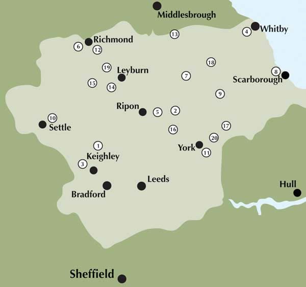
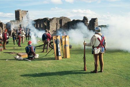
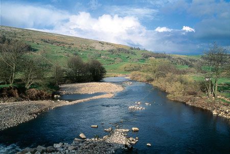
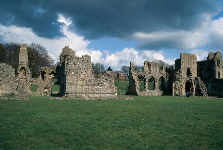
Productomschrijving: Een gids over historische wandelingen in North Yorkshire, in 20 meestal circulaire routes. Zij brengen u van open heidegebied en blootgestelde delen van heuvel en kliffen naar de meer beschutte dales en de straten van York. Wandelingen bevatten Skipton Castle, Ripon en Fountains Abbey, Ripley Castle, Castle Howard, Whitby Abbey, Bolton Abbey en de Romeinse stad Aldborough. Historische wandelingen in North Yorkshire nemen een poging om wat pracht van dit land, de ruime akkers te onthullen. Vergezeld door OS (Ordnance Servey kaarten) toewijzing en geïllustreerd met kleurenfoto's, combineren de serie van wandelingen, landschap met architectuur, natuurlijke schoonheid met geschiedenis, en ons erfgoed, met onze diverse en complexe cultuur.
Product description: The historic past makes its presence felt in virtually every fold and turn of the north Yorkshire landscape, and the walks in this guidebook have been chosen for their combination of scenic and historical appeal.
- The guide contains 20 walks, 4.5 to 12 miles in length. - The walks take in a variety of scenery, including open moorland, hillside, gentle dales and coastal cliffs.- The visit numerous historical towns, such as Richmond and York, and a variety of historical sites, including castles, churches
- The guide is in full colour throughout, and each route is accompanied by Ordnance Survey mapping.
Locatie op kaart
Overzichtskaarten
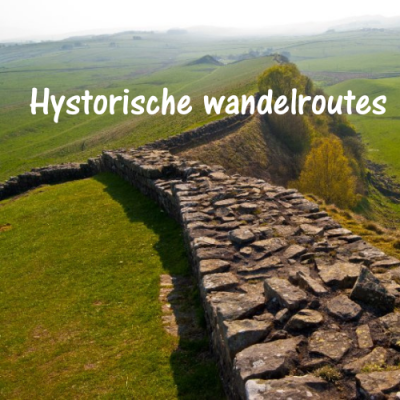
Hystorische wandel- en fietsroutes
Hystorische wandel- en fietsroutes

Producten op de overzichtskaart
Klik op een product om naar de detailpagina te gaan.
- Wandelkaart South Downs Way - Harvey maps
- Wandelgids North Yorkshire historic walks - Cicerone
- Wandelkaart OL13 - Brecon Beacons NP - Eastern area - OSI
- Wandelgids The Great Glen Way - Trailblazer
- Wandelgids Hadrian's wall Path - Knife Edge
- Wandelkaart XT40 Offa's Dyke Path - Harvey Maps
- Wandelkaart OL43 Hadrian's Wall - OSI
- Wandelkaart 351 Dunbar & North Berwick- Schotland - OSI
- Wandelgids Walking in the Forest of Dean - Cicerone
- Wandelkaart 130 Salisburry & Stonehenge- Wiltshire - OSI
- Wandelkaart 256 Wrexham- Wrecsam & Llangollen - OSI
- Wandelkaart 130 Salisbury & Stonehenge- Wiltshire - OSI
- Wandelgids John Muir Trail - Cicerone
- Wandelkaart Rob Roy Way National trail - Harvey maps
- Wandelkaart Hadrian's Wall Path - Harvey maps
- Wandelkaart Offa's Dyke Path- Route Map Booklet - Cicerone
Artikelen uit dezelfde regio

Wandelkaart 289 Leeds- Harrogate- Wetherby & Pontefract - OSI • 9780319244869
Wandelkaart Leeds- Harrogate- Wetherby & Pontefract England Productbeschrijving: OS Explorer kaart 289 dekt Harrogate tot Pontefract, met inbegrip van Leeds en de rivieren Nidd, rivier, Aire en Calder. Hoogtepunten omvatten de Dales Way en de Trans Pennine Trail. De OS Explorer kaart voor Leeds is beschikbaar in zowel de standaard papieren versie en weerbestendige 'Actief' versie. Prod…

Wandelgids The Cleveland Way - Rucksack Readers • 9781898481973
Wandelgids Cleveland Way - Rucksack Readers Productomschrijving: De Cleveland Way is één van de oudste en meest geliefde National Trails van Engeland. De route loopt over een afstand van 174 km rond het North York Moors National Park en begint in het binnenland bij Helmsley, met een panoramisch uitzicht over de valleien van York en Mowbray en vanaf de Cleveland Hills. Na de kust bij Saltb…

Wandelgidse The Cleveland Way - Trailblazer • 9781912716494
The Cleveland Way - Trailblazer Productomschrijving: De Cleveland Way is een "National Trail" in het prachtige wilde landschap van het North York Moors National Park. Het loopt 107,4 mijl (127,9 km) Van Helmsley bij Thirsk rond de westelijke rand van het park om de kust bij Saltburn-by-the-Sea te bereiken. Vervolgens gaat de route langs de oostelijke rand van het park zuidwaarts langs de k…

Wandelkaart OL2 - Yorkshire Dales- Southern & Western Areas - OSI • 9780319475331
Wandelkaart Yorkshire Dales- Southern & Western Areas - OSI Productomschrijving: Kaart nummer OL2 in de OS Explorer kaartenserie is de ideale kaart om te gebruiken bij het verkennen van de zuidelijke en westelijke gebieden van de Yorkshire Dales, waaronder Whernside, Ingleborough en Pen-y-ghent. Hoogtepunten: De drie pieken van Yorkshire, The Devils Bridge bij Kirkby Lonsdale, Leeds to Liv…
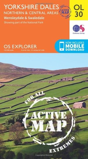
Wandelkaart OL30 Yorkshire Dales - Yorkshire England - OSI • 9780319475379
Wandelkaart Yorkshire Dales - Yorkshire England Omvat ook: Wensleydale & Swaledale Productbeschrijving: Kaart nummer OL30 in de OS Explorer kaarten reeks is de ideale kaart voor mensen die een bezoek willen brengen aan de noordelijke en centrale gebieden van de Yorkshire Dales, met inbegrip van Wensleydale & Swaledale. Er is een schat van landschappen in dit deel van het Yorkshire Dale…