

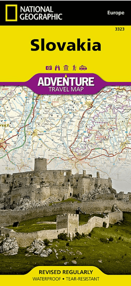
Landkaart Wegenkaart 3323 Adventure map Slowakije - Nat Geo
High Tatras- Bratislava- Ethereal ice caves


Korte omschrijving
Wegen- & stadskaarten Slowakije van National Geographic. Ideaal voor tochten in Slowakije.
Wegenkaart Adventure map Slowakije - Nat Geo Productomschrijving: National Geographic's Slovakia Adventure Map is designed to meet the needs of adventure travelers with its detailed, accurat...

Specificaties
- Uitgever: National Geographic
- ISBN-13: 9781566956420
- HOOFDCATEGORIEËN: Wegenkaart - Landkaart
- Activiteiten: Street/Road maps & city plans
- Auteur: National Geographic
- Regio: Slowakije
- Land: Slowakije
- Waterafstotende kaart: Nat Geo waterproof series
- TOPO's & Stafkaarten: Topografisch wandelen
- Schaal: 1:295000
- Taal: Engels
- Reeks/Serie: NAT GEO Adventure travel maps
Volledige omschrijving
Wegenkaart Adventure map Slowakije - Nat Geo
Productomschrijving: National Geographic's Slovakia Adventure Map is designed to meet the needs of adventure travelers with its detailed, accurate information and user-friendly design. Cities and towns are easy to find with the map's helpful index. Motorways, expressways, and other roads are clearly designated and include distance in kilometers so travelers can easily plan their best route. Specialty content such as hundreds of diverse and unique recreational, ecological, cultural, and historical destinations make Adventure Maps the perfect companion to a guidebook. Among the many diverse points of interest are museums, skifields, spas, viewpoints, campsites, zoos, archaeological sites, and more.
Slovakia's snow-capped mountains and lush valleys making up almost a third of its area making it a great place for adventure whether you are on a solo holiday, travelling with a partner, or with a family group. Use side one of the print map to trek through the Alpine peaks of the High Tatras on the northern border with Poland. Afterward, explore some of central Europe's largest castles, go underground to visit ethereal ice caves, and visit the marked UNESCO heritage sites. The reverse side will take you through Slovakia's lively capital, Bratislava, and its charming Old Town. Explore the largely undeveloped countryside of northern Slovakia by bike, foot, or river barge.
Every Adventure Map is printed on durable synthetic paper, making them waterproof, tear-resistant and tough — capable of withstanding the rigors of international travel.
Overzichtskaarten

NAT GEO Adventure maps EUROPE 3302 - 3328
NAT GEO Adventure maps EUROPE 3302 - 3328
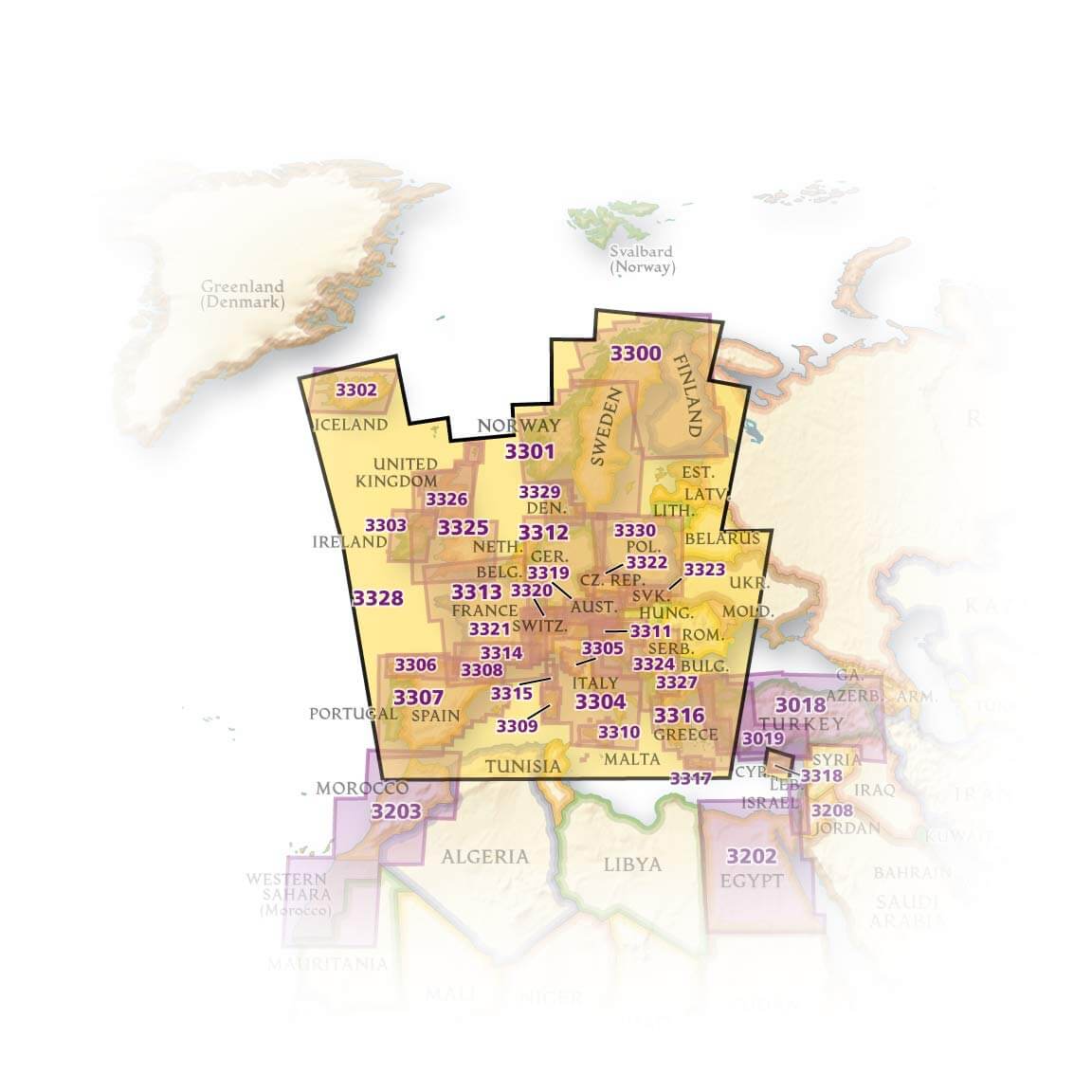
Producten op de overzichtskaart
Klik op een product om naar de detailpagina te gaan.
- Landkaart Wegenkaart 3301 Zweden Zuid & Noorwegen - Nat Geo
- Landkaart Wegenkaart 3302 Ijsland - Nat Geo
- Landkaart Wegenkaart 3303 Ierland - Nat Geo
- Landkaart Wegenkaart 3304 Italië - Nat Geo
- Landkaart Wegenkaart 3305 Toscane - Nat Geo
- Landkaart Wegenkaart 3306 Spanje Noord - Nat Geo
- Landkaart Wegenkaart 3307 Spanje & Portugal - Nat Geo
- Landkaart Wegenkaart 3308 Pyreneeën & Andorra - Nat Geo
- Landkaart Wegenkaart 3309 Sardinië - Nat Geo
- Landkaart Wegenkaart 3312 Adventure map Duitsland - Nat Geo
- Landkaart Wegenkaart 3313 Adventure map Frankrijk - Nat Geo
- Landkaart Wegenkaart 3314 Adventure map Zuid-Frankrijk - Nat Geo
- Landkaart Wegenkaart 3315 Adventure map Corsica - Nat Geo
- Landkaart Wegenkaart 3316 Adventure map Griekenland - Nat Geo
- Landkaart Wegenkaart 3317 Adventure map Kreta - Nat Geo
- Landkaart Wegenkaart 3318 Adventure map Cyprus - Nat Geo
- Landkaart Wegenkaart 3319 Adventure map Oostenrijk - Nat Geo
- Landkaart Wegenkaart 3320 Adventure map Zwitserland - Nat Geo
- Landkaart Wegenkaart 3321 De Alpen - Nat Geo
- Landkaart Wegenkaart 3322 Adventure map Tsjechië - Nat Geo
- Landkaart Wegenkaart 3323 Adventure map Slowakije - Nat Geo
- Landkaart Wegenkaart 3324 Adventure map Kroatië - Nat Geo
- Landkaart Wegenkaart 3325 Adventue map Groot-Brittannië - Nat Geo
- Landkaart Wegenkaart 3326 Adventure map Schotland - Nat Geo
- Landkaart Wegenkaart 3327 Westelijke Balkan - Nat Geo
- Landkaart Wegenkaart 3328 Europa - Nat Geo
Artikelen uit dezelfde regio

Reisgids Dominicus Slowakije - Gottmer Uitgevers Groep • 9789465250007
Reisgids Slowakije - Gottmer Productomschrijving: Zelfs als modern westers land heeft Slowakije nog altijd iets romantisch. Bezoek vooral de schilderachtige historische stadjes met monumenten, kerken en burchten, waar de tijd lijkt te hebben stilgestaan. De hoofdstad Bratislava wordt ook wel de 'Parel aan de Donau' genoemd. Maar ook buiten de steden valt er in Slowakije een hoop t…

Landkaart Wegenkaart Tsjechische Rep. & Slowakije - ExpressMap • 9788375461091
Wegenkaart Tsjechische Rep. & Slowakije - ExpressMap Productomschrijving: ExpressMap is de uitgever van comfort! maps, geplastificeerde kaarten die eenvoudig te vouwen zijn, zelfs met één hand. Een uniek en innovatief product. Comfortabel, waterbestand, onverscheurbaar, comfort! maps blijven hun kwaliteit lang behouden. Duurzame kaarten, nuttig om een uitstap te plannen en handig voor onde…

Landkaart Wegenkaart 731 Tsjechische Rep.& Slowakije - Michelin • 9782067171794
Wegenkaart Tsjechië & Slowakije - Michelin Productomschrijving: Deze Nationale kaart van Tsjechië & Slowakije, werd ontwikkeld, om zich snel uit de voeten wil maken, met plaatsnamenindex, en toeristische informatie, geven u alle elementen om dat werkelijkheid te maken. De kaarten zijn gemakkelijk leesbaar en gedrukt op sterk papier. De rode Michelin wegenkaarten met schaal 1:300.000 zi…
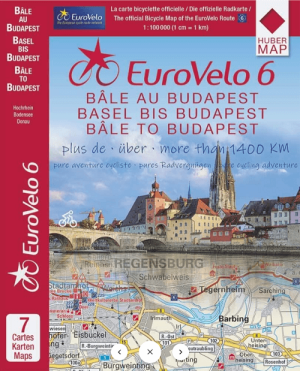
Fietskaartenset Eurovelo 6 Deel 2 Basel > Budapest - Huber • 9783943752632
Kaartenset Eurovelo 6 route Deel 2 - Basel > Budapest - Huber Productomschrijving: Eurovelo 6 DEEL 2: Basel - Budapest - Een klassieker onder de lange-afstandsfietsroutes: langs de Rijn & de Donau van Basel tot Budapest. Fietsroute, accommodaties, attracties, fietsreparatieshops en restaurants worden op de kaart getoond. 7 individuele kaarten in een hoesje. De set bevat: …

Wandelgids Hohe Tatra - Rother Bergverlag • 9783763347896
Wandelgids Hohe Tatra - Rother Productomschrijving: De Hoge Tatra is het kleinste hooggebergte van Europa, maar het hoogste in de lange boog van de Karpaten. De rotsachtige, grillige bergkammen steken opvallend boven het laagland uit, terwijl meer dan honderd legendarische meren en vele watervallen de valleien verlevendigen. De Rother wandelgids “Hoge Tatra” presenteert 50 geselecteerde to…