

Landkaart Wegenkaart 3317 Adventure map Kreta - Nat Geo
Includes the locations of thousands of towns and villages


Korte omschrijving
Wegenkaart Adventure map Kreta - Nat Geo Productomschrijving: National Geographic's Crete Adventure Map is designed to meet the needs of adventure travelers with its detailed, accurate infor...

Specificaties
- Uitgever: National Geographic
- ISBN-13: 9781566956222
- HOOFDCATEGORIEËN: Wegenkaart - Landkaart
- Activiteiten: Street/Road maps & city plans
- Auteur: National Geographic
- Regio: Kreta Griekenland
- Land: Griekenland
- Waterafstotende kaart: Nat Geo waterproof series
- TOPO's & Stafkaarten: Topografisch wandelen
- Schaal: 1:150000
- Taal: Engels
- Reeks/Serie: NAT GEO Adventure travel maps
- De Griekse Eilanden: Kreta
- Grote Eilanden: Kreta, Griekenland
Volledige omschrijving
Wegenkaart Adventure map Kreta - Nat Geo
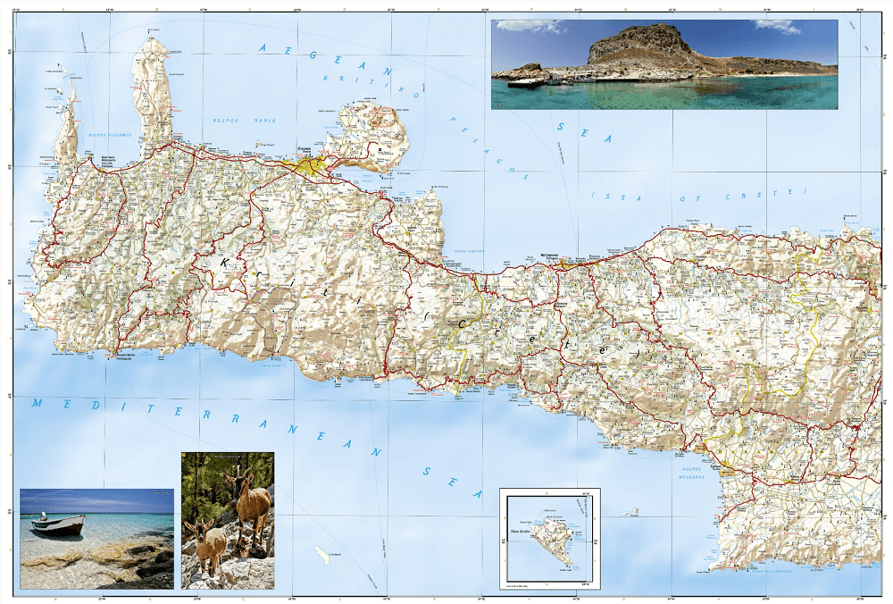
Productomschrijving: National Geographic's Crete Adventure Map is designed to meet the needs of adventure travelers with its detailed, accurate information and user-friendly design. This map includes the locations of thousands of towns and villages, plus a clearly marked road network complete with distances and designations for expressways and roadways.
Secondary roads, tracks, and paths are included for adventurers seeking to explore more remote regions. With specialty content to include hundreds of diverse and unique recreational, ecological, cultural, and historical destinations, this map is a perfect companion to a guidebook. Whether your aim is to see the manmade attractions such as antiquity sites, churches, monasteries, and monuments, or you'd like to explore the natural beauty of Crete on its beaches and hiking trails, this map with prove invaluable in your travels.
The front side of the print map details the eastern region of the island with the Sea of Crete to the north. The reverse side of the map shows the western region of the island with the Aegean Sea to the north and the Mediterranean Sea to the south. The locations of airports, airfield, harbors, and ferry routes take the guesswork out of travel around the island.
Every Adventure Map is printed on durable synthetic paper, making them waterproof, tear-resistant and tough — capable of withstanding the rigors of international travel.
Key Features:
- Waterproof and tear-resistant
- Detailed interpretive information and local travel tips
- Detailed topography complete with activity symbols, ideal for exploring the country
- City overview maps
- Hundreds of points of interest, including the location of World Heritage sites, national parks and nature reserves.
- Thousands of place names
- Important travel aids including airports, lighthouses, ferry routes and rail lines
- Developed in cooperation with local agencies
- Updated regularly to ensure accuracy
Overzichtskaarten

NAT GEO Adventure maps EUROPE 3302 - 3328
NAT GEO Adventure maps EUROPE 3302 - 3328
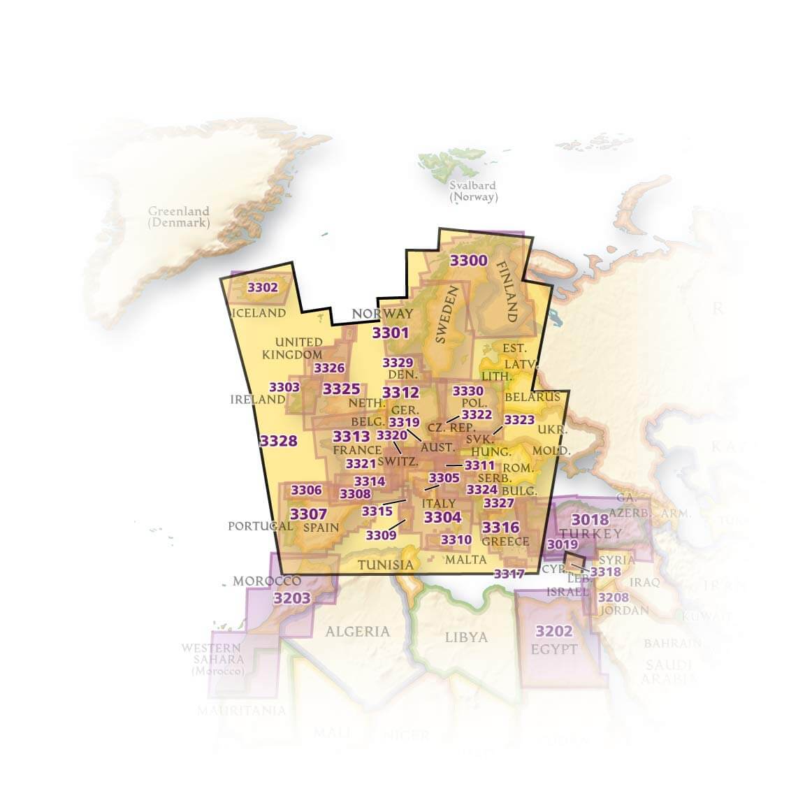
Producten op de overzichtskaart
Klik op een product om naar de detailpagina te gaan.
- Landkaart Wegenkaart 3301 Zweden Zuid & Noorwegen - Nat Geo
- Landkaart Wegenkaart 3302 Ijsland - Nat Geo
- Landkaart Wegenkaart 3303 Ierland - Nat Geo
- Landkaart Wegenkaart 3304 Italië - Nat Geo
- Landkaart Wegenkaart 3305 Toscane - Nat Geo
- Landkaart Wegenkaart 3306 Spanje Noord - Nat Geo
- Landkaart Wegenkaart 3307 Spanje & Portugal - Nat Geo
- Landkaart Wegenkaart 3308 Pyreneeën & Andorra - Nat Geo
- Landkaart Wegenkaart 3309 Sardinië - Nat Geo
- Landkaart Wegenkaart 3312 Adventure map Duitsland - Nat Geo
- Landkaart Wegenkaart 3313 Adventure map Frankrijk - Nat Geo
- Landkaart Wegenkaart 3314 Adventure map Zuid-Frankrijk - Nat Geo
- Landkaart Wegenkaart 3315 Adventure map Corsica - Nat Geo
- Landkaart Wegenkaart 3316 Adventure map Griekenland - Nat Geo
- Landkaart Wegenkaart 3317 Adventure map Kreta - Nat Geo
- Landkaart Wegenkaart 3318 Adventure map Cyprus - Nat Geo
- Landkaart Wegenkaart 3319 Adventure map Oostenrijk - Nat Geo
- Landkaart Wegenkaart 3320 Adventure map Zwitserland - Nat Geo
- Landkaart Wegenkaart 3321 De Alpen - Nat Geo
- Landkaart Wegenkaart 3322 Adventure map Tsjechië - Nat Geo
- Landkaart Wegenkaart 3323 Adventure map Slowakije - Nat Geo
- Landkaart Wegenkaart 3324 Adventure map Kroatië - Nat Geo
- Landkaart Wegenkaart 3325 Adventue map Groot-Brittannië - Nat Geo
- Landkaart Wegenkaart 3326 Adventure map Schotland - Nat Geo
- Landkaart Wegenkaart 3327 Westelijke Balkan - Nat Geo
- Landkaart Wegenkaart 3328 Europa - Nat Geo
Artikelen uit dezelfde regio

Reisgids Crete - Lonely Planet • 9781837583201
Travelguide Crete - Lonely Planet Productomschrijving: Crete is a tapestry of splendid beaches, ancient treasures, and landscapes encompassing vibrant cities and dreamy villages, where locals share their traditions, cuisine and generous spirit. Covers: Hania, Iraklio, Rethymno, Lasithi, Knossos, Vai, Elounda, Agia Nikolaos, Agia Marina, Hersonisos, Platanias, Vamos, Almyrida, Ierapetr…
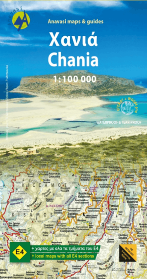
Landkaart Wegenkaart 94 Chania Kreta - Anavasi Ed. • 9789608195790
Wegenkaart Chania Kreta - Anavasi Ed. Productomschrijving: Road map for western Crete and the region of Chania nr. 94 - in scale 1:100 000. Western Crete has some remarkable landscapes such as the shore of Gramvousa and Elafonisos, the numerous gorges of the southern side, including Samaria gorge and many more. Indeed it is the most attractive area for hikers as it includes the most engag…
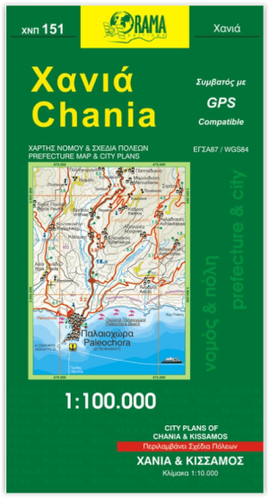
Landkaart Wegenkaart 151 Chania, Kreta Griekenland - Orama • 9789604480081
Wegenkaart Chania, Kreta Griekenland - Orama Productomschrijving: Een uit de kluiten gewassen detailkaart met de wegen en landschappen van de omgeving van de stad Chania op het Griekse eiland Kreta.
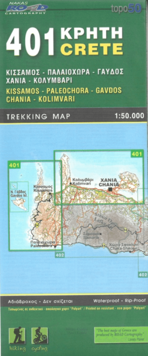
Wandelkaart 401 KRETA Griekenland - Road Editions • 9789604489497
Wandelkaart 401 Kreta Griekenland - Road Editions Productomschrijving: Een algemene, gedetailleerde topografische wandelkaart van het eilandKreta. De kaart omvat alle nodige wandel informatie met verblijfplaatsen. Een algemene zeer geschikte kaart voor alle wat u op een eiland zou kunnen doen! Omvat: Kissamos, Chania, Paleochora, Gavdos & Kolimvari
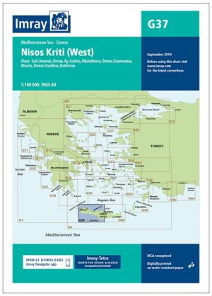
Passage kaart G37 Nísos Kríti (West) - Imray (F&B) • 9781846239359
Passagekaart Nísos Kríti (West) - Imray (F&B) Productomschrijving: Voor deze editie zijn magnetische variatiecurves toegevoegd. De kaart is volledig geactualiseerd.. (Freytag & Berndt) - 1:193.000 Kaart omvat: Het westelijke deel van het eiland Nisos Kriti (Kreta), van Iraklion tot het westelijke puntje. Schaal: 1 : 193.000. Grotere schaalplannen van Ormos Gramvousa, Hania, Rethimno,…