
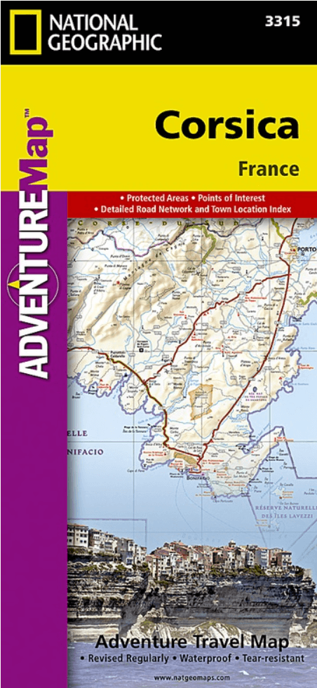
Landkaart Wegenkaart 3315 Adventure map Corsica - Nat Geo
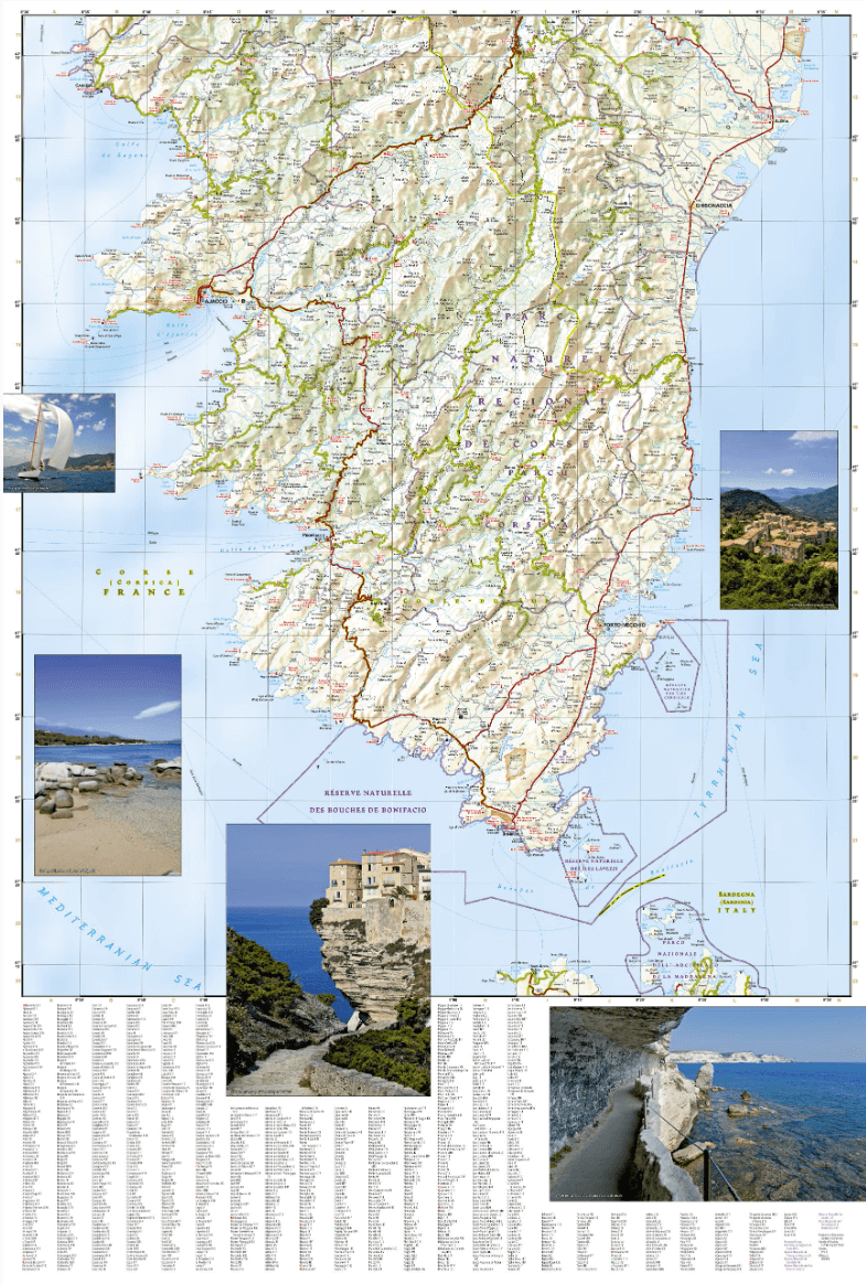
Golfe de Sagone- Golfe de Porto- Bouches de Bonifacio
Korte omschrijving
Wegenkaart Adventure map Corsica - Nat Geo Productomschrijving: Explore the most mountainous island in the Mediterranean and discover while it's called the "isle of beauty" with National Geo...

Specificaties
- Uitgever: National Geographic
- ISBN-13: 9781566956062
- HOOFDCATEGORIEËN: Wegenkaart - Landkaart
- Activiteiten: Street/Road maps & city plans
- Auteur: National Geographic
- Regio: Corsica, Frankrijk
- Land: Frankrijk
- Waterafstotende kaart: Nat Geo waterproof series
- TOPO's & Stafkaarten: Topografisch wandelen
- Schaal: 1:150000
- Taal: Engels
- Reeks/Serie: NAT GEO Adventure travel maps
- Grote Eilanden: Corsica, Frankrijk
Volledige omschrijving
Wegenkaart Adventure map Corsica - Nat Geo
Productomschrijving: Explore the most mountainous island in the Mediterranean and discover while it's called the "isle of beauty" with National Geographic's Corsica Adventure Map. Cities and towns are clearly indicated and easy to find in the user-friendly index. A road network complete with distances and designations for major roads, expressways, scenic routes, and secondary roads will help you find the route that's right for you. The popular GR 20 trail is noted for advanced hikers looking to traverse one of the most beautiful mountain trails in Europe.
With specialty content to include hundreds of diverse and unique recreational, ecological, cultural, and historical destinations, this map is a perfect companion to a guidebook. Beaches, winter sports resorts, golf courses, spas, castles, churches, camping areas, and UNESCO World Heritage sites are clearly indicated so travelers can take advantage of Corsica's many natural attractions and activities. The locations of airports, airfields, harbors, marinas, and ferry routes take the guesswork out of travel around the island.
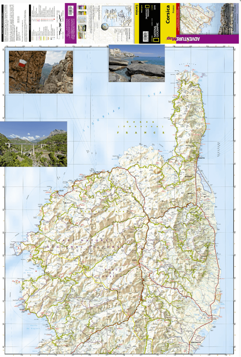
The front side of the print map details the northern region of this island country; bordering Golfe de Sagone and Golfe de Porto to the west, Tyrrhenian Sea to the east, and the Ligurian Sea and Golfe de St. Florent to the north. The reverse side of the map shows the southern region; from its border with the Bouches de Bonifacio to the south, to the Tyrrhenian Sea, Golfe de Santa-Manza and Golfe de Porto-Vecchio to the east, and the Mediterranean Sea, Golfe de Sagone, Golfe de Valinco and Golfe d' Ajaccio to the west. This island is located west of Italy, southeast of the French mainland and north of the Italian island of Sardinia.
Every Adventure Map is printed on durable synthetic paper, making them waterproof, tear-resistant and tough — capable of withstanding the rigors of international travel.
Overzichtskaarten

NAT GEO Adventure maps EUROPE 3302 - 3328
NAT GEO Adventure maps EUROPE 3302 - 3328
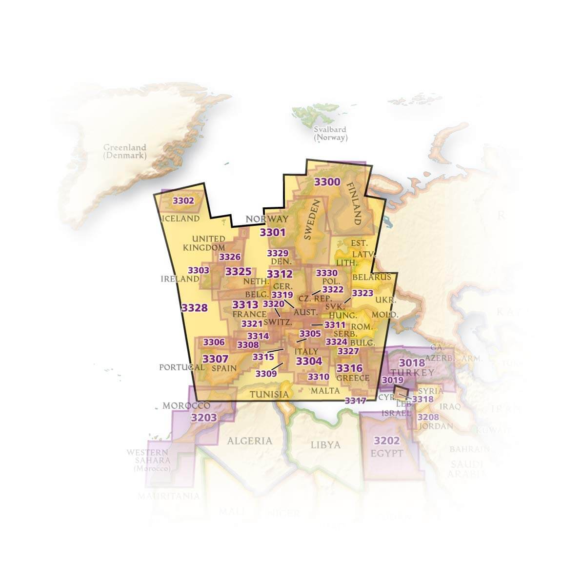
Producten op de overzichtskaart
Klik op een product om naar de detailpagina te gaan.
- Landkaart Wegenkaart 3301 Zweden Zuid & Noorwegen - Nat Geo
- Landkaart Wegenkaart 3302 Ijsland - Nat Geo
- Landkaart Wegenkaart 3303 Ierland - Nat Geo
- Landkaart Wegenkaart 3304 Italië - Nat Geo
- Landkaart Wegenkaart 3305 Toscane - Nat Geo
- Landkaart Wegenkaart 3306 Spanje Noord - Nat Geo
- Landkaart Wegenkaart 3307 Spanje & Portugal - Nat Geo
- Landkaart Wegenkaart 3308 Pyreneeën & Andorra - Nat Geo
- Landkaart Wegenkaart 3309 Sardinië - Nat Geo
- Landkaart Wegenkaart 3312 Adventure map Duitsland - Nat Geo
- Landkaart Wegenkaart 3313 Adventure map Frankrijk - Nat Geo
- Landkaart Wegenkaart 3314 Adventure map Zuid-Frankrijk - Nat Geo
- Landkaart Wegenkaart 3315 Adventure map Corsica - Nat Geo
- Landkaart Wegenkaart 3316 Adventure map Griekenland - Nat Geo
- Landkaart Wegenkaart 3317 Adventure map Kreta - Nat Geo
- Landkaart Wegenkaart 3318 Adventure map Cyprus - Nat Geo
- Landkaart Wegenkaart 3319 Adventure map Oostenrijk - Nat Geo
- Landkaart Wegenkaart 3320 Adventure map Zwitserland - Nat Geo
- Landkaart Wegenkaart 3321 De Alpen - Nat Geo
- Landkaart Wegenkaart 3322 Adventure map Tsjechië - Nat Geo
- Landkaart Wegenkaart 3323 Adventure map Slowakije - Nat Geo
- Landkaart Wegenkaart 3324 Adventure map Kroatië - Nat Geo
- Landkaart Wegenkaart 3325 Adventue map Groot-Brittannië - Nat Geo
- Landkaart Wegenkaart 3326 Adventure map Schotland - Nat Geo
- Landkaart Wegenkaart 3327 Westelijke Balkan - Nat Geo
- Landkaart Wegenkaart 3328 Europa - Nat Geo
Artikelen uit dezelfde regio

Reisgids Cartoville Bonifacio Corsica - Gallimard • 9782742467433
Reisgids Bonifacio - Gallimard Productomschrijving: Haute-Ville, remparts, escalier du Roy d’Aragon, cimetière marin, marina, ermitage de la Trinité, phare et falaises de Pertusatu, îles Lavezzi, plage de Rondinara, producteurs et épiceries du terroir, tables locavores et bars de plage, balades littorales : suivez le guide ! • Les incontournables, et aussi tous les musées, monuments, …
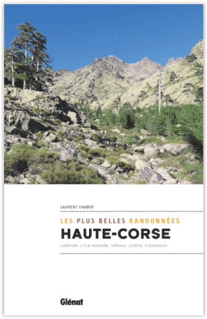
Wandelgids Haute Corse - Les plus belles randonnée - Ed. Glénat • 9782344050811
Haute-Corse - Les plus belles randonnée - Glénat Productomschrijving: 36 routes om de pracht van de Haute-Corse te ontdekken. Corsica wordt vaak beschreven als een bergeiland, een berg in zee. Hier hoef je niet alleen de toppen van 2.000 m te achtervolgen, want het middelgebergte is net zo interessant en cultureel rijker, en de kustlijn is uitzonderlijk. Je kunt tientallen kilometers langs…
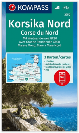
Wandelkaart 2250 Corsica Noord - Kompass • 9783990449530
Wandelkaart Corsica Noord - Kompass Productomschrijving: Het bijzondere en uitermate speciale Corsica is een bergachtig eiland en daardoor dunbevolkt. De 2 hoogste punten van het eiland zijn de Monte Cinto (2706 m) en de Monte Rotondo (2622 m). De KOMPASS wandelkaarten overtuigen door: - Een GPS-nauwkeurige en actuele kaart met eenvoudige oriëntatie - Gebruiksvriendelijke lay-out e…

Wandelgids Corse- Les plus beaux treks - Fra a Corsica • 9782344053263
Corse Les plus beaux treks - Fra a Corsica Productomschrijving: Fernando Ferreira, een groot kenner van de plaatsen die hij 40 jaar lang heeft onderzocht en gefotografeerd, biedt je in dit prachtige boek 10 wandeltochten om alle schatten van het Eiland van de Schoonheid te ontdekken. Tot groot genoegen van wandelaars biedt het Eiland van de Schoonheid een zeldzame verscheidenheid aan wilde…

30 Rando sur les GR de la Haute Provence à la Méditerrannée • 9782737388538
30 Rando sur les GR de la Haute Provence à la Méditerrannée - Ouest-france Productomschrijving: Een vervolg op het grote succes van "70 randonnées sur les GR® de France" en "30 randonnées sur les GR® de Bretagne"! Een gids met 30 wandelingen, van 2 tot 4 dagen, in de Drôme, Hautes-Alpes, Vaucluse, Alpes-de-Haute-Provence, Alpes-Maritimes, Gard, Bouches-du-Rhône, Var en Corsica. Een ontsnap…