

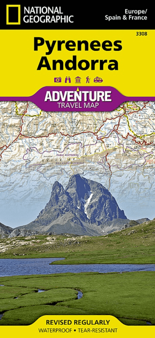
Landkaart Wegenkaart 3308 Pyreneeën & Andorra - Nat Geo
Narbonne- Carcassone- Pamiers- St-Gaudens- St-Girons- Perpignan
Korte omschrijving
Wegenkaart Pyreneeën & Andorra - Nat Geo Productomschrijving: National Geographic's Pyrenees and Andorra Adventure Map provides global travelers with the perfect combination of detail and p...

Specificaties
- Uitgever: National Geographic
- ISBN-13: 9781566955409
- HOOFDCATEGORIEËN: Wegenkaart - Landkaart
- Activiteiten: Street/Road maps & city plans
- Auteur: National Geographic
- Regio: Andorra, Nouvelle-Aquitaine, Frankrijk, Occitanië, Frankrijk
- Land: Andorra, Frankrijk
- Waterafstotende kaart: Nat Geo waterproof series
- Toepasselijke bergketen: Pyreneeën, Frankrijk
- Nationale parken: Pyrénées NP, Frankrijk
- TOPO's & Stafkaarten: Topografisch wandelen
- Schaal: 1:275000
- Editie: 1
- Taal: Engels
- Reeks/Serie: NAT GEO Adventure travel maps
- De Nationale Parken: Pyreneeën Nationaal Park, Frankrijk
Volledige omschrijving
Wegenkaart Pyreneeën & Andorra - Nat Geo
Productomschrijving: National Geographic's Pyrenees and Andorra Adventure Map provides global travelers with the perfect combination of detail and perspective in a highly functional travel tool. This map includes the locations of cities and towns with a user-friendly index, plus a clearly marked road network complete with distances and designations for roads and highways.
Beaches and yachting harbors dot Spain and France's Mediterranean coastlines while the location of golf courses, camping sites, waterfalls, caves, and ski areas make it easy to enjoy the region's abundant outdoor activities. National parks, World Heritage sites, scenic viewpoints, antiquity sites, museums, and more are included, making it invaluable to travelers hoping to experience all the history, art, and culture the region has to offer.
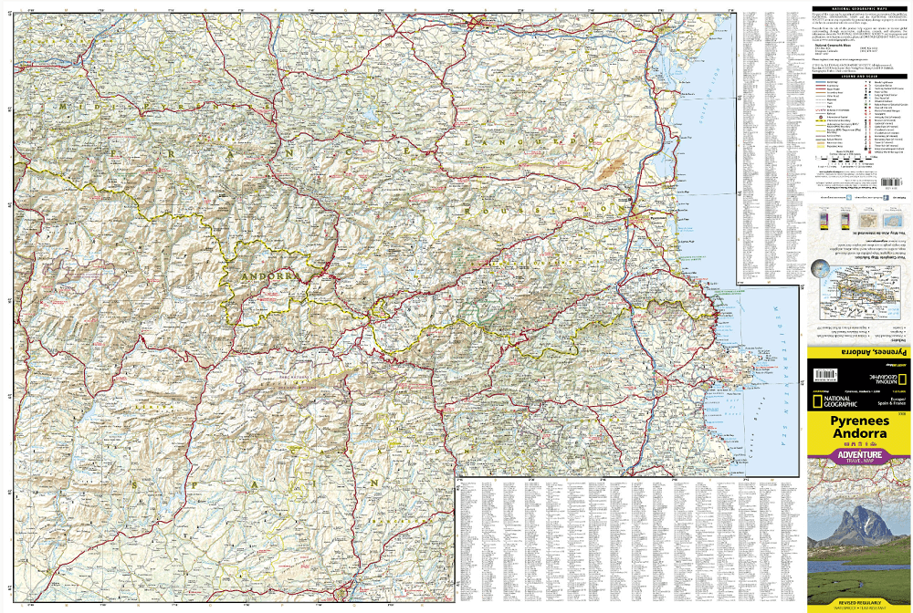
The front side of the print map shows the country of Andorra and the eastern half of the Pyrenees including the cities of Narbonne, Carcassone, Pamiers, St-Gaudens, St-Girons, Perpignan in France, and Balaguer, Manresa, and Figueres in Spain. The reverse side of the map stretches from the city of Biarritz on the Bay of Biscay eastward to include Pamplona and Huesca, Spain, and Pau, Tarbes, and the famed pilgrimage site of Lourdes, France.
Popular for alpine skiing and mountaineering, the Pyrenees are a scenic mountain range which form a natural boundary between Spain and France. Stages of two of cycling's epic grand tours - the Tour de France and the Vuelta a España - traverse the Pyrenees and three long-distance footpaths run the length of the mountain range. Nestled in the center of the Pyrenees is the ruggedly beautiful Andorra, the sixth smallest country in Europe which is roughly two and a half times the size of Washington, D.C. Its picturesque mountain vistas and easy charm have made Andorra a favorite destination for savvy travelers.
Every Adventure Map is printed on durable synthetic paper, making them waterproof, tear-resistant and tough — capable of withstanding the rigors of international travel.
Overzichtskaarten

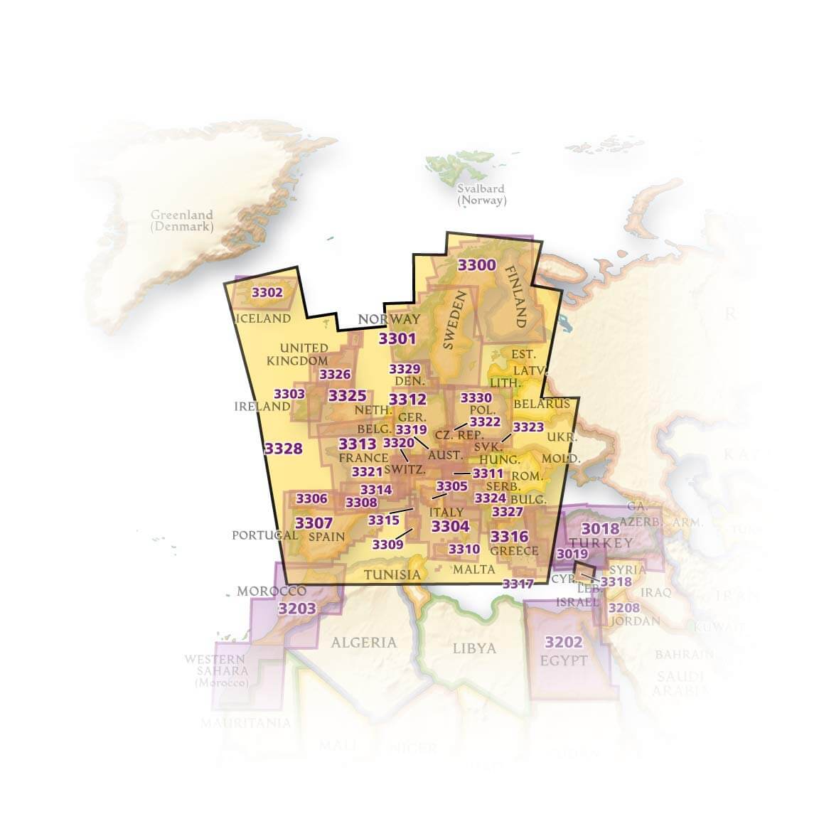
NAT GEO Adventure maps EUROPE 3302 - 3328
NAT GEO Adventure maps EUROPE 3302 - 3328
Producten op de overzichtskaart
Klik op een product om naar de detailpagina te gaan.
- Landkaart Wegenkaart 3301 Zweden Zuid & Noorwegen - Nat Geo
- Landkaart Wegenkaart 3302 Ijsland - Nat Geo
- Landkaart Wegenkaart 3303 Ierland - Nat Geo
- Landkaart Wegenkaart 3304 Italië - Nat Geo
- Landkaart Wegenkaart 3305 Toscane - Nat Geo
- Landkaart Wegenkaart 3306 Spanje Noord - Nat Geo
- Landkaart Wegenkaart 3307 Spanje & Portugal - Nat Geo
- Landkaart Wegenkaart 3308 Pyreneeën & Andorra - Nat Geo
- Landkaart Wegenkaart 3309 Sardinië - Nat Geo
- Landkaart Wegenkaart 3312 Adventure map Duitsland - Nat Geo
- Landkaart Wegenkaart 3313 Adventure map Frankrijk - Nat Geo
- Landkaart Wegenkaart 3314 Adventure map Zuid-Frankrijk - Nat Geo
- Landkaart Wegenkaart 3315 Adventure map Corsica - Nat Geo
- Landkaart Wegenkaart 3316 Adventure map Griekenland - Nat Geo
- Landkaart Wegenkaart 3317 Adventure map Kreta - Nat Geo
- Landkaart Wegenkaart 3318 Adventure map Cyprus - Nat Geo
- Landkaart Wegenkaart 3319 Adventure map Oostenrijk - Nat Geo
- Landkaart Wegenkaart 3320 Adventure map Zwitserland - Nat Geo
- Landkaart Wegenkaart 3321 De Alpen - Nat Geo
- Landkaart Wegenkaart 3322 Adventure map Tsjechië - Nat Geo
- Landkaart Wegenkaart 3323 Adventure map Slowakije - Nat Geo
- Landkaart Wegenkaart 3324 Adventure map Kroatië - Nat Geo
- Landkaart Wegenkaart 3325 Adventue map Groot-Brittannië - Nat Geo
- Landkaart Wegenkaart 3326 Adventure map Schotland - Nat Geo
- Landkaart Wegenkaart 3327 Westelijke Balkan - Nat Geo
- Landkaart Wegenkaart 3328 Europa - Nat Geo
Artikelen uit dezelfde regio

Stadskaart & Plattegrond 88422 Pau & omgeving - IGN • 9782758526643
Stadskaart Pau & omgeving - IGN Productomschrijving: Deze wandel- en omgevingskaart van de stad Pau is te vinden in de regio van de Nouvelle-Aquitaine, in het departement van de Pyrénées-Atlantiques in Frankrijk. De kaarten omvatten: * Alle wegen * Kaart van het centrum van de stad * Index van de omliggende gemeentes * Gedetailleerd toeistische informatie * openlucht activ…

Wandelkaart 2644 OT Pézenas & Murviel-lès-Béziers - IGN • 9782758548799
TOPO Wandelkaart Pézenas & Murviel-lès-Béziers - IGN Productomschrijving: Pézenas & Murviel-lès-Béziers zijn gemeentes in het Franse departement Hérault in de regio Occitanie. De plaats maakt deel uit van het arrondissement Béziers. De TOP 25 kaarten, met nummers die eindigen op "T" hebben betrekking op gebieden van bijzonder toeristisch belang zoals de Alpen, de Pyreneeën, De Cevennes…

Wandelgids Ile d'Oléron - Ile d'Aix à pied - Ed. Chamina • 9782844666215
Ile d'Oléron - Ile d'Aix à pied - Ed. Chamina Productomschrijving: Met deze gids kunt u het eiland Oleron, aan de Atlantische kust, ontdekken dankzij 20 gedetailleerde routes. Het onderzochte gebied strekt zich uit van de baai van Gatseau in het zuiden tot de noordelijke punt van het eiland: de Pointe de Chassiron. Twee wandelingen worden ook voorgesteld op het eiland Aix, in de buurt van …

Wandelkaart 2338 SB Decazeville & Marcillac-Vallon - IGN • 9782758546252
Wandelkaart 2338 SB - Decazeville & Marcillac-Vallon Productomschrijving: Decazeville is een gemeente in het departement Aveyron, Frankrijk. Dichtaan gelegen aan de Provence, is deze locatie erg geschikt als uitvalsbasis voor wandelaars- en fietsers. Productomschrijving: Tussen 2014 en 2018 vernieuwt IGN haar volledige collectie serie blauw. Een nieuwe toewijzing voor optimale leesbaa…

Wandelkaart 1937 SB Belvès & Beaumont-du-Périgord - IGN • 9782758548249
Wandelkaart 1937 SB - Belvès & Beaumont-du-Périgord Productomschrijving: Tussen 2014 en 2018 vernieuwt IGN haar volledige collectie serie blauw. Een nieuwe toewijzing voor optimale leesbaarheid, met een grotere mate van geometrische nauwkeurigheid en verrijkte toeristische informatie. Het formaat van de nieuwe serie blauw is gelijk aan die van de TOP 25 en het aantal verwijzingen wordt dus…