

Wandelkaart XT40 South West Coast Path 1 - Harvey maps
1014 km lange route in Cornwall van Minehead tot St-Ives

Korte omschrijving
Wandelkaarten South & South East England, Devon, England en Summerset van HARVEY MAPS. Ideaal voor tochten in England.
Wandelkaart - South West Coast Path 1 - XT40 - Harvey maps Productomschrijving: Een wandelkaart die het zuidelijk deel beschrijft van het LAW wandelpad in de regio Devon / Cornwall, van Mine...

Specificaties
- Uitgever: HARVEY MAPS
- ISBN-13: 9781851375547
- HOOFDCATEGORIEËN: Wandelkaart
- Activiteiten: Wandelen, Hiking & Trekking
- Regio: Devon, England, South & South East England, Summerset
- Land: England
- TOPO's & Stafkaarten: Topografisch wandelen
- Schaal: 1:40000
- Taal: Engels
- Iconische Wandelroutes: South West coast Path, Cornwall UK
- National Trails UK, England & Wales: South West Coast Path, England
Volledige omschrijving
Wandelkaart - South West Coast Path 1 - XT40 - Harvey maps
Productomschrijving: Een wandelkaart die het zuidelijk deel beschrijft van het LAW wandelpad in de regio Devon / Cornwall, van Minehead tot St-Ives. De route telt in zijn geheel maar liefst 1014km lange wandelpad, genaamd "West Coast Path". De gehele route werd opgesplitst in 3 delen, De ISBN nrs van alle drie de kaarten zijn hieronder te vinden. Het pakket wordt bij BIBLIOTREK.be verkocht als 1 set voor een samengestelde prijs. De route is een superbekende nationale trail, en loopt langs de kust van Somerset, Cornwall, Devon, en Dorset tot Minehead rond Land's End tot in Poole. De ganse route beschrijft 95 mijl lange werelderfgoedpaden gekend als de "Jurasic Coast".
Kaart 1 van 3: Minehead tot St-Ives – 9781851375547
Kaart 2 van 3: St-Ives tot Plymouth – 9781851375554
Kaart 3 van 3: Plymouth tot Pool Harbour - 9781851375561
Kaart is Bio-afbreekbaar, met accomodatie-info, kamperen, eten, startplaatsinfo.
Locatie op kaart
Overzichtskaarten

Harvey Maps - National Trails
Harvey Maps - National Trails

Producten op de overzichtskaart
Klik op een product om naar de detailpagina te gaan.
- Wandelkaart Cape Wrath Trail North - Schotland - Harvey maps
- Wandelkaart Cape Wrath Durness Schotland - Harvey maps
- Wandelkaart Cleveland Way - Across North York NP - Harvey maps
- Wandelkaart Cotswold Way - Harvey maps
- Wandelkaart Cumbria Way - Harvey maps
- Wandelkaart The Dales Way Yorkshire - Harvey maps
- Wandelkaart East Highland Way - Schotland - Harvey maps
- Wandelkaart Glyndwr's Way Wales - Harvey maps
- Wandelkaart Great Glen Way - Schotland - Harvey maps
- Wandelkaart XT40 Pennine Way Zuid - Harvey Maps
- Wandelkaart XT40 South West Coast Path 1 - Harvey maps
- Wandelkaart XT40 Anglesey Coastal Path N. Wales - Harvey Maps
- Wandelkaart XT40 Offa's Dyke Path - Harvey Maps
- Wandelkaart XT40 Pennine Way Noord - Harvey Maps
- Wandelkaart XT40 ultra Crieff & Comrie & Dunblane - Harvey maps
- Wandelkaart XT40 John o'Groats Trail - Harvey Maps
- Wandelkaart XT40 Wales Coast Path 2 - Caernarfon to Cardigan
- Wandelkaart XT40 Wales Coast Path 3 - Cardigan to LIanelli
- Wandelkaart Rob Roy Way National trail - Harvey maps
- Wandelkaart South Downs Way - Harvey maps
- Wandelkaart Loch Ness Trail South - Harvey maps
- Wandelkaart Speyside Way - Harvey maps
- Wandelkaart St-Oswald's Way - Harvey maps
- Wandelkaart Thames Path - Harvey maps
- Wandelkaart Fietskaart Affric Kintail Way - Harvey maps
- Wandelkaart Hadrian's Wall Path - Harvey maps
- Wandelkaart North Downs Way - Harvey maps
- Wandelkaart Pennine Bridleway - Harvey Maps
- Wandelkaart Ridgeway National Trail SE England - Harvey maps
- Wandelkaart Skye Trail - Isle of Skye Schotland - Harvey maps
- Wandelkaart West Highland Way - Harvey maps
- Wandelkaart Beacons Way XT40 - Harvey Maps
- Wandelkaart Cumbrian Way North XT40 - Harvey Maps
- Wandelkaart Lake District South-East XT40 - Harvey Maps
Artikelen uit dezelfde regio

Landkaart Wegenkaart 7 Zuidwest Engeland & Zuid Wales - OSI • 9780319263792
Wegenkaart Zuidwest Engeland & Zuid Wales - OSI Productomschrijving: Plan your journey with this series of road maps from OS. Showing all major road, rail and ferry links as well as settlements and selected features in 1: 250 000 scale, this is the ideal map for planning trips and holidays by car or cycle. OS Road 7 covers: the south-west England plus south Wales, Devon & Cornwall. …

Wandelkaart 202 Torbay - South Dartmoor NP - OSI • 9780319263976
Wandelkaart Torbay - South Dartmoor NP - OSI Productomschrijving: De Landranger kaart nummer 202 is een kaart voor alle doeleinden, boordevol informatie om u te helpen een gebied echt te leren kennen. Elke kaart bestrijkt een gebied van 40 km bij 40 km. Deze kaart van Torbay & South Dartmoor omvat ook: Totnes, Salcombe, Totcross, Brixham, Paignton, Torquay, Newton Abbot, Ivybridge, Ho…

Landkaart Wegenkaart 03 Engeland Zuid Oost - AA Road Maps • 9780749584665
Wegenkaart 03 Engeland Zuid Oost - AA Road Maps Productomschrijving: AA Road Map South East England is a practical and slimline, foldable map from the experts at the AA. Encased in a durable, weatherproof cover, the mapping is produced at a scale of 3 miles to 1 inch (1:200,000 / 2km to 1cm) combining clear design, an easy-to-read scale and more road detail to ensure that you never lose yo…
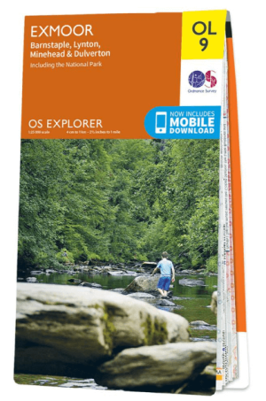
Wandelkaart OL09 Exmoor NP Devon England - OS • 9780319242483
Wandelkaart Exmoor NP Devon England - OS Productomschrijving: Exmoor National Park, Devon England Omvat: Exmoor National Park, Devon England, Barnstaple, Lynton, Minehead & Dulverton. Ontdek de OL-serie van Ordnance Survey: De OL-serie (Outdoor Leisure) van Ordnance Survey is dé referentie voor wie gaat wandelen op de Britse eilanden. Deze topografische kaarten maken deel uit va…

Wandelkaart 127 South Molton & Chulmleigh Devon England - OSI • 9780319470022
Wandelkaart South Molton & Chulmleigh - Devon England Omvat: King’s Nympton, Chittlehampton & Dolton. Productbeschrijving: Kaart nummer 127 in de OS Explorer kaarten reeks is ideaal om Noord-Devon te ontdekken. Dit gebied, net ten zuiden van Exmoor National Park, biedt prachtige landschappen en wandelingen onbedorven door het massa's. Andere hoogtepunten van het gebied zijn Chittlehamp…