

Wandelkaart Beacons Way XT40 - Harvey Maps
Bannau Brycheiniog NP / Brecon Beacons NP
Korte omschrijving
Wandelkaarten South Wales en Pen y Fan, Wales van HARVEY MAPS. Ideaal voor tochten in Wales.
Wandelkaart Beacons Way - Harvey Maps Productomschrijving: The Beacons Way traverses across the full length of Bannau Brycheiniog National Park. Established in 2005, the Way is a challenging...

Specificaties
- Uitgever: HARVEY MAPS
- ISBN-13: 9781851377251
- HOOFDCATEGORIEËN: Wandelkaart
- Activiteiten: Wandelen, Hiking & Trekking
- Regio: Pen y Fan, Wales, South Wales
- Land: Wales
- Lange afstand wandelroutes: Beacons Way, Brecon Beacons NP, (139 km) Wales
- Nationale parken: Brecon Beacons NP (Western Area)
- TOPO's & Stafkaarten: Topografisch wandelen
- Schaal: 1:40000
- Taal: Engels
- Reeks/Serie: National Trails, UK, Superwalker XT40, Harvey Maps
Volledige omschrijving
Wandelkaart Beacons Way - Harvey Maps
Productomschrijving: The Beacons Way traverses across the full length of Bannau Brycheiniog National Park. Established in 2005, the Way is a challenging route that has been designed to showcase the best the park has to offer, taking in deep valleys, expansive moorland, and the highest mountains in Southern Britain. A challenging trail, navigation skills are required on the more open sections where waymarking is limited.
NEW TRAIL MAP - Entire route on one map
The Beacons Way is a long-distance walking trail that stretches for 159 km (99 miles) across the stunning landscape of Bannau Brycheiniog (Brecon Beacons National Park). The route runs from Abergavenny in the east to Llangadog in the west, and it showcases some of the most dramatic and diverse scenery the National Park has to offer - rugged mountains, serene valleys, windswept moorlands and historic sites.
Designed for experienced walkers, the Beacons Way offers a challenging yet rewarding journey through the heart of Welsh natural beauty and heritage - navigation skills are required on the more open sections where waymarking is limited.
![]()
Overzichtskaarten

Harvey Maps - National Trails
Harvey Maps - National Trails

Producten op de overzichtskaart
Klik op een product om naar de detailpagina te gaan.
- Wandelkaart Cape Wrath Trail North - Schotland - Harvey maps
- Wandelkaart Cape Wrath Durness Schotland - Harvey maps
- Wandelkaart Cleveland Way - Across North York NP - Harvey maps
- Wandelkaart Cotswold Way - Harvey maps
- Wandelkaart Cumbria Way - Harvey maps
- Wandelkaart The Dales Way Yorkshire - Harvey maps
- Wandelkaart East Highland Way - Schotland - Harvey maps
- Wandelkaart Glyndwr's Way Wales - Harvey maps
- Wandelkaart Great Glen Way - Schotland - Harvey maps
- Wandelkaart XT40 Pennine Way Zuid - Harvey Maps
- Wandelkaart XT40 South West Coast Path 1 - Harvey maps
- Wandelkaart XT40 Anglesey Coastal Path N. Wales - Harvey Maps
- Wandelkaart XT40 Offa's Dyke Path - Harvey Maps
- Wandelkaart XT40 Pennine Way Noord - Harvey Maps
- Wandelkaart XT40 ultra Crieff & Comrie & Dunblane - Harvey maps
- Wandelkaart XT40 John o'Groats Trail - Harvey Maps
- Wandelkaart XT40 Wales Coast Path 2 - Caernarfon to Cardigan
- Wandelkaart XT40 Wales Coast Path 3 - Cardigan to LIanelli
- Wandelkaart Rob Roy Way National trail - Harvey maps
- Wandelkaart South Downs Way - Harvey maps
- Wandelkaart Loch Ness Trail South - Harvey maps
- Wandelkaart Speyside Way - Harvey maps
- Wandelkaart St-Oswald's Way - Harvey maps
- Wandelkaart Thames Path - Harvey maps
- Wandelkaart Fietskaart Affric Kintail Way - Harvey maps
- Wandelkaart Hadrian's Wall Path - Harvey maps
- Wandelkaart North Downs Way - Harvey maps
- Wandelkaart Pennine Bridleway - Harvey Maps
- Wandelkaart Ridgeway National Trail SE England - Harvey maps
- Wandelkaart Skye Trail - Isle of Skye Schotland - Harvey maps
- Wandelkaart West Highland Way - Harvey maps
- Wandelkaart Beacons Way XT40 - Harvey Maps
- Wandelkaart Cumbrian Way North XT40 - Harvey Maps
- Wandelkaart Lake District South-East XT40 - Harvey Maps

Harvey Maps - Mountain XT40 Maps
Harvey Maps - Mountain XT40 Maps

Producten op de overzichtskaart
Klik op een product om naar de detailpagina te gaan.
- Wandelkaart Yorkshire Dales NP - Harvey Maps
- Wandelkaart Ben Nevis and Glen Coe Schotland - Harvey maps
- Wandelkaart Brecon Beacons NP - Harvey maps
- Wandelkaart Cairngorms National Park - Harvey maps
- Wandelkaart Dartmoor National Park - Harvey maps
- Wandelkaart Knoydart - Kintail & Glen Affric - Harvey maps
- Wandelkaart Lake District National Park XT40 - Harvey Maps
- Wandelkaart en klimkaart - North Yorkshire Moors - Harvey maps
- Wandelkaart Snowdonia NP South - Harvey maps
- Wandelkaart Torridon & remote Fisherfield Hills - Harvey maps
- Wandelkaart Snowdonia Noord XT40 ultra - Harvey Maps
- Wandelkaart Beacons Way XT40 - Harvey Maps
- Wandelkaart Lake District South-East XT40 - Harvey Maps
- Wandelaart Dark Peak - Peak District NP XT40 - Harvey Maps
Artikelen uit dezelfde regio

Wandelkaart 159 Swansea & Gower- South Wales - OSI • 9780319262573
Wandelkaart Swansea & Gower - South Wales - OSI Productbeschrijving: Deze kaart van Swansea & Govers omvat ook Burry Port, Llanelli, Carway, Morfa Beach, Llandeilo, Caerfyrddin evenals deel van het Brecon Beacons National Park. OS Landranger kaart 159 toont de zuidwestelijke kust van Wales, en is ideaal voor het ontdekken van afgelegen dorpen en zandstranden De OS Landranger kaarten reeks …
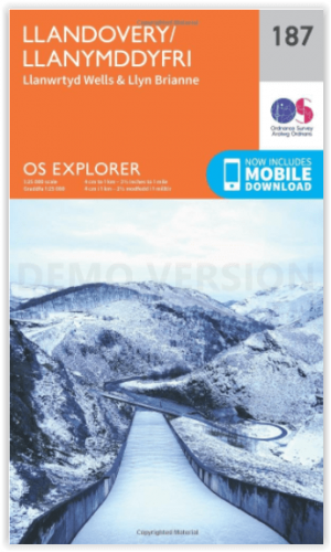
Wandelkaart 187 Llandovery- South Wales - OSI • 9780319243800
Wandelkaart Llandovery - South Wales Omvat ook: Llanwrtyd Wells & Llyn Brianne. Productbeschrijving: OS Explorer kaart blad 187 toont Claerwen Resevior aan de Tywi Forest en Llandovery. De Wereldkampioenschappen Bog snorkelen worden er jaarlijks gehouden in de buurt van Llanwrtyd Wells. De OS Explorer kaart voor Llandovery is beschikbaar in zowel de standaard papieren versie als de wee…

Wandelkaart 166 Rhondda & Merthyr - Wales - OSI • 9780319470381
Wandelkaart Rhondda & Merthyr & Merthyr Tudful - Wales Productbeschrijving: Kaart nummer 166 in de OS Explorer kaarten reeks is ideaal voor het ontdekken van het gebied van Rhondda en Merthyr Tydfil in Zuid-Wales. Dit gebied ligt net ten zuiden van de Brecon Beacons, met bijzonder hoge natuurlijke schoonheid en vele wandelingen. Hoogtepunten van het gebied zijn onder andere: Aberdare, Bar…
Wandelkaart XT40 Brecon Beacons Oost Wales - Harvey Maps • 9781851376001
Wandelkaart -XT40 Brecon Beacons Oost Wales - Harvey Maps Productomschrijving: Omvat een grote oppervlakte, maar is heel handig & compact. Gedetailleerde kaart voor hardlopers en wandelaars van het oostelijke deel van het Brecon Beacons National Park en de Black Mountains op de magische schaal van 1:40, 000. Omvat: Pen y Fan en de Black Mountains. Welsh-Engelse tekst.

Landkaart Wegenkaart 7 Zuidwest Engeland & Zuid Wales - OSI • 9780319263792
Wegenkaart Zuidwest Engeland & Zuid Wales - OSI Productomschrijving: Plan your journey with this series of road maps from OS. Showing all major road, rail and ferry links as well as settlements and selected features in 1: 250 000 scale, this is the ideal map for planning trips and holidays by car or cycle. OS Road 7 covers: the south-west England plus south Wales, Devon & Cornwall. …