

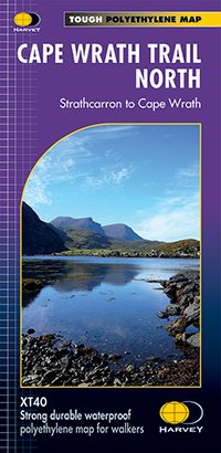
Wandelkaart Cape Wrath Trail North - Schotland - Harvey maps
De Cape Wrath Trail is een route van Fort William naar Cape Wrath
Korte omschrijving
Wandelkaarten Northern Highland's, Schotland van HARVEY MAPS. Ideaal voor tochten in Schotland.
Wandelkaart Cape Wrath Trail North - Schotland - Harvey maps Omvat: Cape Wrath - Durness Schotland - Trail North Productomschrijving: De Cape Wrath Trail is een uitdagende route van For...

Specificaties
- Uitgever: HARVEY MAPS
- ISBN-13: 9781851375332
- HOOFDCATEGORIEËN: Wandelkaart
- Activiteiten: Wandelen, Hiking & Trekking
- Regio: Northern Highland's, Schotland
- Land: Schotland
- TOPO's & Stafkaarten: Topografisch wandelen
- Schaal: 1:40000
- Taal: Engels
Volledige omschrijving
Wandelkaart Cape Wrath Trail North - Schotland - Harvey maps
Omvat: Cape Wrath - Durness Schotland - Trail North
Productomschrijving: De Cape Wrath Trail is een uitdagende route van Fort William naar Cape Wrath. Hij is ongeveer 200 mijl lang en stroomt door enkele van de wildste en meest spectaculairste landschappen van Schotland. Deze kaart heeft betrekking op het noordelijke deel van de route, vanaf Strathcarron naar Cape Wrath.
De trail is geëvolueerd in gebruik maar is geen officieel erkende Nationael Trail. Er zijn geen definitieve routes. Er zijn verschillende manieren om die aan te pakken, alles is gemarkeerd op de kaarten, om de werkelijke routekeuze over te laten aan de individuele wandelaar. Dit is het ruw, niet te onderschatten, landschap. Sommige secties van de route vergen een nachtelijke stop in de bergen. Dit zal ofwel wild kamperen worden of het gebruik van een bothy. De bothies (cabanes) zijn ook op de kaart getoond.
Nieuwe generatie HARVEY Superwalker, XT25 waterproof, werden ontworpen om de meest praktische tools te zijn voor GPSnavigatie. Het formaat geeft meer toewijzingen op het blad zonder de kaart zwaarder en volumineuser te maken. De kaartvouw werd ontwikkeld waarmee u direct naar elk deel en aan weerszijden van het blad, eenvoudig kan bladeren zonder te moeten vechten tegen de wind. De Superwalker-XT25 is gebaseerd op de originele HARVEY mapping, met alle informatie die een wandelaar zou verwachten op een kaart van schaal 1: 25.000. Het geheel van de Arran coast Route wordt ook getoond op deze kaart.
De duidelijkheid van de toewijzingen zijn verbeterd, zodat meer mensen zonder het gebruik van een bril zouden kunnen lezen. De kaart is rijk aan informatie, die relevant is voor de wandelaar. Ervaar de tevredenheid van fijne navigatie met de Superwalker XT25 serie, nu gedrukt op 100% waterdicht- en bijna onverwoestbaar papier, ongeacht het weer!
Locatie op kaart
Overzichtskaarten

Harvey Maps - National Trails
Harvey Maps - National Trails

Producten op de overzichtskaart
Klik op een product om naar de detailpagina te gaan.
- Wandelkaart Cape Wrath Trail North - Schotland - Harvey maps
- Wandelkaart Cape Wrath Durness Schotland - Harvey maps
- Wandelkaart Cleveland Way - Across North York NP - Harvey maps
- Wandelkaart Cotswold Way - Harvey maps
- Wandelkaart Cumbria Way - Harvey maps
- Wandelkaart The Dales Way Yorkshire - Harvey maps
- Wandelkaart East Highland Way - Schotland - Harvey maps
- Wandelkaart Glyndwr's Way Wales - Harvey maps
- Wandelkaart Great Glen Way - Schotland - Harvey maps
- Wandelkaart XT40 Pennine Way Zuid - Harvey Maps
- Wandelkaart XT40 South West Coast Path 1 - Harvey maps
- Wandelkaart XT40 Anglesey Coastal Path N. Wales - Harvey Maps
- Wandelkaart XT40 Offa's Dyke Path - Harvey Maps
- Wandelkaart XT40 Pennine Way Noord - Harvey Maps
- Wandelkaart XT40 ultra Crieff & Comrie & Dunblane - Harvey maps
- Wandelkaart XT40 John o'Groats Trail - Harvey Maps
- Wandelkaart XT40 Wales Coast Path 2 - Caernarfon to Cardigan
- Wandelkaart XT40 Wales Coast Path 3 - Cardigan to LIanelli
- Wandelkaart Rob Roy Way National trail - Harvey maps
- Wandelkaart South Downs Way - Harvey maps
- Wandelkaart Loch Ness Trail South - Harvey maps
- Wandelkaart Speyside Way - Harvey maps
- Wandelkaart St-Oswald's Way - Harvey maps
- Wandelkaart Thames Path - Harvey maps
- Wandelkaart Fietskaart Affric Kintail Way - Harvey maps
- Wandelkaart Hadrian's Wall Path - Harvey maps
- Wandelkaart North Downs Way - Harvey maps
- Wandelkaart Pennine Bridleway - Harvey Maps
- Wandelkaart Ridgeway National Trail SE England - Harvey maps
- Wandelkaart Skye Trail - Isle of Skye Schotland - Harvey maps
- Wandelkaart West Highland Way - Harvey maps
- Wandelkaart Beacons Way XT40 - Harvey Maps
- Wandelkaart Cumbrian Way North XT40 - Harvey Maps
- Wandelkaart Lake District South-East XT40 - Harvey Maps
Artikelen uit dezelfde regio
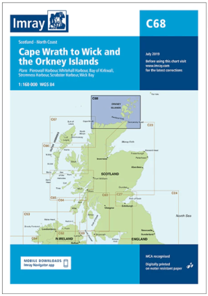
Passage kaart C068 Cape Wrath tot Wick en de Orkney-eilanden • 9781846239298
PassagekaartCape Wrath tot Wick en de Orkney-eilanden - Imray (F&B) Productomschrijving: De noordkust van Schotland van Cape Wrath tot Wick, inclusief de Pentland Firth en de Orkney-eilanden. Grotere schaalplannen van Pierowall, Kirkwall, Whitehall Harbour, Wick Bay, Stromness en Scrabster. Op schaal 1: 160.000 De Imray Charts C-serie bestrijken vaargebieden in Noordwest-Europa, en…
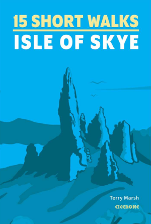
Wandelgids 15 Short Walks on the Isle of Skye - Cicerone Press • 9781786312334
15 Short Walks on the Isle of Skye - Cicerone Productomschrijving: Would you like to explore the best of the Isle of Skye? This guidebook covers 15 of the best short walks in the area (all under three hours), including the Old Man of Storr, the Quiraing pinnacles, Rubha Hunish and the Fairy Pools. Why choose this guidebook? - Easy to moderate walks suitable for almost everyone -…
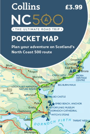
Landkaart Wegenkaart Schotlands North Coast 500 pocket map • 9780008780432
Wegenkaart Schotlands North Coast NC 500 pocket map Productomschrijving: Explore new places with handy pocket maps from Harper Collins. Handy little full colour map of the popular North Coast 500 route. A perfect guide for travelling around Northern Scotland. Detailed mapping and tourist information ideal for any road trip. Main features of this map include: • Clear mapping • T…
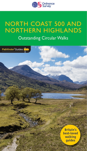
Wandelgids 083 Pathfinder North Coast 500 & Northern Highlands • 9780319092095
Wandelgids North Coast 500 & Northern Highlands Productomschrijving: Enhance your North Coast 500 tour with the only walking guidebook featuring routes based on or accessible from Scotland’s ultimate road trip. Discover Britain’s remotest sandy beaches, Scotland’s most northerly munro, some of the oldest rocks on Earth and more with 28 breathtaking walks accessed from the North Coast 500 …
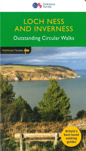
Wandelgids 030 Pathfinder guides Loch Ness & Iverness - OS • 9780319090817
Wandelgids Loch Ness & Iverness Schotland - OS Productomschrijving: The area covered by this guide centres on the Highland 'capital' of Inverness, and extends north and east along the shores of the Moray Firth, and south and west to Fort Augustus and Glen Affric, encompassing Caithness, eastern Sutherland, Easter Ross, the Black Isle, Moray and the banks of Loch Ness. With coastal wal…