

Wandelkaart 704 Flaming Gorge- Recreational Area - Utah
Een gebied rond het Flaming Gorge Reservoir

Korte omschrijving
Wandelkaarten Utah, USA van National Geographic. Ideaal voor tochten in Verenigde Staten van Amerika (USA).
TOPO Wandelkaart 704 - Flaming Gorge- Recreational Area - Nat Geo Productomschrijving: Het Flaming Gorge National Recreation Area is een gebied rond het Flaming Gorge Reservoir en de Green R...

Specificaties
- Uitgever: National Geographic
- ISBN-13: 9781566954143
- HOOFDCATEGORIEËN: Wandelkaart
- Auteur: National Geographic
- Regio: Utah, USA
- Land: Verenigde Staten van Amerika (USA)
- Regionale parken: Flaming Gorge recreational Area, Utah USA
- TOPO's & Stafkaarten: Topografisch wandelen
- Schaal: 1:75000
- Taal: Engels
Volledige omschrijving
TOPO Wandelkaart 704 - Flaming Gorge- Recreational Area - Nat Geo
Productomschrijving: Het Flaming Gorge National Recreation Area is een gebied rond het Flaming Gorge Reservoir en de Green River. Het ligt voor het grootste deel in het zuidwesten van de staat Wyoming en voor het overige deel in het noordoosten van de staat Utah van de Verenigde Staten. Deze National Recreation Area ligt ten zuidwesten van Rock Springs, ten noorden van Vernal, die ten zuidoosten ligt van de plaats Green River.
Engelse omschrijving: The red cliffs of the Green River's Flaming Gorge stretch from Wyoming's high deserts to the wooded slopes of Utah's Uinta Mountains. Expertly researched and created in partnership with local land management agencies, National Geographic's Trails Illustrated map of Flaming Gorge National Recreation Area provides an unparalleled tool for exploring this magnificent region. Some of the key areas of interest featured on this map include Lucerne Valley; Firehole Canyon; Sheep Creek Canyon Geological Area; Red Fleet and Steinaker state parks; and a portion of the Little Hole National Recreation Trail.
Designed with a wide range of visitors in mind, this map features detailed topography with contour lines, shaded relief and elevations; easy-to-read trails that are marked according to use; clearly defined, color-coded boundaries of state parks, wildlife areas, conservation areas, Indian reservations, and private land; and an accurate road network. If you're taking in the scenery by car, several scenic byways and backways are labeled including Flaming Gorge - Uintas, Flaming Gorge - Green River Basin, Sheep Creek Spirit Lake Loop, Sheep Creek Geologic Loop, and Browns Park. Some of the many recreation features noted include campgrounds, trailheads, interpretive trails, river access, boat launches, marinas, fishing access, and cross country ski areas. Every Trails Illustrated map is printed on "Backcountry Tough" waterproof, tear-resistant paper. A full UTM grid is printed on the map to aid with GPS navigation.
Other features found on this map include: Ashley National Forest, Black Mountain, Blacks Fork, Flaming Gorge Dam, Flattop Mountain, Marsh Peak, Uinta Mountains.

Locatie op kaart
Overzichtskaarten

NAT GEO Utah trail maps
NAT GEO Utah trail maps

Producten op de overzichtskaart
Klik op een product om naar de detailpagina te gaan.
- Wandelkaart 210 Canyonlands NP - Utah - Natgeo
- Wandelkaart 211 Arches National Park- Utah - Natgeo
- Wandelkaart 214 Zion National Park - Natgeo
- Wandelkaart 219 Bryce Canyon NP Utah - Natgeo
- Wandelkaart 267 Capitol Reef NP Utah - Natgeo
- Wandelkaart 702 Cedar Mountain - Utah USA - Nat Geo
- Wandelkaart 703 Manti-La Sal National forest - Natgeo
- Wandelkaart 704 Flaming Gorge- Recreational Area - Utah
- Wandelkaart 705 Mount Dutton & Aquarius Plateau - Nat Geo
- Wandelkaart 213 Glen Canyon & Capitol Reef NP - Nat Geo
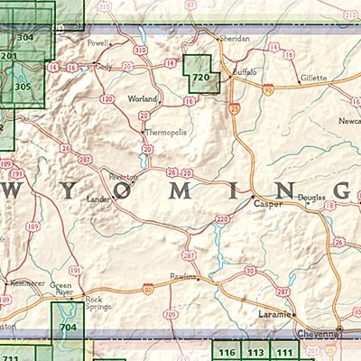
NAT GEO Wyoming trail map
NAT GEO Wyoming trail map

Producten op de overzichtskaart
Klik op een product om naar de detailpagina te gaan.
- Wandelkaart 201 Yellowstone NP- Wyoming - Nat Geo
- Wandelkaart 202 Grand Teton NP- Wyoming - Nat Geo
- Wandelkaart 302 Yellowstone NP & Old Faithful - Nat Geo
- Wandelkaart 303 Mammoth Hot Springs- Yellowstone - Nat Geo
- Wandelkaart 304 Tower & Canyon Yellowstone NP - Nat Geo
- Wandelkaart 305 Yellowstone Lake - Yellowstone NP - Nat Geo
- Wandelkaart 704 Flaming Gorge- Recreational Area - Utah
Artikelen uit dezelfde regio
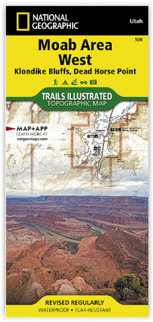
Wandelkaart 506 Moab West - Klondike Bluffs & Dead Horse Point • 9781566959018
Wandelkaart Moab West - Klondike Bluffs & Dead Horse Point Productomschrijving: Deze kaart omvat het westelijke gedeelte van het grote Moab recreatie gebied van het befamde National Geographic's Trails Illustrated. De kaart biedt een overzicht genummerd 506 op onderstaande kaart van het gebied. Het gebied omvat 3 kaarten met nummers, 505, 506 & 507. De 505 is de kaart die alles in één keer…
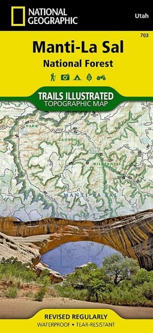
Wandelkaart 703 Manti-La Sal National forest - Natgeo • 9781566953771
TOPO Wandelkaart 703 - Manti-La Sal National forest - Nat Geo Productomschrijving: Het Manti–La Sal National Forest omvat meer dan 4,900 km, en is gelegen in centraal- en zuidoostelijke deel van Utah en het extreme westelijke deel van Colorado. Engelse omschrijving: Expertly researched and created in cooperation with the U.S. Forest Service, Bureau of Land Management and others, Natio…

Wandelkaart 211 Arches National Park- Utah - Natgeo • 9781566953276
TOPO Wandelkaart 211 - Trails Illustrated Arches NP - Utah Productomschrijving: Het Arches National Park is een iets kleiner exemplaar onder die van Amerika vergeleken uiteraard. Het Park is beroemd omwille van de vele speciale rotsformaties en balancerende rotsen zoals de Courthouse Towers, Windows Section, Fiery Furnace, Devils Garden, Klondike Bluffs en de Balanced Rock. Er zijn meer da…

Wandelkaart 700 Ogden- Monte Cristo Range Utah USA - Nat Geo • 9781566956345
Ogden- Monte Cristo Range- Utah USA - Nat Geo Productomschrijving: Outdoor enthousiastelingen die willen genieten van de grenzeloze recreatieve mogelijkheden in het noorden van Utah net ten oosten van Great Salt Lake zullen zich vergapen aan National Geographic's Trails Illustrated kaart van Ogden en de Monte Cristo Range. Ontworpen met een breed scala van bezoekers in het achterhoofd, wer…
Reisgids Californië- Arizona- Nevada & Utah - Gottmer • 9789025779139
Californië- Arizona- Nevada & Utah van Gottmer Productomschrijving: Of je nu nieuwsgierig bent naar cultuurbepalende wereldsteden als San Francisco en Los Angeles dan wel je juist graag terugtrekt in de natuur: de zuidwestelijke hoek van de VS is voor iedereen een gebied vol hoogtepunten. Californië trekt het grootste aantal bezoekers, gevolgd door de Grand Canyon in Arizona, de nationale …