

Wandelkaart 210 Canyonlands NP - Utah - Natgeo
Gelegen in het Zuidoosten van Utah- dichtbij de stad Moab

Korte omschrijving
Wandelkaarten Utah, USA van National Geographic. Ideaal voor tochten in Verenigde Staten van Amerika (USA).
TOPO Wandelkaart 210 - Canyonlands NP - Utah - Nat geo Productomschrijving: Canyonlands National Park is een Amerikaans nationaal park gelegen in het Zuidoosten van Utah, dichtbij de stad M...

Specificaties
- Uitgever: National Geographic
- ISBN-13: 9781566953269
- HOOFDCATEGORIEËN: Wandelkaart
- Activiteiten: Wandelen, Hiking & Trekking
- Auteur: National Geographic
- Regio: Utah, USA
- Land: Verenigde Staten van Amerika (USA)
- Nationale parken: Canyonlands NP, Utah USA
- TOPO's & Stafkaarten: Topografisch wandelen
- Schaal: 1:70000
- Taal: Engels
Volledige omschrijving
TOPO Wandelkaart 210 - Canyonlands NP - Utah - Nat geo
Productomschrijving: Canyonlands National Park is een Amerikaans nationaal park gelegen in het Zuidoosten van Utah, dichtbij de stad Moab. Het park omvat een kleurrijk landschap, geerodeerd in verschillende canyons door het water van de Colorado River. The park is verdeeld in 4 districten: the Island in the Sky District, the Needles district, the Maze district, en the combined rivers—the Green & Colorado rivieren
Engelse omschrijving: National Geographic's Trails Illustrated map of Canyonlands National Park is designed to meet the needs of outdoor enthusiasts by combining valuable information with unmatched detail of this mesmerizing landscape of river canyons and fantastically formed buttes. Expertly researched and created in partnership with local land management agencies, this map is loaded with helpful information on the park's archaeology, Glen Canyon, Horseshoe Canyon, backcountry safety, park regulations and more. Key areas of interest featured on this map include Canyon Rims Recreation Area; Glen Canyon National Recreation Area; the Island in the Sky district; the Needles district; and the Maze district.
With miles of clearly marked trails that include mileages between intersections, this map will prove invaluable in your exploration of the park. River mileage on the Colorado and Green rivers is noted as well, for those exploring the winding river canyons by boat. Some of the many recreation features include visitor centers, campgrounds, points of interest, scenic overlooks, and boat launch sites. The map base includes contour lines and elevations for summits and passes. Every Trails Illustrated map is printed on "Backcountry Tough" waterproof, tear-resistant paper. A full UTM grid is printed on the map to aid with GPS navigation.
Other features found on this map include: Canyonlands National Park, Glen Canyon National Recreation Area, Green River, Orange Cliffs, Soda Springs Basin.
Locatie op kaart
Gekoppelde artikelen
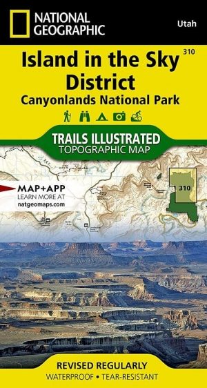
Wandelkaart 310 Canyonlands NP - Island in the Sky District • 9781566954600
standaard versieTOPO Wandelkaart 310 -Canyonlands NP - Island in the Sky District Productomschrijving: Canyonlands National Park is een Amerikaans nationaal park gelegen in het Zuidoosten van Utah, dichtbij de stad Moab. Het park omvat een kleurrijk landschap, geerodeerd in verschillende canyons door het water van de Colorado River. Het park is verdeeld in 4 districten: the Island in the Sky District, the…
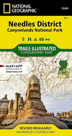
Wandelkaart 311 Canyonlands NP - Needles District - Natgeo • 9781566954617
standaard versieTOPO Wandelkaart 311 - Canyonlands NP - Needles District Productomschrijving: Canyonlands National Park is een Amerikaans nationaal park gelegen in het Zuidoosten van Utah, dichtbij de stad Moab. Het park omvat een kleurrijk landschap, geerodeerd in verschillende canyons door het water van de Colorado River. Het park is verdeeld in 4 districten: the Island in the Sky District, the Needles …
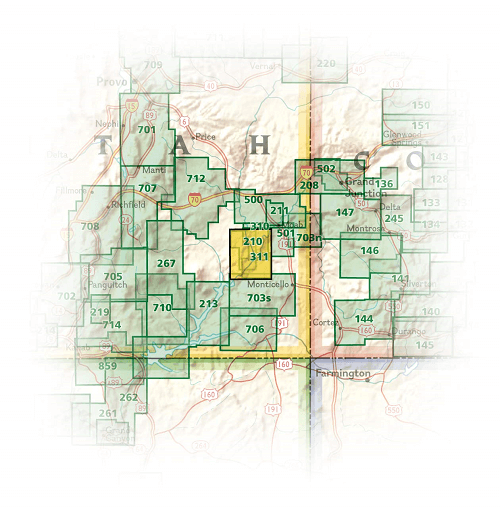
Overzichtskaarten

NAT GEO Utah trail maps
NAT GEO Utah trail maps

Producten op de overzichtskaart
Klik op een product om naar de detailpagina te gaan.
- Wandelkaart 210 Canyonlands NP - Utah - Natgeo
- Wandelkaart 211 Arches National Park- Utah - Natgeo
- Wandelkaart 214 Zion National Park - Natgeo
- Wandelkaart 219 Bryce Canyon NP Utah - Natgeo
- Wandelkaart 267 Capitol Reef NP Utah - Natgeo
- Wandelkaart 702 Cedar Mountain - Utah USA - Nat Geo
- Wandelkaart 703 Manti-La Sal National forest - Natgeo
- Wandelkaart 704 Flaming Gorge- Recreational Area - Utah
- Wandelkaart 705 Mount Dutton & Aquarius Plateau - Nat Geo
- Wandelkaart 213 Glen Canyon & Capitol Reef NP - Nat Geo
Artikelen uit dezelfde regio

Wandelkaart 714 Grand Staircase - Natgeo • 9781566956864
TOPO Wandelkaart 714 - Grand Staircase - Utah - Nat Geo Productomschrijving: Grand Staircase-Escalante National Monument is een gebied van 7571 km² in het zuiden van Utah in de Verenigde Staten. Er zijn drie belangrijke gebieden: de Grand Staircase, het Kaiparowits Plateau, en de Canyons van de Escalante. Engelse omschrijving: Outdoor enthusiasts seeking to enjoy the abundance of publ…
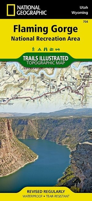
Wandelkaart 704 Flaming Gorge- Recreational Area - Utah • 9781566954143
TOPO Wandelkaart 704 - Flaming Gorge- Recreational Area - Nat Geo Productomschrijving: Het Flaming Gorge National Recreation Area is een gebied rond het Flaming Gorge Reservoir en de Green River. Het ligt voor het grootste deel in het zuidwesten van de staat Wyoming en voor het overige deel in het noordoosten van de staat Utah van de Verenigde Staten. Deze National Recreation Area ligt ten…
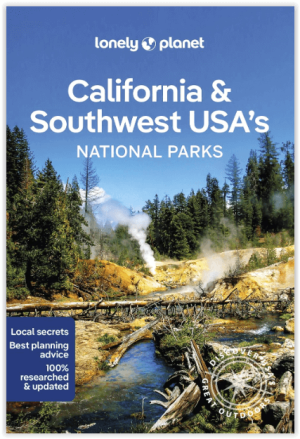
Wandelgids California & Southwest USA's NP's - Lonely Planet • 9781838696061
Wandelgids California & Southwest USA's National Parks Productomschrijving: Lonely Planet's California and Southwest USA's National Parks is uw paspoort voor het meest actuele advies over wat je moet zien en overslaan. Wandel door de Grand Canyon, bewonder Sequoia en jaag op watervallen in Yosemite; allemaal met je vertrouwde reisgenoot. Duik in het hart van de nationale parken van Califor…

Wandelkaart 267 Capitol Reef NP Utah - Natgeo • 9781566956703
Wandelkaart Capitol Reef NP Utah - Nat Geo Productomschrijving: Capitol Reef National Park is een verborgen juweel gelegen in de Waterpocket Fold, een rimpel in de aarde die zich uitstrekt bijna 100 mijl door het zuiden-centrale rode rots land van Utah. National Geographic's Trails Illustrated kaart van Capitol Reef biedt ongeëvenaarde details van het park om tegemoet te komen aan de behoe…
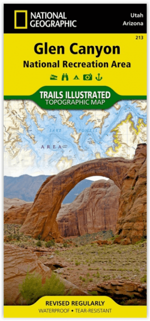
Wandelkaart 213 Glen Canyon & Capitol Reef NP - Nat Geo • 9781566953436
Wandelkaart Glen Canyon & Capitol Reef NP - Nat Geo Omvat: Bullfrog Creek, Cataract Canyon, Dirty Devil River, Escalante River, Glen Canyon, Glen Canyon Dam, Glen Canyon National Recreation Area, Kaibito Creek, Lake Powell, Mount Hillers, Navajo Creek, Paria River, Rainbow Plateau, Red Canyon, San Juan River, Smoky Mountain, Wahweap Creek, Wilson Mesa. Engelse omschrijving: Let Nationa…