

Wandelkaart 213 Glen Canyon & Capitol Reef NP - Nat Geo
Glen Canyon National Recreation Area & Capitol Reef NP

Korte omschrijving
Wandelkaarten Arizona, USA en Utah, USA van National Geographic. Ideaal voor tochten in Verenigde Staten van Amerika (USA).
Wandelkaart Glen Canyon & Capitol Reef NP - Nat Geo Omvat: Bullfrog Creek, Cataract Canyon, Dirty Devil River, Escalante River, Glen Canyon, Glen Canyon Dam, Glen Canyon National Recreation ...

Specificaties
- Uitgever: National Geographic
- ISBN-13: 9781566953436
- HOOFDCATEGORIEËN: Wandelkaart
- Activiteiten: Wandelen, Hiking & Trekking
- Auteur: National Geographic
- Regio: Arizona, USA, Utah, USA
- Land: Verenigde Staten van Amerika (USA)
- Waterafstotende kaart: Nat Geo waterproof series
- Nationale parken: Capitol Reef NP, Utah USA
- Schaal: 1:90000
- Taal: Engels
Volledige omschrijving
Wandelkaart Glen Canyon & Capitol Reef NP - Nat Geo
Omvat: Bullfrog Creek, Cataract Canyon, Dirty Devil River, Escalante River, Glen Canyon, Glen Canyon Dam, Glen Canyon National Recreation Area, Kaibito Creek, Lake Powell, Mount Hillers, Navajo Creek, Paria River, Rainbow Plateau, Red Canyon, San Juan River, Smoky Mountain, Wahweap Creek, Wilson Mesa.
Engelse omschrijving: Let National Geographic's Trails Illustrated map of Glen Canyon National Recreation Area guide you over the hundreds of miles and 1.2 million acres of this historic, scenic and recreation rich area. Expertly researched and created in cooperation with the National Park Service and others, the map provides unparalleled detail of many popular points of interest, including Lake Powell, Colorado River, Antelope Island, Rainbow Bridge National Monument, Navajo Indian Reservation, Vermilion Cliffs National Monument and Trail of the Ancients Scenic Byway.
Since the recreation area has no maintained trails, you can navigate the area with the help of the map's detailed topography, including shaded relief, contour lines, elevations, labeled peaks and water features. For those who prefer to explore the area by water, Lake Powell is shown with bathymetric shading and contour lines along with correctly positioned and numbered buoys. Additionally, descriptions of Lake Powell marinas is provided along with their contact information. Other recreation features include boat and kayak launch points, campgrounds and scenic views.
Every Trails Illustrated map is printed on "Backcountry Tough" waterproof, tear-resistant paper. A full UTM grid is printed on the map to aid with GPS navigation.
Locatie op kaart
Overzichtskaarten

NAT GEO Utah trail maps
NAT GEO Utah trail maps

Producten op de overzichtskaart
Klik op een product om naar de detailpagina te gaan.
- Wandelkaart 210 Canyonlands NP - Utah - Natgeo
- Wandelkaart 211 Arches National Park- Utah - Natgeo
- Wandelkaart 214 Zion National Park - Natgeo
- Wandelkaart 219 Bryce Canyon NP Utah - Natgeo
- Wandelkaart 267 Capitol Reef NP Utah - Natgeo
- Wandelkaart 702 Cedar Mountain - Utah USA - Nat Geo
- Wandelkaart 703 Manti-La Sal National forest - Natgeo
- Wandelkaart 704 Flaming Gorge- Recreational Area - Utah
- Wandelkaart 705 Mount Dutton & Aquarius Plateau - Nat Geo
- Wandelkaart 213 Glen Canyon & Capitol Reef NP - Nat Geo
Artikelen uit dezelfde regio
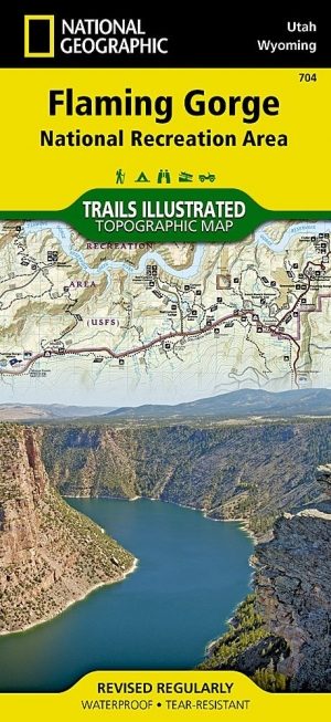
Wandelkaart 704 Flaming Gorge- Recreational Area - Utah • 9781566954143
TOPO Wandelkaart 704 - Flaming Gorge- Recreational Area - Nat Geo Productomschrijving: Het Flaming Gorge National Recreation Area is een gebied rond het Flaming Gorge Reservoir en de Green River. Het ligt voor het grootste deel in het zuidwesten van de staat Wyoming en voor het overige deel in het noordoosten van de staat Utah van de Verenigde Staten. Deze National Recreation Area ligt ten…

Wandelkaart 214 Zion National Park - Natgeo • 9781566952972
Wandelkaart Zion National Park - Nat Geo Productomschrijving: Ontdek de schoonheid en het geologische wonder van Utah's aller eerste nationale park met National Geographic's Trails Illustrated kaart van Zion National Park. Deze deskundige kaart combineert ongeëvenaarde details met nuttige informatie om u te helpen het meeste uit uw bezoek te halen, inclusief een kaart met details over de b…

Reisgids Arizona & the Grand Canyon - Insight Guides ENG • 9781780052915
Reisgids Arizona & the Grand Canyon - Insight Guides Productomschrijving: From deciding when to go, to choosing what to see when youarrive, this Insight Guides book is allyou need to plan your trip and experience the best of Arizona and the GrandCanyon, with in-depth insider information on must-see, top attractions like Monument Valley, and hidden cultural gems like Tempe Center for the Ar…
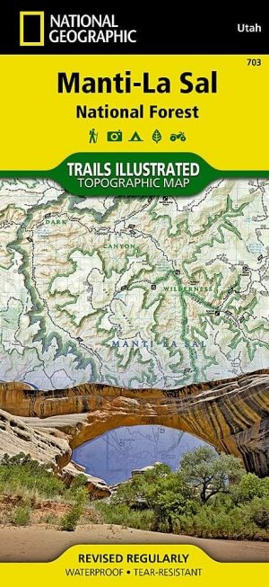
Wandelkaart 703 Manti-La Sal National forest - Natgeo • 9781566953771
TOPO Wandelkaart 703 - Manti-La Sal National forest - Nat Geo Productomschrijving: Het Manti–La Sal National Forest omvat meer dan 4,900 km, en is gelegen in centraal- en zuidoostelijke deel van Utah en het extreme westelijke deel van Colorado. Engelse omschrijving: Expertly researched and created in cooperation with the U.S. Forest Service, Bureau of Land Management and others, Natio…

Landkaart Wegenkaart Arizona State Guide Map - Nat Geo • 9781597750868
Wegenkaart Arizona State Guide Map - Nat Geo Productomschrijving: Combining a comprehensive road map with a convenient travel guide, National Geographic's Arizona Guide Map is an essential travel companion for all visitors. The main map's road network is complemented by a user friendly index of counties, cities and towns. Clear designations are given for free access and toll roads; interst…