

Wandelkaart 702 Cedar Mountain - Utah USA - Nat Geo
Pine Valley Mountain - Dixie National Forest

Korte omschrijving
Wandelkaarten Utah, USA van National Geographic. Ideaal voor tochten in Verenigde Staten van Amerika (USA).
Wandelkaart Cedar Mountain - Utah USA - Nat Geo Omvat: Ashdown Gorge Wilderness, Brian Head, Dixie National Forest, Kolob Terrace, Little Salt Lake, Markagunt Plateau, Panguitch Lake, Parowa...

Specificaties
- Uitgever: National Geographic
- ISBN-13: 9781566953061
- HOOFDCATEGORIEËN: Wandelkaart
- Activiteiten: Wandelen, Hiking & Trekking
- Auteur: National Geographic
- Regio: Utah, USA
- Land: Verenigde Staten van Amerika (USA)
- Waterafstotende kaart: Nat Geo waterproof series
- Schaal: 1:75000
- Taal: Engels
Volledige omschrijving
Wandelkaart Cedar Mountain - Utah USA - Nat Geo
Omvat: Ashdown Gorge Wilderness, Brian Head, Dixie National Forest, Kolob Terrace, Little Salt Lake, Markagunt Plateau, Panguitch Lake, Parowan Valley, Pine Valley Mountain Wilderness, Pine Valley Mountains, Signal Peak.
Engelse omschrijving: Cedar City is the headquarters of the Dixie National Forest which is a two-million-acre, 170-mile stretch of breathtaking wilderness across southern Utah. This map covers the Markagunt OHV Trail System from the stunning Pink Cliffs in the South to the Parowon Valley Northwest to the town of Panguitch in the East, and the spectacular Markagunt Plateau Scenic Drive—a 123-mile trail from Cedar City to Parowan.
Also featured are Cedar Breaks National Monument—with meadows at 10,000 feet and stunning nights for stargazing—as well as the shallow Navajo Lake, ideal for fishing, swimming, and boating, and the red limestone Hurricane Cliffs.
The area offers boundless outdoor recreation opportunities, from hiking, hunting, and horseback riding to skiing, swimming, and scenic driving—for all seasons, and a wide range of visitors. Recreation features are clearly marked, including trailheads, campgrounds, boat launches, mountain bike routes, ATV trails, downhill ski areas, scenic overlooks, and points of interest. The map includes contour lines, shaded relief, and elevations for summits and passes, as well as safety tips, visitor centers and ranger stations, and contact information for local agencies.
The printed map contains an inset showing greater detail of the popular Brian Head Ski Area and Cedar Breaks National Monument.
Every Trails Illustrated map is printed on "Backcountry Tough" waterproof, tear-resistant paper. A full UTM grid is printed on the map to aid with GPS navigation.
Other features found on this map include: Ashdown Gorge Wilderness, Brian Head, Dixie National Forest, Kolob Terrace, Little Salt Lake, Markagunt Plateau, Panguitch Lake, Parowan Valley, Pine Valley Mountain Wilderness, Pine Valley Mountains, Signal Peak.
Locatie op kaart
Overzichtskaarten

NAT GEO Utah trail maps
NAT GEO Utah trail maps

Producten op de overzichtskaart
Klik op een product om naar de detailpagina te gaan.
- Wandelkaart 210 Canyonlands NP - Utah - Natgeo
- Wandelkaart 211 Arches National Park- Utah - Natgeo
- Wandelkaart 214 Zion National Park - Natgeo
- Wandelkaart 219 Bryce Canyon NP Utah - Natgeo
- Wandelkaart 267 Capitol Reef NP Utah - Natgeo
- Wandelkaart 702 Cedar Mountain - Utah USA - Nat Geo
- Wandelkaart 703 Manti-La Sal National forest - Natgeo
- Wandelkaart 704 Flaming Gorge- Recreational Area - Utah
- Wandelkaart 705 Mount Dutton & Aquarius Plateau - Nat Geo
- Wandelkaart 213 Glen Canyon & Capitol Reef NP - Nat Geo
Artikelen uit dezelfde regio
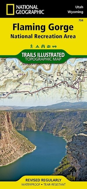
Wandelkaart 704 Flaming Gorge- Recreational Area - Utah • 9781566954143
TOPO Wandelkaart 704 - Flaming Gorge- Recreational Area - Nat Geo Productomschrijving: Het Flaming Gorge National Recreation Area is een gebied rond het Flaming Gorge Reservoir en de Green River. Het ligt voor het grootste deel in het zuidwesten van de staat Wyoming en voor het overige deel in het noordoosten van de staat Utah van de Verenigde Staten. Deze National Recreation Area ligt ten…

Wandelkaart 709 Wasatch Front North Utah - Nat Geo • 9781566953702
Wasatch Front North - Utah - Nat Geo Omvat: Bountiful, Centerville, Cottonwood Heights, Currant Creek Peak, Daniels Canyon, Deer Creek Reservoir, Draper, Highland, Holladay, Lindon, Lone Peak Wilderness, Midvale, Mount Olympus Wilderness, Mount Timpanogos, Mount Timpanogos Wilderness, Murray, North Salt Lake, Orem, Pleasant Grove, Provo, Provo River, Rockport Lake, Salt Lake City, South Sa…
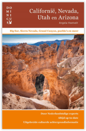
Reisgids Californië- Arizona- Nevada & Utah - Gottmer • 9789025779139
Californië- Arizona- Nevada & Utah van Gottmer Productomschrijving: Of je nu nieuwsgierig bent naar cultuurbepalende wereldsteden als San Francisco en Los Angeles dan wel je juist graag terugtrekt in de natuur: de zuidwestelijke hoek van de VS is voor iedereen een gebied vol hoogtepunten. Californië trekt het grootste aantal bezoekers, gevolgd door de Grand Canyon in Arizona, de nationale …
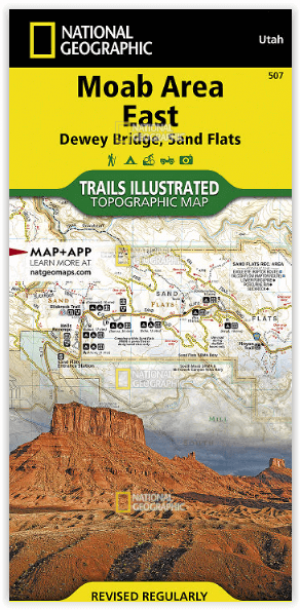
Wandelkaart 507 Moab Oost - Dewey Bridge & Sand Flats - Nat Geo • 9781566959025
Wandelkaart Moab Oost - Dewey Bridge & Sand Flats - Nat Geo Productomschrijving: Deze kaart omvat het Oostelijke gedeelte van het grote Moab recreatie gebied van het befamde National Geographic's Trails Illustrated. De kaart biedt een overzicht genummerd 507 op onderstaande kaart van het gebied. Het gebied omvat 3 kaarten met nummers, 505, 506 & 507. De 505 is de kaart die alles in één kee…
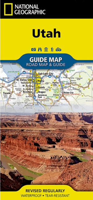
Landkaart Wegenkaart Utah State guide map - Nat Geo • 9781566957236
Wegenkaart Utah State guide map - Nat Geo Productomschrijving: National Geographic's Utah Guide Map is designed to meet the needs of all travelers with by combining a detailed and accurate road map with and an expertly researched travel guide. Find your destination quickly using the user friendly index of cities and towns. Then plan your route on the comprehensive road map, complete with r…