

Landkaart Wegenkaart 05 Midlands & Engeland Centraal - AA Road
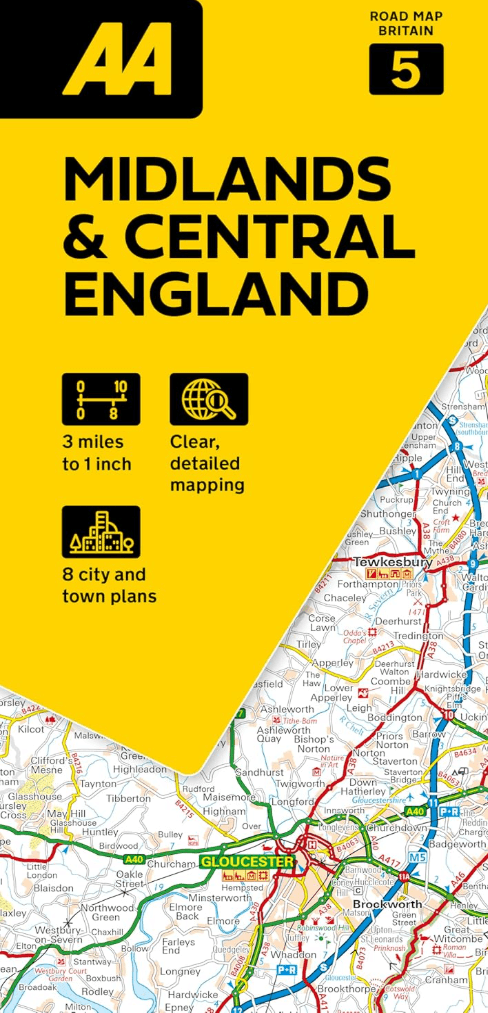
Road Map Midlands & Central England
Korte omschrijving
Wegenkaart 05 Midlands & Engeland Centraal - AA Road Maps Productomschrijving: AA Road Map Midlands & Central England is a practical and slimline, foldable map from the experts at the AA. En...

Specificaties
- Uitgever: AA Publishing
- ISBN-13: 9780749584689
- HOOFDCATEGORIEËN: Wegenkaart - Landkaart
- Activiteiten: Street/Road maps & city plans
- Regio: Midlands, England
- Land: England
- Schaal: 1:200000
- Taal: Engels
- Reeks/Serie: AA Road maps Britain
Volledige omschrijving
Wegenkaart 05 Midlands & Engeland Centraal - AA Road Maps
Productomschrijving: AA Road Map Midlands & Central England is a practical and slimline, foldable map from the experts at the AA. Encased in a durable, weatherproof cover, the mapping is produced at a scale of 3 miles to 1 inch (1:200,000 / 2km to 1cm) combining clear design, an easy-to-read scale and more road detail to ensure that you never lose your way.
Also included are toll points, service areas, road numbers, motorways, dual carriageways and wide narrow local roads, National Parks and other places of interest.
• Fully updated speed camera locations, plus speed cameras with speed limits shown
• Clear place name index
• 8 city and town plans
• Caravan & camping sites are pinpointed on the mapping
• National Parks and places of interest are also highlighted
• National Trust, English Heritage, Scottish and Welsh Heritage sites shown
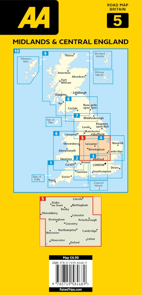
Road Map Midlands & Central England is one in a series of expertly produced road maps of Britain from the AA.
Overzichtskaarten

Wegenkaarten Landkaarten Road Maps Britain 1 > 10
Wegenkaarten Landkaarten Road Maps Britain 1 > 10
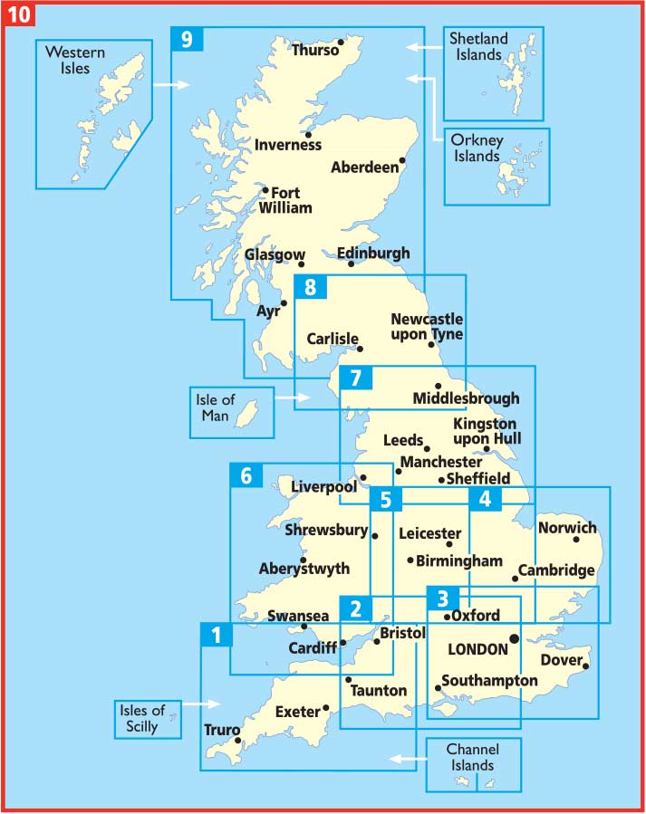
Producten op de overzichtskaart
Klik op een product om naar de detailpagina te gaan.
- Landkaart Wegenkaart 01 West Country & Wales Zuid - AA Road Maps
- Landkaart Wegenkaart 02 Engeland, Centraal Zuid - AA Road Maps
- Landkaart Wegenkaart 03 Engeland Zuid Oost - AA Road Maps
- Landkaart Wegenkaart 04 East Anglia - AA Road Maps
- Landkaart Wegenkaart 05 Midlands & Engeland Centraal - AA Road
- Landkaart Wegenkaart 06 Wales - AA Road Maps
- Landkaart Wegenkaart 07 Engeland Noord - AA Road Maps
- Landkaart Wegenkaart 08 Engeland Noord & Scottish Borders
- Landkaart Wegenkaart 09 Schotland - AA Road Map
- Landkaart Wegenkaart 10 Groot-Brittannië - AA Road Map
Artikelen uit dezelfde regio

Wandelgids White Peak walks Southern Dales - Cicerone • 9781852845186
Wandelgids - White Peak walks Southern Dales - Cicerone Productomschrijving: Deze gids gaat over wandelen in de zuidelijke dales van de witte piekoppervlakte van het Peak District, tussen Ashbourne, Matlock, Buxton en Leek. 30 gemakkelijke circulaire routes doorsteken de hoge plateau en volgen de Dove, Manifold en Hamps rivieren door de dales in het UK's eerste Nationaal Park. Eén van twee…

Landkaart Wegenkaart 5 Midlands Oost & East Anglia - OSI • 9780319263778
Wegenkaart Midlands Oost & East Anglia - OSI Productomschrijving: Plan your journey with this series of road maps from OS. Showing all major road, rail and ferry links as well as settlements and selected features in 1: 250 000 scale, this is the ideal map for planning trips and holidays by car or cycle. OS Road 5 covers: the East Midlands, including the Norfolk and the Thames Estuary.…

Landkaart Wegenkaart 6 Wales & Midlands West - OSI • 9780319263785
Wegenkaart Wales & Midlands West - OSI Productomschrijving: Plan your journey with this series of road maps from OS. Showing all major road, rail and ferry links as well as settlements and selected features in 1: 250 000 scale, this is the ideal map for planning trips and holidays by car or cycle. OS Road 6 covers: the Wales plus the West Midlands.

Wandelkaart Cotswold Way - Harvey maps • 9781851374182
Wandelkaart Cotswold Way - Chipping Campden to Bath - Harvey maps Productomschrijving: Toont de gehele 166km (103miles) van The Cotswold Way, door de Cotswolds van Chipping Campden naar Bath, Broadway, Winchcombe, Stroud, Wooton-under-Edge en Chipping Sodbury passeren. Informatie over het vinden van accommodatie, camping, voedsel. Routebeschrijving naar het begin. Ook Ranger Service en…
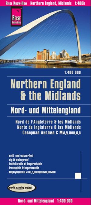
Landkaart Wegenkaart Engeland Noord & Midlands - Reise Know-How • 9783831774364
Wegenkaart Engeland Noord & Midlands - Reise Know-How Productomschrijving: De Reise Know-How wegenkaart van Engeland Noord & Midlands is een betrouwbare, gedetailleerde en duurzame landkaart voor wie Engeland Noord & Midlands zelfstandig wil verkennen. Deze hoogwaardige reiskaart is ideaal voor gebruik tijdens een rondreis met de auto, camper, motor of fiets en biedt alle informatie die j…