

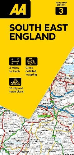
Landkaart Wegenkaart 03 Engeland Zuid Oost - AA Road Maps
South East England
Korte omschrijving
Wegenkaart 03 Engeland Zuid Oost - AA Road Maps Productomschrijving: AA Road Map South East England is a practical and slimline, foldable map from the experts at the AA. Encased in a durable...

Specificaties
- Uitgever: AA Publishing
- ISBN-13: 9780749584665
- HOOFDCATEGORIEËN: Wegenkaart - Landkaart
- Activiteiten: Street/Road maps & city plans
- Regio: South & South East England
- Land: England
- Schaal: 1:200000
- Taal: Engels
- Reeks/Serie: AA Road maps Britain
Volledige omschrijving
Wegenkaart 03 Engeland Zuid Oost - AA Road Maps
Productomschrijving: AA Road Map South East England is a practical and slimline, foldable map from the experts at the AA. Encased in a durable, weatherproof cover, the mapping is produced at a scale of 3 miles to 1 inch (1:200,000 / 2km to 1cm) combining clear design, an easy-to-read scale and more road detail to ensure that you never lose your way.
Also included are toll points, service areas, road numbers, motorways, dual carriageways and wide narrow local roads, National Parks and other places of interest.
•Fully updated speed camera locations, plus speed cameras with speed limits shown
•Clear place name index
•10 city and town plans
•Caravan & camping sites are pinpointed on the mapping
•National Parks and places of interest are also highlighted
•National Trust, English Heritage, Scottish and Welsh Heritage sites shown
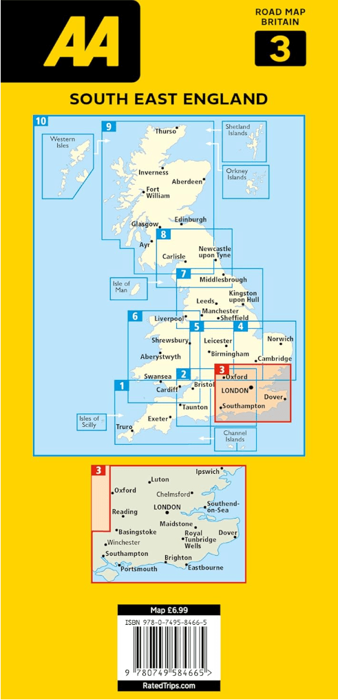
Road Map South East England is one in a series of expertly produced road maps of Britain from the AA.
Overzichtskaarten

Wegenkaarten Landkaarten Road Maps Britain 1 > 10
Wegenkaarten Landkaarten Road Maps Britain 1 > 10
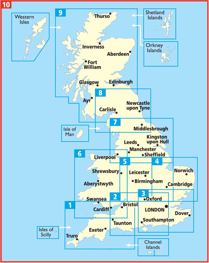
Producten op de overzichtskaart
Klik op een product om naar de detailpagina te gaan.
- Landkaart Wegenkaart 01 West Country & Wales Zuid - AA Road Maps
- Landkaart Wegenkaart 02 Engeland, Centraal Zuid - AA Road Maps
- Landkaart Wegenkaart 03 Engeland Zuid Oost - AA Road Maps
- Landkaart Wegenkaart 04 East Anglia - AA Road Maps
- Landkaart Wegenkaart 05 Midlands & Engeland Centraal - AA Road
- Landkaart Wegenkaart 06 Wales - AA Road Maps
- Landkaart Wegenkaart 07 Engeland Noord - AA Road Maps
- Landkaart Wegenkaart 08 Engeland Noord & Scottish Borders
- Landkaart Wegenkaart 09 Schotland - AA Road Map
- Landkaart Wegenkaart 10 Groot-Brittannië - AA Road Map
Artikelen uit dezelfde regio
Reisgids Country guide Sud de l'Angleterre - Petit Futé • 9782305122274
Reisgids Sud de l'Angleterre - Petit Futé Productomschrijving: La série télévisée britannique à succès Broadchurch a jeté un coup de projecteur sur cette destination si proche de la France et qui n'a rien a envier à nos cotes normandes. Partir pour le Sud de l'Angleterre, c'est découvrir Londres, bien sur, mais aussi la Manche, située à quelques kilomètres de la capitale, et le Sussex…

Wandelgids Thames Valley walking guide - Cicerone • 9781852845704
Wandelgids - Thames Valley walking guide - Cicerone Productomschrijving: Deze handige gids biedt 25 avontuurlijke dagwandelingen in de Thames Valley, die betrekking hebben op de North Hampshire Downs, Berkshire en de zuidelijke Chilterns met gemakkelijke toegang tot Londen. De circulaire wandelingen variëren van 10 tot 18 mijl, waaronder een twee-daagse trot, evenals kortere route opties v…

Wandelgids The Kennet and Avon Canal walk - Cicerone • 9781786312303
The Kennet and Avon Canal walk - Cicerone Productomschrijving: Wandelgids langs het Kennet & Avon kanaal. De 151 Km lange route van Reading naar Bristol is verdeeld in 7 etappes van redelijk gemakkelijke wandelingen en omvat het UNESCO werelderfgoed Bath en de drijvende haven van Bristol. Er zijn ook 20 rondwandelingen opgenomen, variërend van 4¼ tot 9 mijl, waarbij de beste delen van het …
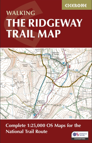
The Ridgeway Map Booklet - Cicerone Press • 9781786312921
The Ridgeway Map Booklet - Cicerone Engelse Productomschrijving: Map of the 87 mile (139km) Ridgeway National Trail through the south of England from Avebury in Wiltshire to Ivinghoe Beacon in Buckinghamshire. This booklet is included with the Cicerone guidebook to the trail, and shows the full route on Ordnance Survey 1:25,000 maps. Presented in 12 stages in the guidebook, the trail typic…

Wandelkaart OL22 New Forest- Southampton & Ringwood - OSI • 9780319475782
Wandelkaart New Forest national park - Southampton - OSI Productomschrijving: Kaart nummer OL22 in de OS Explorer kaartenserie is de perfecte kaart voor vakantiegangers en dagjesmensen om te gebruiken bij een bezoek aan het New Forest Nationaal Park in West Engeland. Het nationale park is beroemd om zijn uitstekende wandelingen en ritten en is de thuisbasis van New Forest pony's en heidela…