


HOOFDCATEGORIEËN
Activiteiten
Kamperen
Fietsen
VTT / MTB
Klimmen
Auteur:
Land
Regio
Reeks/Serie:
Taal
Schaal
Wandkaarten & Planokaarten
Techniekgidsen
Lange afstand wandelroutes
Nationale parken
Regionale parken
Bedevaart routes
TOPO's & Stafkaarten
Toepasselijke bergketen
Waterafstotende kaart
Specialiteiten
De Franse Regio's
De Italiaanse Regio's
De Griekse Eilanden
De Scandinavische Landen
De beroemdste Eilandengroepen
De Engelse Graafschappen
Eurovélo-Routes
Grote Eilanden
Iconische Wandelroutes
Historische wandelroutes
Scotlands Great Trails
National Trails UK, England & Wales
De Nationale Parken
UNESCO werelderfgoed
Uitgever

 Wandelen in Engeland
Wandelen in Engeland is naast Wales, Schotland en Noord-Ierland, één van de 4 gebieden die samen het Verenigd Koninkrijk vormen. De volledige landmassa van dit grote eiland wordt meestal aangeduid met de naam UK (United Kindom) Groot-Brittannië. In de volksmond wordt echter heel vaak over een uitstapje naar Engeland gesproken als men in het algemeen ergens in Groot-Brittannië is geweest. Sinds de grote BREXIT deal, is de UK wat meer afgesloten dan vroeger en vormt het niet langer een deel van de Europese Unie.
Gekend voor zijn oudheid en middeleeuwse relikwieën, is Engeland wat reizen, wandelen en fietsen betreft een regio die openstaat voor toeristen. Het gebied is altijd al zeer gastvrij geweest. Engeland wordt uit de doeken gedaan door meerdere grote uitgevers en cartografen, zoals Ordnance Survey en Cicerone Press. Daarnaast bestaan nog AA, Harvey maps en ga maar door. Routes die door de zogenaamde AONB-regio's lopen, doorheen Unesco-gebieden of nationale parken, routes die van kust tot kust lopen of die de hoogste punten van het land aandoen. BIBLIOTREK biedt hierover duizenden gidsen en kaarten. Neemt u een kijkje op onze pagina's Wandelkaarten Engeland - Wandelgidsen Engeland - Fietsgidsen Engeland & Reisgidsen Engeland

Wandelgids 049 Pathfinder guides Vale of York East England - OS • 9780319090732
Wandelgids Vale of York East England - OS Productomschrijving: With 28 circular, graded walks all tried and tested by seasoned walkers, this guidebook for the Vale of York and the Yorkshire Wolds will help you to make the most of a holiday or day out. Routes range from 4km (2.5 miles) up to 15.3km (9.5 miles), so there is a route to suit all abilities and available time. While most vi…

Wandelgids 006 Pathfinder guides Cotswolds AONB - OS • 9780319090282
Wandelgids Cotswolds AONB - OS Productomschrijving: 28 carefully selected and tested country walks around The Cotswolds, graded by length and ranging from just over four to 10 miles. All of the walks in this book include written directions, an extract of the OS map for the area and some background on the history and natural environment you may see. Most of the walks avoid busy roads, a…

Wandelgids 039 Pathfinder Durham, North Pennines & Tyne & Wear OS • 9780319090411
Wandelgids Durham, North Pennines & Tyne & Wear - OS Productomschrijving: This walking guide covers both the Cumbrian and Durham sides of the North Pennines, a designated Area of Outstanding Beauty, and also extends eastwards to Durham to the North Sea Coast. The area contains some of the finest moorland in the country, walks across Bowes Moor and Holwick as well as low-level walks beside …
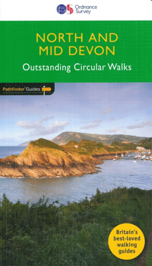
Wandelgids 068 Pathfinder guides Devon North & Mid - OS • 9780319090756
Wandelgids North & Mid Devon - OS Productomschrijving: A must-have for a day trip to North Devon, this Jarrold Pathfinder Guide maps out 28 walks that are ideal for exploring new regions and beautiful scenery. Ideal for planning a weekend walk with the family, this handy walking guide from Jarrold lets you explore with extended strolls and exhilarating hikes for young and old. - Featu…

Wandelgids 051 Pathfinder guides Cambridgeshire & The Fens - OS • 9780319090794
Wandelgids Cambridgeshire & The Fens - OS Productomschrijving: Often dismissed as flat and featureless, the waterlands of East Anglia offer great, and largely undiscovered, opportunities for any walker. With the tranquil riverside scenery, charming towns, villages and country houses, and the mesmerising beauty of the Fens, the area is rich in heritage, wildlife and history. Each walk i…

Wandelgids 067 Pathfinder guides South Downs NP & East Sussex- OS • 9780319090909
Wandelgids South Downs NP & East Sussex - OS Productomschrijving: The Pathfinder walking guidebook for East Sussex and the South Downs National Park has 28 carefully selected walking routes for all abilities. Routes range from 5km (3 miles) to 19km (12 miles) and each is also graded by difficulty. With each route these is a detailed route description, an extract of the OS map of the area a…

Wandelgids 063 Pathfinder guides Peak District England - OS • 9780319090275
Wandelgids Peak District England - OS Productomschrijving: The Pathfinder Guide for the Lake District is the ideal companion to gaining an appreciation of England's most mountainous region with its balanced range of walks across the whole of the National Park. There are a total of 28 outstanding circular walks in the Lake District National Park from 3 to 10 miles with easy-to-follow route…

Wandelgids 005 Pathfinder guides Cornwall England - OS • 9780319090299
Wandelgids Cornwall England - OS Productomschrijving: Pathfinder(R) Cornwall covering Land's End, Prussia Cove and Bodmin Moor. This selection offers interest, regional variety and balance of routes in Cornwall providing the best walks in the area. From an easy stroll along Falmouth Bay to the much more challenging walks along Looe Bar this volume contains something for everyone. Cover…
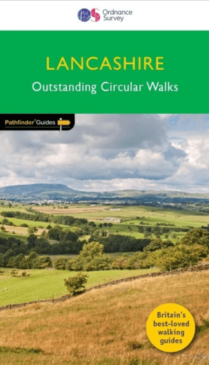
Wandelgids 053 Pathfinder guides Lancashire NW En England - OS • 9780319091203
Wandelgids Lancashire NW En England - OS Productomschrijving: With its fen-like lowlands, its coastal scenery, the high fells of Bowland and the lush river valleys of the Ribble and Lune, Lancashire is a county of surprising diversity from its great Industrial heritage towns to its attractive, rural villages and its numerous historic monuments. There can be no better way of exploring Lanc…
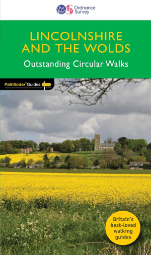
Wandelgids 050 Pathfinder guides Lincolnshire & the Wolds - OS • 9780319091005
Wandelgids Lincolnshire & the Wolds - OS Productomschrijving: The second largest county in England, Lincolnshire offers a surprising diversity of landscape - rolling wolds, coastal reaches, marshlands with endless skies and wide and impressive vistas, interspersed with historic market towns, magnificent churches and, of course, the ancient cathedral city of Lincoln. The county is larg…

Wandelgids 020 Pathfinder guides Sherwood Forest - OS • 9780319091098
Wandelgids Sherwood Forest - OS Productomschrijving: With 28 circular, graded walks all tried and tested by seasoned walkers, this guidebook for the Sherwood Forest & the East Midlands walks guidebook is ideal for holidaymakers and locals alike. Sherwood Forest lies in Nottinghamshire England.

Wandelgids 069 Pathfinder guides South West England Coastal walks • 9780319091135
Wandelgids South West England Coastal walks - OS Productomschrijving: Immerse yourself in 28 beautiful walks along the South West Coast of England with the OS Pathfinder Guidebooks, graded by length and ranging from 3 to 9 miles. The routes range from extended strolls to longer hikes, something for all levels! Each walk includes a detailed description, an OS map, GPS waypoints and notes of…

Wandelgids 044 Pathfinder guides Essex England - OS • 9780319091166
Wandelgids Essex England - OS Productomschrijving: This book has 28 circular, graded walks all around Essex. The routes range from extended 4.8km (3 miles) up to 15.6km (10 miles), so there is something for everyone of all abilities. Each walk includes a detailed description, an extract of the OS Explorer 1:25k map, GPS waypoints and key features to look out for. You can also find informa…

Wandelgids 073 Pathfinder guides More Peak District - OS • 9780319091081
Wandelgids More Peak District - OS Productomschrijving: This companion to the Pathfinder Peak District Guidebook contains 28 additional circular walks of 5km (3 miles) to 17km (10.5 miles). Like the main book, each is graded by length difficulty, and ranges from relatively easy strolls to some of the more challenging routes with considerable vertical ascent. Each route includes a deta…
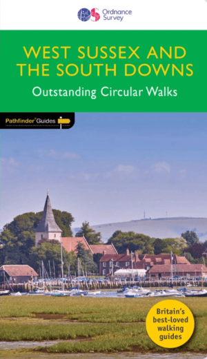
Wandelgids 066 Pathfinder guides West Sussex & South Downs - OS • 9780319091746
Wandelgids West Sussex & South Downs AONB - OS Productomschrijving: Containing 28 circular, graded walks that have all been created and tested by experienced walkers, this walking guidebook is ideal for both visitors and locals. The routes range from extended strolls to exhilarating hikes, so there is something for everyone. Each route includes a detailed description, the Ordnance Survey …

Wandelgids 084 Pathfinder Berkshire- Buckinghamshire- Oxfordshire • 9780319092279
Wandelgids Berkshire- Buckinghamshire- Oxfordshire Productomschrijving: This all-new Pathfinder® Guide covering the ceremonial counties of Berkshire, Buckinghamshire and Oxfordshire features 28 outstanding circular walks across all three counties, offering more wonderful Pathfinder® routes in the south-central Midlands between the Cotswolds (PF 6 Cotswolds) and the Chilterns (PF 25 Thames…

Wandelgids 080 Pathfinder guides Shropshire England - OS • 9780319092040
Wandelgids Shropshire England - OS Productomschrijving: 180 miles of stunning walking among A. E. Housman's 'Blue remembered hills' of the Shropshire Hills Ara of Outstanding Natural Beauty, including the Long Mynd, Stiperstones, and Caer Caradoc. There's also a climb to the top of The Wrekin. By way of contrast, walks visit the marshy meres of Brown and Whixall Moss, the World Heritage S…

Wandelgids 076 Pathfinder guides Somerset & the Mendips Hills- OS • 9780319091999
Wandelgids Somerset & the Mendips Hills - OS Productomschrijving: Gelegen tussen Weston-super-Mare en het oostelijker gelegen Frome. Pathfinder Guide to Somerset and the Mendips (Mendip Hills), featuring 28 outstanding walks designed for a range of abilities covering 170 miles of walking. Features: 28 guided walks for a range of abilities Large scale Ordnance Survey map extracts K…

Wandelgids 022 Pathfinder guides More Lake District - OS • 9780319092071
Wandelgids More Lake District - OS Productomschrijving: The Second Lake District title has 28 circular walks - all tried and tested by seasoned walkers. The routes range from extended strolls to exhilarating hikes, meaning there is something for everyone. This guidebook includes several walks that are either on the periphery of or outside the boundaries of the national park. There are…

Wandelgids 065 Pathfinder guides Surrey England - OS • 9780319090206
Wandelgids Surrey England - OS Productomschrijving: Get lost in these 28 beautiful walks across Surrey with the OS Pathfinder Guidebooks, graded by length and ranging from 3 to 9.5 miles. The routes range from extended strolls to longer hikes, something for all levels! The Surrey Pathfinder is tried and tested by seasoned walkers - it's ideal for both visitors and locals. Each walk in…
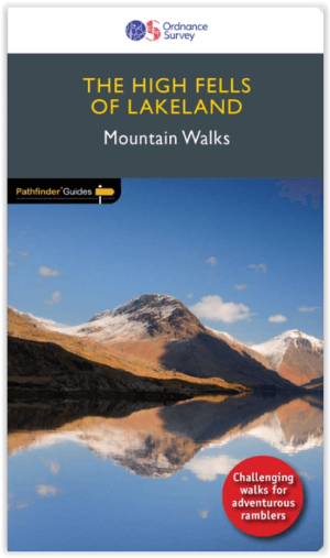
Wandelgids 071 Pathfinder guides High Fells of Lakeland - OS • 9780319091111
Wandelgids High Fells of Lakeland - OS Productomschrijving: Discover 20 majestic and challenging fell walks amid the glorious scenery of the Lake District mountains. The routes range from extended strolls to longer hikes, something for all levels! This book was created for those looking to push their walking adventures that bit further. Compiled by photographer and prolific guidebook …
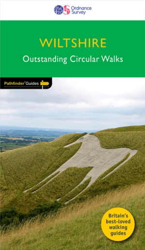
Wandelgids 077 Pathfinder guides Wiltshire - OS • 9780319092002
Wandelgids Wiltshire - OS Productomschrijving: Walking among the expansive landscapes and fascinating prehistoric sites of Wiltshire has never been easier or more rewarding. Discover rolling chalk downs, stone circles, white horses and millennia of English history with these 28 walks through gorgeous Wiltshire, graded by length and difficulty. Featured Wiltshire walks include: - S…

Wandelgids 081 Pathfinder guides Staffordshire - OS • 9780319092057
Wandelgids Staffordshire - OS Productomschrijving: 185 miles of superb country walking from the moorland of The Roaches and Three Shire Heads in the Peak District to the rolling woodlands and open countryside explored from Kinver. There's waterside walking along the Shropshire Union Canal and best the Trent, Heathland rambles across Cannock Chase and beautiful walks within easy reach of L…

Wandelgids 087 Pathfinder guides Northumberland - OS • 9780319092576
Wandelgids Northumberland - OS Productomschrijving: Opening with a gentle short walk at Kielder Water and concluding with an energetic and challenging ramble to the summit of The Cheviot, walks are arranged in the book by completion time, with shorter and easier routes at the start and longer outings at the end. Walks are professionally authored and depicted with GPS waypoints, Ordnance S…

Wandelgids 093 Pathfinde North Yorkshire Accessible walks - OS • 9780319092859
Wandelgids North Yorkshire Accessible walks - OS Productomschrijving: This guide comprises 33 beautiful walks, ranging in distance from 0.5 to 8 miles, across North Yorkshire, with ten routes in the Yorkshire Dales National Park, eleven in the North York Moors National Park, North Sea coast routes at Whitby, Robin Hood’s Bay and Bempton, and routes handily placed near the Richmond, Ripon, …
Engeland - De oude gemeenschap
Engeland - De oude gemeenschap met hun bovenvermelde AONB regio's staan voor “Areas of Outstanding Natural Beauty”. Vrij vertaald betekent dit: regio’s die de mooiste stukken natuur van het land aan u voorstellen en die strikt beschermd blijven tegen invloeden van buitenaf. Ook de verschillende nationale parken die het United Kingdom rijk is, lonen de moeite. Zo zijn er bijvoorbeeld North York Moors NP, Lake district NP, Dartmoor NP, Exmoor NP, Yorkshire Dales NP, The South Downs NP en het Peak District NP. Het Verenigd Koninkrijk is gezegend als het om AONB-regio’s gaat. In die mate zelfs dat BIBLIOTREK er een afzonderlijke pagina aan heeft gewijd > AONB. Regio’s als de North Wessex Downs AONB, Surrey Hills AONB, South Downs AONB zijn absoluut een bezoekje waard.
Engeland is uiterst gekend voor zijn lange fietsroutes die doorheen Historische fiets- en wandelroutes, regio’s die langs speciale bezienswaardigheden voeren. Niet veel landen kunnen het Verenigd Koninkrijk evenaren als het op cultuur en lange afstandsfietsen gaat. Ook aan andere toeristische bezigheden is er geen gebrek, maar wij hebben het natuurlijk hoofdzakelijk over wandelen, fietsen en klimmen. Voor de Klimmers zijn er bij ons de Klimgidsen van toepassing, die voeren u ondermeer ook door naar schotland waar de berggebieden u veel meer parten spelen dan in Engeland.
Wandelroutes Engeland
De Wandelroutes Engeland kennen een ongelofelijk historisch erfgoed. In tegenstelling tot sommige andere landen zijn de Britten zelf ook werkelijk dol op hun erfgoed en proberen ze het zo goed als mogelijk te bewaren. Dit met de bedoeling om alle generaties er bewust van te laten genieten. Op het Europese continent raken dergelijke gebieden en locaties soms jammerlijk in de vergeethoek.
Engeland heeft een aantal toplocaties die jaarlijks heel wat toeristen aantrekken, zoals bijvoorbeeld Cornwall, Yorkshire, Kent enz. Voor wie een route plant in Engeland, vergeet best niet dat het Verenigd Koninkrijk niet langer een onderdeel vormt van de Europese Unie en dat identiteit opnieuw een rol speelt bij het binnenkomen van het land, EN daar rijden ze links van de baan!. Engeland biedt ronduit unieke bezienswaardigheden, zoals bijvoorbeeld Stonehenge, The white cliffs of Dover en nog zo veel meer. Uiteraard geraakt u door Engeland met één van de taltijke Europese Reisgidsen ook. De reeks van de National Trails is in Engeland door en door gekend, zo gekend zelfs dat ze van het buitenland komen om die te doen. The Cleveland Way door York Moors National park, The Cotswold Way through the Cotswolds AONB naar het stadje Bath, Hadrian's Wall path, de oude restanten van de Roman Empire, een muur van 135 Km lang, en onderdeel van de Historische fiets- en wandelroutes. The North Downs Way, van Surrey to the Kent coastline. Offa's Dike Path, langs de Engelse/Welsch border. Peddar's Way and Norfolk coast path. Pembrokeshire Coast path, langs de kust van Wales en rond de Pembrokeshire coast National Park. enz...