

Wandelgids 086 Pathfinder guides Lake District and Cumbria - OS
Butt of Lewis - Vatersay - The ancient Callanish Standing Stones

Korte omschrijving
Wandelgidsen Cumbria & Lake District, England van Ordnance Survey. Ideaal voor tochten in England.
Wandelgids Lake District and Cumbria - OS Productomschrijving: 122 miles of thrilling Hebridean walking across ten stunning isles, from the Butt of Lewis in the north to Vatersay in the sou...

Specificaties
- Uitgever: Ordnance Survey
- ISBN-13: 9780319092569
- HOOFDCATEGORIEËN: Wandelgids
- Activiteiten: Wandelen, Hiking & Trekking
- Regio: Cumbria & Lake District, England
- Land: England
- Taal: Engels
- Reeks/Serie: Outstanding Circular Walks, Pathfinder Series, OS
- De Nationale Parken: Lake district National Park, England
- De Engelse Graafschappen: Cumberland (Cumbria)
- Wandelen in de Bossen & natuurgebieden van Europa: Lake district, England
Volledige omschrijving
Wandelgids Lake District and Cumbria - OS
Productomschrijving: 122 miles of thrilling Hebridean walking across ten stunning isles, from the Butt of Lewis in the north to Vatersay in the south. Discover crafting heritage, the ancient Callanish Standing Stones and the impressive broch of Dùn Carloway; delight in the variety of birdlife at Balranald and wooded Arinaban; enjoy miles of silver sand and turquoise sea at Luskentyre and Halaman Bay; and revel in the panoramic views from Èabhal and Heabhal.
Walks are presented sequentially geographically, starting in Stornoway, heading up to the Butt of Lewis and then working southwards along the main touring route down the island chain. Walks are professionally authored and depicted with GPS waypoints, Ordnance Survey maps and beautiful photography.
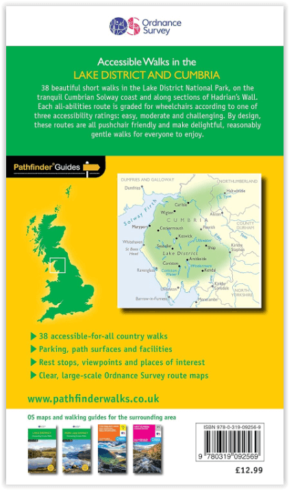
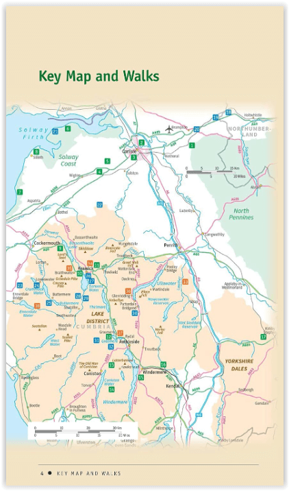
This unique guide is devoted entirely to accessible walks, includes 38 routes across Cumbria, featuring the Solway coast, Carlisle, Hadrian’s Wall, and the Lake District from Bassenthwaite Lake to Windermere and Ennerdale to Lowther Park.
Designed to help wheelchair users get outside across the Lake District and Cumbria, the walks are also suitable for pushchairs and all-terrain buggies, and favour families with younger children and anyone wanting a relatively gentle walk amid beautiful surroundings to enjoy at their own pace.
The book sets out with a pleasing circuit of Talkin Tarn and concludes with an adventurous ‘expedition’ in Ennerdale, in between offering delightful lakeside strolls beside – among others – Derwent Water, Grasmere and Windermere; old railway trackbed rambles through Smardale and from Keswick to Threlkeld; coastal promenades at Silloth and Allonby; woodland wanders at Grizedale and Miltonrigg; following Hadrian’s Wall at Willowford and Harrow’s Scar; nature encounters at Watchtree and Revelin Moss; and village-based walks at Caldbeck and Staveley.
OS Pathfinder Guides: Outstanding Circular Walks
- The definitive pocket book guide to Great Britain’s great outdoors
- 38 fully accessible walks for all Walks ranging from ¾ to 8 miles vast majority less than 3 miles with almost half linear
- Walks graded by distance and difficulty easy, moderate, and challenging – based on nature of path surfaces.
- Very challenging final walk - 8 mile distance and rough going terrain
- Photos showing typical path conditions for routes with tricky points
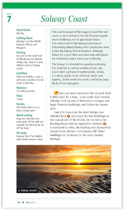
- Packed with essential information per walk: Start / finish position, travel information on how to get there, parking, toilets and refreshments stops, distance and time, terrain
Includes OS Explorer 1:25 000 scale map extracts for every route (4cm to 1km or 2½ inches to one mile)
Discover GPS waypoints, parking information and detailed route descriptions for foolproof navigation
Enhances your walk with information on rare wildlife, natural habitats and points of historical interest
Artikelen uit dezelfde regio

Wandelgids Lakeland short walks book 3- West Lakeland - Cicerone • 9781852843083
Wandelgids -Lakeland short walks book 3- West Lakeland - Cicerone Routes bedekken Rydal, Grasmere, Langdale, little Langdale, Coniston, Torver en het zuiden, Grizedale, Satterthwaite, e.a. Productomschrijving: Een gids van korte wandelingen in het zuiden van het engelse Lake District, het VK, de derde van deze drie-delige lake landserie. Routes bedekken: Rydal, Grasmere, Langdale, …

Wandelkaart Lake District South-East XT40 - Harvey Maps • 9781851376667
Wandelkaart Lake District Zuid-Oost XT40 - Harvey Maps Productomschrijving: Omvat een groot gebied maar is praktisch en compact, zakformaat. Gedetailleerde kaart voor lopers en wandelaars van de zuidoostelijke heuvels van het Lake District National Park. Op de kaart staat Lake Windermere in het midden. Inclusief Ambleside, Coniston en Kendal en het uitstekende mountainbikegebied van G…
Landkaart Wegenkaart Planning map Lake District & Cumbria • 9781788688376
Wegenkaart Planning map Lake District & Cumbria Productomschrijving: From Lonely Planet, the world's leading travel guide publisher Durable and waterproof, with a handy slipcase and an easy-fold format, Lonely Planet's Lake District & Cumbria Planning Map helps you get around with ease. Get more from your map and your trip with images and information about top attractions, itinerary sugges…
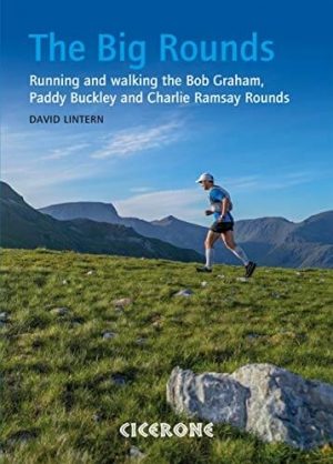
Wandelgids The Big Rounds - Cicerone • 9781852847722
Wandelgids - The Big Rounds - Cicerone Productomschrijving: Deze inspirerende gids kijkt naar elk van de 19 nationale routes in het Verenigd Koninkrijk, met informatie die vergelijkings- en contrastgemak mogelijk maakt, waardoor u wordt geïnspireerd om meer te weten te komen en een uitdaging op lange afstand aan te gaan. Sommige paden zijn kort en gemakkelijk, anderen veel langer, en veel …

Wandelkaart Lake District West - XT40 ultra - Harvey Maps • 9781851377190
Wandelkaart Lake District West - Harvey Maps Productomschrijving: Omvat een groot gebied maar is praktisch en compact, zakformaat - Gedetailleerde kaart voor lopers en wandelaars van de westelijke heuvels van het Lake District National Park. - Scafell en de Langdale Pikes, en fells ten westen van de Kendal-Keswick-weg. - Hard Knott en Wrynose passen. Ennerdale, Wast Water en Conist…