
Activiteiten
Land
Regio
Editie
Taal
Schaal
Auteur:
Lange afstand wandelroutes
Historische wandelroutes
Waterafstotende kaart
Nationale parken
Regionale parken
VTT / MTB
Toepasselijke bergketen
UNESCO werelderfgoed
TOPO's & Stafkaarten
Uitgever


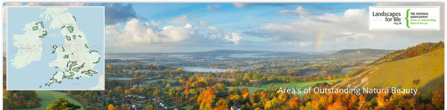
 Area's of Outstanding Natural Beauty
Areas of Outstanding Natural Beauty (AONB's) in het Verenigd Koninkrijk zijn regio's die bekend staan om hun uitzonderlijke landschappen, die een toevluchtsoord zijn voor de natuur en een toevluchtsoord voor bezoekers die op zoek zijn naar natuurschoon en rust. Deze gebieden worden beschermd om hun natuurlijke charme, culturele erfgoed en biodiversiteit te behouden.
Het Verenigd Koninkrijk telt 46 AONB's, elk met een uniek karakter. De Cotswolds, met zijn heuvels en pittoreske dorpjes, is een van de grootste en bekendste en biedt een typisch Engels landschap. Het Lake District NP, hoewel in de eerste plaats een nationaal park, overlapt met AONB's zoals Arnside en Silverdale, bekend om zijn kalkstenen trottoirs en rijke vogelleven. In het zuiden biedt de Surrey Hills AONB eeuwenoude bossen en krijtrotsen, terwijl de South Downs AONB, nu onderdeel van het South Downs National Park, bekend staat om zijn weidse uitzichten en historische locaties. De Wye Valley, op de grens tussen Engeland en Wales, staat bekend om zijn dramatische rivierlandschappen en dichte bossen.
Verder weg vindt u in het Northumberland Coast AONB ruige kliffen, zandstranden en historische kastelen, terwijl de Mourne Mountains in Noord-Ierland een verbluffende mix bieden van ruige bergtoppen en serene valleien. Elke AONB biedt een uniek stukje natuurschoon van het Verenigd Koninkrijk, voor elke natuurliefhebber wat wils. Een deel van de AONB regio's klaseren zelfs tegelijk als UNESCO Werelderfgoed.

Wandelkaart OL41 Forest of Bowland & Ribblesdale - OS • 9780319242803
Wandelkaart Forest of Bowland AONB & Ribblesdale - OS Productomschrijving: Pendle Hill- Clitheroe & Settle - Yorkshire Dales NP, A pennine Journey, Dales High Way, Lancashire Coastal Way, Line Valley Ramble, Pendle Way, Pennine bridleway, Ribble Way & Wyre Way. Omvat: Pendle Hill- Clitheroe & Settle - parts of the Yorkshire Dales NP, Ontdek de OL-serie van Ordnance Survey: De O…

Wandelkaart OL45 The Cotswolds AONB - OS • 9780319242841
Wandelkaart The Cotswolds AONB - OS Productomschrijving: Wychwood Community Forest, The Centenary Way, Cotswolds Way, D'Arcy Dalton Way, Diamond Way, E2 European Long Distance Path, Gloucestershire Way, Heart of England Way, Macmillan Way, Monarch's Way, Oxfordshire Way, Thames Path, Shakespeare Way, Warden's Way, Winchcombe Way, Windrush Way & Wychavon Way. Omvat: Burford, Chipping C…

Wandelkaart OL30 Yorkshire Dales - Northern & Central areas - OS • 9780319263358
Wandelkaart Yorkshire Dales - Northern & Central areas - OS Productomschrijving: Een topografische wandelkaart van het Noordelijke & centrale gedeelte van het Yorkshire Dales Nationaal Park. Omvat: Wensleydale & Swaledale, northern & Central areas of Yorkshire Dales National Park, with The Nidderdale & Northern Pennines AONB area's, A Pennine Journey, the Dales Way, E2 European Long di…
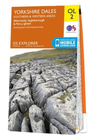
Wandelkaart OL02 Yorkshire Dales - South& Western areas - OS • 9780319263310
Wandelkaart OL2 Yorkshire Dales - South& Western areas - OS Productomschrijving: Yorkshire Dales Nationale Park - South& Western areas, Whernside, Ingleborough & Pen-y-ghent, The AONB Area's of Forest of Bowland & Nidderdale AONB. Yorkshire three peaks, The Devils Bridge at Kirkby Lonsdale, Leeds to Liverpool Canal at Skipton, The Pennine Way, Settle, and Old Town. Omvat: Whernside, I…
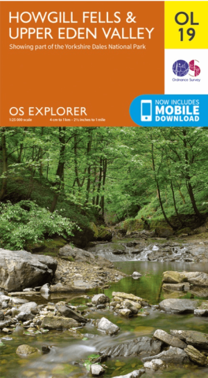
Wandelkaart OL19 Howgill Fells & Upper Eden Valley - OS • 9780319263341
Wandelkaart Howgill Fells & Upper Eden Valley - OS Productomschrijving: Topografische wandelkaart van The Howgill Fells & The Upper Eden Valley, dat deels in het Lake Distrisct National Park ligt. Omvat: Howgill Fells & Upper Eden Valley, parts of the Yorkshire Dales National Park en The Lake Distrisct National Park, The Pennine Journey, Dales High Way, Dales Way, E2 European Long D…
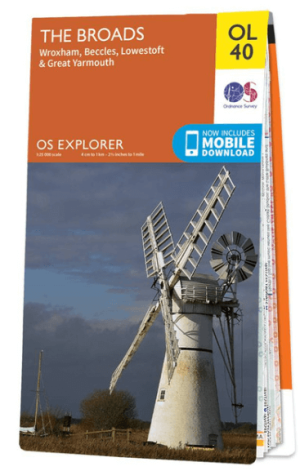
Wandelkaart OL40 The Broads National Park - OS • 9780319263549
Wandelkaart The Broads National Park - OS Productomschrijving: The Broads National Park, Wroxham, Beccles, Lowestoft and Great Yarmouth. Omvat: Wroxham, Beccles, Lowestoft and Great Yarmouth Ontdek de OL-serie van Ordnance Survey: De OL-serie (Outdoor Leisure) van Ordnance Survey is dé referentie voor wie gaat wandelen op de Britse eilanden. Deze topografische kaarten maken deel …
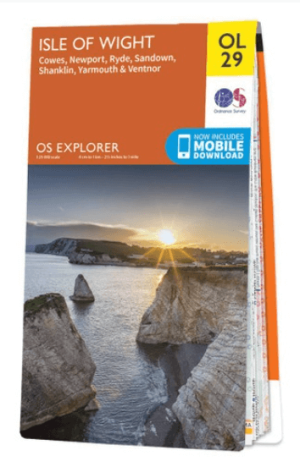
Wandelkaart OL29 Isle of Wight South East England - OS • 9780319263631
Wandelkaart Isle of Wight - OS Productomschrijving: Isle of Wight South East England, Isle of Whight AONB, New Forest National Park, Allan King Way, Bembridge Trail, Coastal Path, E9 European Long Distance Trail, Freshwater Way, Hamstead Trail, Nunwell Trail, Pilgrim's Trail, Shepherds Trail, Shipwrights Way, Solent Way, Stenbury Trail, Tennyson Trail, Worsley Trail & Yar River Trail. …

Wandelkaart The Mournes with Slieve Croob - OSI • 9781911643029
Wandelkaart The Mournes with Slieve Croob - OSI productomschrijving: De Mourne Mountains en Slieve Croob: Berglandschap vol Pracht en Panorama In het zuidoosten van Noord-Ierland rijzen de Mourne Mountains op als een granieten muur, doorkruist met smalle valleien, stille meren en adembenemende toppen. Deze regio in County Down is beschermd als Area of Outstanding Natural Beauty, en het…
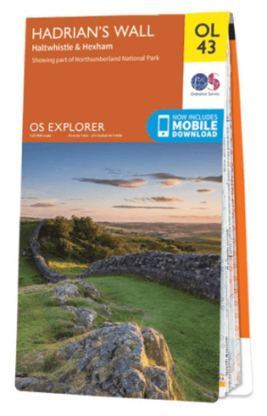
Wandelkaart OL43 Hadrian's Wall- Haltwhistle & Hexham - OS • 9780319263624
Wandelkaart Hadrian's Wall- Haltwhistle & Hexham - OS Productomschrijving: Topografische wandelkaart van Hadrian's Wall- Haltwhistle & Hexham. Omvat: Haltwhistle & Hexham, historic Hadrian's Wall path across Northern England, with parts of Northumberland National park & The Pennine Way. Ontdek de OL-serie van Ordnance Survey: De OL-serie (Outdoor Leisure) van Ordnance Survey is …
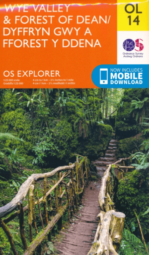
Wandelkaartv OL14 Wye Valley, Forest of Dean & Dyfryn Gwy - OS • 9780319263839
Wandelkaartv Wye Valley, Forest of Dean & Dyfryn Gwy - OS Productomschrijving: Parts of Offa's Dyke Path, on the border of England & Wales. Omvat: Wye Valley, Forest of Dean & Dyfryn Gwy, Wye Valley AONB, Daffodil Way, Gloucestershire Way, Herefordshire Way, Jubilee Way, Offa's Dyke Path, Severn Way, Thames & Severn Way, Three Coastal Walk, Wales Coast Path, Wye Valley Walk & Wysis Way…

Wandelkaart OL22 New Forest National Park - OS • 9780319263921
Wandelkaart New Forest National Park - OS Productomschrijving: New Forest National Park, Hampshire England. Omvat: Southampton, Ringwood, Ferndown, Lymington, Christchurch and Bournemouth, parts of the New Forest National Park. Ontdek de OL-serie van Ordnance Survey: De OL-serie (Outdoor Leisure) van Ordnance Survey is dé referentie voor wie gaat wandelen op de Britse eilanden. D…

Wandelkaart OL05 English Lakes - North Eastern area - OS • 9780319264003
Wandelkaart English Lakes - North Eastern area - OS Productomschrijving: Een topografische wandelkaart van het noordoostelijke deel van de Lake District National park. Omvat: English Lakes - North Eastern area, Penrith, Patterdale & Caldbeck, Parts of the Lake District, and The Cumbria Way. Ontdek de OL-serie van Ordnance Survey: De OL-serie (Outdoor Leisure) van Ordnance Survey …
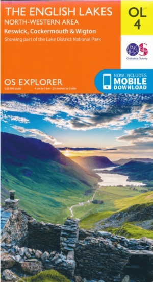
Wandelkaart OL04 English Lakes - North Western area - OS • 9780319263990
Wandelkaart English Lakes - North Western area - OS Productomschrijving: Een toppografische wandelkaart van het noordwestelijke deel van het Lake district. Omvat: Keswick, Cockermouth & Wigton, parts of the Lake District National Park. Also showing the Englisch coast patc and the Cumbria Way. Ontdek de OL-serie van Ordnance Survey: De OL-serie (Outdoor Leisure) van Ordnance Surv…
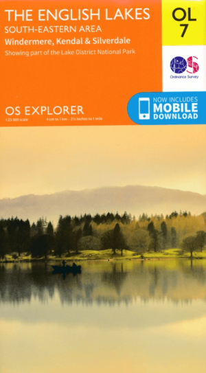
Wandelkaart OL07 English Lakes - South Eastern area - OS • 9780319264027
Wandelkaart English Lakes - South Eastern area - OS Productomschrijving: Een topografische wandelkaart van het Zuid-Oostelijke gedeelte van het Lake District National Park, & the Cumbria Way. Omvat: Windermere, Kendal & Silverdale, the South-Eastern part of the Lake District National Park, The Cumbria Way, Dales Way, Lancashire Coastal Way & Lune Valley Ramble. Ontdek de OL-serie v…

Wandelkaart OL28 Dartmoor National Park - OS • 9780319264034
Wandelkaart Dartmoor National Park - OS Productomschrijving: Dartmoor National Park, Devon England. Ontdek de OL-serie van Ordnance Survey: De OL-serie (Outdoor Leisure) van Ordnance Survey is dé referentie voor wie gaat wandelen op de Britse eilanden. Deze topografische kaarten maken deel uit van de Explorer-reeks en bieden ongeëvenaarde nauwkeurigheid en detail op een schaal van 1:…
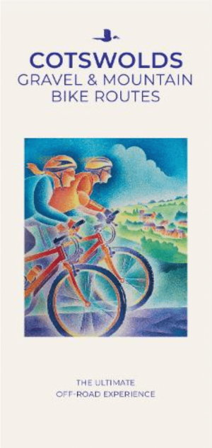
Moutainbike Cotswold Gravel & Mountain AONB - Goldeneye • 9781859653135
Moutainbike map Cotswold - Goldeneye Productomschrijving: Cotswold Gravel & Mountain Bike Routes: The Ultimate Off-Road Experience - Gravel & Mountain Bike Routes 18 (Paperback) When mountainbiking in the Cotswolds, in an Area of Outstanding Natural Beauty of AONB area, a lot of sportsfanatics & MTB fanatics are very interested, and cannot go wrong with this new Goldeneye mountainbiki…

Wandelgids 025 Pathfinder guides Thames Valley & Chilterns - OS • 9780319090053
Wandelgids The Thames Valley & The Chilterns AONB Productomschrijving: The Chilterns AONB form part of the long line of chalk hills stretching intermittently across southern and eastern England. It is an area characterised by beech woods and dry valleys, and these natural features are explored in the 28 routes available in this walks guidebook. The Thames Valley is steeped in history,…

Wandelgids 029 Pathfinder guides Wye Valley AONB & Forrest of Dean • 9780319090442
Wandelgids Wye Valley AONB & Forrest of Dean -OS Productomschrijving: The Wye Valley and Forest of Dean Pathfinder guidebook contains 28 circular walks for all abilities. Walks are from 4km to 17km long, and each route includes a difficulty rating, route directions, an extract of the Ordnance Survey map and notes and photos of key features to look for. All of them have been created and te…
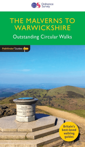
Wandelgids 074 Pathfinder guides Malverns to Warwickshire - OS • 9780319090725
Wandelgids The Malverns AONB to Warwickshire - OS Productomschrijving: With 28 circular, graded walks all tried and tested by seasoned walkers, this walking guidebook for The Malverns AONB and Warwickshire is ideal for both holidays and locals. The routes discovered in this guidebook are from 4.8 to 15km (3 to 9 miles), so there's a choice for all abilities. Each route includes a detailed…

Wandelgids 006 Pathfinder guides Cotswolds AONB - OS • 9780319090282
Wandelgids Cotswolds AONB - OS Productomschrijving: 28 carefully selected and tested country walks around The Cotswolds, graded by length and ranging from just over four to 10 miles. All of the walks in this book include written directions, an extract of the OS map for the area and some background on the history and natural environment you may see. Most of the walks avoid busy roads, a…

Wandelgids 039 Pathfinder Durham, North Pennines & Tyne & Wear OS • 9780319090411
Wandelgids Durham, North Pennines & Tyne & Wear - OS Productomschrijving: This walking guide covers both the Cumbrian and Durham sides of the North Pennines, a designated Area of Outstanding Beauty, and also extends eastwards to Durham to the North Sea Coast. The area contains some of the finest moorland in the country, walks across Bowes Moor and Holwick as well as low-level walks beside …
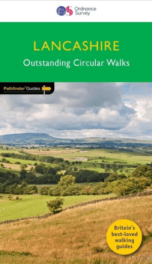
Wandelgids 053 Pathfinder guides Lancashire NW En England - OS • 9780319091203
Wandelgids Lancashire NW En England - OS Productomschrijving: With its fen-like lowlands, its coastal scenery, the high fells of Bowland and the lush river valleys of the Ribble and Lune, Lancashire is a county of surprising diversity from its great Industrial heritage towns to its attractive, rural villages and its numerous historic monuments. There can be no better way of exploring Lanc…
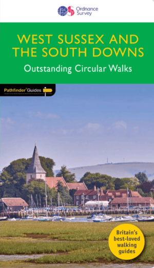
Wandelgids 066 Pathfinder guides West Sussex & South Downs - OS • 9780319091746
Wandelgids West Sussex & South Downs AONB - OS Productomschrijving: Containing 28 circular, graded walks that have all been created and tested by experienced walkers, this walking guidebook is ideal for both visitors and locals. The routes range from extended strolls to exhilarating hikes, so there is something for everyone. Each route includes a detailed description, the Ordnance Survey …

Wandelgids 080 Pathfinder guides Shropshire England - OS • 9780319092040
Wandelgids Shropshire England - OS Productomschrijving: 180 miles of stunning walking among A. E. Housman's 'Blue remembered hills' of the Shropshire Hills Ara of Outstanding Natural Beauty, including the Long Mynd, Stiperstones, and Caer Caradoc. There's also a climb to the top of The Wrekin. By way of contrast, walks visit the marshy meres of Brown and Whixall Moss, the World Heritage S…
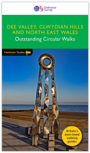
Wandelgids 079 Pathfinder guides Dee Valley & Clwydian hills - OS • 9780319092026
Wandelgids Dee Valley AONB & Clwydian hills NP - OS Productomschrijving: Pathfinder ® Guide to North East Wales, featuring 28 outstanding and mostly circular rambles in the Dee Valley, over the Clwdian Hills and across Conwy east of the Vale of Conwy, Denbighshire, Flintshire and Wrexham: from the Great Orme to Chirk and from the Point of Ayr (the most northerly tip of mainland Wales) to …
Gebieden van uitmuntend natuurschoon
Gebieden van uitmuntend natuurschoon, of AONB of Area’s of Outstanding Natural Beauty, is een sublieme collectie aan natuur schoon, die alles samen bracht in een speciale verdrag beschreven in de “National Parks and Access tot he Countryside Act 1949”. In Schotland daarentegen noemen ze dezelfde regio’s “National Scenic Area’s”. Ongeveer 18% van het land is gedekt met deze AONB regio’s, onlangs kwamen er nog enkele bij zoals Erne Lakeland, Fermanagh en Caveland. Het grootste gebied zijn de Cotswolds met zo’n 2038 km² Km. Dat zich uitstrekt in ondermeer West Oxfordshire & Gloucestershire. De kleinste, The isles of Scilly , is maar 16 km².
De AONB organisatie, en bijgevolg ook zijn eerste AONB regio vieren algauw hun 50e verjaardag. Gowers Golden anniversary, word aanschouwd als een goede reden om de aanvang van de organisatie te vieren, die nu zo’n 46 regio’s dekt over 4 delen van Groot Brittannië. AONB’s als de Cannock Chase, de Chilterns, Cornwall & de Cotswolds, zijn tot ver buiten hun grenzen gekend voor zijn prachtige natuurgebieden, en zijn dan ook een jaarlijkse trekpleister voor natuurfanaten, en fans van wandelingen door speciale gebieden. In het westen van Engeland bevinden zich de meeste van de AONB’s, de kans bestaat dat u bij uw aanwezigheid in Engeland, reeds door zo’n gebied bent gereden zonder te weten.
Wandelen in een AONB gebied
Wandelen in de Britse AONB gebied, is een reis door enkele van de meest adembenemende landschappen van de UK. Deze beschermde gebieden bieden diverse paden die geschikt zijn voor wandelaars van elk niveau, van rustige wandelingen tot uitdagende tochten, allemaal tegen een adembenemend decor. De Chiltern Hills AONB, op korte afstand van Londen, biedt een mix van glooiende heuvels, beukenbossen en historische dorpjes. Paden zoals het Ridgeway National Trail bieden panoramische uitzichten en een gevoel alsof je terug in de tijd stapt, met oude paden en prehistorische vindplaatsen langs de route. Sommige van deze trails ijzn zelfs geklasseerd als Hystorische fiets- en wandelpaden.
In de Cotswolds, een van de grootste AONB's, kunnen wandelaars een typisch Engels landschap verkennen met heuvels, honingkleurige stenen dorpjes en meanderende rivieren. De Cotswold Way, een langeafstandspad, biedt een reis door dit schilderachtige gebied, met mogelijkheden om historische monumenten en charmante stadjes te ontdekken. De North Pennines AONB, bekend als de laatste wildernis van Engeland, biedt ruiger terrein met heidevelden, watervallen en zeldzame wilde dieren. De High Force waterval en het weidse uitzicht vanaf Cross Fell zijn hoogtepunten voor avontuurlijke wandelaars.
Of het nu de dramatische kliffen van de Cornwall AONB zijn, de serene schoonheid van de Wye Valley of de weidse landschappen van de Yorkshire Dales NP, wandelen in een AONB dompelt je onder in de meest waardevolle natuurlijke omgevingen van het Verenigd Koninkrijk.
Waar vindt men de AONB gedieden
Waar vindt men de AONB gedieden? Uiteraard zijn AONB's verspeidt over gans Groot Brittannië, we sommen die op per regio:
Engeland: Arnside and Silverdale, Blackdown Hills, Cannock Chase, Chichester Harbour, Chilterns, Cornwall, Cotswolds, Cranborne Chase and West Wiltshire Downs, Dedham Vale, Dorset, East Devon, East Hampshire, Forest of Bowland, High Weald, Howardian Hills, Isle of Wight, Isles of Scilly, Kent Downs, Lincolnshire Wolds, Malvern Hills, Mendip Hills, Nidderdale, Norfolk Coast, North Devon Coast, North Pennines, Northumberland Coast, North Wessex Downs, Quantock Hills, Shropshire Hills, Solway Coast, South Devon, South Hampshire Coast, Suffolk Coast and Heaths, Surrey Hills, Sussex Downs, Tamar Valley.
Wales: Anglesey, Clwydian Range, Gower, Lleyn, Wye Valley.
Noord Ierland: Antrim Coast en Glens, Causeway Coast, Lagan Valley, Lecale Coast, Mourne Mountains, North Derry, Ring of Gullion, Sperrins & Strangford Lough.
Dit zijn de 50 Area's of Outstanding Natural beauty.